Wales Coast Path Run – Llangennith to Llanmorlais
Coast Path Vital Stats
Llangennith to Llanmorlais
- Distance: 17.27 miles
- Elevation Gain Today: 331m
- Highest Elevation: 64m
- Time: 3:25:08
- Av. Pace: 12:03 mins/mile
- Calories: 1683
Totals to Date
- Total Distance: 799.50 miles
- Total Time: 148:04:43
- Total Elevation Gain: 22999
- Total Calories: 72890
- Distance to go: 293 miles
Yeah, 2 weeks in a row on the my Coast Path run – that hasn’t happened for a while. This time I was without the support of Anna so the logistics and planning were probably more difficult than the run itself. Not helped by the fact that there were only two buses a day between my start and end points. One of which left at either 8:23am or 8:33am (we weren’t sure which time it would be) and the other was later in the evening. The evening bus was no use to me so I’d have to make an early start.
I’d need to be in Llanmorlais, where I was planning to finish my run, by 8:00am at the latest. That should give me time to find somewhere suitable to park, get into my running kit and find the bus stop before 8:23am. Google maps was saying it would take almost 2.5 hours to drive there so I’d have to leave home at 5:30am. That meant getting up at 4:30am. I set an alarm the night before but didn’t need it as I was awake well before it went off.
The drive to Llanmorlais was quite nice. There was a huge ‘Super Moon’ in the sky and my way seemed to be lined by avenues of blackthorn and cherry blossom. It didn’t take as long as indicated either. I found somewhere to park straight away and soon had my kit on and had found the bus stop. Yep, you’ve guessed it. it was now only 7:40am so I had at least 43 minutes to wait for the bus. And, the bus didn’t arrive until 8:40am so I actually had to wait for an hour on the chilly roadside.
I was the only person on the bus and soon got off in the village of Llangenith at around 9:00am where I started my run.
Technology
Unfortunately my trusty Garmin Fenix 3 stopped working over the weekend and my new super-duper Fenix 6x had yet to arrive. It’s not essential for navigational purposes as the Coast Path is usually easy to follow and well sign-posted. However, it is nice to record where I’ve been and to have a GPX file of my progress. I’ve recorded one for every other leg of my Coast Path project so it would be a shame to miss this one. I had therefore borrowed Anna’s Apple Watch. It wouldn’t record all of the metrics and I didn’t have the course pre-loaded onto it but hopefully it would record the GPS data which is all that I really wanted.
I wasn’t sure how long the battery would last in GPS mode though so I also had my Garmin Edge 530 bike computer with me as a back up. It’s not ideal for running and again wouldn’t record some of the running metrics I’m used to. I was however able to hold it in my hand and use it to record my run in case the Apple watch battery didn’t last.
I therefore set up and started both devices and headed off towards the Coast.
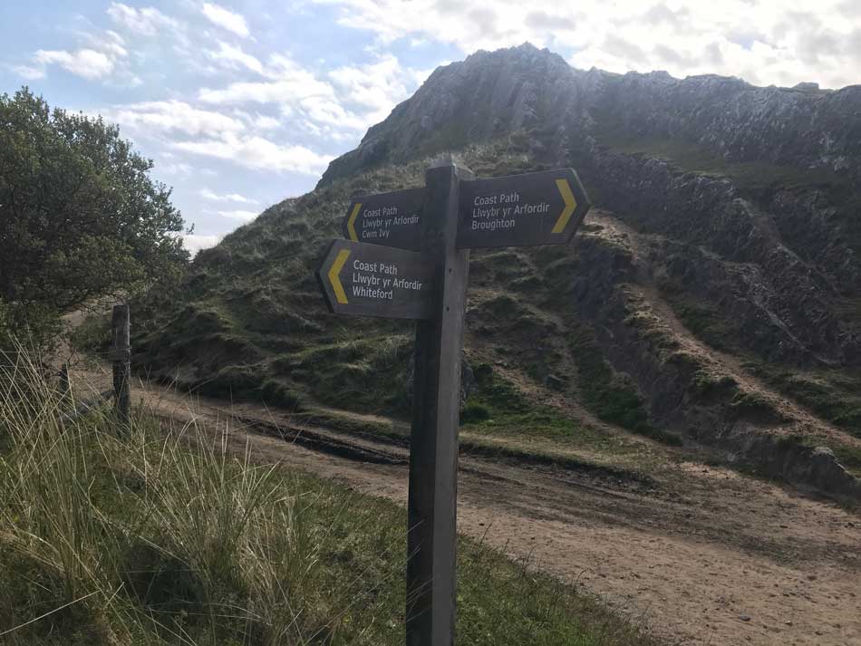
Llangennith Burrows
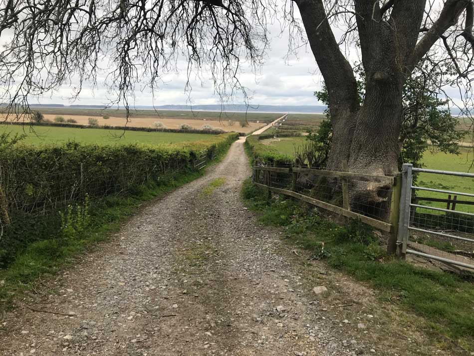
The first part of my run took me down the country lanes from the village of Llangennith to the beach at Hill End. There was no wind, the skies were overcast and the temperatures cool. Perfect conditions for running. After about a mile and a half I entered the Car Park and ran across the same bit of tarmac that I’d ran along last week whilst finishing my run from Oxwich. I was back on the Coast Path again.
I was soon off the tarmac too and into super soft sand as I made my way through the dunes and down onto the deserted beach. All was calm and there was barely a ripple on the water. The Super Moon that had accompanied me on my drive here was producing large Spring tides. The water was receding rapidly leaving me with plenty of beach to run along.


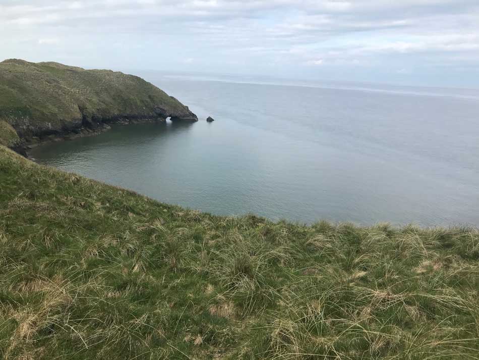
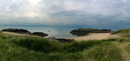
I made my way across the sands, hopping over pebbles and crunching razor clam shells as I went. The small island of Burry Homs was my destination at the end of the beach. It was only just island as the tide dropped. I ran up onto the low cliffs and followed the signs out around the headland and then up onto it’s slopes. The views back to Llangennith and Worms Head in the distance opened up as I gained a little bit of elevation.


The paths became sometimes grassy, somtimes sandy as I made my way along the northern edge of Llangenith Burrows. I had sand dunes to my right, cliffs with various caves and the calm sea to my left, and the familiar song of skylarks above. Running through soft sand is never easy but it was pleasant enough as I made my way onto the northern shores of The Gower Peninsula.
Llangenith Burrows became Broughton Burrows as I made my way past the Three Chimneys, Bluepool Corner and Foxhole Point. Here the path turned into a wooden boardwalk on top of the sand as it descended towards the caravan park at Broughton Farm. The boards were all a little rotten and rickety so I picked my way along them somewhat gingerly.
Broughton Bay
The sands of Broughton Bay could be seen from my vantage point as I made my way down towards them. I went through the caravan park and then down onto the golden sands. The path goes through the dunes but I followed the high tide mark for a while first and then made my way into the dunes to find the path.
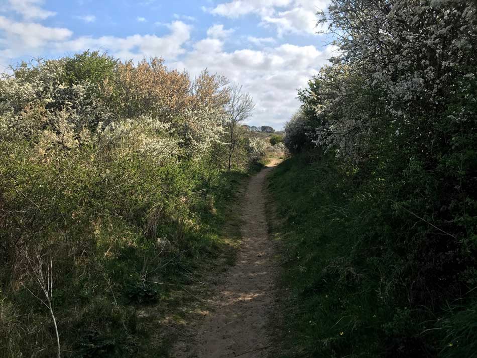
At the end of the dunes the path took me through a gate and into a little glade of blackthorn trees heavy with blossom.
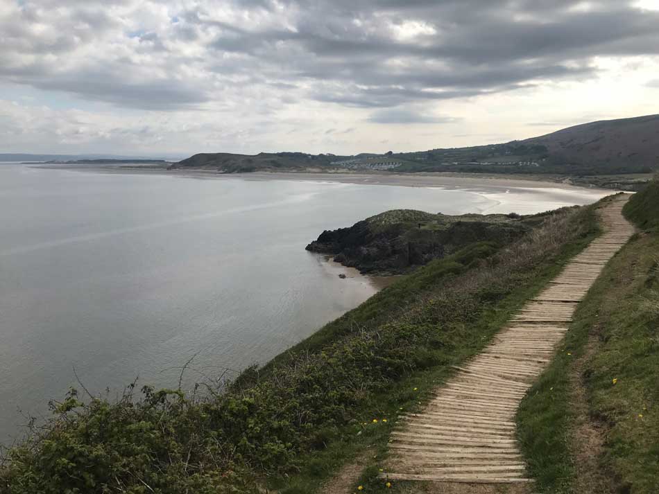
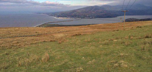
I was soon back into the open and now had a tough climb up a sandy slope to the top of Hills Tor where I had views of both Broughton Bay and the huge sweep of Whiteford Sands. There were lizard and invertebrate trails all over the sand on the climb to the top.


Whiteford Sands National Nature Reserve
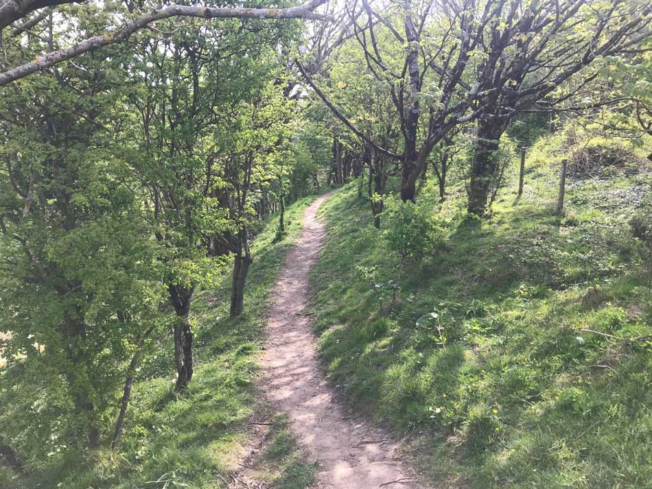
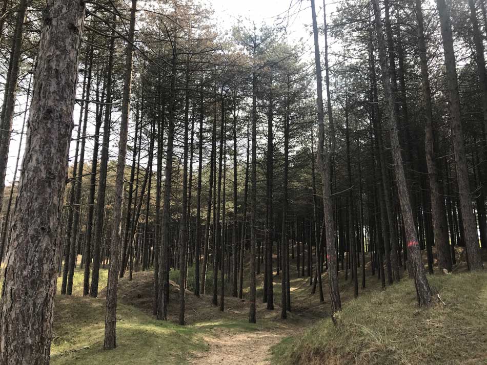
I made my way down from Hills Tor and into Cwm Ivy Woods where the trees were just coming into leaf.
At the base of these I came out into a clay pigeon shooting range and then into the massive dune complex of Whiteford National Nature Reserve. There was an option here to cut out the whole of the Nature Reserve, or to head out right around the point.
I took the latter option and made my way through the dune slacks and then into the dunes proper. The Going was tough through the dunes and finding a proper path difficult. It took a while to make it all the way to the point but I got here in the end. As I rounded the point I entered into the conifer woodland on Berges Island. At the other side of the woodland and stopped for a little snack, sitting on the grass, leaning against a conifer tree.
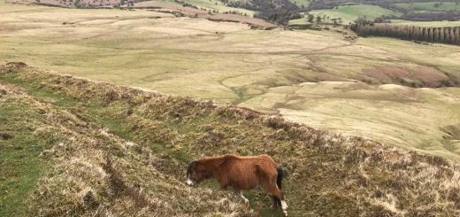
Ponies grazed on the marshy grassland and in the distance beyond the mud and sand of the Loughor Estuary I could just make out the tall buildings of Llanelli.
I was soon on my way again, weaving in and out of the trees and negotiating the now muddy paths. The large high tides had obviously flooded this area earlier in the day and it had yet to dry out fully.
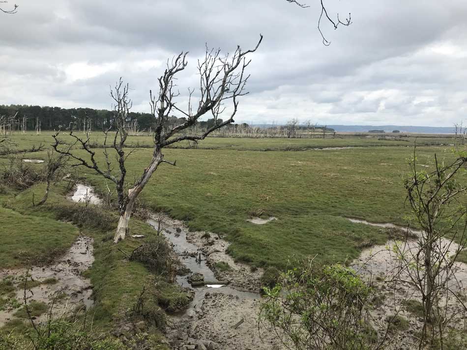
Eventually I made it back to the end of the Nature Reserve. The path used to follow the seawall across Cwm Ivy Marsh but a section of seawall has been washed so there was a diversion in place. This diversion took me pretty much back to the location where I had the choice to add on the loop around the Nature Reserve or not. The loop had been about 4 miles in total and now I was back to where it started. I now had a short detour into the quaint village of Cwm Ivy and then back into Cwm Ivy Woods until I made my way to the far end of the seawall. Skeletal trees could be seen in the flooded land behind the damaged seawall.
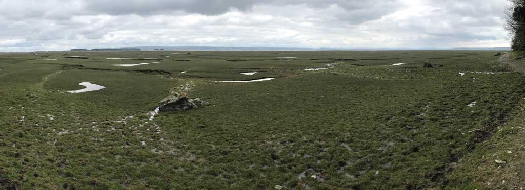
Landimore and Llanrhidian Marshes
As I came out of the woods I dropped down onto the very soggy, very muddy edges of Landimore Marsh. Muddy channels cut through the short grass and once again the day high tides made thing very squelchy for a while. The driest part was the stepping stones over Burry Pill.


The path took me around the base of North Hill Tor and then onto a gravelly, pebbly track along side the extensive salt marshes.
More ponies grazed here as I made my way between the marshes and the steep wooded slopes of Tor-gro.
The path then took me up into Landimore and then out onto farmland as I made my way through a number of fields below Hambury Wood. There wasn’t much happening here, just fields separated by gates and the ever present salt marsh of Llanrhidian Marsh to my left. The causeway out onto the marsh was the only thing that punctuated the marshland. The ruined walls of Weobley Castle could be made out through the trees.
The path took me through occasional villages, most of which seemed to have some very plush looking houses in them. After making my way through the narrow streets of Llanrhidian I came back out onto the edge of the marshland and followed the road through The Common. This was a long flat road with nothing of too much note. Eventually it led back to Llanmorlais where I left the coast behind and headed back to the car.
That was another 17 miles of Coast Path ticked off with quite a way still to go. Hopefully the drives to and from each section should soon start to get a little shorter as I am now finally beginning to get closer to home once again. That might not be the case for some parts of Pembrokeshire, but with The Gower pretty much finished I’m beginning to head home.
All that was left for today was a 2 and a half hour drive home. I did stop for a burger to refuel. Now to start planning the logistics of the next section.
Discover more from A Simple Life of Luxury
Subscribe to get the latest posts sent to your email.


Sounds a lovely run , with nice photos and descriptions along the way to look back on in your old age ,maybe Morgan will follow the same route one day and can note the changes .