Wales Coast Path Run – Oxwich to Llangennith
Coast Path Vital Stats
Oxwich to Llangennith
- Distance: 14.27 miles
- Elevation Gain Today: 483m
- Highest Elevation: 163m
- Time: 2:44:01
- Av. Pace: 11:30 mins/mile
- Calories: 1482
Totals to Date
- Total Distance: 782.23 miles
- Total Time: 144:39:35
- Total Elevation Gain: 22668
- Total Calories: 71207
- Distance to go: 310 miles
Finally, another chance to write a blog post about my project to run around the circumference of Wales, this time along the cliffs of The Gower. As seems to have become a habit with these it will have to start with explanations about the hiatus between this run and the previous coast path run. In fact, the last time I completed a section of the Coast path was over a year ago on March 3rd 2020 when I ran from Swansea to Oxwich Bay. I finished the post about that particular run with the following sentence:
I wonder how long it’ll be before I do the next stretch. Hopefully I’ll be up for it next week but we’ll have to see.
Well, that never happened! I certainly didn’t expect the next stretch to have to wait over a year though. It wasn’t my fault, it was all down to a certain global pandemic and the various restrictions imposed on us because of it. Thankfully, with travel restrictions now lifted I once again had the opportunity to run the next stretch. I still wasn’t really comfortable with jumping on public transport, so Anna came with me. This meant that she could drop me off at Oxwich Bay and could meet me again at the other end of the run in Llangennith.
Progress so Far
This project is taking quite a lot longer than I had anticipated! I actually started it back in January 2016 with a run from Llanrhystud to Aberystwyth. Since then, over the years I have made my way around Wales in a clockwise direction. I’ve taken in the huge sweep of Cardigan Bay, the rugged coastline of the Lleyn Peninsula. The entire coastline of Anglesey has been negotiated, as have the long stretches of North Wales coast all the way to Chester. I then headed south along Offa’s Dyke path following the border between Wales and England. Once I reached the coast again it was westward bound along the sometimes urban and industrial coasts of South Wales. I have now made it to the rugged coastline of the Gower. You can read posts about each of these runs along the Wales Coast path here.
Oxwich to Port Eynon
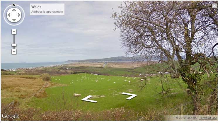
The drive to Oxwich was pleasant enough, and the furthest we have been from home for quite some time. We made our way through the narrow Gower roads. Anna dropped me at the car park where I ended my run over a year ago and I set off towards the beach.
Anna meanwhile headed off along the country lanes of The Gower to Llangenith. A journey of about 7 miles. My route along the meandering coast path would be twice that distance and quite a bit hillier too.
After a brief stint on the sands and pebbles of Oxwich Beach, the first of those hills made itself evident as I headed into Oxwich Woods and up a steep flight of steps.
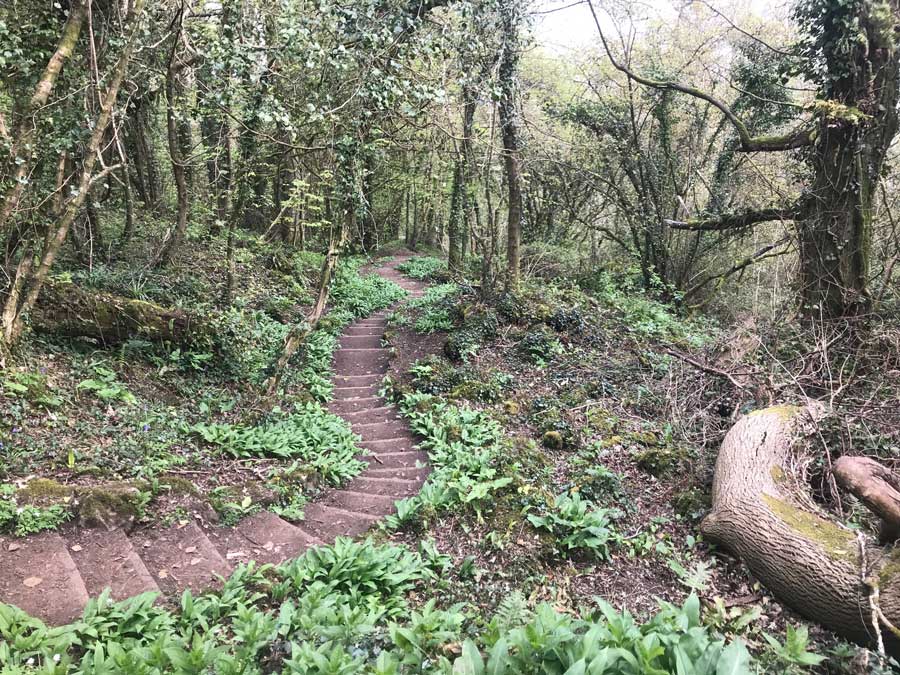
The conditions were ideal for running. There was only the lightest of breezes, temperatures were around 9ºC and the skies were a little overcast. At the top of the steps I paused briefly to take a photo or two and then headed off along the narrow pathway through the woods.


The trees were yet to come into leaf so I could see through them to the calm waters below as they lapped against the rocks leading to Oxwich Point. The woodland floor was carpetted with the fresh growth of wild garlic and pale yellow primroses brightened my way. Small areas of Euphorbia dotted the woodland here and there too and Bluebells were just beginning to flower in some areas. The only sound was that of bird song and the steady patter of my feet. The track wiggled its way through the woods. The going was steady but not fast as I hopped over rocks and jumps tree roots across the path.
After a while the path opened out onto a low Gower clifftop, leaving the woodland behind. Here the bright yellow flowers of gorse and their associated fresh scent created a corridor for me to run through.
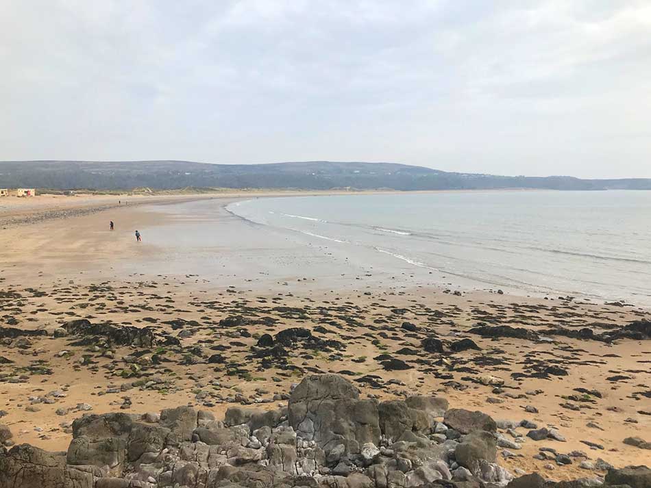
The path took me along these low cliffs for a while as I made my way along the southern side of Oxwich Point. There was a slight detour inland towards Slade to avoid a section where the cliff has eroded and then I was heading toward the beach at Horton.
Here I dropped down onto the sands and ran along the beach where a number of people were out walking their dogs. The far end of this beach is the little village and sandy cove of Port Eynon. I soon made my way up off the beach, past a quiet campsite and climbed steeply up past disused quarries to a standing stone monument on top of Port-Eynon Point.


Overton Cliffs to Mewslade
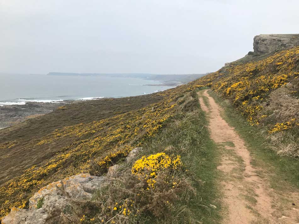
At the top of Port-Eynon Point I turned right to follow the south-western coast of The Gower. This is a rugged coastline with towering limestone cliffs and deep gulleys. Caves dot the cliffs in places too.


I could see a couple of people kayaking off the point and a fishing boat chugging through the calm waters. The lack of rain meant that the tracks were as dry as could be and as hard as concrete. The path runs mainly along the top of the cliffs with a few little detours here and there. There is also the occasional drop and subsequent climb into and out of one of the deep gulleys. These all have interesting names such as Blackhole Gut, Foxhole Slade, Deborah’s Hole and Red Chamber. Remains of Palaeolithic, Mesolithic and Neolithic man have been found along these coasts.


The sun was trying to some out by now but couldn’t quite manage to do so. Crows and Ravens cawed from the clifftops and nightingales filled the air with their song. Away from the clifftops I was taken through grazed pasture land where cattle looked on in an uninterested fashion. There were quite a few people out walking along the path here and there. In the distance I could sometimes make out the cliffs of Worms Head. I dropped down towards the pretty sweep of Mewslade bay and then started the climb up towards Rhossili Head.


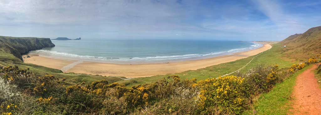
Rhossili and Llangennith
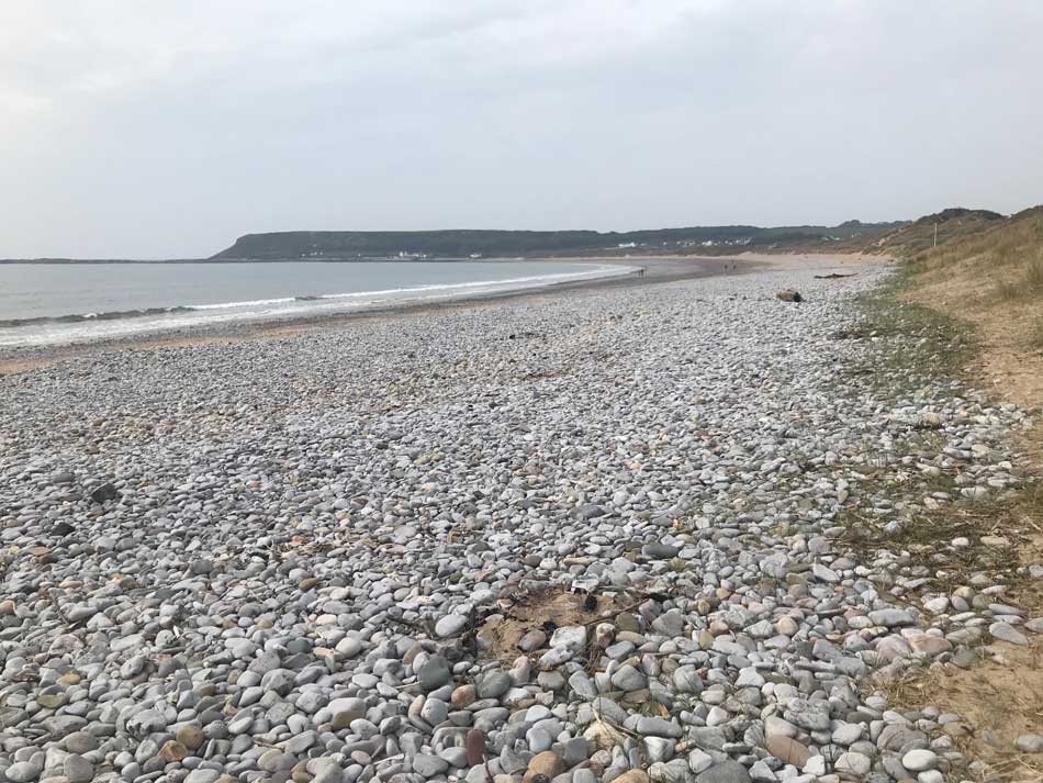
The clifftop views from Rhossili Head are a draw for tourists so numbers increased as I approached. The paths around the Lookout Station were quite busy but not too bad. Hazy sunshine was now the order of the day as I stopped to look at the views of Worm’s head and then take some photos of the wide expanse of sand that is Rhossili Bay.


Small surf rolled into the sands and a few people were out making the most of it. Anna would be parked at Hillend Campsite halfway along this sweep of sand.
I made my way along the tops of the cliffs towards the village of Rhosilli where coffee shops and ice cream stalls were open. I followed the signs around a church yard, through a couple of gates and then out onto another hard-packed path than led gradually down hill towards the sand dunes.


Finally, the sun came out and bathed the sands in its warmth.
I passed the Old Rectory which is a now a holiday Cottage owned by the National Trust. The ideal Gower Getwaway! Not far to go now, just a mile or so through undulating paths behind the caravans at Hillend and then I dropped down into the car park where Anna was waiting.
Refreshments
Once changed we headed up to the café where we shared a baguette and some chips and then started our journey home. The route had been just short of 15 miles for me.
Not particularly far for a Coast Path run, but I guess I’m not as young as I was when I first started this project. I’m not going to tempt fate by suggesting a date that I’ll complete the next stretch. With over 300 miles still to go I can’t afford to wait another year, as at that rate I’ll never get it finished!
Discover more from A Simple Life of Luxury
Subscribe to get the latest posts sent to your email.


Yey back at last to reading about your coastal run .I too won’t tempt fate but hopefully another to come shortly