Maltraeth to Four Mile Bridge Coast Path Run
Coast Path Vital Stats
Maltraeth to Four Mile Bridge
- Distance: 18.70 miles
- Elevation Gain Today: 332m
- Highest Elevation: 68m
- Time: 4:06:45
- Av. Pace: 13:12 mins/mile
- Av. Heart Rate: 101bpm
- Max Heart Rate: 158bpm
- Calories: 1452
Totals to Date
- Total Distance: 262.72 miles
- Total Time: 48:44:59
- Total Elevation Gain: 7349m
- Total Calories: 23209
- Distance to go: 623 miles
That was a lot harder than it should be and I’m not sure that I can even call it a run as my Coast Path ‘run’ from Maltraeth to Four Mile Bridge had more walking in it than running. This was all due to a very sore achilles tendon. So sore in fact that I nearly stopped early, but in the end I soldiered on as I wanted to get to Four Mile Bridge. This means that my next Coast Path run can be an attempt at circumnavigating the whole of Holy Island. If I can make it all the way around I’ll be able to stop where I started and therefore won’t need to make use of public transport. That’s for another week though as after Saturday’s struggle I’m not convinced I can make it all the way around Holy Island in one go.
An Early Start
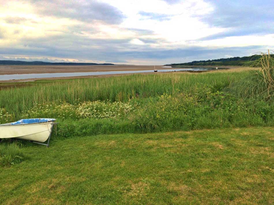
As usual, I made an early start to the day, getting up at 4am so that I could get ready and leave by 5:15am. With nice clear roads and a fast drive to Maltraeth I was changed, out of the car and ready to run by 7am. My calves were tight for some reason and had been the night before so I eased into a slow run through the streets of Maltraeth and then down a little overgrown lane towards the shores of Maltraeth Sands with the River Cefni meandering through them.
Good Pace
Today’s run was only going to be about 19 miles, considerably shorter than recent Coast Path runs and fairly flat too. I was therefore expecting to finish in just over 3 hours. That should get me there for about 10am, then by the time I’d caught the bus back to the car it would probably be midday meaning that I could get home by around 2pm. Things started well too with a few fairly fast miles as I made my way inland from Maltraeth Sands up the Pen Boncan hill through Hermon and then along various lanes towards the dunes of Aberffraw.
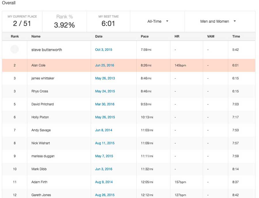
I even managed to get a Strava trophy for 2nd overall on the Pen Boncan Climb.
Despite the hills my pace was looking good, maybe a little too good in fact.
- Mile 1: 9:29 mins/mile
- Mile 2: 8:04 mins/mile
- Mile 3: 7:47 mins/mile
It slowed a little once on the soft sands of the dunes, but not by much:
- Mile 4: 8:10 mins/mile
Aberffraw
The dunes were awash with colour with loads of orchids everywhere. Following our orchid walk last weekend I could easily identify the Pyramidal Orchids from the Marsh Orchids, and I assume this far north that they are Northern Marsh Orchids too.
- Aberffraw Dunes
- Orchid
- Sandy Dunes
I slowed a little through the dunes as I stopped to take photos and take in the scenery, and then once on the beach of Aberffraw the soft sands slowed me yet more.
- Mile 5: 9:28 mins/mile
- Mile 6: 9:09 mins/mile
I made my way across the sands to the little trickle of a river that is the River Ffraw. The Coast Path here heads into the village of Aberffraw and then straight back down the other side of the river. It was tempting just to jump across the river and save myself just over a mile of running up one side and down the other, but I stuck with the plan and followed the Coast Path to the letter.
The tide was very low, the sands were soft and muddy but there was plenty to keep me interested. Herons, Lapwings, Oyster Catchers and a number a pure white Small Egrets were hunting and foraging along the river. I made my way to the bridge over the river and then ran back along the narrow path on the other side of it towards the small rocky cliffs of the coast.
Coast Path
The Coast Path now became my favourite sort of coastal path. A narrow path along the tops of small cliffs, ever winding one way or the other and climbing up and down along the coast. Sometimes it dropped down onto the soft shingle, shell and rock covered beaches themselves as I weaved my way along the rocky shoreline and across secluded coves.
- Shingle and Shell Beach – Porth Lleidiog
- Shoreline Selfie
The weather wasn’t bad, but it wasn’t great either. Quite cloudy but not too warm and with a gentle breeze. The seas were calm though and I was feeling OK. My sore calves were feeling better and I was still making good time. The pace had slowed thanks to a few stops, the rocky terrain and some route finding.
- Mile 7: 11:29 mins/mile
- Mile 8: 10:22 mins/mile
- Mile 9: 10:21 mins/mile
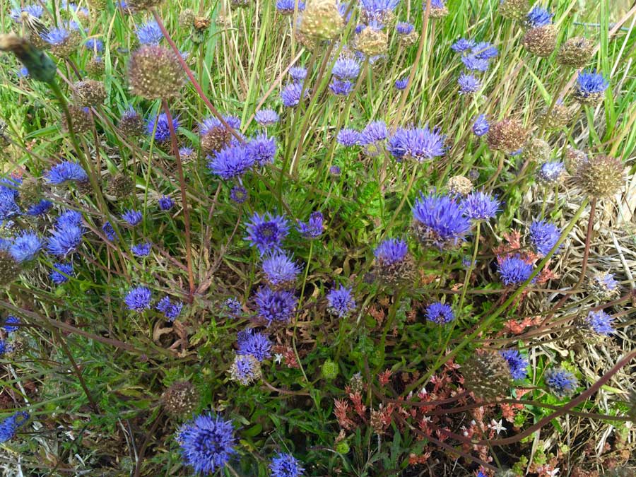
In many places the coast path took me over rocky coves which slowed progress somewhat and when on top of the cliffs it was along very narrow paths overgrown with grass, nettles, brambles and thistles so I was treading carefully. In places the coast path was lined with bright blue, thrift-like flowers. I’m not sure what they are though (can anyone help?)
Cribinau and the Church of St Cwyfan
I soon rounded the headland and made my way down onto the soft shingle of Porth Cwyfan and Porth China beaches which are separated by the small island of Cribinau and it’s church of St Cwyfan. The island can be reached on foot at low tide and certainly today could as I ran past it. The island of Cribinau is notable for the 13th-century church of St Cwyfan or in Welsh: eglwys bach y mor (“the little church in the sea”).
- Porth Cwyfan
- Cribinau
- St Cwyfan Church
The Church of St Cwyfan was in existence by 1254 and was enlarged in the 14th and 15th centuries. The building later fell into disrepair, and in the 19th century parts of the church were demolished. An appeal was launched in 1891 which paid for the building of a new roof and in the 1970s all the windows were restored. Unfortunately the building is deteriorating again and a new restoration appeal has been launched. Despite the need for some restoration it is still in use and is popular for weddings. Not surprising really given it’s location.
Towards Rhosneigr
The Coast path now headed inland a little to avoid an MOD Danger Area. It took me alongside the Anglesey Motor Racing Circuit and along various little lanes before heading back to the rocky coast. My achilles on my right ankle was beginning to hurt quite a bit by now though and with it my pace was dropping.
- Mile 10: 10:41 mins/mile
- Mile 11: 13:21 mins/mile
Mile 10 took me along the coast and around behind Porth Trecastell, a lovely looking sheltered sandy beach. Mile 11 took me up an over the headland of Mynydd Mawr and Mynydd Bach complete with a chambered cairn and then out onto the beaches of Porth Nobia, Porth Sûr and Porth y Tywod and Traeth Llydan (Porth means bay or cove, Traeth means beach). These beaches are all separated by rocky outcrops at high tide, but at low tide they merge into one. As the tide was low I could make my way along the beaches in one go, weaving my way between the rocky outcrops. There is a path through the dunes behind them should the tide be high.
The pain in my achilles had now gotten worse though and running was just too painful. I tried a bit of walk/run for a while but once on the soft sands decided to just walk across them to see if the pain would ease. Needless to say my paced slowed to walking pace as I made my way into and through the streets of Rhosneigr.
- Mile 12: 16:40 mins/mile
- Mile 13: 16:50 mins/mile
It was now just gone 9am and Rhosneigr was beginning to wake up as people rode bikes to the shops to get newspapers and cafe owners prepared for the day ahead. It certainly wasn’t busy, but there were now some people about.
Tywyn Trewan Common and Traeth Cymyran
I did try running once or twice but my achilles was in agony after just a few steps, so I resigned myself to walking the rest of the way. It was going to be a long day!
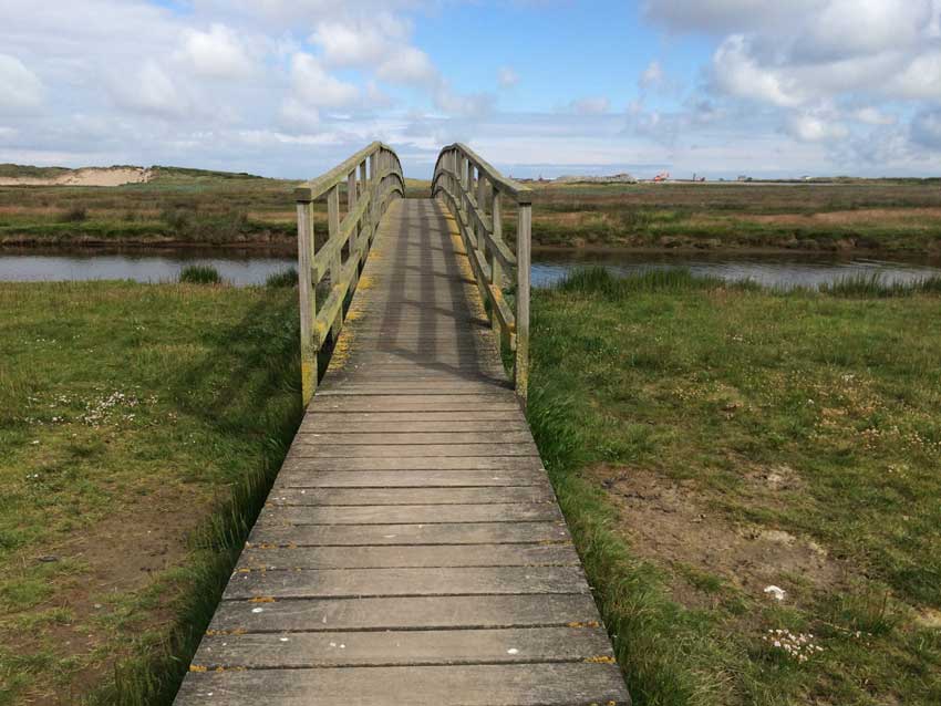
The Coast Path led me out of Rhosneigr, a town well known to the windsurfing community and across a little bridge over the river onto the dunes of Tywyn Trewan Common. Once again the dunes were full of flowers including orchids and are backed by the RAF Base of Valley. They seem to be doing lots of work on the RAF base too with diggers and construction machinery everywhere. As far as I can workout, they are building a new runway.
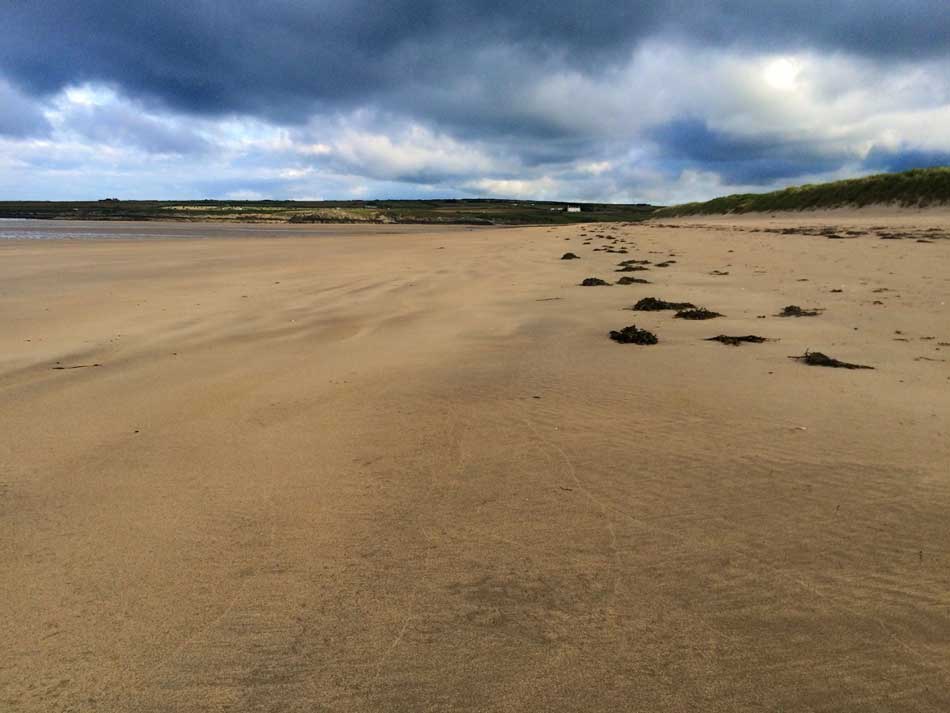
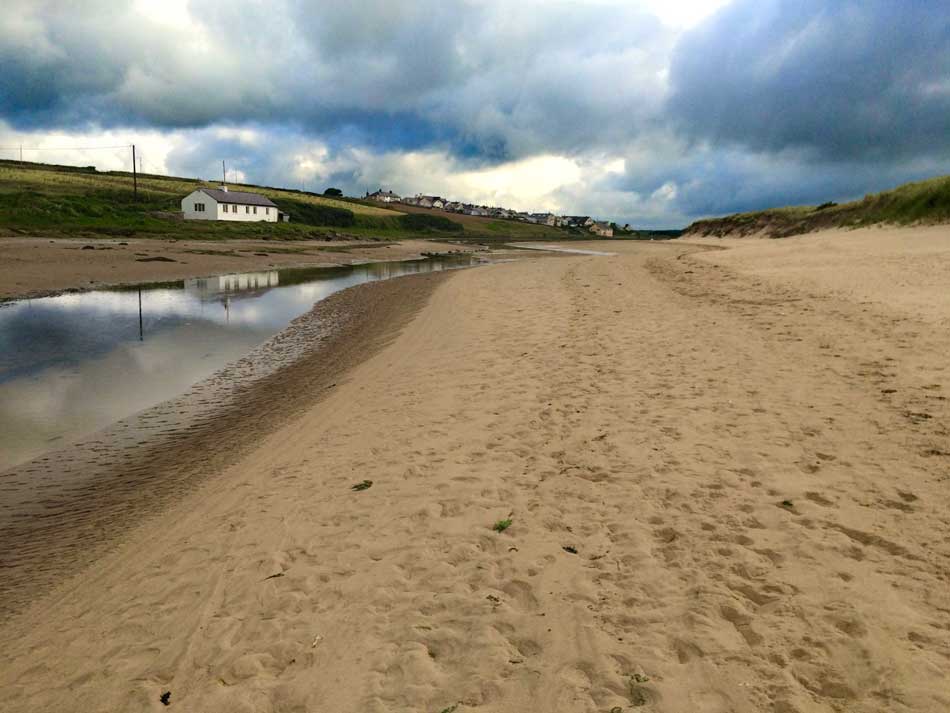
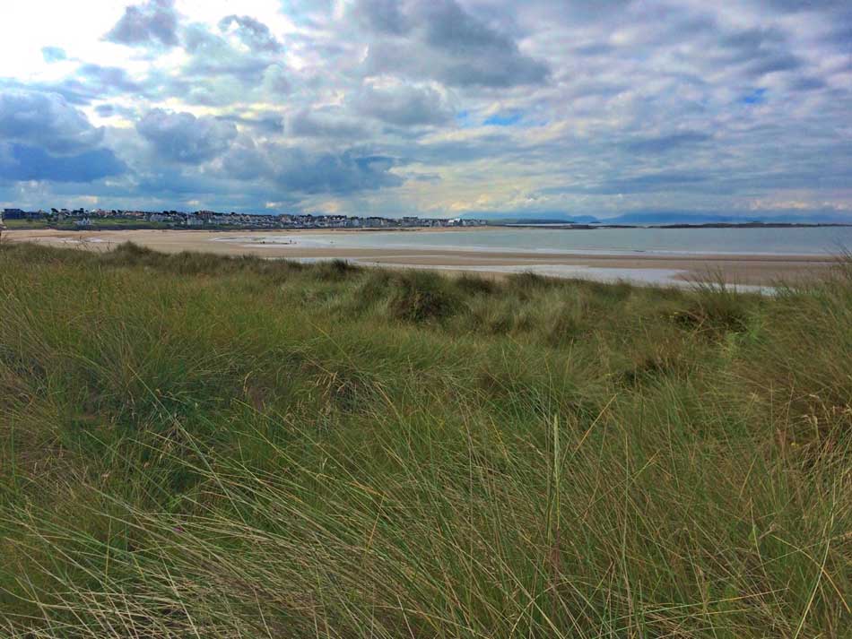
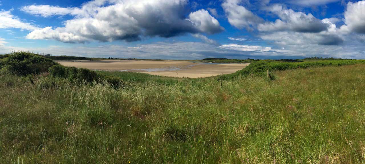
After slogging through the dunes the path eventually emerged out onto the wide expanse of sand at the junction between Traeth Crigyll and Traeth Cymyran.
My achilles was killing my now so I sat on the dunes for a bit and admired the flowers.
I had a snack and contemplated walking back across the beach to Rhosneigr from where I could get a bus back to my car. This would have messed things up for the next stage of my Coast Path adventure though and looking at the map, my planned destination of Four Mile Bridge didn’t look too far away. I therefore continued on my way across the sands of Traeth Cymyran.
Holy Island Divide
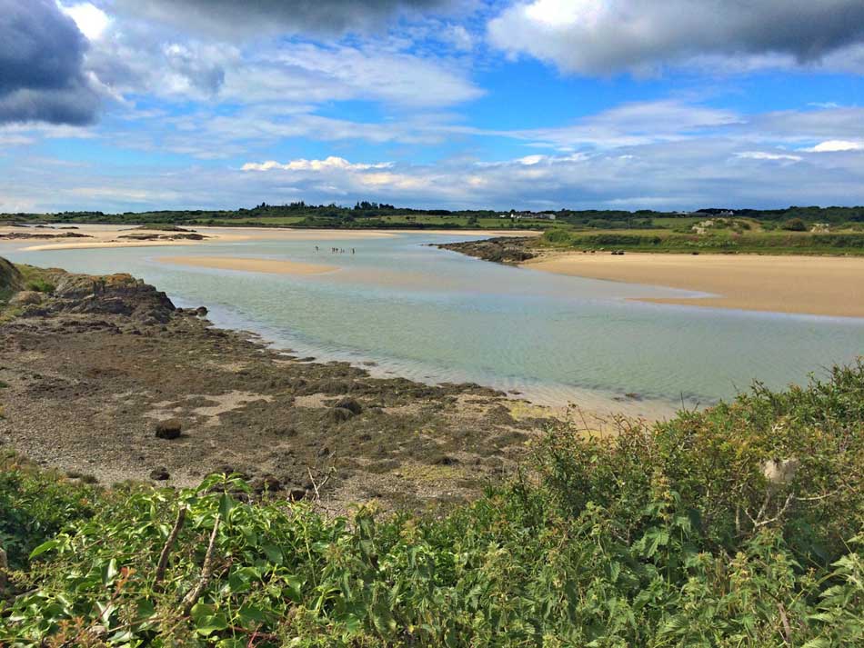
At the end of the beach the Coast Path started to follow the narrow waterway between Anglesey and Holy Island. The tide was still low so the water was a narrow band weaving it’s way through the sandbanks. It doesn’t seem to dry out completely, even on the lowest tides, so there is always some water dividing Holy Island from Anglesey. It looked lovely today as the sun broke through the clouds on occasion. I’m sure there would be some nasty currents at times, but it looks like a perfect place to explore in our new canoe.
The path weaved it’s way all over the place though, sometimes along the sandy and muddy coast, other times next to Valley Airfield, across fields and through long grass. Through gates, over stiles, around creeks and inlets. All this ‘to-ing and fro-ing’ meant that what looked like quite a short walk on the map was actually quite a long one and by now I was struggling even at walking pace. On it went with me getting more and more tired and my achilles getting worse. The long grass, stiles, gates and constant obstacles slowed progress even more.
- Mile 14: 19:18 mins/mile
- Mile 15: 18:16 mins/mile
- Mile 16: 18:41 mins/mile
- Mile 17: 22:03 mins/mile
- Mile 18: 21:17 mins/mile
Flowers
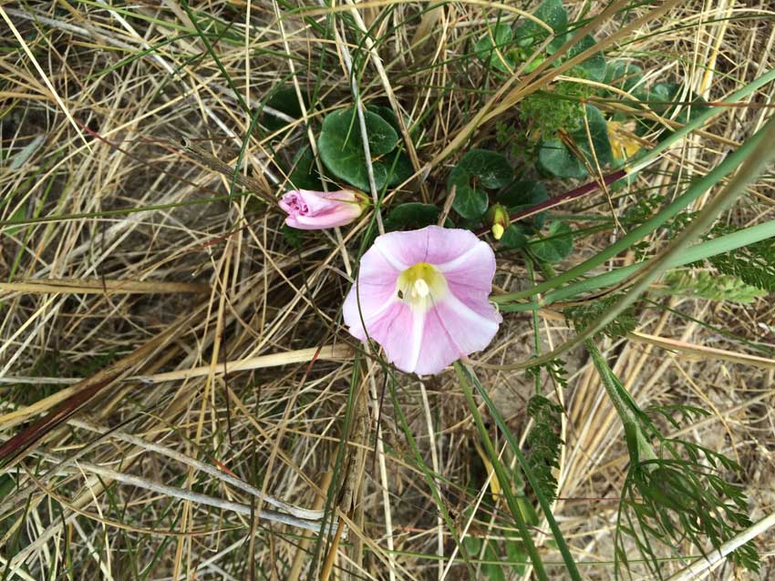
It was obviously June though as the hedgerows and meadows were awash with flowers. Red Campion was everywhere, the sweet scent of honeysuckle filled the air, the meadows were covered in bright yellow buttercups, foxgloves rose out of the grass, poppies were bursting into colour and the bright white trumpets of bindweed stood out along the verges.
- Foxglove
- Honeysuckle
- Meadow
- Poppies
- Red Campion
On to Four Mile Bridge
The path continued weaving its way past little cottages, around creeks and even across a little seaweed covered causeway.
Every now and then I got a glimpse of cars crossing the bridge to Holy Island in the distance but it seemed to be getting closer very slowly indeed. At other times there were glimpses of the sandbanks and the meandering channels between Anglesey and Holy Island. There was even a family wading across it at one point.
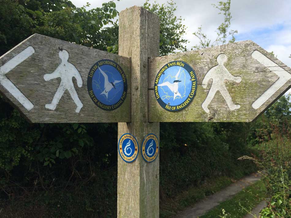
Although the route the path took was fairly tortuous it was at least well signposted.
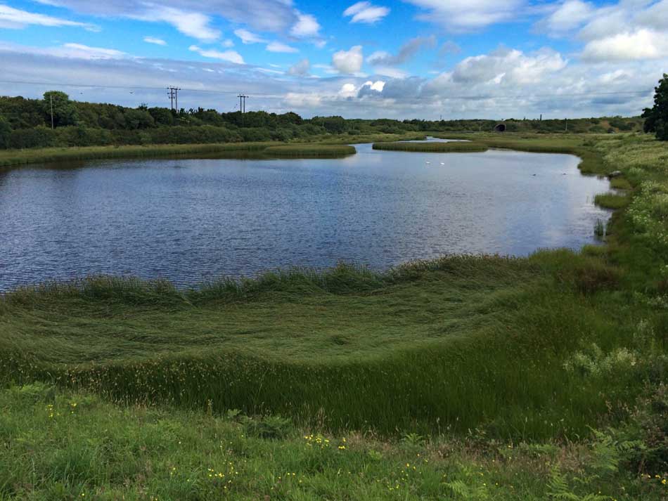
Finally the path crossed a little dam at the Valley Tidal Doors and from here it wasn’t far to the small road bridge at Four Mile Bridge.
The Journey Home and the Strangeness of Llangefni
Four Mile Bridge was my destination for the day so I walked across the bridge, watching the people having a kayak lesson on the waters below, walked into the village and found the bus stop. The next bus wasn’t due for 45 minutes so I sat on the bench and waited. After a while it started raining so I moved into the shelter of the bus stop and stood there waiting for the bus. It was about 10 minutes late and when it did arrive didn’t actually go to Maltraeth (where I’d left my car). The driver was helpful though and said he could take me to Llangefni from where I could probably get another bus to Maltraeth.
The journey to Llangefni was uneventful and I arrived there at 13:10. According to the timetable there was indeed a bus to Maltraeth but it didn’t leave until 14:00 so I had 50 minutes to waste in the pouring rain. The people on the bus stop were all a little weird and wanted to talk far too loudly to me so I headed off to the shops for some lunch.
When I got back the weirdness continued with old men needing me to help them do up their cardigans, chain smoking old ladies, a group of men trying to put on bin liners to protect themselves from the rain (they ended up with 5 bin-liners each from head to toe). It was absolutely pouring with rain so I guess it kept them dry but I couldn’t help laughing at the spectacle as they tried to sort themselves out, what made it even funnier was the fact that they didn’t seem to think it was even slightly odd!
Next to turn up at the bus stop were a couple of teenage lads who simply couldn’t read the bus timetable and then when the number 32 bus turned up decided between them that it would be ages until the 42 would be there as “that meant they had to wait for the 33, 34, 35….”. They got stuck with what came after 35 though and decided they couldn’t wait that long anyway so left.
I couldn’t quite believe what was going on and thought that maybe I was being wound-up and half expected a hidden camera to appear at any minute. I looked around behind me to check, only to see some guy in a tracksuit and headphones doing a Michael Jackson style dance in the pouring rain on the other side of the road. He stayed there doing it for ages. A woman with a shopping trolley full of (past their best) cut flowers was also wandering through the town sticking the flowers to everything – bins, shop windows, lamp-posts, railings, the wheels of parked cars anything she could see she taped a flower to it. Then a fairly normal looking girl came along and sat by me, she said ‘alright’ as she sat down and seemed quite nice, but a couple of minutes later she just started reeling of the names of supermarkets to no one in particular in a heavy North Wales accent ” Lidl, Iceland, Aldi, Morrisons, Asda…” On she went with more supermarkets than I would have been able to think of.
Finally the bus turned up and I was glad to get on it and away from the madness. It made quite a circuitous route to Maltraeth but finally at around 3pm I got to my car ready for the long drive home.
Home at Last
I arrived home at around 5pm. Not the best of days on the Coast Path so far. My achilles was sore, my progress had been hampered by it and it had taken much longer than expected. So long in fact that I didn’t have time to build the new shed as planned. I had however ticked off another section of the coast path, seen some nice bits of coast and was now onto Holy Island. The adventure continues.


















You’ll need to rest your foot or you’ll be back to square one, and I know you know that, so take note of your body.
The bus stop at llangefni sounds a great place,