Cadair Idris Circuit
With my continued uncertainty about which boots to use for my upcoming Kilimanjaro trek it would have been silly of me not to get out into the hills for a walk at the weekend. And whilst testing boots, why not make it a long walk? With little daylight around at this time of year this meant an early start so I was in the Minffordd car park at the bottom of Cadair Idris before it even started to get light.
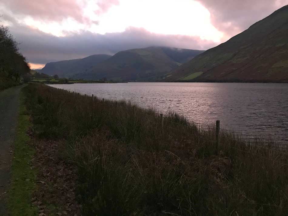
Headtorch and a couple of layers on, as it was pretty chilly, and off I set. Usually people just head straight up here as the Minffordd Path is one of the best ways up Cadair Idris and quite a direct route. Not for me today though as I set off along the Tal-y-Llyn valley first, heading west so as to skirt along the northern shores of the lake.
I splashed through the fast flowing river over a ford. The boots were waterproof and the layers of wax I’d applied did their job. The water was a little deeper than it looked in my torch-light though and even the most waterproof of boots can’t stop water getting in if it goes over the top of them. Oh well, my feet would dry soon enough!
Light started seeping into the sky as I made my way along the lake and then past the The Rectory on the Lake B&B (I’d built the website for this B&B many years ago, but I think it has been sold on now and there was work being carried out on the building as I walked past.)
From here I headed along the road for a little bit and then up into the oak woodland.
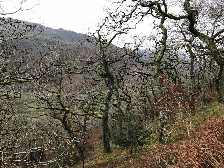
After a bit of a climb I emerged out of the woodland into scrubby fields between the peaks of Mynydd Tyn-Y-Fach and Foel Caerbellan. It was a little chilly in the breeze here, but the sun was just touching the tops of the hills and things would still start warming up.
I put on my gaiters as I started splashing through a stream bed and some deep muddy sections of field. I then made a bit of a detour to avoid a group of feisty looking cows that didn’t take too kindly to being disturbed at this time of day.
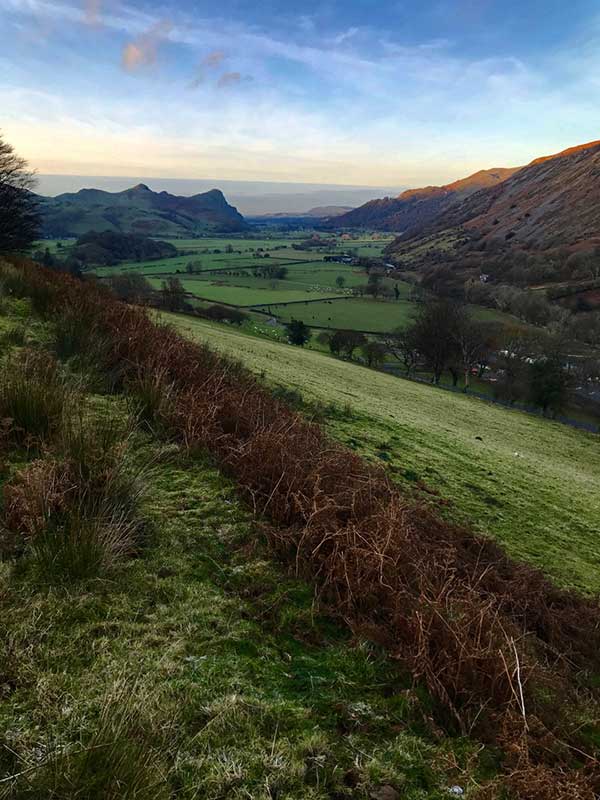
After tromping through these hills for a little while I emerged above the tiny hamlet of Llanfihangel-y-Pennant with it’s attractive church alongside the River Dysynni. To the west the green pastures of the Dysynni Valley could be seen, towered over by the impressive and fore-boding cliffs of Bird Rock.
I made my way down to the river and across a little footbridge before heading up into the valley. Here I came across another herd of grumpy cows. They decided that I was actually quite interesting so all came charging down the hillside to greet me. I shouted at them to get out the way but they didn’t move. A massive white bull with a ring through his nose squeezed his way to the front of them, snorted a couple of times and then bellowed at me and made it quite clear that they weren’t going to move. Not to worry, I had a plan B anyway and it involved a hasty retreat, a quick skip across the river and then a steeper track up into the hills. The cows tried to follow me for a while but then gave up and stood at the bottom mooing loudly at me as I stomped up the hill looking over my shoulder every now and then just in case!
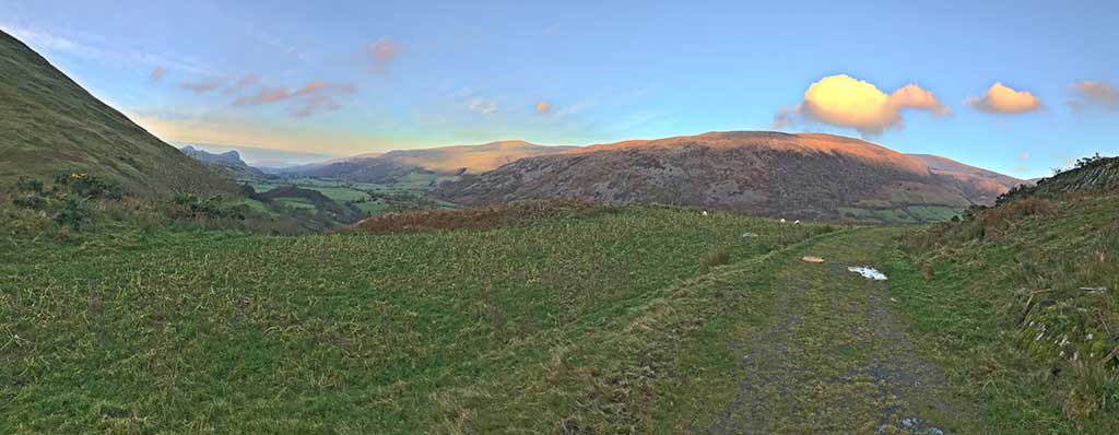
After a while I emerged out onto upland moor and started making may way steadily up through the valley. The wind picked up the higher I went and temperatures dropped. It was soon time for a hat, gloves and buff as I climbed ever higher on a fairly obvious but not much used path.
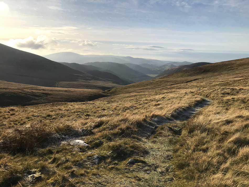
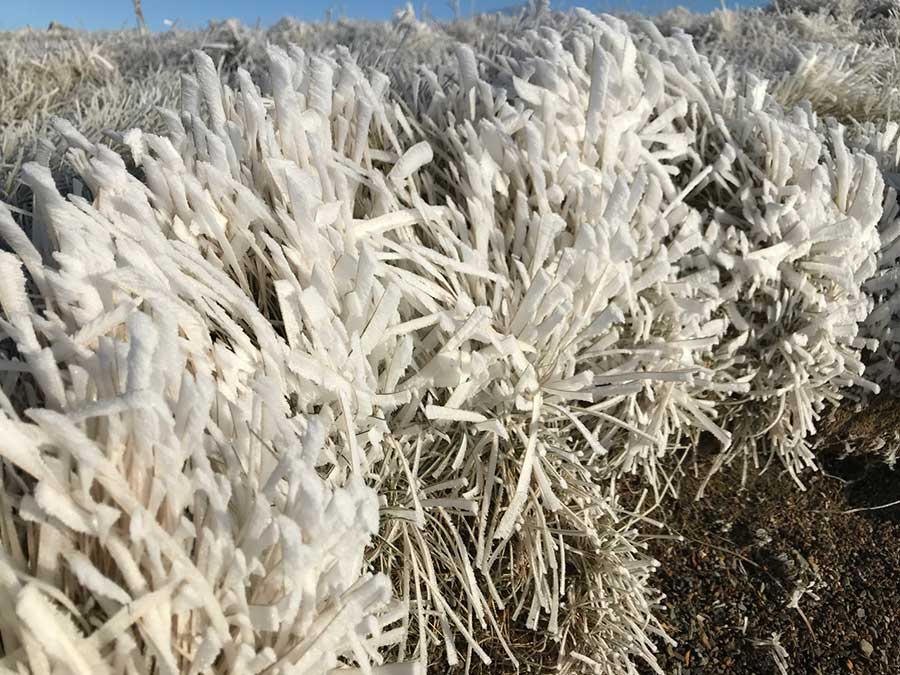
Puddles became ice and the green grass became coated in a white layer of frost. So far, I had seen no one since leaving the car and there was no sign of people anywhere.
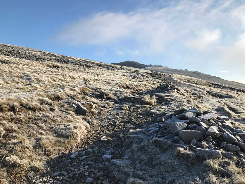
After a long and winding route around the western edge of the Cadair Idris Massif I finally came across a gate and onto the well known Pony Path. This path leads to the summit of Cadair Idris from the northern side so I had made my way all the way around to the other side. I turned right and joined the path.
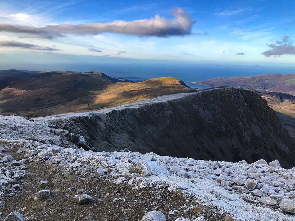
I could soon see the summit above me and for once everything was looking clear with blue skies. I stopped to take a look around and had some amazing views back down the Pony Path and all the way to Barmouth on the coast.
I also spotted the small figure of someone else climbing the Pony Path behind me.
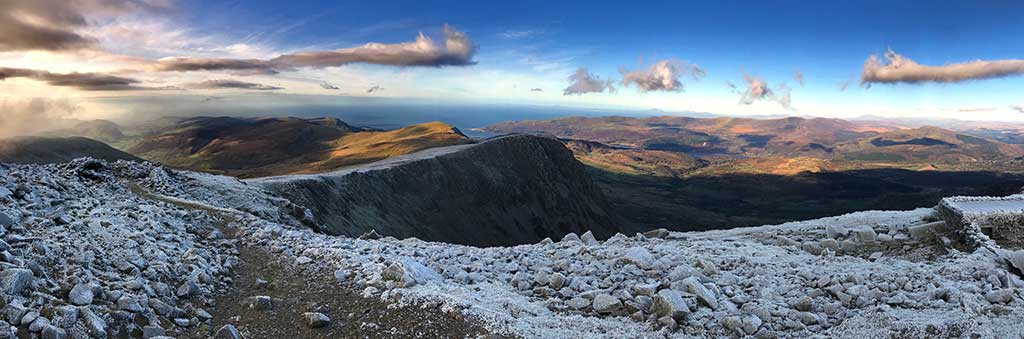
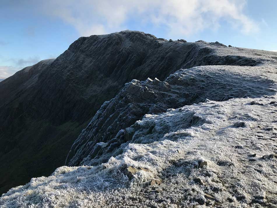
The crags of Cyfrwy Arete were bathed in early morning sunshine with Llyn Gader far below. I did climb these once many years ago, but I’m not sure that I still have the head for heights for such antics these days.


On I pushed to the summit with temperatures dropping all the time and ice lying thick on the rocks.
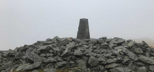
Eventually, at the trig point I was in a different world. The clouds were closing in a little, the wind was howling and temperatures were well below freezing. Ice covered everything. I took a few photos at the summit and then headed into the shelter to get out of the biting wind. I was the only person here so I ate a sandwich and a banana and then continued on my way.


Once I emerged it was really cold and the clouds closed in dropping visibility to just a few feet. I stopped to put on thicker gloves and was soon shivering. I could have put another layer on but decided that I’d soon warm up once I got walking again. I was now heading east along the ridge towards the summit of Mynydd Moel. Not that I could see the summit or anything else through the mist and murk. The clouds weren’t that thick but the sunshine trying to shine through them only made things worse as it created a white blinding light all around.
From the summit of Mynydd Moel I took a slight detour to usual. Rather than follow the fence line I wandered around the summit a little until I could see the path leading east to Gau Graig. Here I looped back and headed over to the fence line through the tussocky grass.
As I hit the fence I also dropped below the clouds and was once again in sunshine. The winds dropped completely and temperatures rose pretty quickly as I descended down the steep rocky path. The contrast between the relative calm and warmth here and the extreme conditions at the summit were massive. I took my time descending as I’d now walked quite a way and my knees didn’t take too kindly to any spritely rock-hopping. I passed a family group heading up. They were only halfway up and already hoping they were nearly there! I didn’t like to tell them that they had quite a way to go, nor that they might need a few more layers once they were eventually at the top.
After about 5 ½ hours of walking and over 14 miles of distance covered I made it back to the car and headed home.
A good day out, a different ascent of Cadair and a good test for my boots and my cold weather gear!
Discover more from A Simple Life of Luxury
Subscribe to get the latest posts sent to your email.


Amazing and spiritually uplifting sharing your boot testing walk?