Morfa Nefyn to Glynllifon Coast Path Run
Coast Path Vital Stats
Morfa Nefyn to Glynllifon
- Distance: 20.01 miles
- Elevation Gain Today: 810m
- Highest Elevation: 350m
- Time: 3:34:26
- Av. Pace: 10:43 mins/mile
- Av. Heart Rate: 130bpm
- Max Heart Rate: 164bpm
- Calories: 1924
Totals to Date
- Total Distance: 192.98miles
- Total Time: 37:35:28
- Total Elevation Gain: 6460m
- Total Calories: 19,216
- Distance to go: 684 miles
After and amazing day on the coast path on Tuesday running from Aberdaron to Morfa Nefyn, I was back at it again on Saturday as my quest to run around the entire perimeter of Wales continues. Once again there were some travel logistics to coordinate and so after a busy day on Friday and a short sleep, I was back up again at 5:00am so that I could do a little bit of work before setting off towards Pwllheli once again at around 6:15am.
The drive up was fairly quick, even with loads of Mansell Davies lorries on the road, so I arrived at Pwllheli Bus Station with about half an hour to wait for the first bus to Morfa Nefyn. I’m getting quite familiar with Pwllheli Bus Station now. That didn’t help once the bus arrived though as I only had a £20 note and the driver had no change. He did wait while I sprinted across to the Spar to get some change for me though so I was soon successfully on the 8:35 bus to Morfa Nefyn.
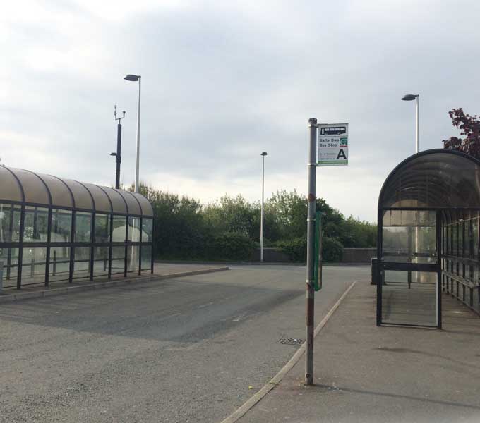
Pwllheli Bus Station
I had a little chat to another woman who was also on the bus and then the bus driver was chatting to me for the rest of the way – it’s not like me to be sociable, but I was almost ‘chatty’ this morning as we made our way through the Lleyn Peninsula. It didn’t take long and I was soon jumping off the bus into hazy sunshine at Morfa Nefyn.
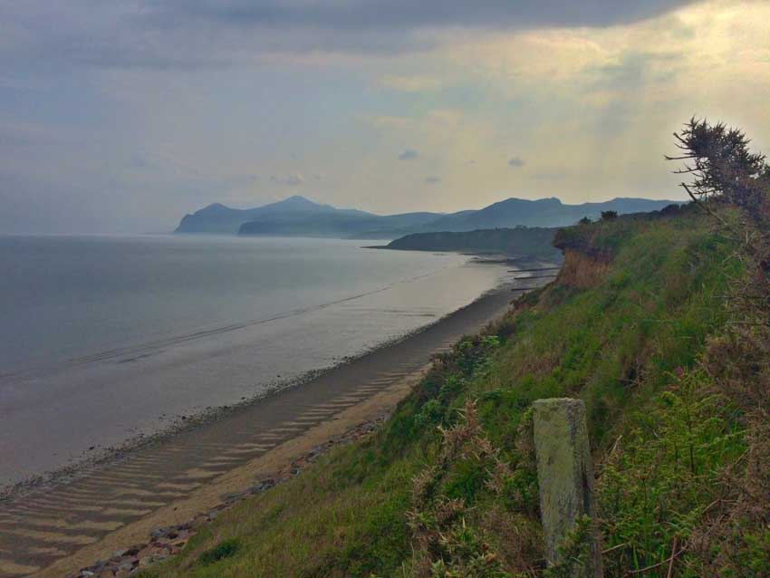
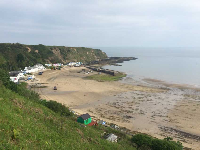
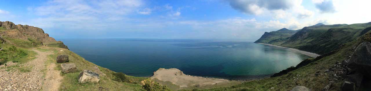
Porth Dinllaen and Porth Nefyn
It was on with my rucksack, which was full to the brim with water and therefore quite heavy today and off down the road towards Porth Dinllaen where I joined the Coast Path and climbed up onto the cliffs above the beach. The path made it’s way along the tops of these loose cliffs which had a few landslides here and there and one or two patches where there wasn’t much left of the path. The sun was shining but the views were quite hazy as I made my way out onto the little rocky peninsula of Penrhyn Nefyn and ran through the maze of little paths here, each one lined with nettles. I was doing my best not to get stung and managed to do so fairly well.
Porth Dinllaen looking East
Porth Dinllaen
From this peninsula I had some nice views of the sweep of sand that makes up Porth Nefyn and the looming hills ahead of me.
-

- Porth Nefyn
-
- Porth Nefyn
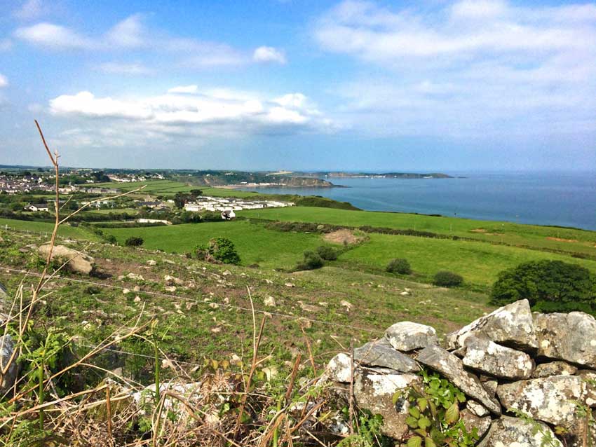
The Coast Path weaved it’s way into the village of Nefyn, then back out along more nettle lined tracks along the cliff tops above the beach and then back into the centre of the village. From here it cut through the village and out onto the lower slopes of Mynydd Nefyn, Carreglefain and Gwylwyr.
In the shadow of Quarries, Pilgrims and Saints.
These hill have been extensively quarried and the path runs along the lower slopes of them. Sometimes climbing, sometimes descending and all the time over uneven, rocky, muddy and grassy ground. There are a few gates and stiles to negotiate and some interesting steps and stairs up onto quarry scree slopes and back down. The sun was coming out now and whilst out of the trees on open tracks there were some nice views back towards Porth Nefyn and Porth Dinllaen.
-
- Coast Path above Nefyn

-
- Looking back to Porth Nefyn and Porth Dinllaen
Eventually I left the quarries behind and headed across the road onto undulating tracks, past a campsite and through some fields and then out onto an old Pilgrims Way and past St Bueno’s Church at Pistyll.
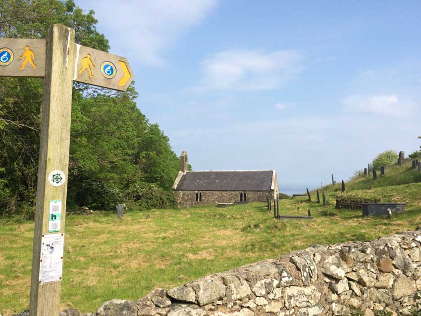
St Bueno’s Church, Pistyll
There has been a church on this site since the 6th Century when St Beuno, a Celtic saint, retreated here for peace and quiet. It was fairly peaceful here today in the sunshine so I guess he had the right idea all those years ago. All that remains of the early church is a large corner stone at the south east corner. The present building is thought to be 12th Century and lies in a grassy hollow beside a stream which has been dammed so has a little pond nearby. From above the church there are views out across the sea.
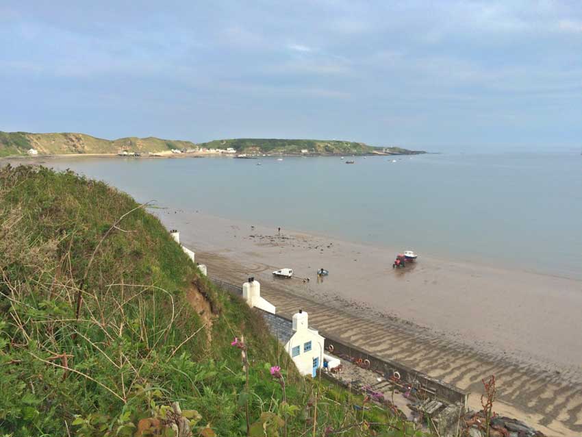
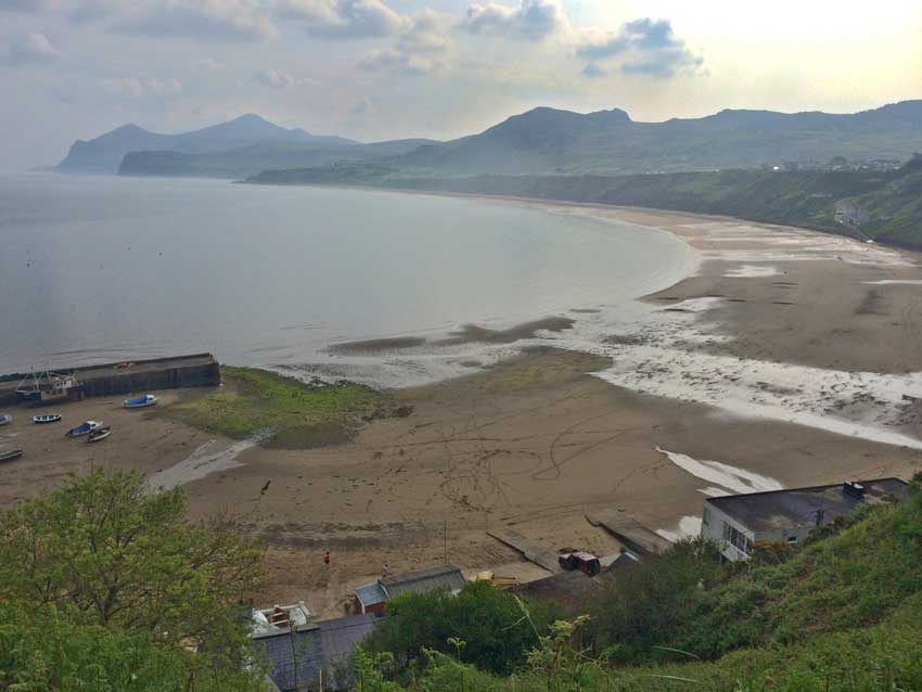
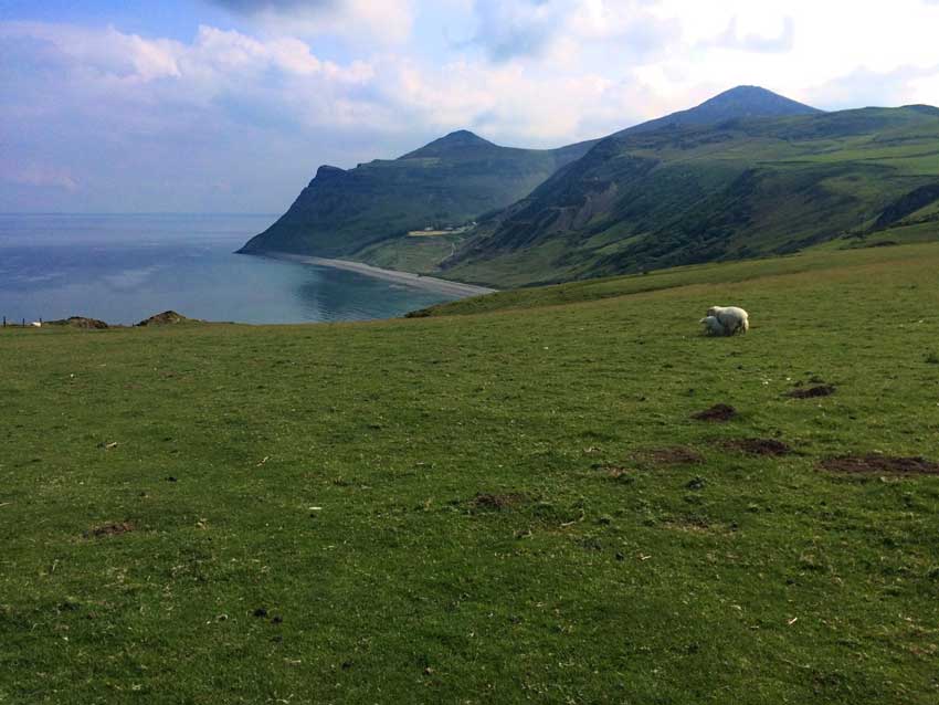
Porth y Nant
The Coast Path cut across the base of hillsides once again, some with yet more quarries on them. The path was grassy but with lots of rocks in it for me to jump over, run around and generally keep me focussed. It soon started to head uphill though onto the slopes of Penrhyn Glas where huge rock slabs at the back of disused quarries dominated the landscape. At least, they did dominate until I crested the brow of the hill and views down to the green waters lapping at the pebbly beach of Porth y Nant drew the attention instead.
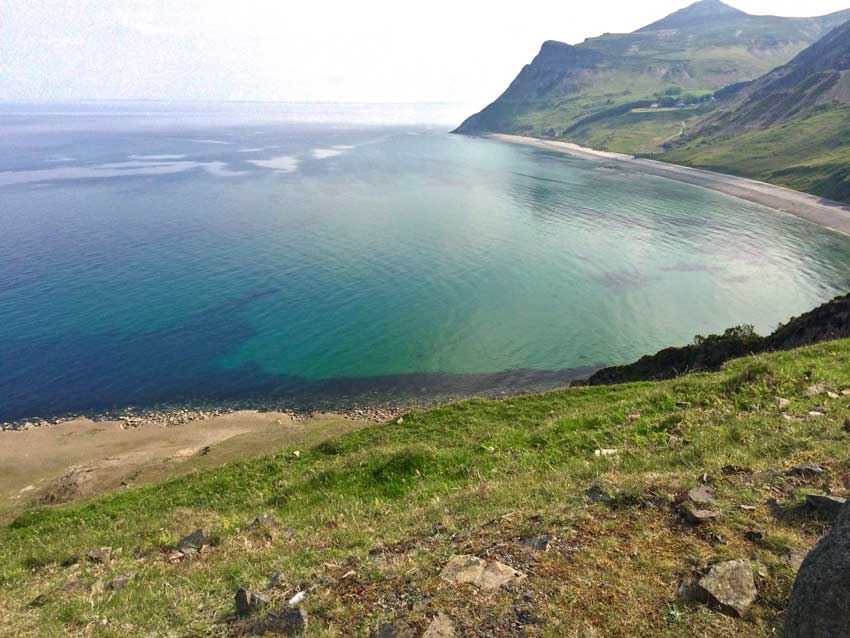
Looking down on Porth y Nant
I was now high up on a hillside but knew that the path headed all the way down the sea before climbing once again over the massive hills I could see behind the beach. You can just make out a small track halfway along the beach in the photo above which is the beginning of what would be a significant uphill stretch over the hills at the end of the beach. At least the views were good from here and the sun was shining.
Porth y Nant Views
View from Penrhyn Glas
The Coast Path however contoured along the hillside for a little while, dropping down and climbing up here and there along tricky paths with some fairly horny local residents that wouldn’t hang around long enough for me to get a decent photo of them.
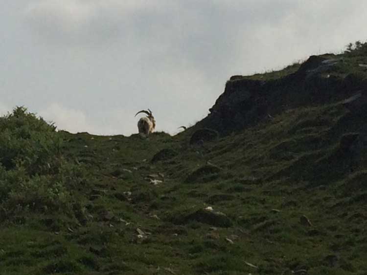
Local Residents
After a while the Coast Path descended steeply through lightly wooded slopes and then through bracken and ferns all the way down the the fortress like old quarry buildings halfway along the beach of Porth y Nant.
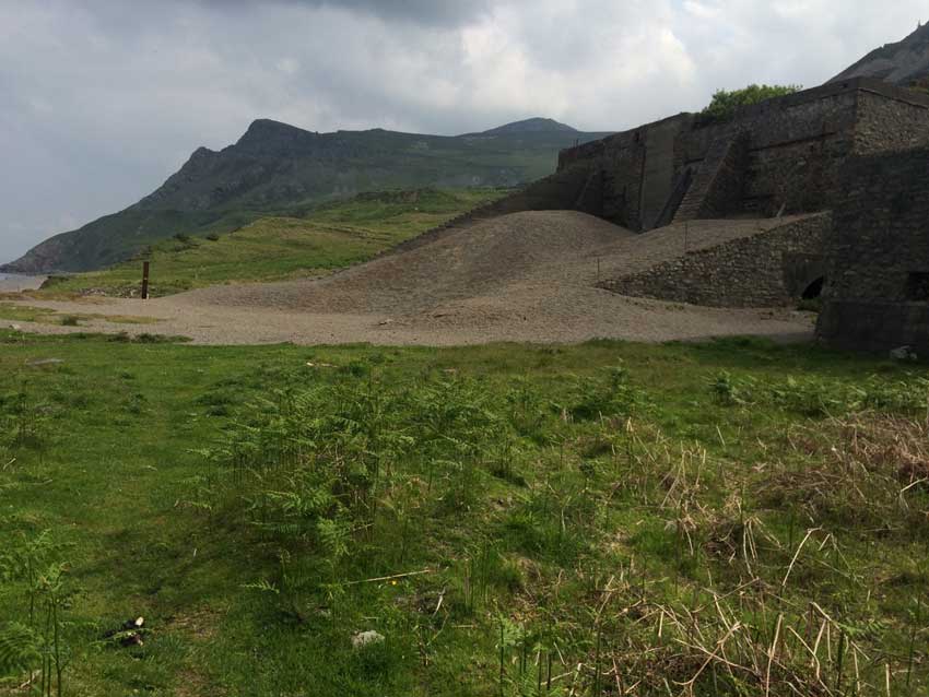
Porth y Nant
Huge Nant Gwytheryn Climb
It was now time to get my game face on though and tackle what I knew would be quite a climb. There were quite a few people walking up the first part of the climb who all got out of my way as I ran past them and looked at me as though I was mad. I think I must be as it was pretty steep here but with so many people around I couldn’t stop. The path led to the Nant Gwytheryn Heritage Centre where the signs proclaiming that they sold ice creams and coffees were tempting but I wanted to get this climb done in one go and this was just the beginning.
Nant Gwrtheyrn or “the Nant” as it is often called, now home to the National Welsh Language and Heritage Centre, is a magical place located in a former quarrying village on the northern coast of the LlÅ·n Peninsula in North Wales. This secluded Victorian village has undergone a £5m renovation in recent years which included construction of a new access road and the addition of a new weddings and conference centre as well as the provision of 5* accommodation for up to 120 guests.
Not even a 5* rest stop for me though as on the climb went, out onto a tarmac road with several steep switchbacks and then it just kept climbing, always steep, always hard and with the sun beating down on me it felt like torture and I felt like a sweaty mess! I know it exaggerates the steepness but you can see the extent of the hill in the elevation profile below – it’s a monster, climbing from sea level to 350m, the highest point so far for me on the coast path.
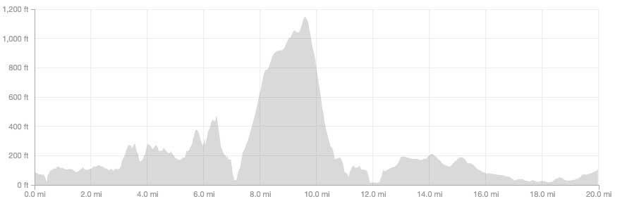
Elevation Profile
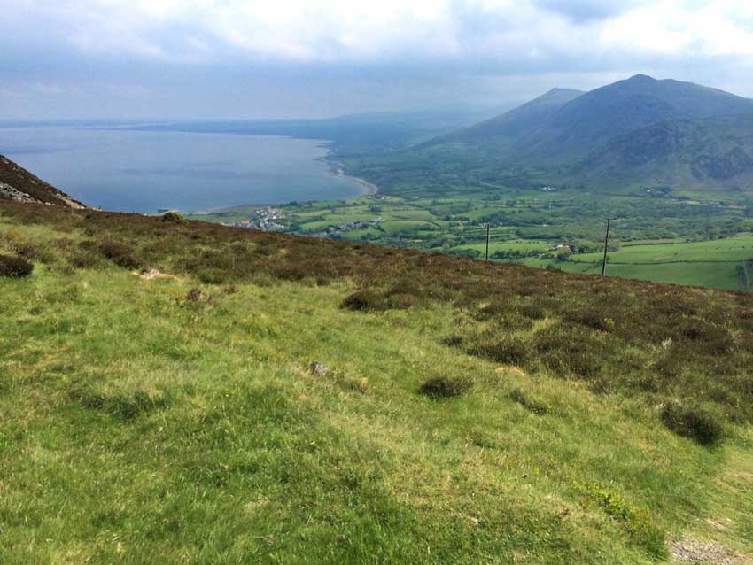
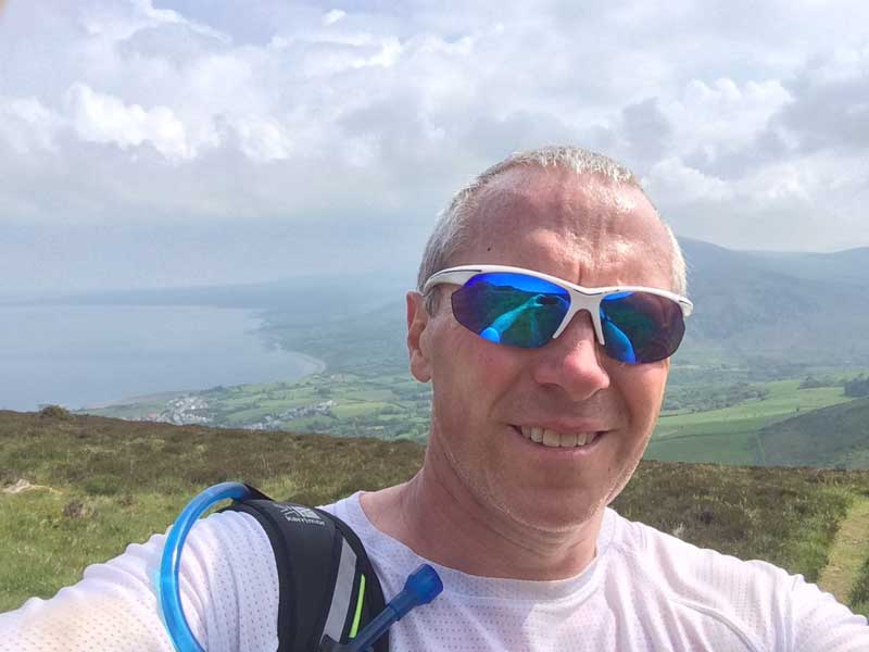
Finally the Coast Path turned off the steep tarmac road onto a loose, gravelly track that continued up but with a slightly shallower gradient. Don’t get me wrong, it was still uphill – significantly so – but not quite as incessant as it had been. I was able to increase the pace a little and there was finally a breeze as I made my way ever higher and became more exposed on the hilltop. The breeze was lovely after the stifling heat of the lower slopes and eventually, the summit of the hill with it’s radio masts and yet more quarries was in sight. After 30 minutes and 2.5 miles with an average gradient of 8% I crested the top and had some views out across the village of Tefor to the coast beyond where my journey would continue. I stopped briefly for a drink, a snack and the obligatory sweaty selfie.
-
- Ever Onwards
-
- Sweaty Selfie
I then continued ever onwards down the steep slopes off Yr Eifl and down towards Trefor. The descent is just as tough for me but not quite so sweaty. Halfway down the hill the Coast Path turns left out onto paths and fields and then coastal grassland along the tops of the cliffs at Trwyn y Tai. There were seabirds everywhere and cormorants basking in the sun on top of the rocks. The path then wound it’s way past the large pier and up through some houses on the outskirts of Trefor before following the road out towards the main A499.
The Long Road to Glynllifon
The coast path then follows the main road for miles and miles towards Caernarfon. Sometimes it runs along the old, mainly disused, road besides the A499. Other times it is on a pavement alongside the road. At least now it was fairly flat with just a few undulations. At first there were occasional glimpses of the sea across the road and over some fields to my left and the ever present slopes of the large hills of Gyrn Ddu, Gyrn Goch and Bwlch Mawr to my right. As I continued along the road these hills were left behind and I ran through little villages, each with their own bus stop. The bus stops were important to me as they were all for the number 12 bus from Caernarfon to Pwllheli, the very bus that I would be catching at the end of my run. I did see the bus go past after about a mile of running along the road, and there should be one every hour. So, with what turned out to be 6 miles to go, I had about 50 minutes to get to my desired bus stop. I checked the time, checked where I was on the map and estimated that I could just make it, assuming that the bus stop wasn’t too far past the junction where the coast path headed off towards the sea again. I would have to pick the pace up a bit though and push on.
On the road went, the little undulations were no problem, but my right ankle was beginning to feel a little sore thanks to both running on tarmac and the increased pace. It didn’t help that I still had quite a heavy rucksack on. It’s barely noticeable at a slower pace but once I’m running a bit faster the extra weight starts to feel a little cumbersome. It was getting a little boring running along the road too, but the miles were flying by and the times were OK.
- Mile 14: 8:34 mins
- Mile 15: 8:28 mins
- Mile 16: 7:54 mins
- Mile 17: 8:00 mins
Surely I must be nearly there by now as I thought it was only 18 miles in total. I checked the map again and walked for a few hundreds yards as I did so. My ankle needed a bit of a rest too. Mile 18 was therefore a slower mile.
- Mile 18: 10:19 mins
I started wondering if maybe I should stop at one of the many bus stops I was passing. I now only had 20 minutes until the bus got to the stop I had in mind and judging by the map I still had 2 miles to go and probably couldn’t keep the faster pace up.
- Mile 19: 9:09 mins
I had just under 11 minutes so I was going to have cut my run slightly short and stop at the next bus stop just in case. But where was it? There wasn’t one and time was getting short. On I went, getting faster and faster as I needed to get to that stop before the bus so as to avoid having to wait an hour for the next one. Eventually, the turning to Dinas Dinlle, where the Coast Path heads back to the sea, appeared. But still there was no bus stop. I was going as fast as I could, the bus stop must be here somewhere. Finally I spotted it, just before the entrance to Glynllifon Hall. It was the stop I had in mind all along so I hadn’t cut my run short just in case after all, and I arrived there at 12:49, 3 minutes before the 12:52 bus was due. Phew!!!
12:52 came and went, but there was no sign of the bus. I had at least cooled down a little now and so looked a little more respectable ready to get on the bus.
13:00 came and went and still there was no bus.
There’s no way I could have missed it as I’d been running along the road all the way and would have seen it. Unless of course it had gone by during that couple of hundred yards where the path went away from the main road and behind a few trees. I was beginning to think that it had been a few minutes early and I’d missed it.
I sent Anna a text message to let her know where I was and that I may have to wait an hour for the next bus. As I did so it started to rain a little.
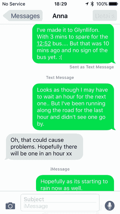
Messages
It wasn’t the nicest of places to have to wait either and the signs for the café and shops at Glynllifon Hall looked much more inviting. I I couldn’t risk missing the next bus as well though so stayed where I was, waiting at the dreary bus stop beside the busy A499 with what looked like a heavy thunderstorm on the way.
Waiting
Thankfully at about 13:10 the bus did turn up. Only 18 minutes late, but ‘better late than never’ and at least I didn’t have to wait for a whole hour. I hadn’t missed it after all and was now on my way back to Pwllheli.
In Pwllheli I stopped in Costa Coffee for my now habitual post Coast Path run panini and coffee. This may be the last time I’m doing this though. After basing the last 4 segments of my Coast Path run around a finish at Pwllheli I think I may be moving on. The Lleyn Peninsula is pretty much behind me and I’ll soon be on Anglesey so I’m probably going to be basing myself out of Bangor next. I’m sure there must be a Costa Coffee there though.
Costa
Suitably refuelled it was back into the car in the blazing sunshine once again for the drive home. I had to pull in to let about 4 emergency vehicles pass me on my way, and then between Corris and Machynlleth came across a huge queue of traffic for what looked like an accident further down the road. I took a detour along the back roads through Ceinws and emerged beyond the accident. I wasn’t the only one with that idea so the going along the single track lane was slow as we all squeezed past each other. It was better than the stationary traffic on the main road though and I was home by 4pm.
Another good day out on the Coast Path. 20 miles in total and in a fairly good time considering the huge hill in the middle of it. There’s still a long way to go though. I feel as though I should get to Anglesey soon, but it’s still about 20 miles away and then it’s a matter of 132 miles around Anglesey before I get back to the mainland! I can’t wait to get on with it though. I picked up a few trophies on Strava for my efforts today as well.
Discover more from A Simple Life of Luxury
Subscribe to get the latest posts sent to your email.


Starts well with a sociable chat presumably you were clean and not smelly at that stage, then gets a bit worrying as you try to take photos of horny residents, then you become a sweaty mess standing at a bus stop on a busy road….some times I worry about you xx