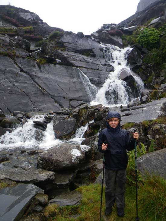
Moelwyn Mountains with Morgan
Morgan and I had a lovely day in the Moelwyn Mountains on Thursday. We had our sights on the final feeder cache for the Gwyddno Mountain Challenge geocache. We needed to find it in order to get the final questions that would give us the last few numbers of the coordinates for the final cache. So, having planned a route through the Moelwyn Mountains above Tanygrisiau that took us to a few other geocaches as well, we set off in the morning into the grey, gloomy weather of North Wales.
It rained all the way there, but we did stop off briefly for a quick cache and dash along the A496 en route to Tanygrisiau. Once the driving was done we put on our waterproof coats and trousers, found another quick cache near the reservoir, got our kit together and started off on our walk.
Walking in Wales
Before long we reached the bottom of the incline, complete with ‘Danger’ sign. Needless to say that was exactly the way we were heading. Yes, it is as steep as it looks.
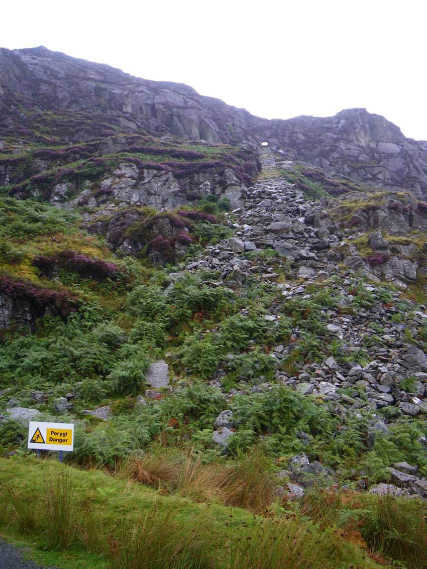
The Incline with The Tunnel at the top
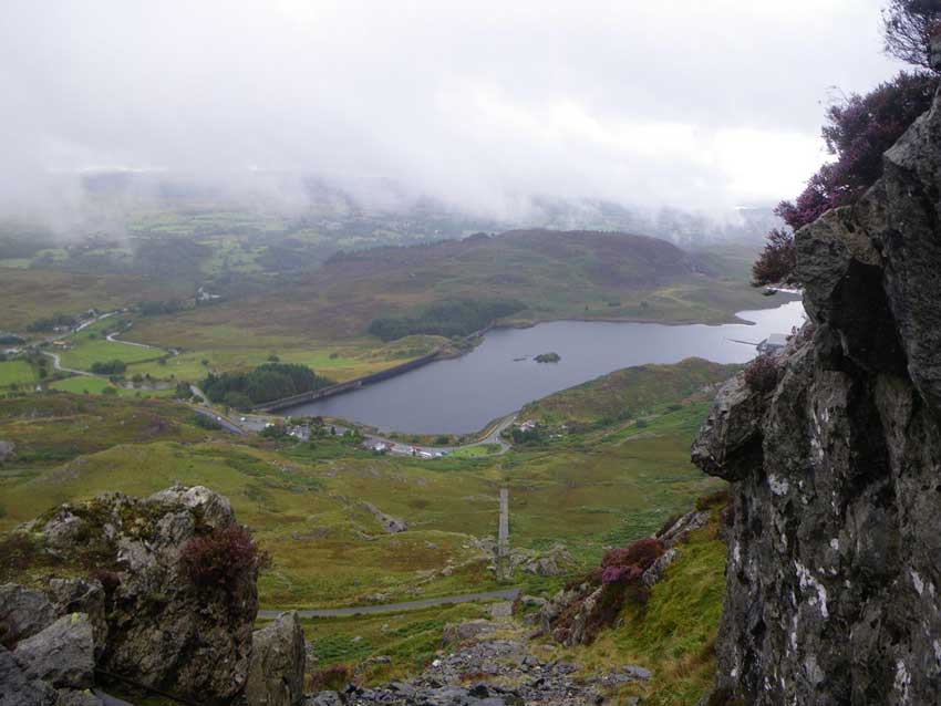
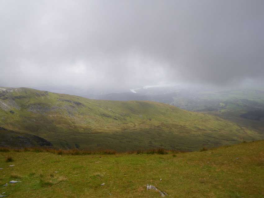
Morgan was quite looking forward to ‘The Tunnel’ though so we made good progress getting ever higher as we went and stopping every now and then to admire the views of Tanygrisiau below us and off towards Trawsfynydd in the distance.
Tanygrisiau Incline
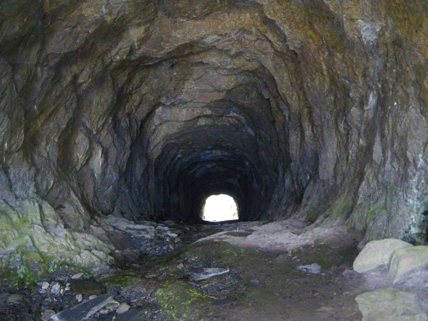
We made it to the tunnel where we had to use our hands a little to scramble up over the slippery rocks. At least it wasn’t raining in here though.
-

- The Tunnel
-
- Into the Tunnel
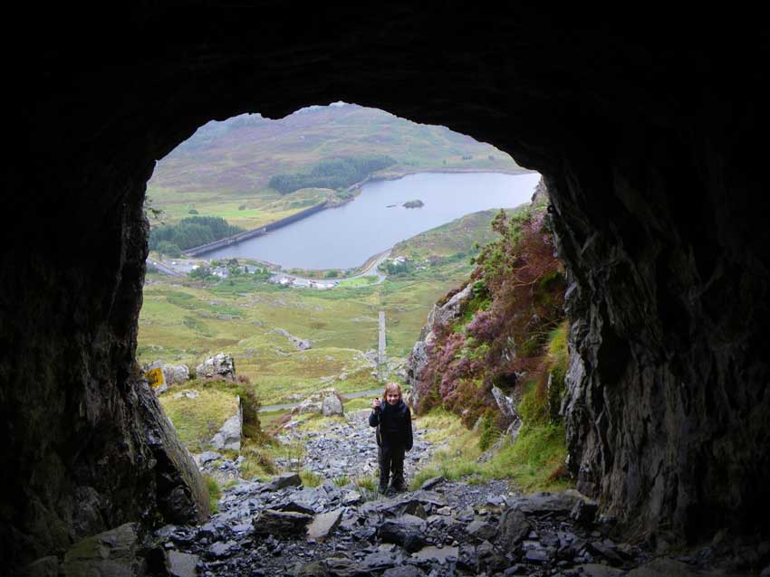
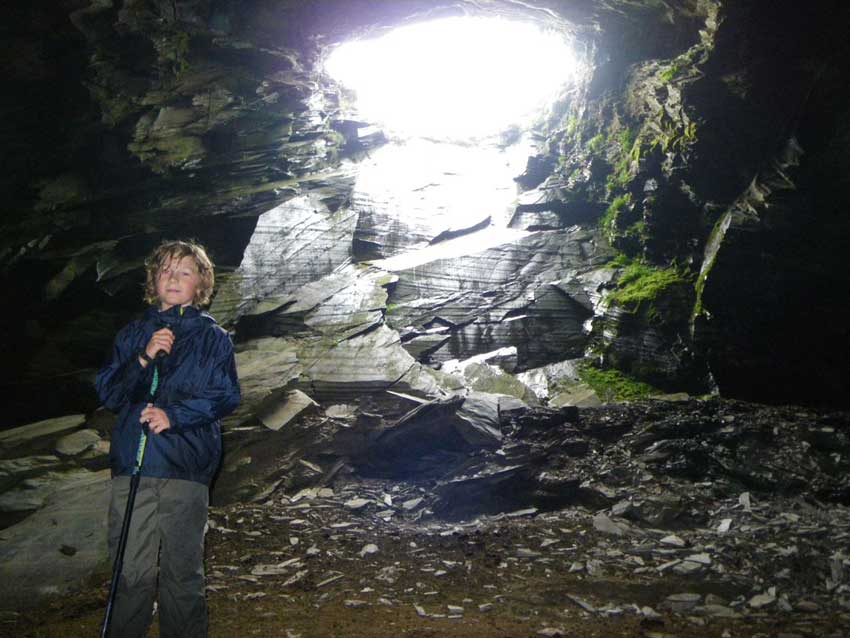
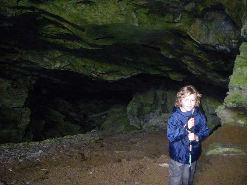
Once through the tunnel we emerged at Wrysgan Quarry and picked our way over the slates and through the old quarry workings before turning left along the bottom of the crags and up another slightly less steep incline. The crags here were riddled with old mines forming some interesting caves that we explored the entrances of. I did have a head torch in my bag, but for the sake of safety we didn’t venture too far into them as we just didn’t know what the state of the mines were. We may leave that for another day – watch this space!
-
- In a cave
-
- Mines
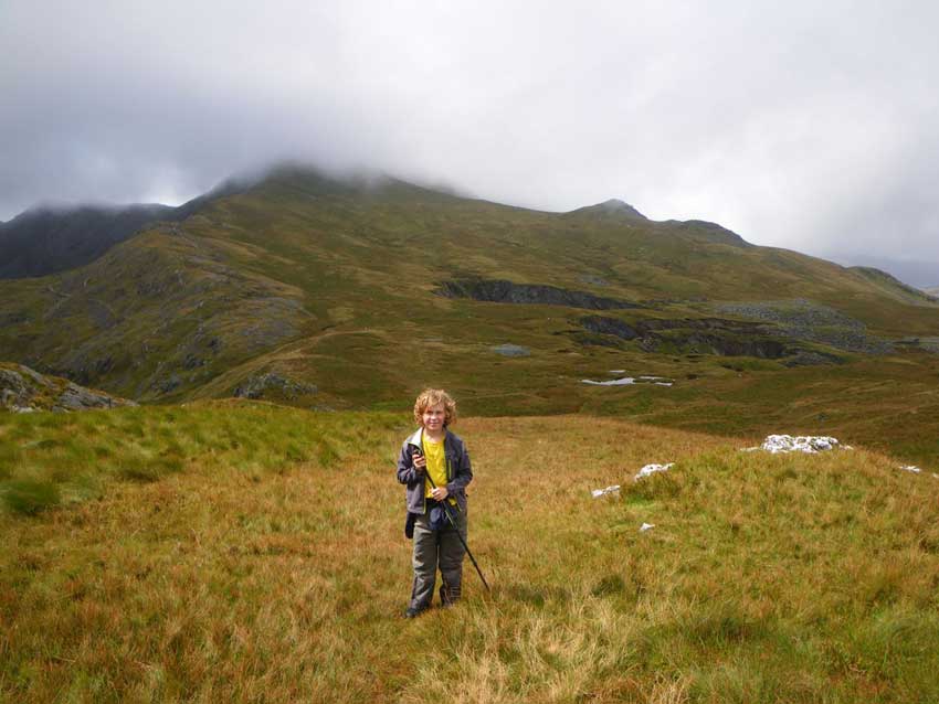
We then made our way around the foot of the crags over boggy ground before scrambling up over the western flank of the crag ever higher into the Moelwyn Mountains and onto Moel-yr-hydd where we crossed the electric fence and headed on up to the 648m summit. We soon had the geocache in hand, signed the logbook, noted down the questions and then headed over to the northern slopes where we could shelter from the wind to eat some lunch.
-
- Morgan on Moel yr Hydd
-
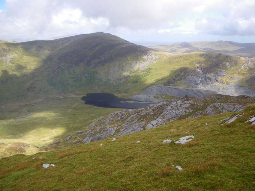
- Cwmorthin
-
- Foel Ddu and Cwmorthin
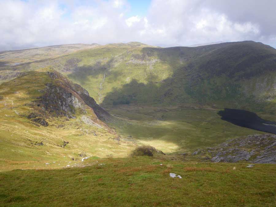
We had some nice views of Foel Ddu in front of us and Cwmorthin with its lake far below us. Our plan was to head off to the SW, retracing our steps off Moel-yr-hydd, into the saddle and then climb to the high point of the day at the summit of Moelwyn Mawr. Morgan wasn’t too keen on this and was beginning to ask about heading back down, but I managed to motivate him in the end and we were soon climbing the steep flanks of Moelwyn Mawr which is a SSSI thanks to some interesting glaciated geomorphology features. The North East flank that we were on exhibits an example of patterned ground, consisting of small-scale vegetated stripes. We could clearly see these as we made our ascent and they were more distinct as we looked back down the hill. On the west side is a debris tongue formed by a rock glacier that extends into Cwm Croesor.
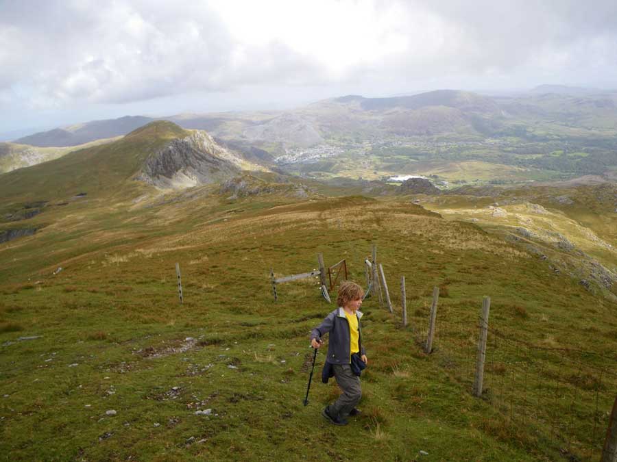
Morgan on Moelwyn Mawr
We also had some nice views down to Llyn Stwlan. We could also see Tanygrisiau Reservoir at the bottom of the hill, Llyn Trawsfynydd off to the South and even the outline of Cadair Idris in the distance.
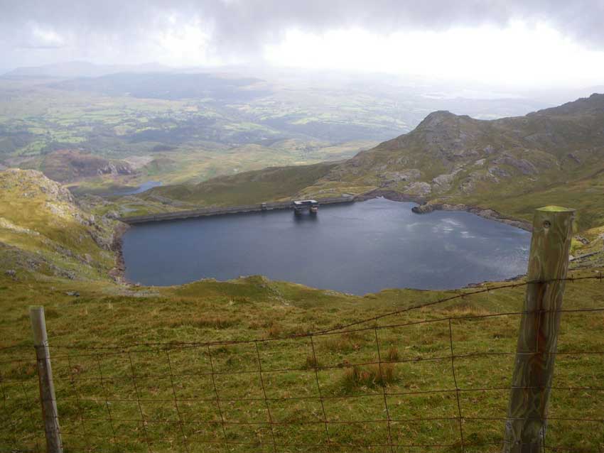
Llyn Stwlan
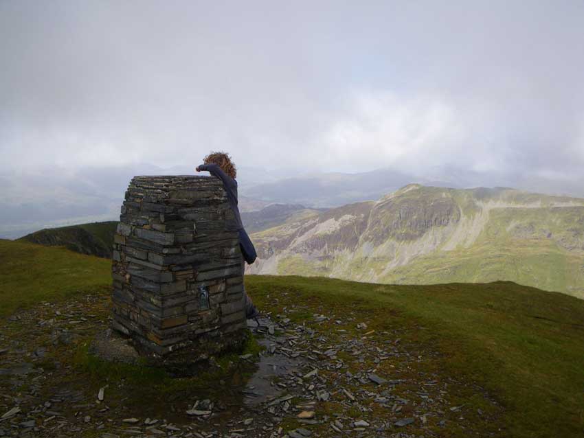
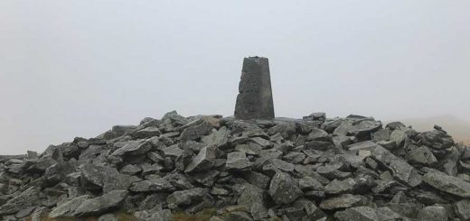
At the top we soon found the cache, signed the log book, investigated the trig point and took in the views. This was the highest point of our walk today at 770m. We could just about see out towards the Dwyryd estuary with the island of Ynys Gifftan between the clouds. It was quite blustery and cold up here though so we soon started heading back down on a slightly different path towards Rhosydd Quarry.
-
- Ynys Gifftan
-
- Trig Point on Moelwyn Mawr
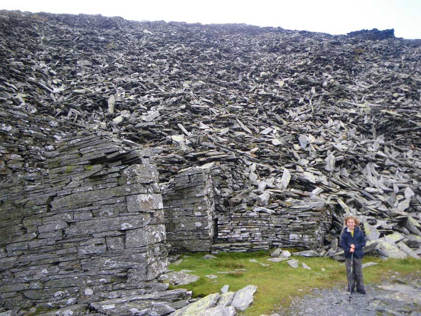
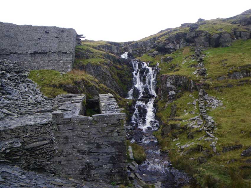
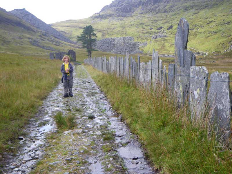
We made our way to the huge spoil tips of Rhosydd Quarry and down a couple of inclines towards the derelict quarry buildings. We found another slightly damp cache here before making our way along Bwlch Cwmorthin past several waterfalls and some interesting fences made from huge pieces of slate.
-
- Huge Spoil Tips
-
- Waterfall
-
- Slate Fence in Cwmorthin
From here it was an easy walk along the edge of Llyn Cwmorthin and then down through Cwmorthin Quarry where our car awaited. A good day out in the Moelwyn Mountains covering just over 6 miles and more than 2,000 feet of climbing. We had found 5 caches, reached two summits, had the final clues for Gwyddno’s Mountain Challenge and had extended our consecutive days geocaching record. All that was left was to drive home and chill for the evening.
Discover more from A Simple Life of Luxury
Subscribe to get the latest posts sent to your email.
4 Responses
-
[…] on the track to Cwmorthin, just beyond Tan-y-Grisiau. It’s actually the same place we parked when I took Morgan for one of his first ‘proper’ hill walks back in 2014. It was a similarly grey day then as […]


Next time gather some slate for me…
Glad to read you didn’t venture too far into caves without investigating their safety:)
Yep…. But this sounds good: http://www.mine-explorer.co.uk/mines/Croesor_195/Croesor_3308.pdf
Al.
Please, please don’t tell me that you are thinking of anything like that!!!!