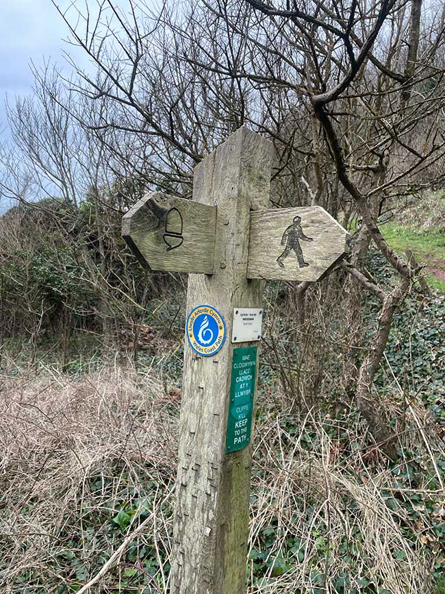
Wales Coast Path Run – Milford Haven to Dale
Coast Path Vital Stats
Milford Haven to Dale
- Distance: 10.28 miles
- Elevation Gain Today: 368m
- Highest Elevation: 52m
- Time: 1:43:34
- Av. Pace: 10:05 mins/mile
- Calories: 1167
Totals to Date
- Total Distance: 956.16 miles
- Total Time: 177:17:42
- Total Elevation Gain: 28541
- Total Calories: 90662
- Distance to go: 140 miles
I managed to get back out on the Coast Path at the weekend. It was only a short run this time but this section was always going to prove logistically challenging.
There is no public transport between Milford Haven and Dale so I had to call on the assistance of the ever-willing Anna. That meant finding a day that she was available and happy to drive all the way to Pembrokeshire, drop me off in Milford Haven and then drive to Dale and wait for me. Next, there were a couple of small estuary crossings that were only possible at low tide. They both had detours at high tide but that would add significantly to the distance and the detours inland were mainly on roads. The low-tide crossings looked a lot more interesting. I therefore had to make sure that the day I was doing them coincided with suitable tides. It’s definitely something worth bearing in mind if you are doing this section of the Coast Path.
The tides this weekend were perfect, Anna was free and there was nothing much happening so we headed down to Pembrokeshire. It was a grey, cold day with temperatures around 4-6ºC. There was no sign of the sun and it was quite windy at home. That was pretty much how it stayed all day except that the wind wasn’t a feature in Pembrokeshire. Not the most inspiring of conditions but perfect for running if suitably attired.
Out of Milford Haven
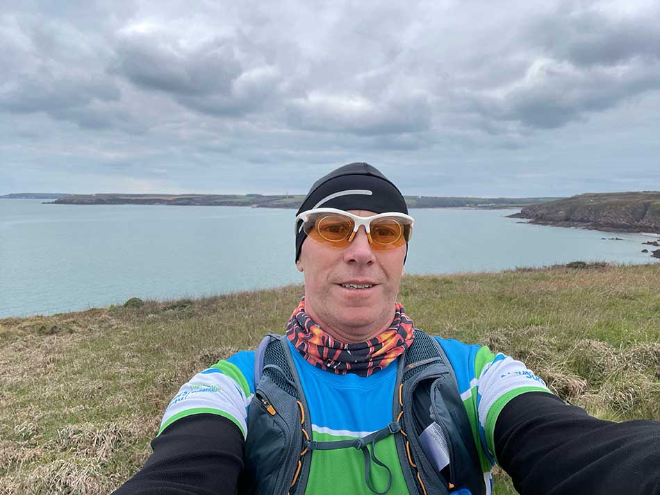
The drive down was uneventful and I soon pulled up at the side of the road on a stretch that I had ran along last time. I put on the layers I’d need for my run. Today that was shorts and some lightweight waterproof trousers on my legs and a thermal long-sleeved base layer and a thin T-shirt on my top. Combined with a hat, gloves and a buff that should be perfect. I did of course have my rucksack too which helps keep me warm and in that there was a warm jacket just in case, some water, some snacks and my phone.
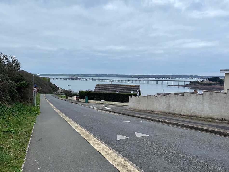
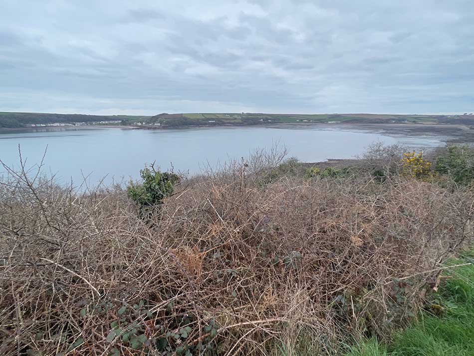
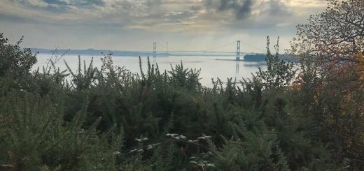
I made plans with Anna and then jumped out of the car and set off downhill through Milford Haven retracing some of my steps from last time. It was certainly chilly but at least I could see across the waters of Milford Haven to the other side today. I could make out some of the landmarks I’d ran past on previous sections of the Coast path.
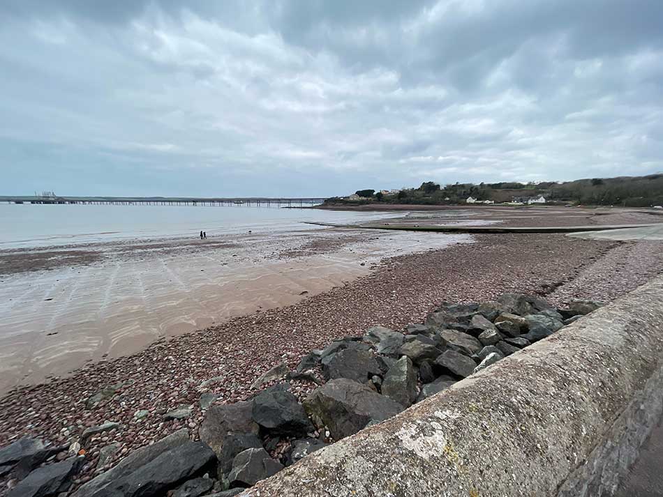
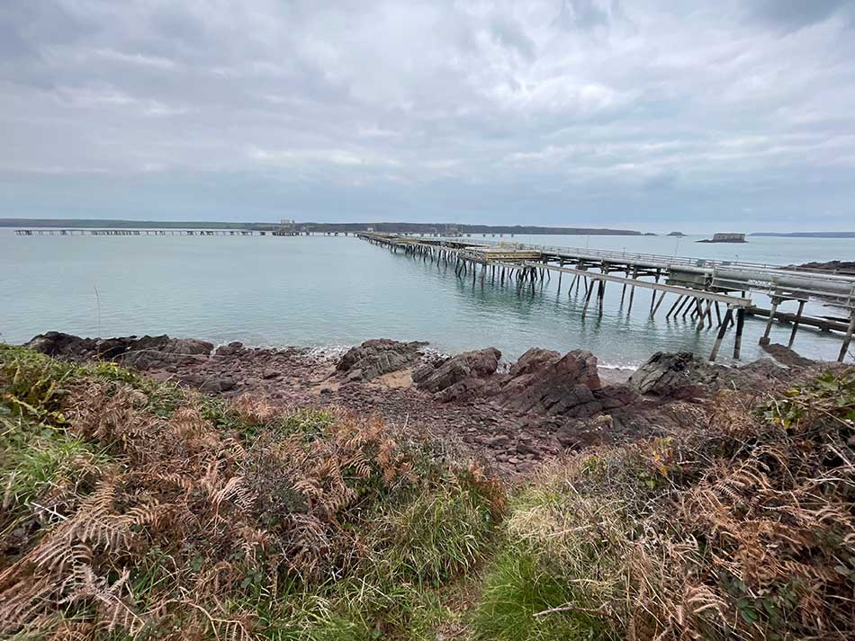
At the bottom of the hill I was now onto new bits of path. I crossed the bridge and headed up into the streets of Milford Haven. After a short section through residential streets, I ran around the side of a playing field where kids were out competing for their teams and parents watched on from the sidelines. I then dropped down a steep path and came out onto Gelliswick Bay where I had views of some standard Milford Haven fare. Namely pipelines and jetties. It was nice to see a beach again though and once I climbed out the other side of the bay things were feeling a little more coastal and a little more rural again.
Gelliswick to Sandy Haven
The path beneath was feet was tarmac here. I’d been expecting it to be a more natural track. This wasn’t ideal as I had my minimalist trail shoes on which have no cushioning. It did make for a decent enough pace though and it still felt like quite a coastal path as it followed the low cliffs around the coastline and was lined by grass and tall hedges. Breaks in the hedgerows provided views out across the water to the forts on Stack Rock and Thorn Island and of course to the various pipelines and jetties.
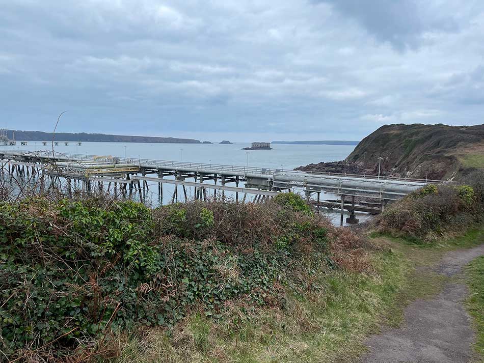
After a while, I dropped down towards one of these pipelines that as usual was heavily protected with tall fences and razor wire. I rounded the perimeter and then ran down onto a sandy beach right underneath the pipeline. As I climbed back out the other side the tarmac surface gave way to red-cloured muddy trails. These were lovely to run on. The lack of rain meant that they were hard-packed but still had a little give. There was plenty of traction, no slippy-slidng and less pounding of my feet than on the tarmac. The twists and turns, occasional roots and rock kept me occupied as well. My pace stayed relatively good thanks to the trails not being too tricky.
There were of course some ups and downs but these were good-natured too. Most were shallow gradients and the steeper bits were always short-lived. There was no need to slow to a walk at any stage.
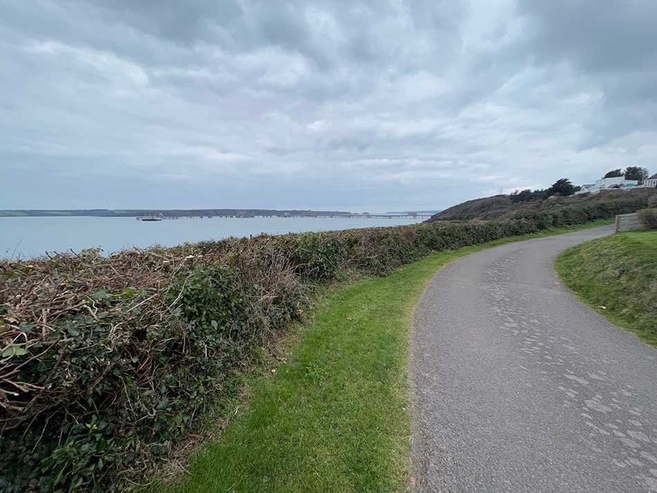
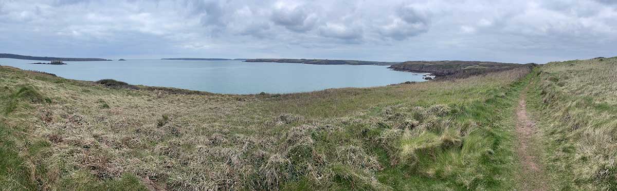
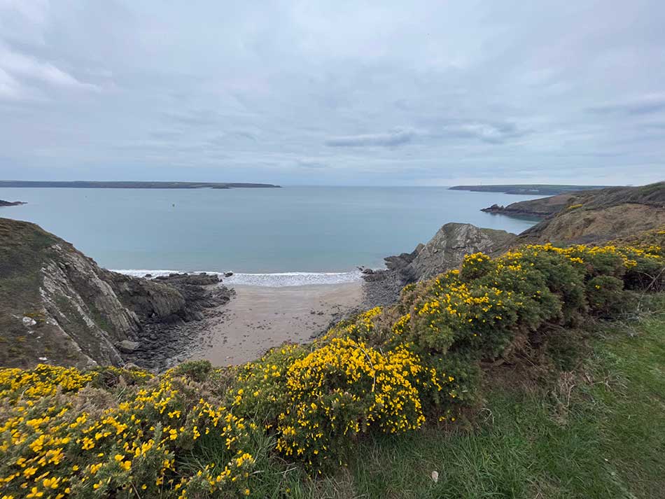
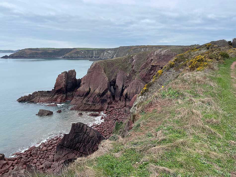
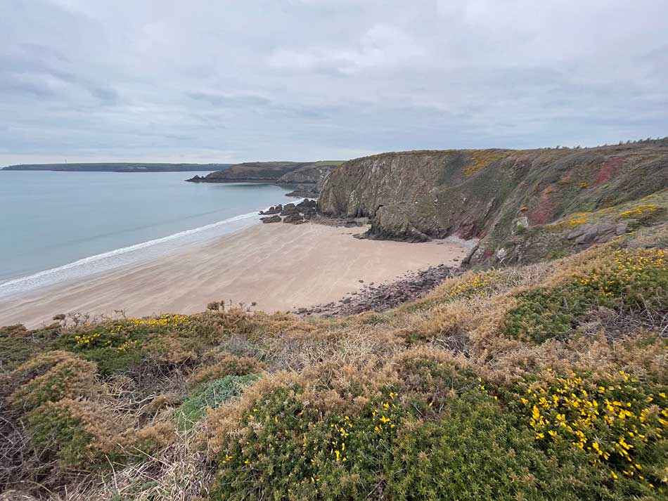
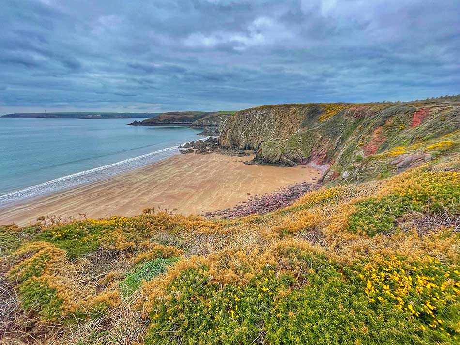
The scenery improved too as I started to leave the industrialisation of oil refineries and power stations behind me and headed off towards the natural surroundings of Pembrokeshire. Old Red Sandstone Cliffs make up the geology of this bit of the coastline. Their hard, resistant nature forms impressive cliffs punctuated by sand and pebble beaches. The calm conditions led to a quiet, serene feeling after the heavy industry around Milford Haven.
It was quiet out on the path too. I’d yet to see anyone since leaving Gelliswick Bay and the wide sweep of sands at Sandy Haven were empty. I did spot a dog running across the beach as I headed inland to skirt around the cliffs behind Sandy Haven, but never saw it’s owner.
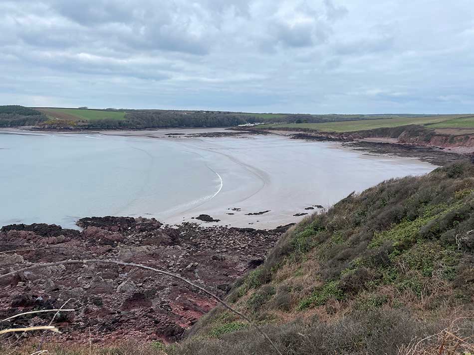
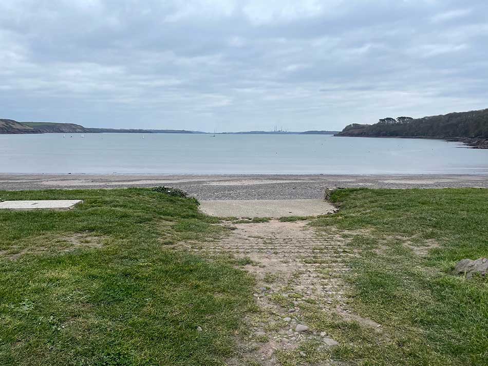
The path took me behind the beach along a series of fields undulating up and down in an easy manner. I then passed through a small caravan park and trotted down a wide concrete slipway onto the mud and sands of Sandyhaven Pill.
Sandy Haven to Musselwick
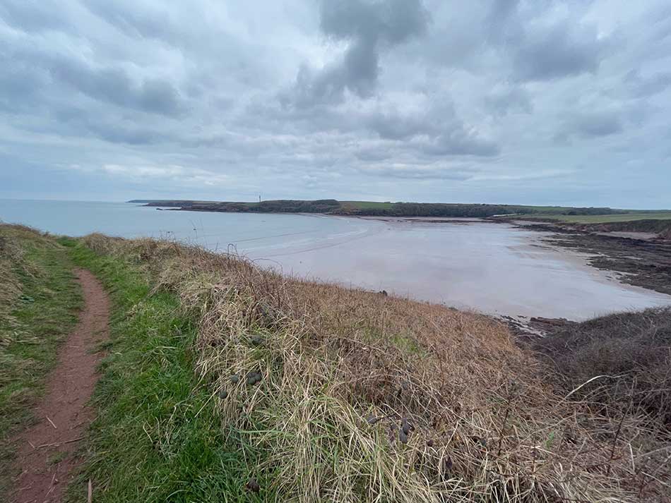
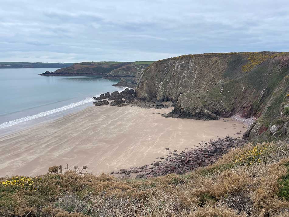
At Sandyhaven Pill I came to the first of the little estuary crossings that required me to be there at low tide. I had of course timed it perfectly. The tide was very low so the concrete and wooden causeway across what little water remained was well exposed. It was a little damp underfoot on the sand and mud of the flats but not a problem. I saw a few people out walking their dogs here who congratulated my efforts as I ran past them.
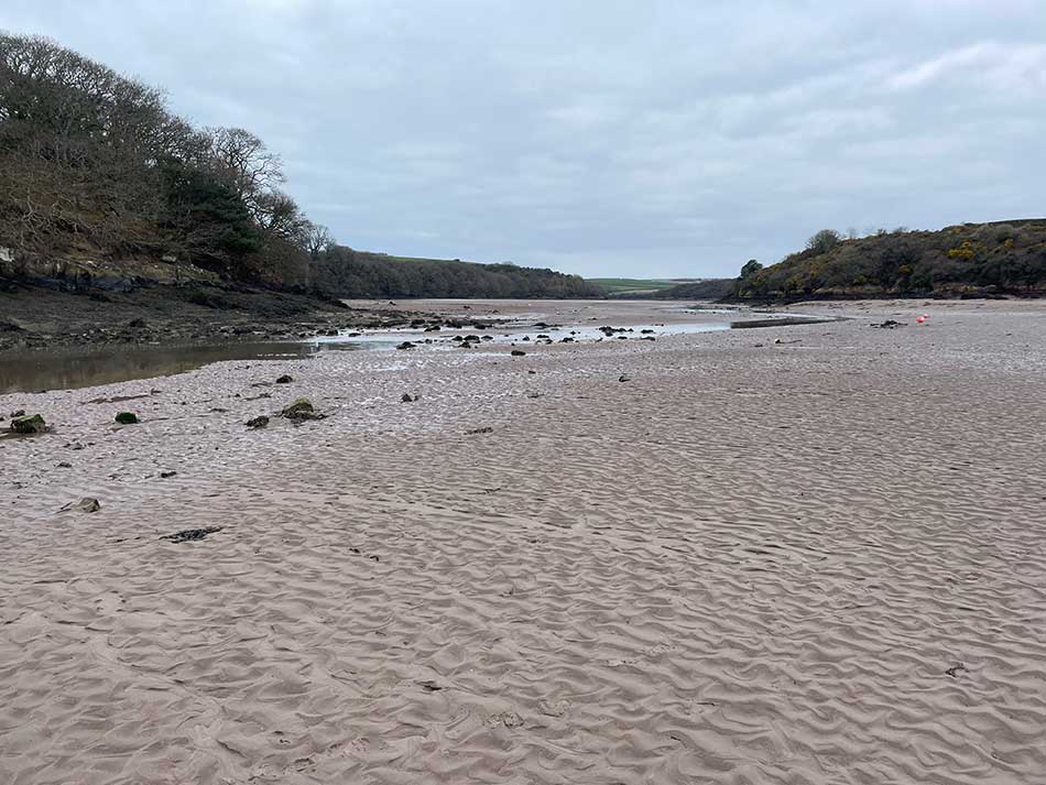
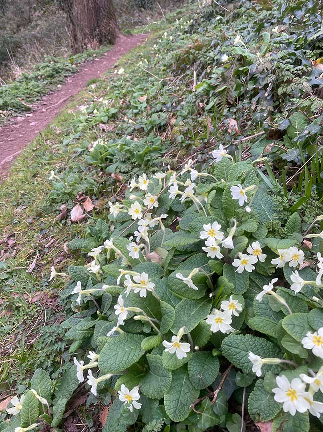
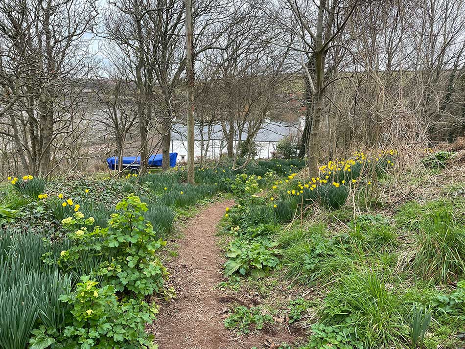
That little crossing had saved a detour inland and I soon climbed up into a pleasant woodland that took me around Sleeping Bay and out to Little Castle Head. The woodland paths were lined with pale yellow primroses. As I came out of the woodland onto the clifftop paths the view ahead was dominated by the rather unattractive Litte Castle Head Lighthouse.
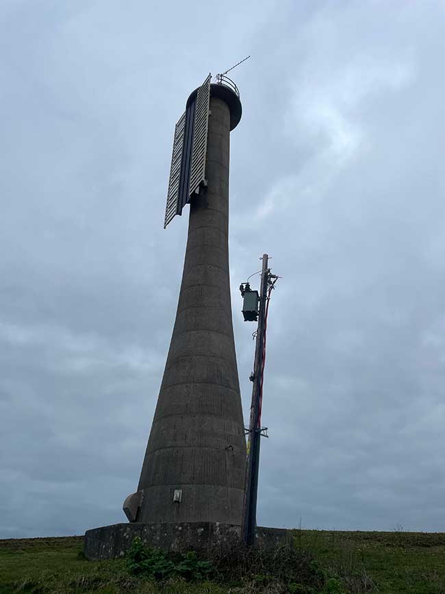
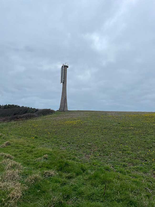
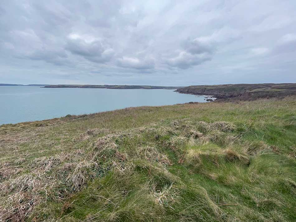
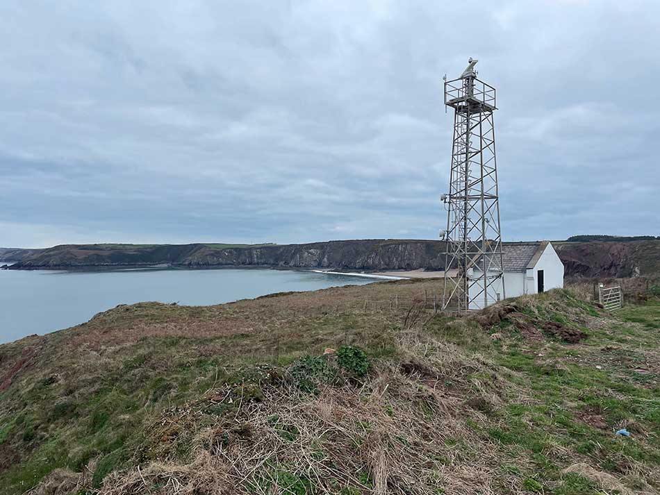
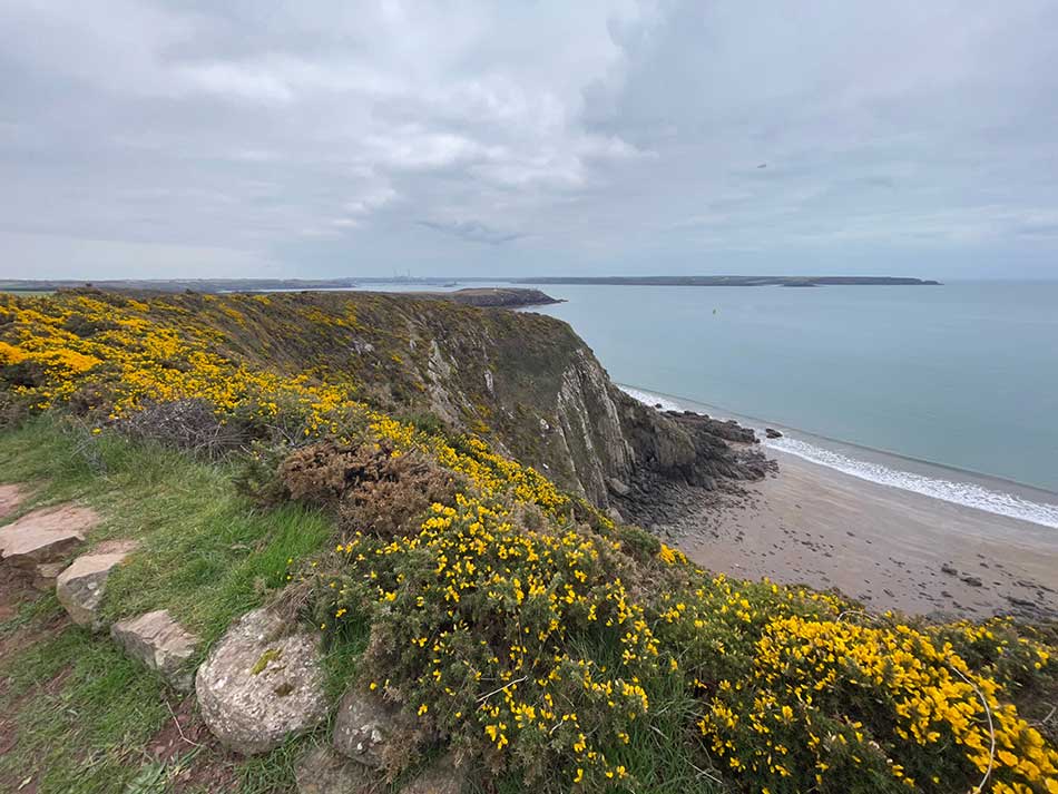
From here the path continued alongside fields and then on typical coast path lined with gorse as it took me past Butts Bay, Longoar Bay and out to a radar station that overlooked the next stretch of coast. I could see my destination of Dale in the distance but first there looked to be plenty more miles of clifftop paths, red sandstone cliffs and sandy beaches ahead of me.
Sure enough, the next stretch took me above the impressive cliffs of Rook’s Nest Point. The rooks flying around it paid homage to its name. I then passed in quick succession Linsday Bay, Wenall Bay and Watch House Bay and then headed out onto Watch House Point.
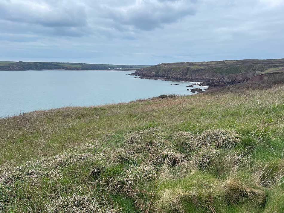
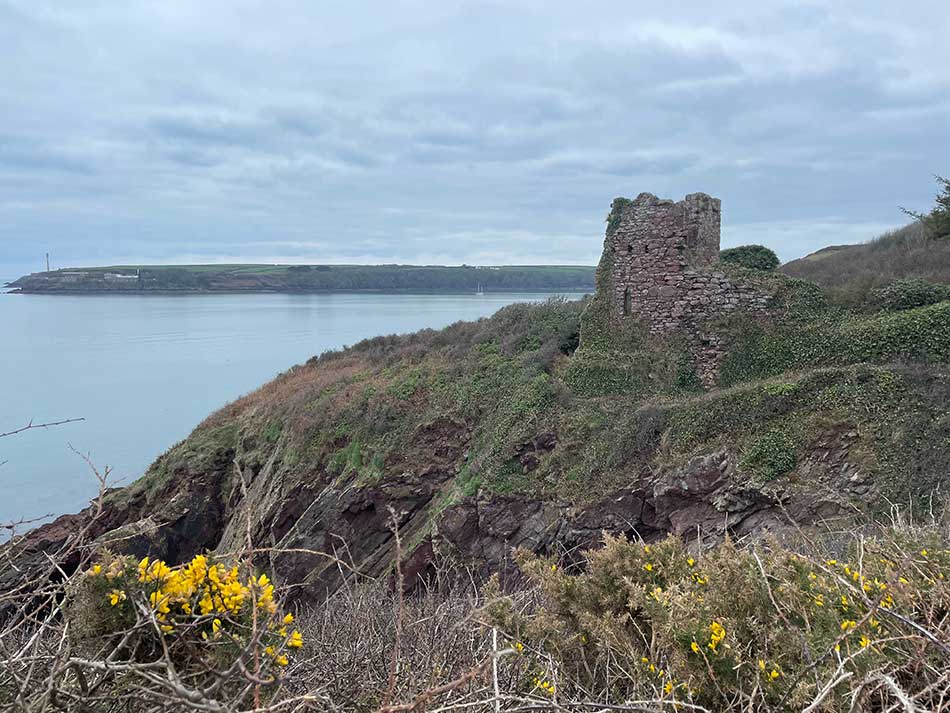
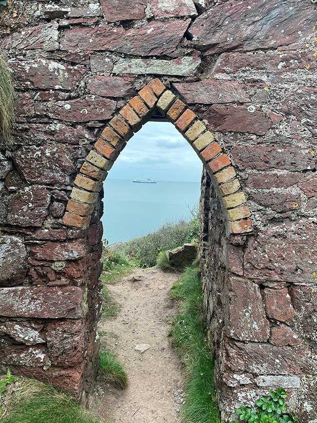
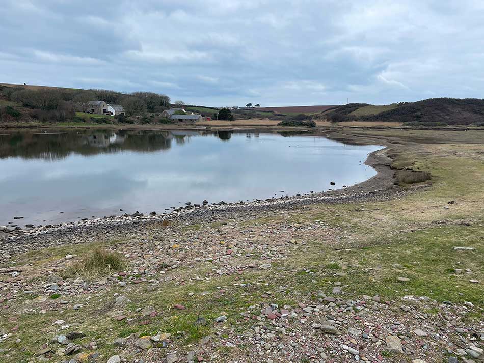
Dale now looked to be not too far away. I passed a few people out walking on the path on the next stretch and I stopped briefly at Monk Haven where the ruins of a church overlooked the waters and a Stena Line Ferry passed by.
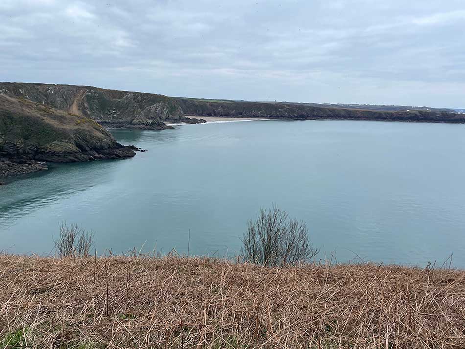
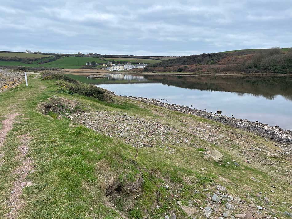
I dropped down to the beach here and then climbed back onto the cliffs. From here I could see that Dale wasn’t quite as close as I had thought thanks to the route needed to get around Musselwick Bay.
Musselwick to Dale
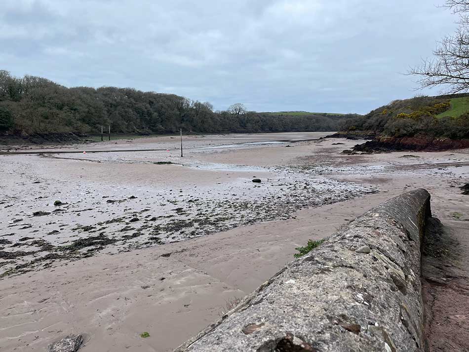
Although Dale was just across the water, Musselwick Bay was between me and it. The low tide exposed a pebbly expanse. The path took me briefly through a daffodil lined path past a cottage and then emerged out onto the beach.
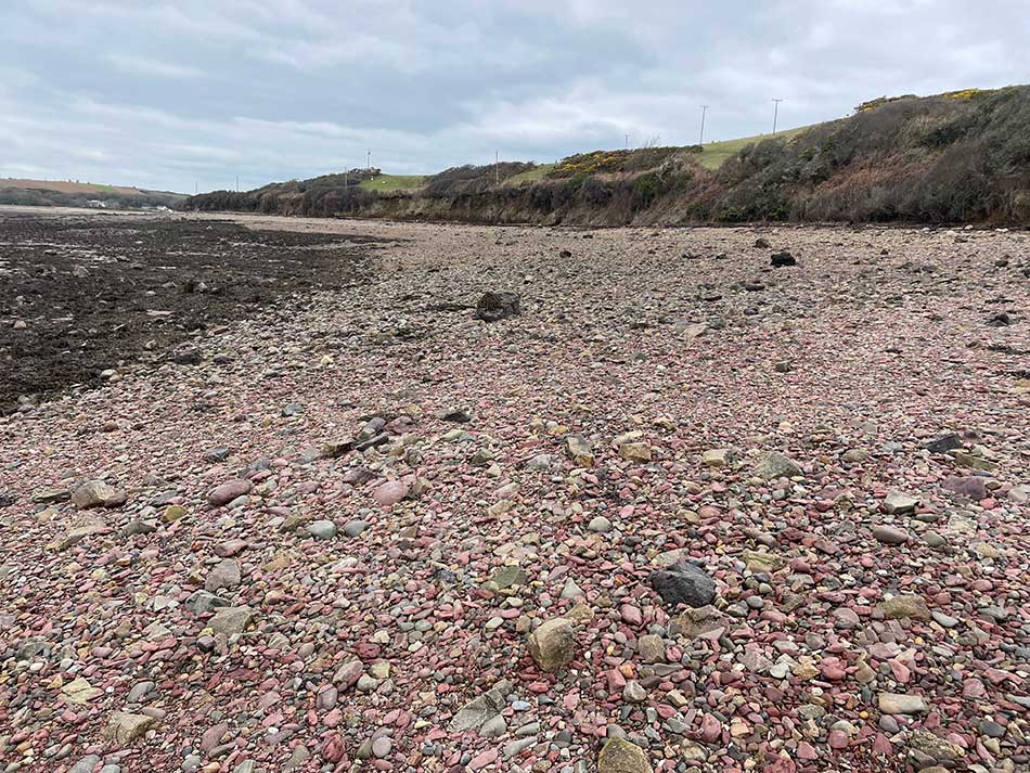
The terrain here was difficult to run on. Soft, wet shingle further down the beach or large angular pebbles and rock closer to the high tide mark. Neither option was ideal and combined with stretches of rock there were times when walking was necessary. It was quite a long stretch along the beach but eventually it took me to the second low tide crossing of the day.
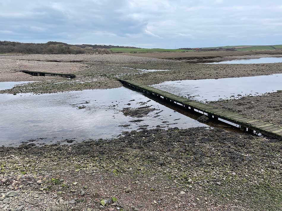
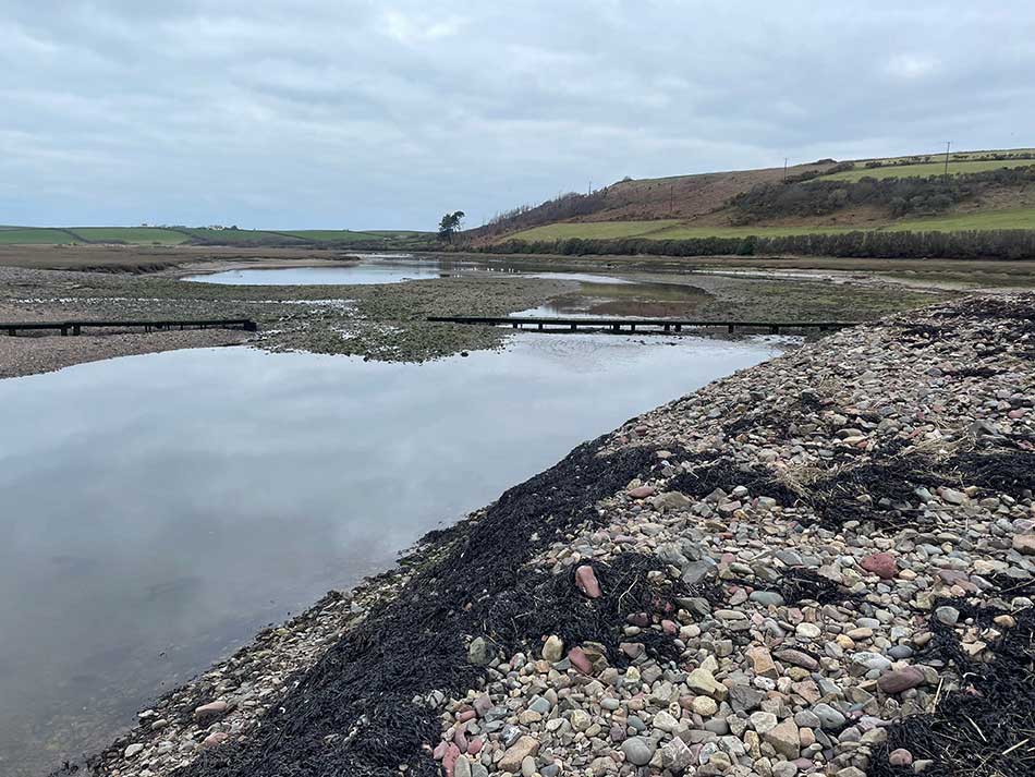
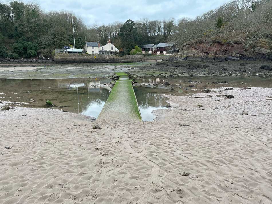
Again the waters were low and the two little wooden walkways were well exposed. I made my way across them and ran up onto the ‘Pickleridge’. This is a ridge of land that contains a tidal lagoon known for its bird life and natural habitat. Today it was inhabited by a large group of school children on a field trip.
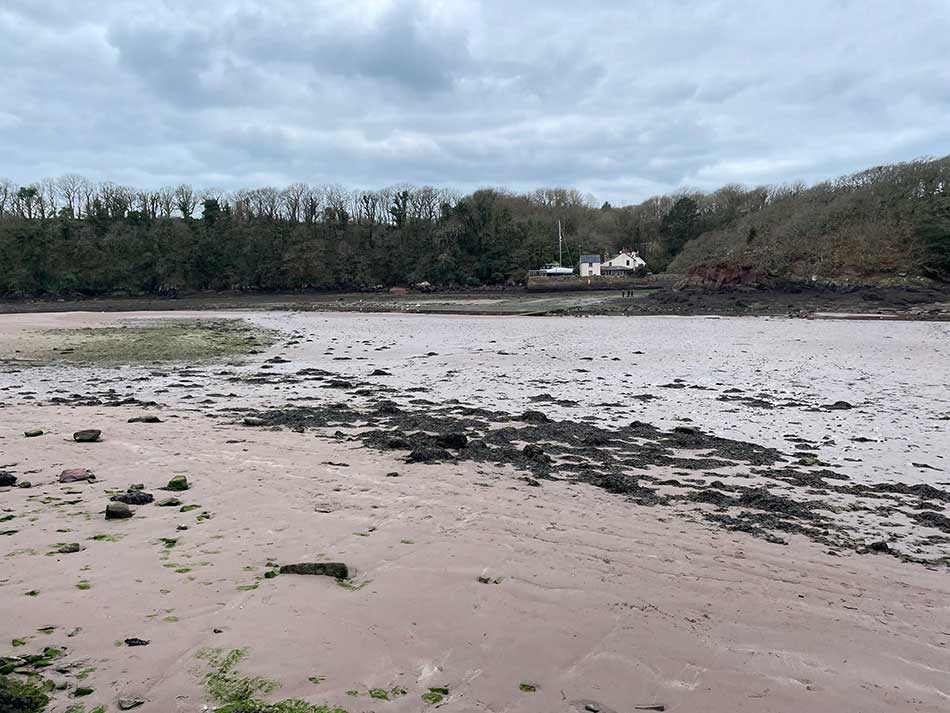
I ran along it’s length and out onto the small road at the location of what looked like some old lime kilns. The road took me up and over the point of Black Rock and then dropped easily down onto the seafront at Dale. There were sailing dinghies out on the water and people learning to windsurfing on a simulator on the grass behind the beach. Anna was there waiting for me.
The run had only been just over 10 miles and had taken less than two hours.
I was tempted to continue on around the Dale Peninsula. I was feeling good but decided that an extra 6-7 miles might be just a little more than I needed today. The path would be there for next time so instead, I quit while I was ahead and decided lunch in the pub with Anna would be a better option. At least, it would have been if I’d brought some trousers with me! As I got changed I realised that I had failed to do so. I had everything else I needed but there were no trousers in my bag. Oh well, I’d have to make do with the waterproof ones I’d just run in!
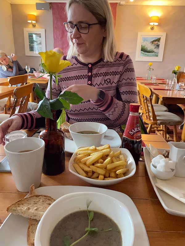
Lunch in the Griffin Pub was delicious. All that was left now was the long drive home after another successful day on the coast path.
Discover more from A Simple Life of Luxury
Subscribe to get the latest posts sent to your email.


Anna is so good to you . I thought for a moment there you were going to sit in boxers for your lunch !