Wales Coast Path – Porth Gain to Pwll Deri
Coast Path Vital Stats
Porth Gain to Pwll Deri
- Distance: 13.9 miles
- Elevation Gain Today: 886m
- Highest Elevation: 110m
- Time: 4:19:27
- Av. Pace: 18:44 mins/mile
- Calories: 1694
Totals to Date
- Total Distance: 1028.31 miles
- Total Time: 197:07:17
- Total Elevation Gain: 32394m
- Total Calories: 99194
- Distance to go: 76 miles
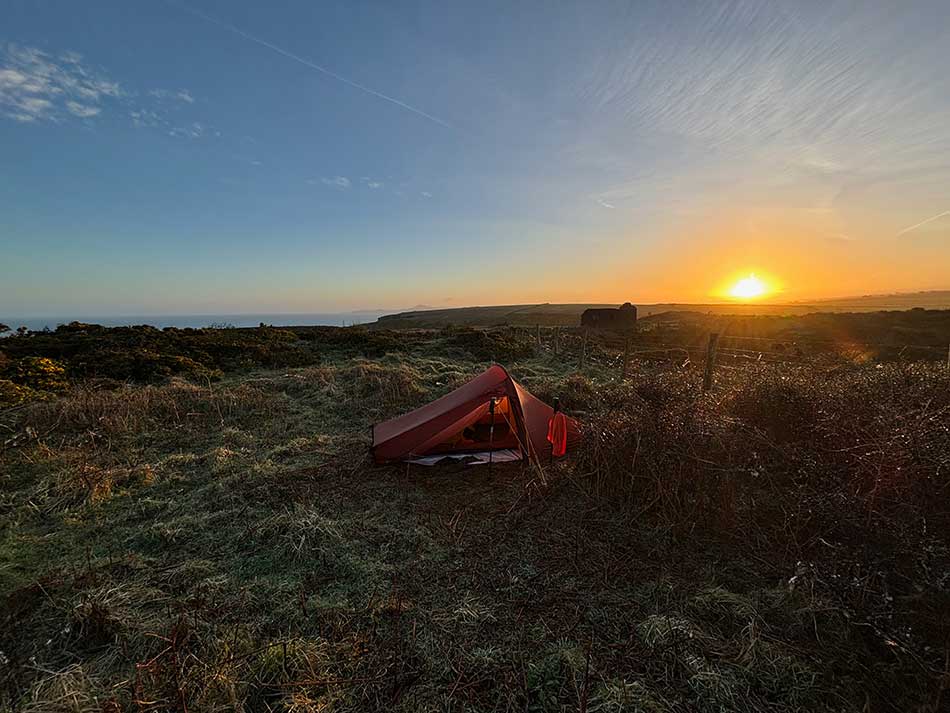
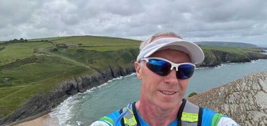
Morning at Camp
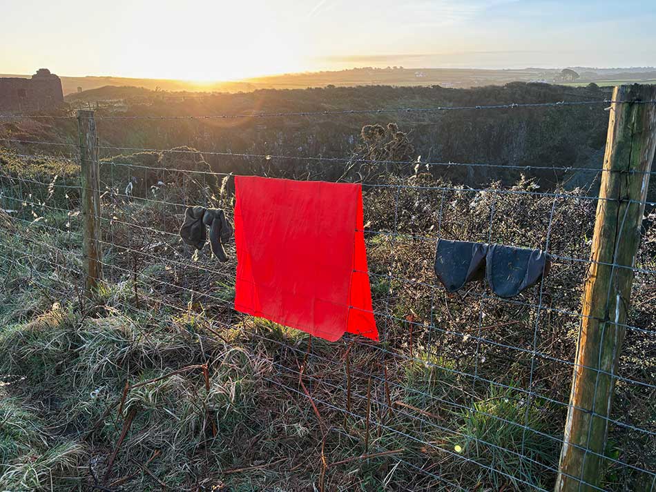
I lingered in bed as long as I could and then as the sun rose got up and had a coffee. I didn’t have much water left so had the remnants of an energy bar for breakfast and thought I’d try to get something else for breakfast and some lunch in Porth Gain. My tent was still wet from the overnight rain and was damp on the inside from condensation. Fortunately, the day dawned dry and bright so I opened up the tent to let it air and dry. As I did a sea mist rolled in so I ended up drying it with a towel and then packing it away before heading off to Porth Gain.

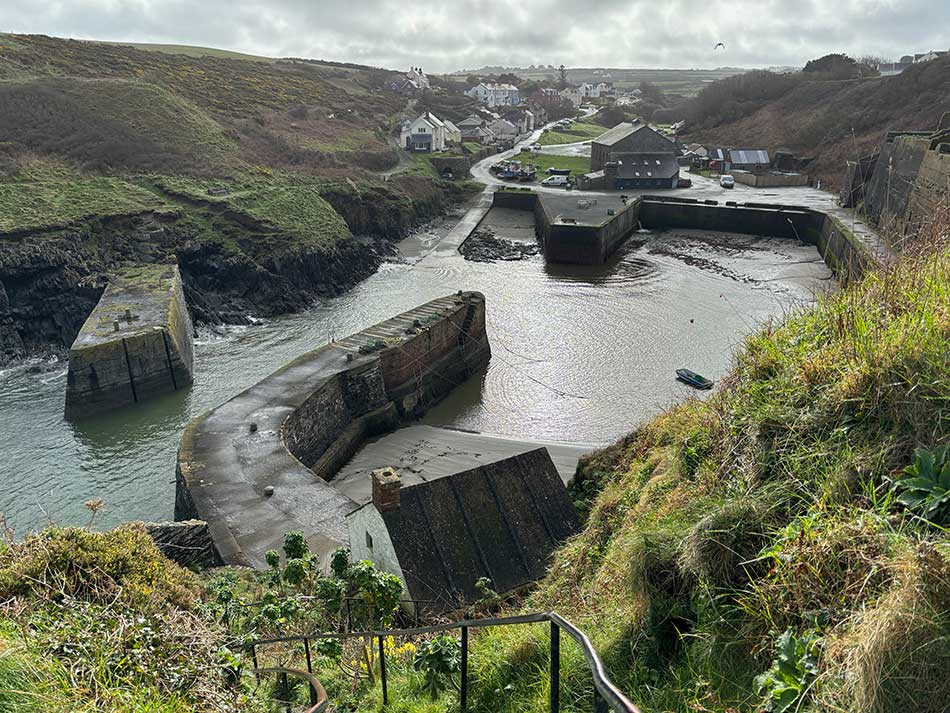
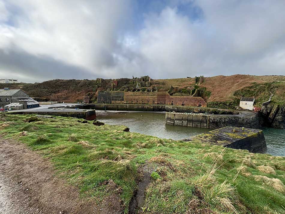
It was only a short descent into the village where I made use of the toilets, filled up my water bottles and had a wash. There wasn’t a shop so there was nowhere to buy any breakfast or anything else for lunch that day. I therefore headed out onto the Coast Path on the other side of the harbour wondering if there would be anywhere along the way.
Porth Gain to Abercastle
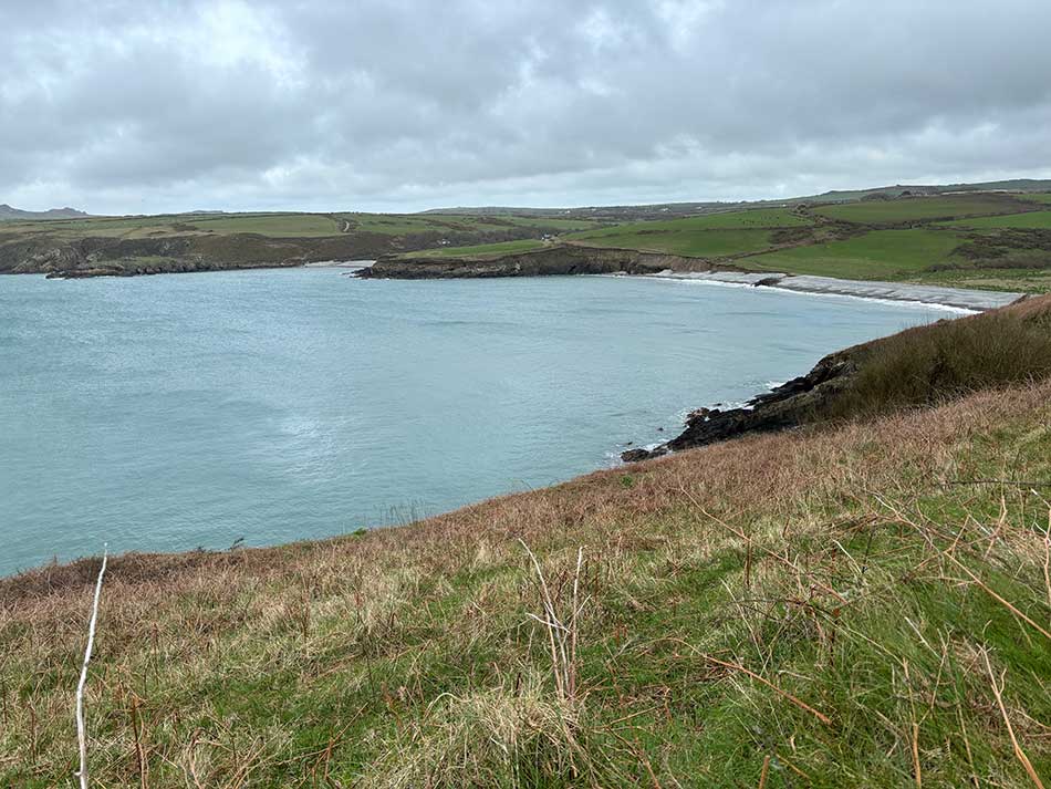
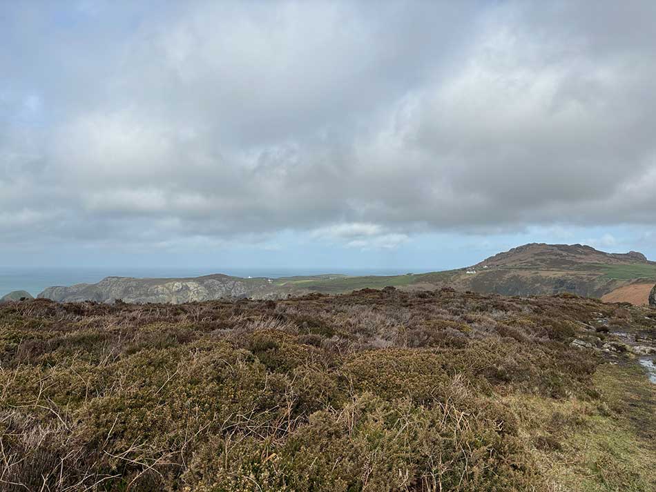
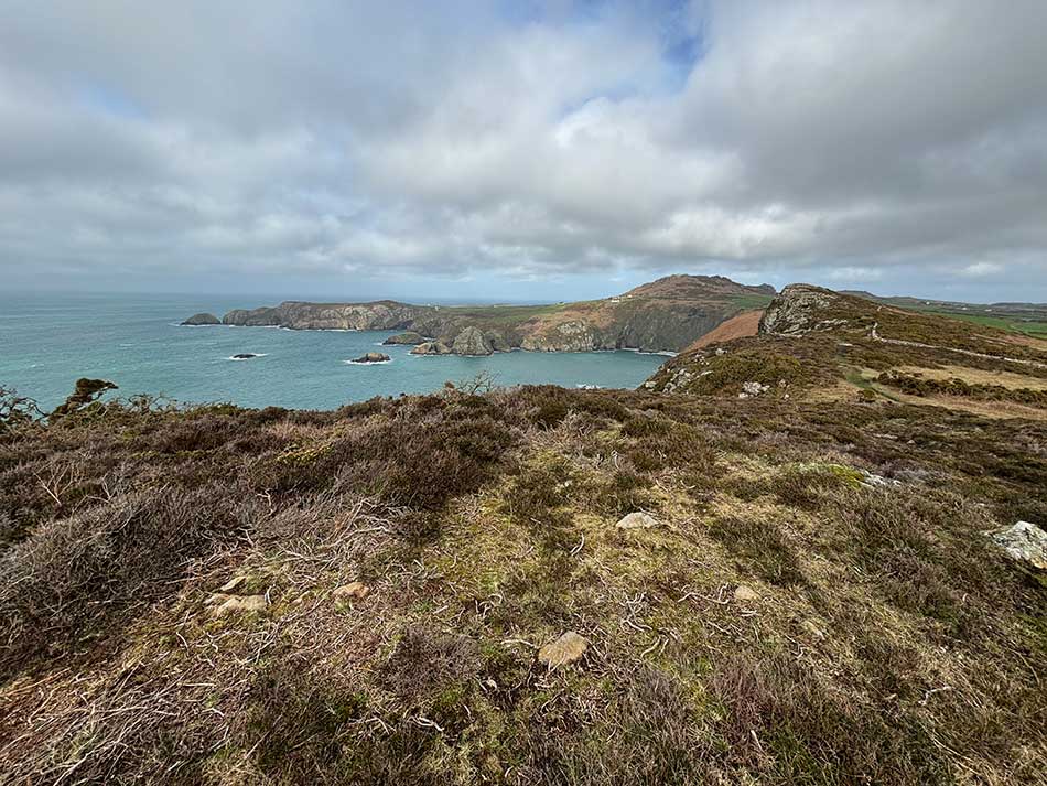
I soon gained height onto the cliffs and could see the coast all the way to Strumble Head in the far distance. That’s where I was hoping to go today. It looked like a long way especially with all the ins and outs, and ups and downs.
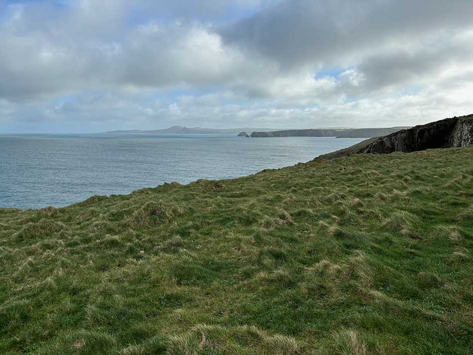
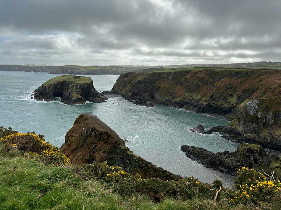
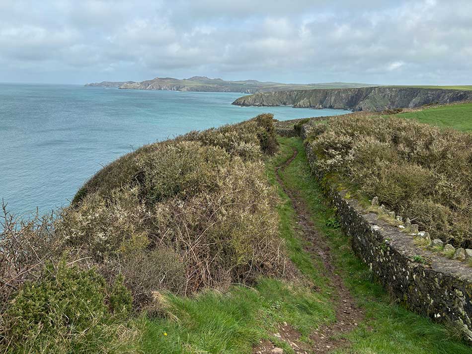
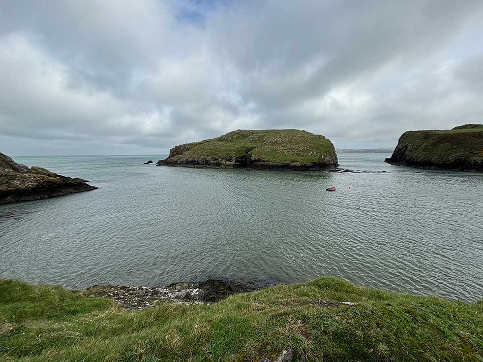
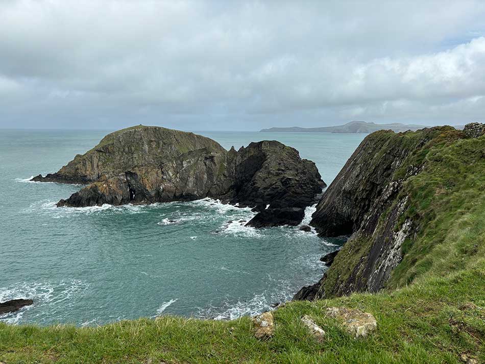
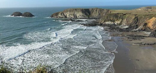
I followed the narrow path hemmed in between the field boundaries to my right and the steep drops off the cliffs to the left. The ground was very wet, very muddy and very slippery for the most part and it was quite perilous in some places. I had to take it easy as a slip here could be fatal. The views were domianted by the cliffs, various bays that were inaccessible from land and a number of grass-topped islands. One of the bays had a number of seals in it all calling and making howling noises that echoed off the steep cliffs.
After a while I descended to a little river crossing near Trefin and decided to go on a detour into the village to find a shop. You’ve geussed it, there wasn’t one. There was a café but it wasn’t open on Monday’s or Tuesday’s. I also called into the youth hostel there as well but they didn’t sell or have any food either. I retraced my steps back down the hill to the coast path and continued on my way.
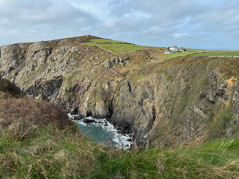
Next was more of the precipitous cliffs and muddy paths with the occasional filed crossing through boggy ground. I met a few other people out walking today, most seemed to be doing the whole coast path bit by bit similar to me. I descended into the calm waters of Abercastle but once again there were no shops here so I climbed back up onto the high cliffs for more of the same. The clifftops were covered in blackthorn that was about to burst into blossom.
Abercastle to Pwll Deri
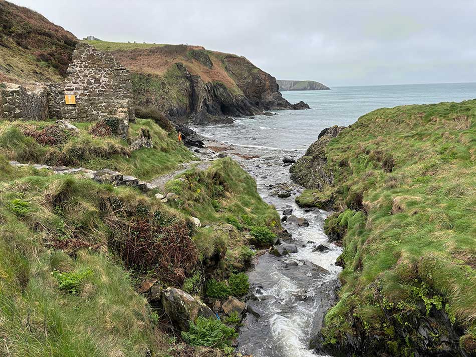
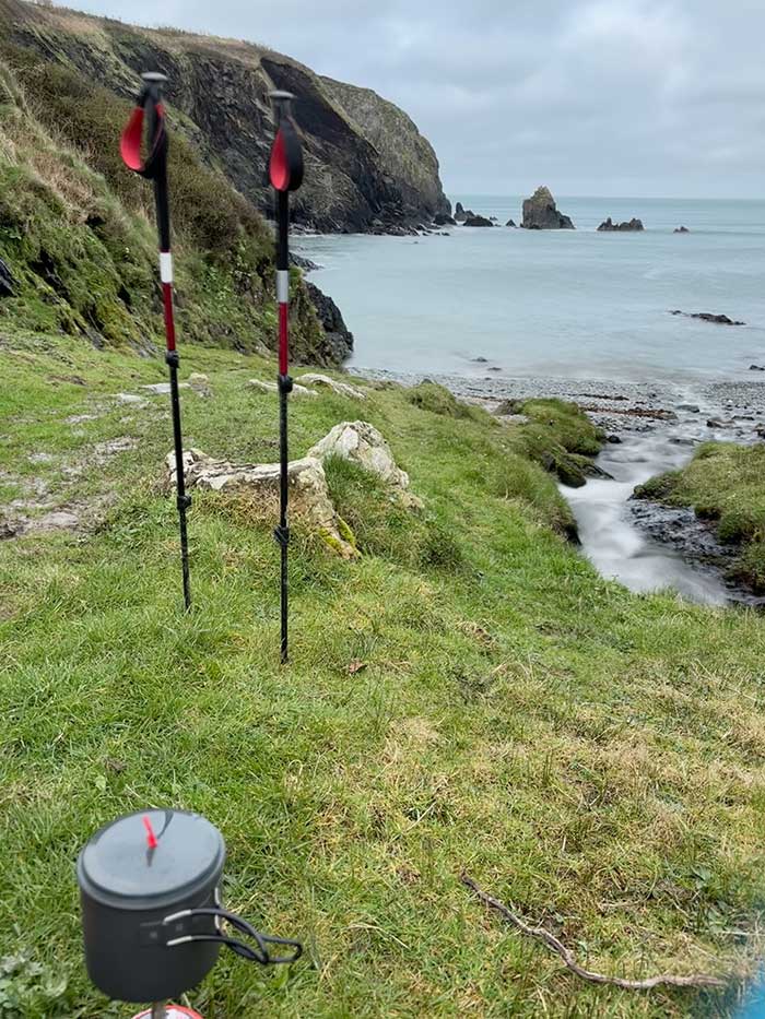
After a steep descent at Pwllstrodur I stopped by a stream and decided it was lunch time. I hadn’t really had a proper breakfast and with nowhere to buy anything I thought the best option would be to make some porridge as I had plenty of that with me. Using water from the stream I sat there for a while eating my porridge and drinking a coffee.
Some people that I had passed earlier in the day overtook me but I soon caught them back up once I got going again. I’d accidentally stopped my watch whilst cooking so I had to start a new recording for the afternoons’ section of the Coast Path. Here’s the morning’s route.
Once back on to the tops of the cliffs there was yet more narrow muddy path and steep drops as the Coast Path hugged the tops of the cliffs. There wasn’t much in the way of ascent and descent here though, just lots of windswept clifftop. The wind had been picking up all day and was now quite a feature on the more exposed headlands. It was quite a relief to drop down to the relative shelter of the beach at Aber Mawr. I had thought about camping somewhere around here and there were a few likely looking spots out of the wind. It was however still quite early in the day and I wanted to keep going.
At the far end of Aber Bach the river was in full flow. There was a sign saying that there was a short detour inland as the river could be uncrossable after rain – I thought I’d prove them wrong and save myself the detour so off came my shoes. socks and trousers to reveal some very dirty feet and in I went, wading through the knee deep water.
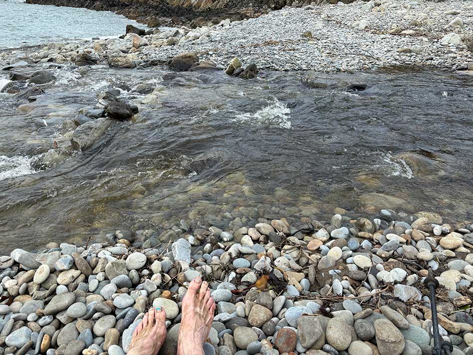
It was actually very nice. Once across the river I took some time to wash my feet and get dressed again. I felt better for it and felt revived and refreshed so climbed back up onto the cliffs with a spring in my step.
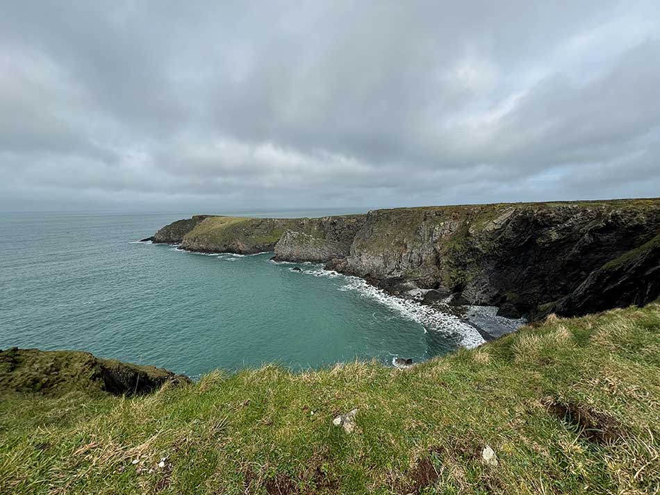
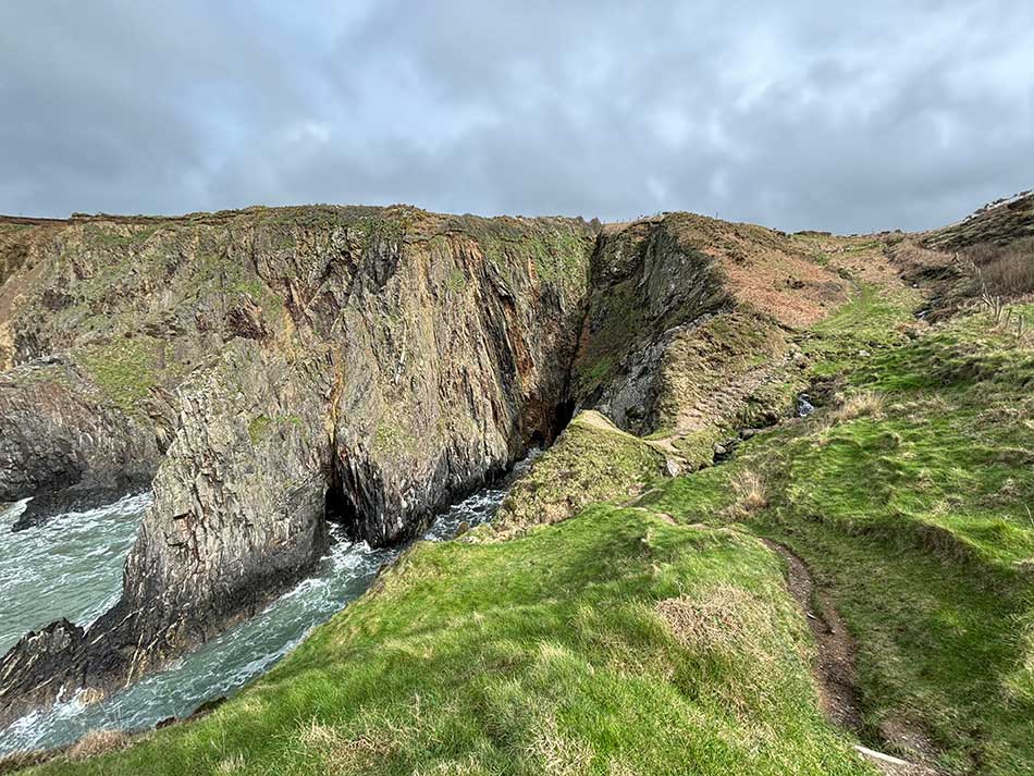
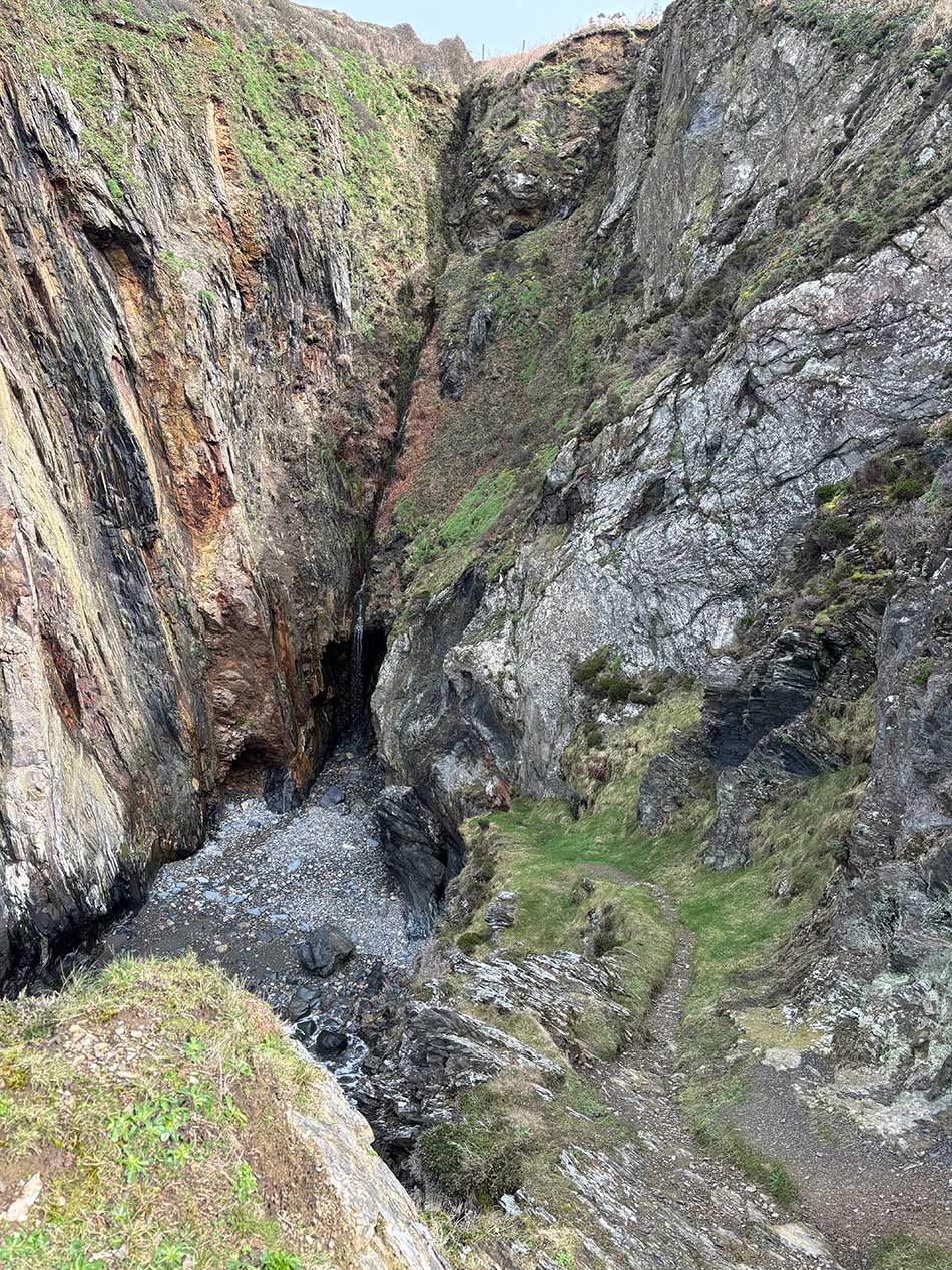
The next section comprised of yet more huge cliffs, some with impressive waterfalls and more in the way of ups and downs than earlier in the day. There were various sections where recent lanslides had washed away the path forcing it to detour a little further into the clifftop fields. The wind continued to increase and the skies started to look a little ominous. I felt the occasional drop of rain but it didn’t quite come to anything.
I was soon climbing up towards a rocky summit where some scrambling was required. With the ever strengthening wind it was getting a little sketchy on the exposed tops. I started thinking about where to camp and kept a look out for sheltered spots. My plan had been to get to Strumble Head and camp there but looking at it in the distance it was likely to be very exposed and might not be the best option given the wind conditions.
Another option would be to go a little way beyond Strumble Head and try to find somewhere closer to sea level that wasn’t so exposed. There was one likely looking cove but I wasn’t sure what it would be like. I was running decisions and options through in my head.
I met an elderly couple heading in the opposite durection. They had come from Strumble Head and were heading to Aber Mawr. They’d also walked the stretch from Fishguard to Strumble Head the day before. I asked them what it was like and they said the going along there was very difficult and they couldn’t think of any opportunities to get down to sea level. They did however mention the Youth Hostel just ahead at Pwll Deri. I started thinking of a possible night in the Youth Hostel rather than the tent. There were certainly no places to camp along the tops of the cliffs between the headland and the Youth Hostel. It was just a narrow strip of land with the path hemmed in by steep drops to the north and exposed farmland to the south. It didn’t look any better beyond the youth hostel either.
Decision at Pwll Deri
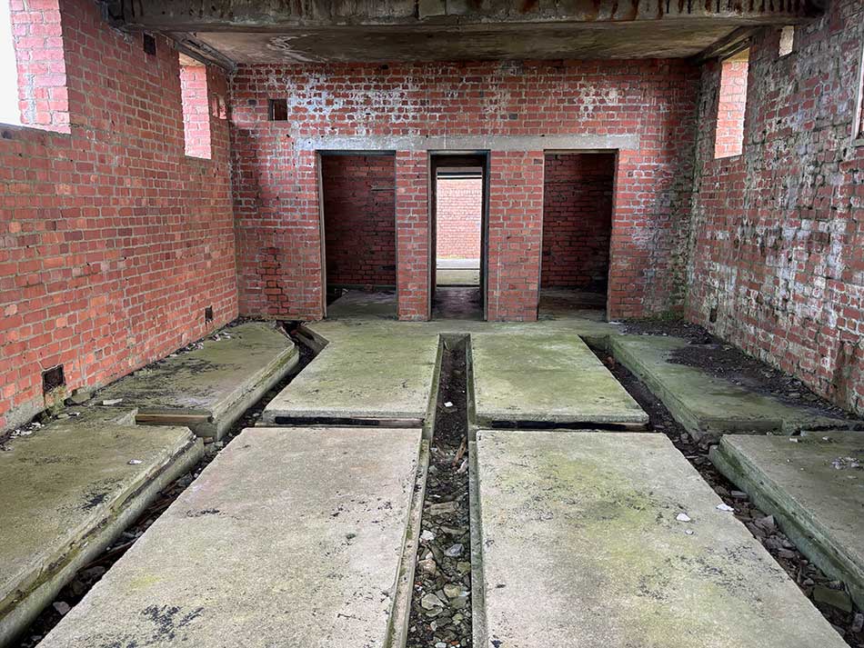
I emerged out on to the road and found that the Youth Hostel wasn’t open. That wasn’t an option then. It was still very windy here so I thought I’d just have to head on to Strumble Head to see what things looked like there. The next section was very rocky, very exposed to the wind and had no places to camp. There were some stone walls I might have been able to get a little shelter behind but the field was full of cattle and there were signs saying beware of the Bull. There was an interesting staircase cut into the cliffs at Pwll Deri, but it didn’t lead to a camping spot. I headed on up to the summit where there were some abandoned buildings. I had a look around and thought maybe I should stay there for the night. I could at least get out of the wind, and with rain forecast it would be dry too.
I looked out towards Strumble Head and decided that would indeed be far too exposed. The wind was now hitting 60 mph and it was difficult to stand up on top of this hill. It wouldn’t be any better at Strumble Head. My watch then buzzed with a ‘Storm Alert’ message. I decided it would probably be safer to wait out the night and the storm in the safety of this building. My only other option with a few hours of daylight left would be to continue on to the little bay I’d seen beyond Strumble Head. The problem with this was that if I got there and found it to be unsuitable I’d then be out of options. I wouldn’t make it to Fishguard before nightfall, I didn’t fancy being stuck on the cliffs in a storm in the dark and it would be a long way back to this building by then. So, I stopped my watch and took a proper look around.
After waiting a while in the building something just didn’t feel right. Despite the four walls and the roof over my head the wind was still whipping into the building and swirling around, my tent wouldn’t quite fit between the gaps in the concrete and the noise of the wind through the ‘windows’ was deafening. There was a lot of banging and clanging as the wind battered the structure too. It was also freezing up here. I’d already put on a fleece and my jacket so had four layer on but was I was still cold.
A Mad Dash to Safety
I’d been having a text conversation with Anna whilst wondering where to camp and had also pondered the idea of bailing and heading into Fishguard. I asked what time the last bus from Fishguard was. It left at 5pm and it was now 4pm. Had there been a later bus I could have given up on the idea of another night of camping and headed back to the road and walked into Fishguard to get the bus back to the car. It was about 6 miles from here to Fishguard along the road so it would take a couple of hours of walking. I would have got there before sunset but there would be no more buses by then.
I then suddenly had the idea of heading to the main road between Fishguard and St Davids and flagging down the bus there. It looked slightly closer than Fishguard itself so I could get there quicker and the bus wouldn’t get there until about 15 minutes after it left Fishguard giving me an extra 15 minutes to make it. By now that meant I probably had an hour to cover 5 miles. It would be tough especially with a 12kg backpack on but with the idea in my head I decided to give it a go and was already hurtling back along the coast path before Anna could reply.
It’s not easy running with a heavy backpack especially after having been walking all day, so I ran the descents and flat bits as best I could and then power hiked the climbs. My phone pinged as a text message came in from Anna but I didn’t have time to stop and read it. I looked at it on my watch as best I could without my glasses on. I thought it said “It’s about 3 miles to the main road”. If that was the case I should make it, but I kept running anyway. The text actually said “It’s about 5 miles to the main road”.
I was now regretting putting the extra fleece and the jacket on as I was getting pretty hot with the effort but there was no time to stop. I tried to flag down a couple of cars that passed for a lift to the main road but no one would stop. On I went, running when I could on what seemed like a never ending road.
Another text message came through from Anna who was tracking me online. “You’re about 1.5 miles from the main road, bus timetable says it gets there about 5:15pm”. I glanced at my watch, it was 4:55pm. 20 minutes to cover a mile and half. It should be doable but I could see that the road ahead was mainly uphill. I saw a lorry on the main road in the distance, it still looked a long way off. On I went pushing ever harder to try to get there in time. Finally the main road came into sight. I stopped at the junction, crossed the road and checked my watch. It was 5:06pm. I messaged Anna saying that I was there and now needed to find a bus stop. She replied with messages saying it looked like it would stop at the junction and should be there at 5:14pm. Phew, I’d made it and with just 8 minutes to spare. Now I just had to hope that there was indeed a bus.
Thankfully there was and I was soon onboard and heading towards St Davids. My toe was sore and I could tell it was bleeding, maybe I’d lost a toenail. I hadn’t expected to be running today, especially not with a fully laden rucksack, and I was a little sweaty. I polished off some water and tried to recover. That had been a bit of excitement for the end of the day. I may have bailed from another night under canvas but I had at least ticked off another 14 miles of the Coast Path and added a 5 mile run onto the end of it just for fun. I was at least safe and would make it home tonight. The next stretch will have to wait for another day.
That was about 32 miles of the coast path completed in the past two days though so depsite the early abandonment I’d made some good progress. Hopefully I’ll be back for more soon.
Discover more from A Simple Life of Luxury
Subscribe to get the latest posts sent to your email.
3 Responses
-
[…] I had another couple of days planned after this so should tick off a decent chunk of the path. Check out the next post to see how I got […]
-
[…] would have been sheltered somewhat from the gale that was blowing last time I was in these parts. That time I had aborted my mission and headed home. I could probably have continued on a little further and camped here but I didn’t know that […]


Talk about living on the edge !
Glad you made it x