3D Wooden World Map
Most of my birthday surprises this year ended up on the wall in the Hall. One of them was an ‘Enjoy the Wood” 3D wooden World Map from my siblings.
3D Wooden World Map Installation
After clearing a space on the walls in the hall by moving a painting into the living room I started work on installing it. First task was to position the two cardboard corner pieces that come with the map.
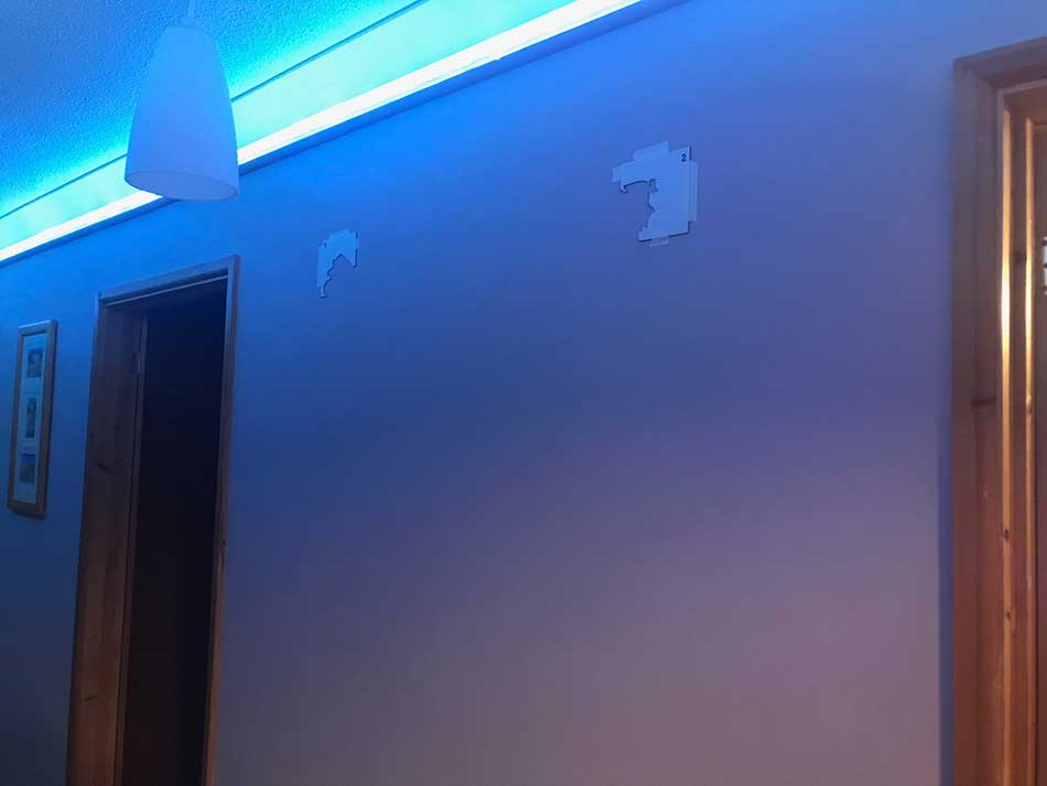
These allow you to mark out the top two corners of the map and position it correctly. I had the smaller of the maps which is 100cm by 60cm and fits nicely on the wall. They do go up to 300cm x 175cm which wold be pretty big! We wouldn’t have a wall large enough for that I don’t think. I therefore made sure that the cardboard template was level and exactly 100cm across. After a bit of adjustment to make sure the entire map would be at the correct height, it was time to start attaching little bits of double sided tape to the backs of the map.
I was rubbish at peeling the backing off the tape so I employed Anna to do that for me while I started attaching pieces to the wall.
The Major Continental Masses
I started of course with one of the corners and then worked out from there. The initial sections were pretty easy. Once the far eastern corner of Russia was in place all of the countries through Asia and Europe and India fit together like pieces of a jigsaw. This means you can’t go wrong with them.
Africa was quite easy too. There is only a very small connection around the Sinai Peninsula in Egypt so they don’t interlock here properly but as long as you get the gaps for the Straits of Gibraltar and the Red Sea looking correct then it is fine.
The same is true of North America. Once the Western end of Alaska is positioned within the cardboard template attaching the rest of the mainland is easy. Once again, the connection between South America and Central America needs a bit of care. It is just a tiny join along the Panama Canal so it doesn’t interlock. Making sure the text of the country names is horizontal helps though.
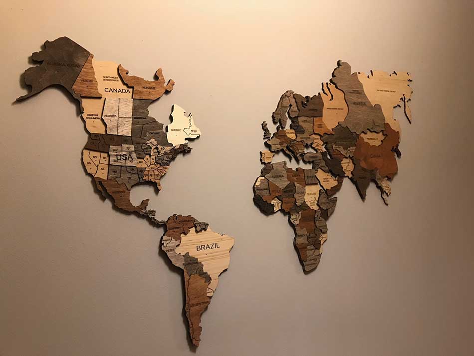
Australasia and the Islands
Next I had to decide how to position the various islands and the continent of Australia correctly. These don’t join onto anything else so I would need a method of positioning them correctly. Making sure they were spaced properly would be important. Rather than do this by eye I decided to print out a life-size template. I therefore scanned the leaflet that comes with the map. I then enlarged it to 100 x 60 cm and printed out various sections of it. Next I cut out the various continents and islands and positioned the paper templates on the wall.


Positioning Australia and all of the islands around the world was now easy. It would make things easier if a full size template was included with the map itself. I’m sure it wouldn’t cost much for them to add such an item.
Once the various islands were in place it was looking good.
We did however realise that re-decorating the hall would now be quite an undertaking! In hindsight it may have made more sense to attach it all to a wooden sheet. That could be framed and hung on the wall allowing us to remove it for decorating. Mind you, it does looks nicer attached directly to the wall. Fortunately we have decorated recently so it should be OK for a while.
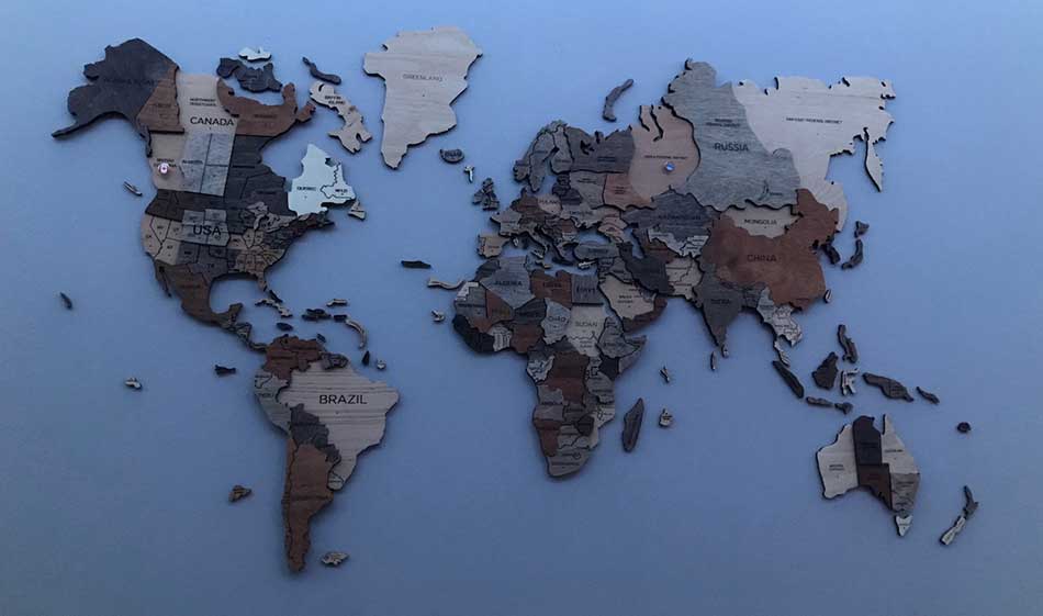
Antarctica and Prime Features of my 3D Wooden World Map
I was given the ‘Prime’ version of the 3D wooden World Map. This comes with the continent of Antarctica, Ocean names, a North Compass. I haven’t added these yet, but they do have bits of tape on them ready to go. I need to get a spirit level out of the shed first to make sure I’m positioning them horizontally. There are also some airplanes and boats to add to the map. Don’t worry, I’ll add another photo once it is all completed.
For now though, here’s a stop-motion video of some of the installation.
Country Pins
As well as the 3D wooden World Map I was given a board full of country pins as well.


We aren’t hugely ‘travelled’ but we were able to add quite a few pins to the map. I did think at first that maybe the pins would obscure the map itself a little too much. This would only be an issue on the smaller map but it actually looks OK. The flags are nice in themselves too. It also feels like a bit of challenge now to add some more pins over the years. We will have to wait until are allowed to travel again of course.
Discover more from A Simple Life of Luxury
Subscribe to get the latest posts sent to your email.
4 Responses
-
[…] promised, here’s a photo of the 3D Woden World Map now that I’ve completed […]
-
[…] due to the scenery it took us through and the fact that it visited 3 different countries so would add three pins to our map. The entire trek was a little too long at around 120 miles but as the plan was to do it on our own […]


Oh well kept you out of mischief for a few hours …,looking good
Glad you like it x