Wales Coast Path Run – Tre Ddol to Machynlleth
Coast Path Vital Stats
Tre Ddol to Machynlleth
- Distance: 11.24 miles
- Total Elevation Gain: 543m
- Highest Elevation: 153m
- Time: 2:08:28
- Av. Pace: 11:26 mins/mile
- Av. Heart Rate: 133bpm
- Max Heart Rate: 158bpm
- Calories: 1237
- Miles Completed: 32.91 miles
- Miles to go: 837.09 miles
Stage 3 of my Wales Coast Path run project and today it was along the coast path from Tre Ddol to Machynlleth. First though there was the little matter of an hour and a half on the turbo trainer and todays TrainerRoad session saw me increasing the intensity a little with the first under-over session for a long time. The session called Warlow is described in the following way:
Warlow is 5×9-minute Over-Under intervals alternating between 2 minutes at 95% FTP & 1 minute at 110% FTP with 6-minute recoveries between intervals.
Goals
Warlow chiefly aims to develop your ability to handle changes in pace while maintaining a high level of work and enhance muscle endurance in the process.
The surges flood the muscle with metabolic byproducts bringing with them the desire to ease up, don’t.
Hold that burn, then back off only slightly during the valleys in order to work through the burn and effectively train your muscles to process the buildup while still doing a lot of work.
These intervals can increase your ability to better process lactate thereby increasing not only how long you can work above FTP but also increasing FTP itself.
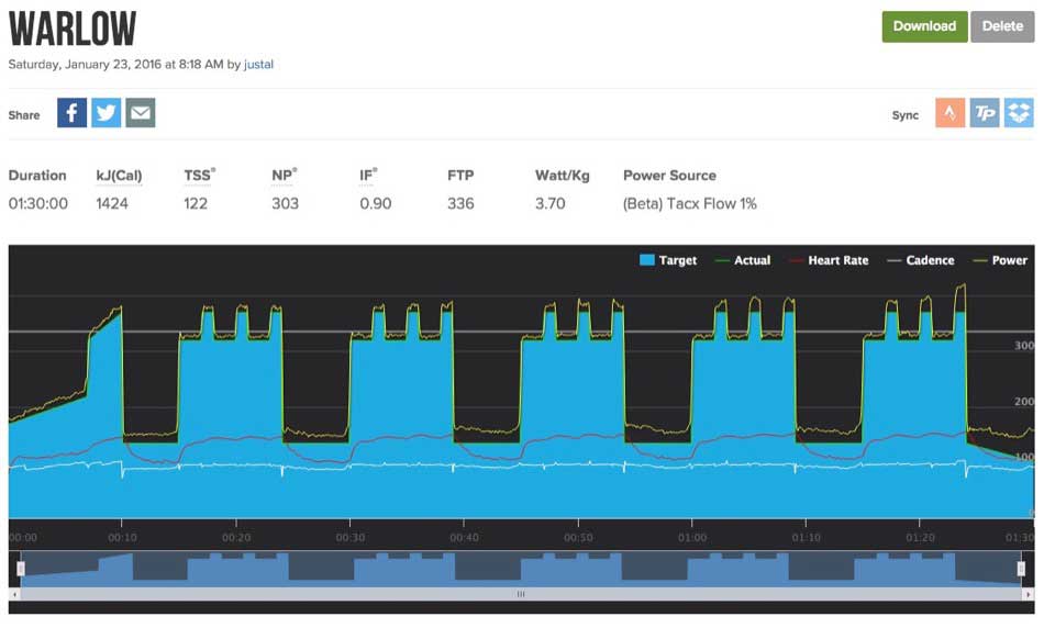
Warlow
It was indeed a bit of a shock to the system and tough at times, but I managed to complete it, had a quick breakfast and then got Anna to drop me off in Tre Ddol ready for stage 3 of my coast path run.
A not very coastal section of Coast Path.
The boundary between Ceredigion and Gwynedd is marked by the Dyfi estuary, the large estuary of the River Dyfi that flows from the Cambrian mountains and out to the sea between Ynyslas (where we live) and Aberdyfi. The first road crossing of the River Dyfi is around 8 miles inland at Machynlleth. This means that the coast path heads inland quite a way here in order to circumnavigate and cross the River.
I started some of this progress inland last week whilst running from the coast at Borth, across Cors Fochno to Tre Ddol. Today I started in Tre Ddol and immediately headed off uphill into the forest clad valley sides of the mid Wales hills. As this is close to home I know many of these trails and have run along most of them fairly recently. The first section up through the woods behind Tre Ddol, across the road and then around the field and over the new bridge into Coed y Wenffrwd was very familiar if a little muddier than usual. We may have had a fairly dry week this week, but the exceptionally warm and wet winter that we’ve had meant that it was still very wet and muddy underfoot. The earlier tough turbo trainer session was making itself felt in my legs too.
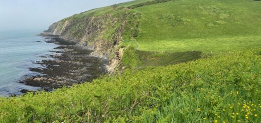
The next section through the woods and then out across several fields before dropping down into Artists Valley was also very familiar to me as I had run it just a few weeks ago whilst trying out my new trail running shoes. Today though, rather than turn back at the bridge over the River Einion, I crossed the bridge and continued along the coast path. I’d never been along this short section of path before, but it soon brought me out onto a small track that I did know and then continued on around the bracken covered slopes of Foel Fawr. Once again I was on familiar ground with some amazing views of the Dyfi Estuary below, and out in the distance a glimpse of Cardigan Bay. I was now quite way from the coast though and running along a section of the coast path that felt very un-coastal.

Dyfi Estuary Pano
I continued on my way, splashing though the puddles, squelching through the mud and slip-sliding down the rocky slopes. I ran past Ruth (a friend of mine) who was out for a walk and continued on my way down a steep slope into Cymerau Valley.
Where are all the Coast Path Signs?
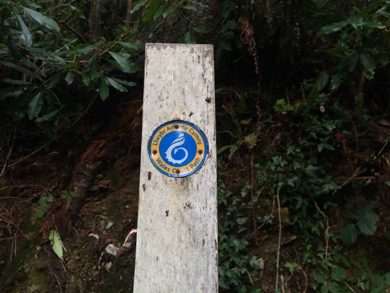
Coast Path Sign
Once again I knew where I was and I was expecting to continue up the valley road towards Cymerau Farmhouse where friends of mine live. The Coast Path Sign sent me off into the fields instead so I followed the signs. It seemed right at first and I soon came across another sign so kept following it, but then couldn’t find any more signs. I ended up going off course and down a long descent that brought me out on the main road in Glandyfi. That wasn’t where I was supposed to be so I turned around and headed all the way back up the hill to try again. This time after running across a couple of soggy fields I ended up on a steep, wooded hillside but the track I was following disappeared. The Coast Path signs were non-existent and I ended up scrabbling through the undergrowth, climbing over fallen trees and was now way off track. There had been lots of forestry work going on here so maybe the signs had gone missing, but this didn’t seem right.
I knew however that the Coast Path did emerge from here onto the road through the Llyfnant Valley and then came down this road before doubling back on itself a little. From my vantage point I could see where the Llynant Vally road emerged onto the main road so I had three choices.
- Double back yet again, all the way to the road through Cymerau Valley and continue along that road to see if I could find some other Coast Path signs, despite the fact that they had told me to come this way.
- Scale the hill through the woodland heading East to see if I could come across the path on the other side of the hill.
- Descend through the clear felled hillside to the main road and then along to the Llyfnant Valley where I could run up the road there and pick up the trail in that valley.
I plumped for option 3 as it was the only one that would have a guaranteed successful outcome so I scrambled my way down the hillside to the main road. I ran along the main road for a couple of hundred yards and then up the road through the Llyfnant Valley where I soon came across the expected Coast Path sign heading off across a bridge and along the northern edge of the River Llyfnant. The going was good along here for a while but it soon got wet and boggy again before heading upwards for a long slog along a forest trail. I was now at the highest point of the trail for the day at just over 150m, way inland from the sea and having not seen any sign of the coast for quite some time.
-

- Muddy Trails
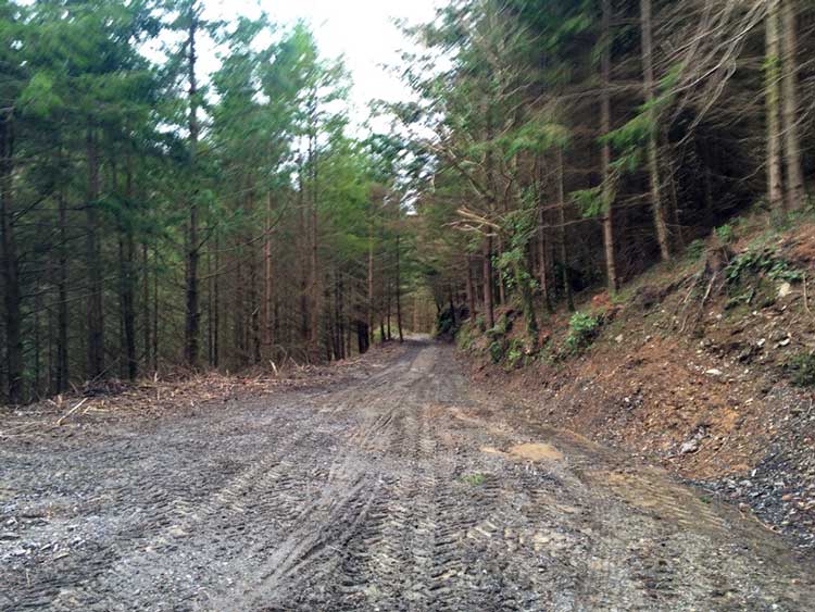
-
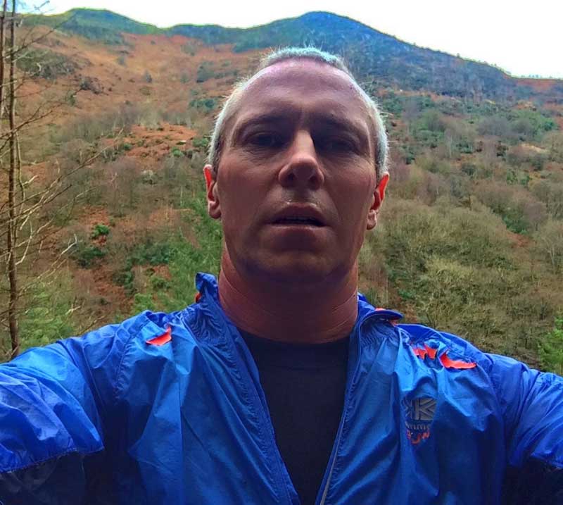
- Sweaty Coast Path Selfie
Racing for the Train
I was now heading towards familiar trails once again though and knew exactly where I was. I had a quick look at my watch and noticed that I had about 25 minutes before the train from Machynlleth to Borth left the station. I wasn’t going to make it, from here I reckoned it would be about a 35 minute run at my current pace. Maybe if I was fresh, hadn’t already done a 90 minute hard turbo trainer session and hadn’t been running for close to two hours then I would have made it, but I didn’t think that would be the case today.
I upped the pace a little anyway just in case and made some good progress once out onto the Glaspwll road. I dropped down into the valley, crossed the river and pushed on up the steep hill, first through the field and then along the tarmac. As I came out onto the top of the Caer Gybi climb, I could see Machynlleth, and there in the station the train. I looked at my watch and it was 12:45, three minutes until the train left and I still had a mile or so to go. I wasn’t going to make it. I started descending the Roman Steps and sure enough, half way down I saw the train pulling out of the station. If I hadn’t lost the trail earlier I probably would have made it, but it just wasn’t to be. The next train wouldn’t be leaving for another 2 hours though so rather than wait around I gave Anna a ring and she started driving out to collect me.
I continued on through Machynlleth to the Train station and turned around and started walking back. About a mile later Anna arrived and gave me a lift back home. That’s stage three of my Coast Path Challenge. Today’s section of the coast path from Tre Ddol to Machynlleth ended up being 11.2 miles but that was with a bit of a detour.
Apart from the problems with the signs around Cymerau Valley it’s lovely part of coast path. Not very coastal at all, but it still affords some excellent views and takes you through deciduous woodlands, steep sided valleys with tumbling waterfalls and gurgling streams, along the lovely Llyfnant Valley up through coniferous plantations and out onto bracken covered hillsides. Quite a different feel to some of the more coastal sections but well worth the effort.
Discover more from A Simple Life of Luxury
Subscribe to get the latest posts sent to your email.