Menai Bridge to Maltraeth Coast Path Run
Coast Path Vital Stats
Menai Bridge to Maltraeth
- Distance: 23.12 miles
- Elevation Gain Today: 322m
- Highest Elevation: 50m
- Time: 3:38:32
- Av. Pace: 9:27 mins/mile
- Av. Heart Rate: 125bpm
- Max Heart Rate: 148bpm
- Calories: 2019
Totals to Date
- Total Distance: 244.02 miles
- Total Time: 44:38:14
- Total Elevation Gain: 7017m
- Total Calories: 21190
- Distance to go: 641 miles
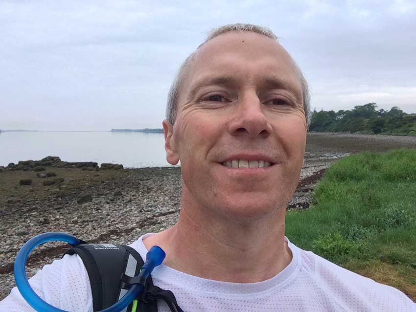
Another early start to the day so that I could continue with my endeavour to run around the entire periphery of Wales. As I get further from home, the travelling time to get to the start point is lengthening and the time taken for my day running on the Coast Path is increasing. I have to therefore make the most of it once I’m there, so no short runs for me at the moment. I was up at 4am so that I could leave the house quite early. I actually left around 5:15am and arrived at the Menai Bridge just before 7am. These early morning drives are lovely with no other cars on the road.
Geocaching on the Coast Path
A quick change of shoes and I was ready to go, but not before doing a quick geocache on the mainland side of the Menai Bridge. I must have missed loads of geocaches whilst running along the coast path, but as Anna pointed out the other day, I just can’t do it all. If I want to make good time I can’t be stopping every 10 minutes to search for geocaches, Each one takes a few minutes (sometimes more) to find, sign the logbook and log on my phone so I just wouldn’t have the time. It also tends to be a drain on my phones battery so I simply haven’t been doing them.
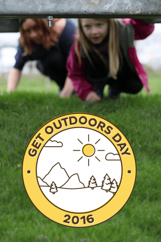
Get Outdoors Day Souvenir
I wanted to find one today though as it was ‘ Get Outdoors Day’ and to celebrate, Geocaching HQ were awarding geocachers with a souvenir if they found a geocache today. It’s only a digital souvenir of course, nothing for real, but Morgan likes it when we get them and even though he wasn’t here I hoped that it would encourage him to get more in the future.
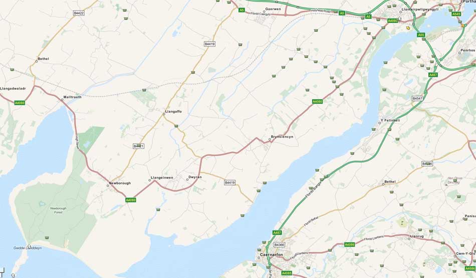
Logging this quick cache before my Coast Path Run qualified us for the souvenir and I think 20 odd miles along the coast path would qualify as ‘getting outdoors’. However, if you check out the map of where I went today and the geocaches along it, I ran past at least 8 others, including a couple Earth Caches on Llanddwyn Island. And last week whilst running along the other side of the Menai Straits I ran past even more – Oh well, “I can’t do them all”!
Geocaches on the Coast Path
Onto Anglesey
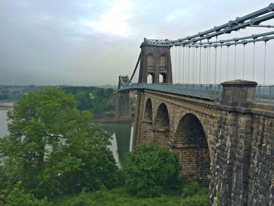
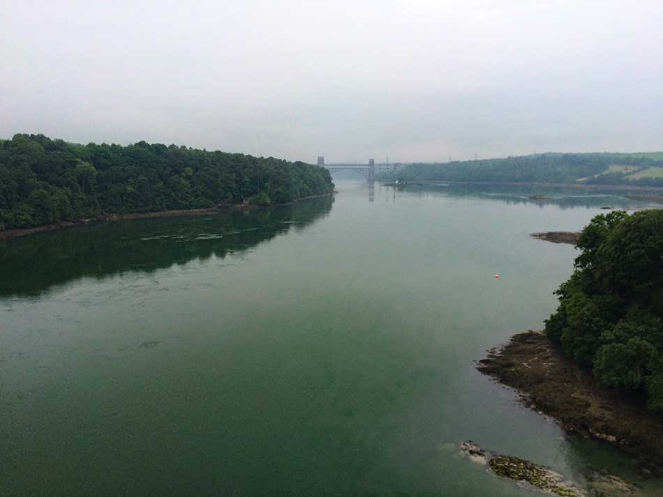
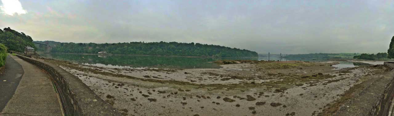
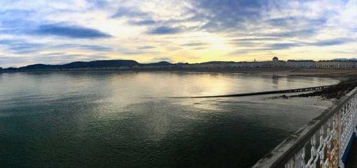
I was then ready to start running so headed off. It had been pouring with rain on the drive here but now had eased to a light drizzle as I set off across the Menai Bridge high above the rushing waters of the Menai Straits. Although, today they were quite calm as it was low tide and by the looks of it pretty much slack water.
-

- Menai Bridge
-
- Menai Straits
The Menai Suspension Bridge designed by Thomas Telford was completed in 1826 and was the first bridge across to Anglesey. Despite the early morning grey and dampness it was still quite warm at around 15ºC so I was wearing just a pair of shorts and a ‘T’-shirt. I did of course have a jacket in my rucksack in case the rain got heavier again, along with plenty of fluids, energy gels and snacks, a map, a survival blanket, sunglasses, my phone, keys and some money.
As usual, there was no one around at this time in the morning as I made my way off the mainland, onto the Isle of Anglesey and then down below the bridge to the Belgian Promenade. This wide, well paved promenade marked the start of the Coast Path around Anglesey which follows the self-contained Isle of Anglesey Coastal path.
Belgian Promenade
The Belgian promenade was first built during the First World War, when refugees from German-occupied Mechelen in Belgium were accommodated in Menai Bridge. In gratitude for the town’s hospitality, they built this promenade along the Menai Strait from Ynys Tysilio (Church Island) to Carreg yr Halen, completing it in 1916. It was rebuilt in 1963 and was resurfaced in 2000 as part of a millennium project so now has little round discs with the Anglesey Coast Path symbol embedded in it. The promenade made for an easy start to the day as I ran along the shores of the Menai Straits through the drizzle with views of the Menai Suspension Bridge behind me and the newer Brittania Bridge ahead.
Ever Changing Coast Path
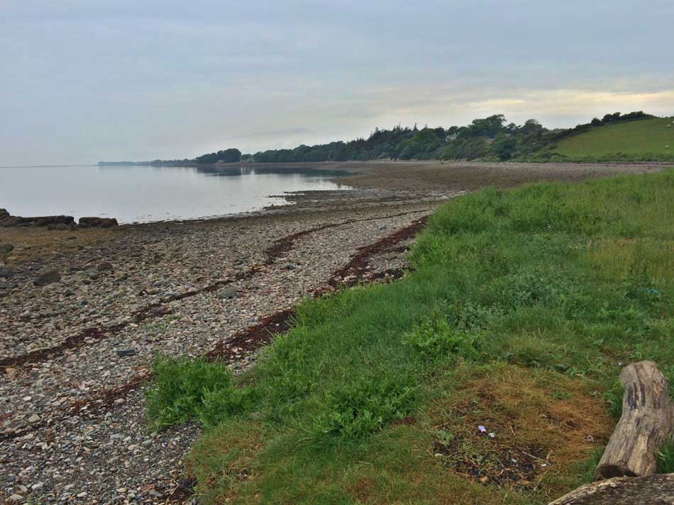
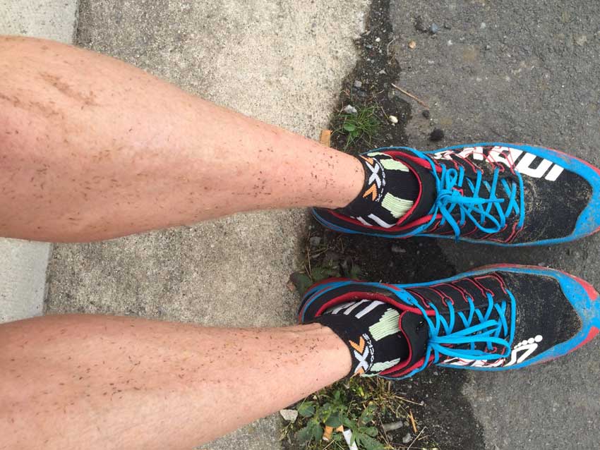
After a brief section along the road the Coast Path took me back down along a little track to the Menai Straits where I ran along the rocky, shingly, seaweed strewn shoreline. I was wearing a brand new pair of shoes today. 20 odd miles along the Coast Path probably isn’t the recommended way to break in a new pair of shoes, but they were exactly the same model as my previous shoes so I was hoping they’d be OK. Being trail shoes they aren’t really suited to running on the road with their deep, stud like tread, but the muddy and grassy paths were just up their street. The recent rains actually made the ground underfoot on these a little softer than it had been for the last few weeks so the going felt good. It was a little more difficult on the foreshore though where the shingles and pebbles moved beneath my shoes soaking up any energy put into my stride and I had to jump over rocks and run around obstacles.

National Trust Woodland
The rocky, shingly beach soon became a grassy path lined with yellow flag irises and then headed through a couple of gates onto a woodland path as I entered the Cae Glan Mor National Trust Nature Reserve. This small woodland was alive with brid song and in places had some long wooden boardwalks. These were actually quite slippery despite having a decent covering of non-slip so I made my way gingerly along them. The ever changing surfaces and scenery kept me occupied and despite the variety already, I had only covered about 2 miles.
Next, the Coast Path took me down into a little hollow and though the churchyard of St Mary’s Church, Llanfairpwllgwyngyll.
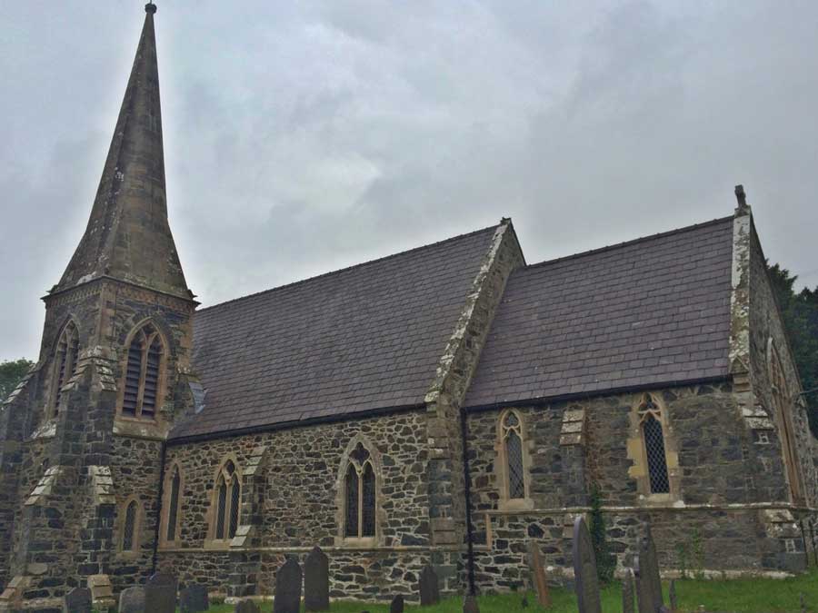
St Marys
Yes, that’s the church that is mentionged the long form of the village name: Llanfairpwllgwyngyllgogerychwyrndrobwllllantysiliogogogoch
This long form of the name is the longest place name in the United Kingdom and one of the longest in the world at 58 characters. Although it really ‘only’ has 51 “letters” since “ch” and “ll” are digraphs, and are treated as single letters in the Welsh language.
The name means: Parish of St. Mary in the Hollow of the White Hazel near the rapid whirlpool and the parish of St. Tysilio with a red cave.
It’s a bit of a made up name really as the village was originally known as Llanfair Pwllgwyngyll. It was given its long name in the 19th century in an attempt to develop it as a commercial and tourist centre. The village is still signposted Llanfairpwllgwyngyll, marked on Ordnance Survey maps as Llanfair Pwllgwyngyll and known to locals as Llanfairpwll or Llanfair. Even the railway station, despite having signs displaying the long name, is officially named Llanfairpwll.
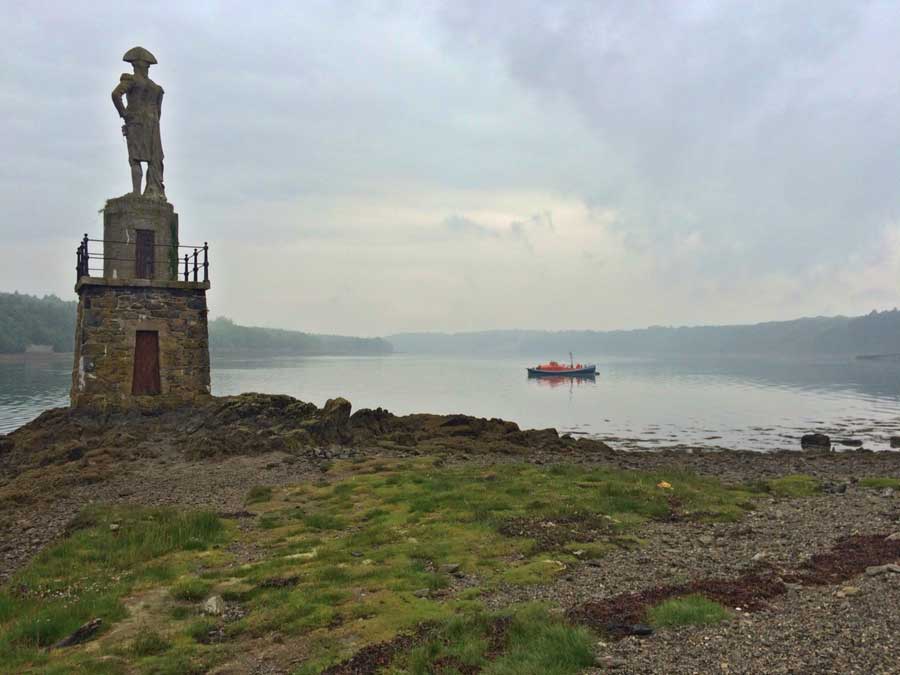
Beyond the church the Coast Path went past Nelsons Statue and then back out onto the rocky, shingly beach along the Menai Straits. I carefully picked my way between the rocks, jumping over branches and other debris washed up along the high tide mark. Fortunately the tide was low as this section would be impassable if the tide were high.
-
- Nelson’s Statue
-
- Shingly Foreshore
The Coast Path then headed uphill towards the A4080 where it ran alongside it on grassy trails and boardwalk before heading off along a rhododendron lined track and then grazed fields to the burial chamber at Bryn Celli Ddu.
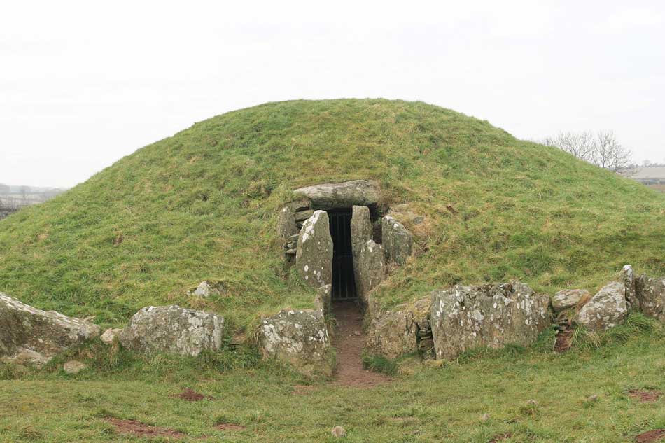
Burial Chamber
I then emerged back out onto a quiet country lane that took me uphill again, across the main A4080 and then back downhill towards the Menai Straits once more. This stretch was quite fast so my average pace was coming down as I made good progress dodging tractors on the roads and getting occasional glimpses of the Menai Straits between the hedgerows. Eventually I came to a junction in the Coast Path. I could go right and head inland across fields, or left through a little woodland down to the rocky foreshore once again. This section would be impassable at high tide, hence the option, but as the tide was low I opted for the more coastal route so once again soon found myself making my way between the rocks of the shingly beaches lining the Menai Straits.
Farmland and Visitor Attractions
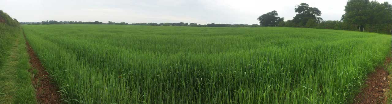
After a while the path headed inland a little once again and then out onto farmland. Through fields of sheep and cattle, through a woodland full of stinging nettles and brambles that were heavy with rain and therefore flopped into the path where I couldn’t avoid being stung and scratched and then out along the edges of fields full of long, wet grass.
-
- Grassy Fields
-
- Sea of Green
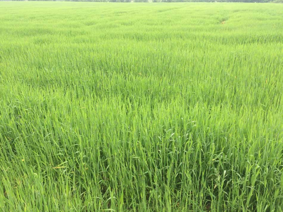
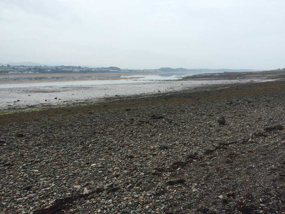
I was now soaked through thanks to the wet grass, but it had stopped raining. My shoes were squelching as they filled with water but they were at least comfortable and do dry out quickly so this was soon forgotten as I left the grassy farmland behind and headed out along the beach once more. With around 10 miles behind me I now had murky views out across the low waters of the Menai Straits to Caernarfon.
-
- Menai Straits Foreshore
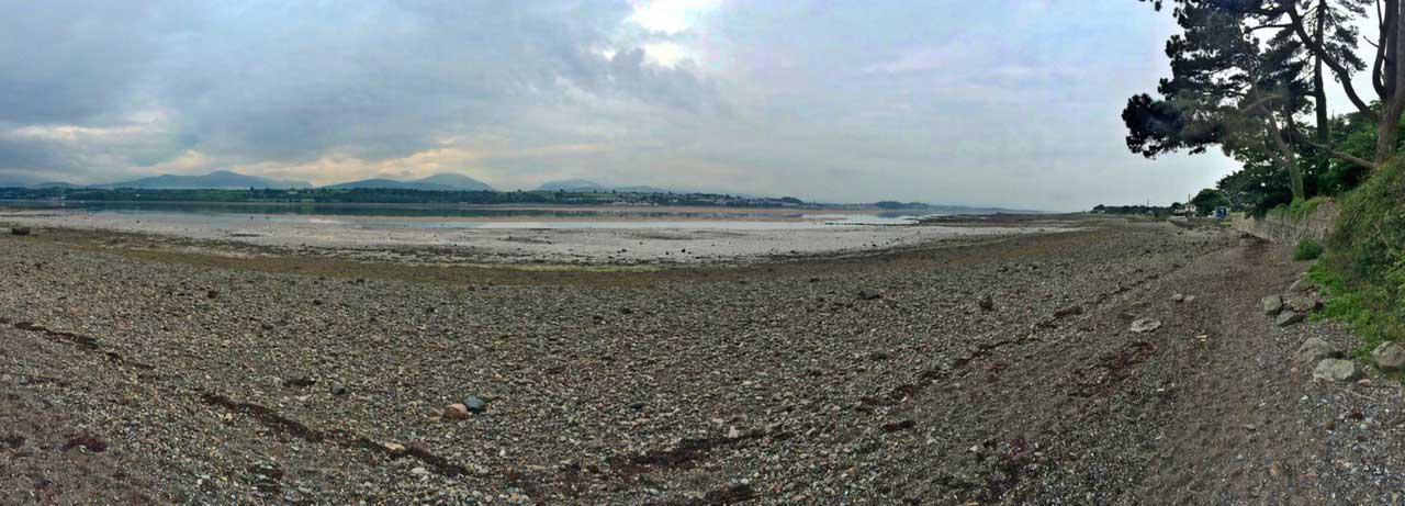
-
- Menai Straits to Caernarfon
After yet more shingly beach the Coast Path took me along a small road above the beach, Here I passed first the Anglesey Salt factory, which is now a visitor attraction and then the Anglesey Sea Zoo. I then ran through a little settlement around the Mermaid Inn and once more out onto the tough terrain of the beach. This was a longer stretch of foreshore but it suddenly headed off up some steps and then up a steep field as it headed inland across farmland once again.
Stiles, Streams and Stepping Stones
The next section of the Coast Path wiggled its way through a patchwork of countryside passing through numerous gates, over wooden stiles, over stone walls with steps, through little farmyards, over little streams and through fields. It wasn’t conducive to fast running but the miles were ticking by and I could see the dunes of Newborough getting ever closer.
I soon found myself running along the River Braint on paths that were feeling a little more coastal once again. These paths suddenly turned right though and out across the The Giant’s (Rhuddgaer) Stepping Stones. The gaps between these are actually quite big in places and with the tops still slippery from the recent rain and quite a large drop around them thanks to the low tide I made my way carefully across them rather than running full pelt!
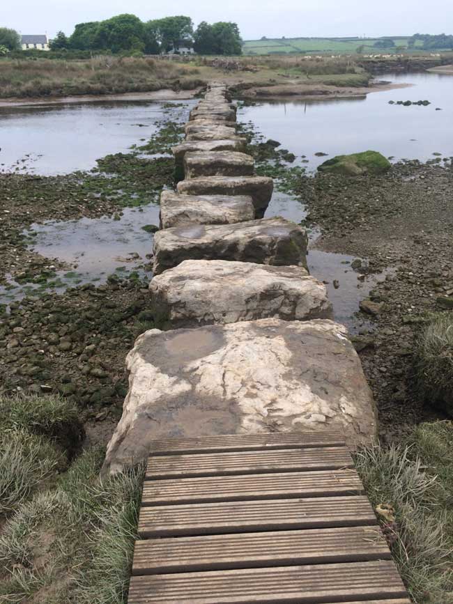
Stepping Stones
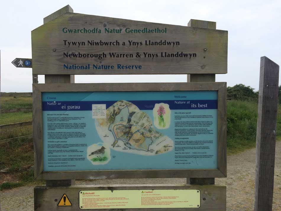
Across the other side was a gravelly track out to the A4080 where I ran along the road a little way before heading off to the sand dunes of Newborough Warren. It was nice to see some Wales Coast Path signs here in addition to the Isle of Anglesey Coast Path signs that I had been following.
-
- Newborough Warren
-
- Sculpture
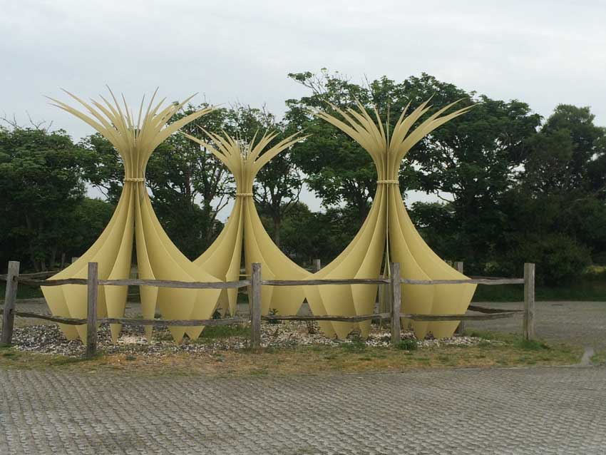
-
- Signs

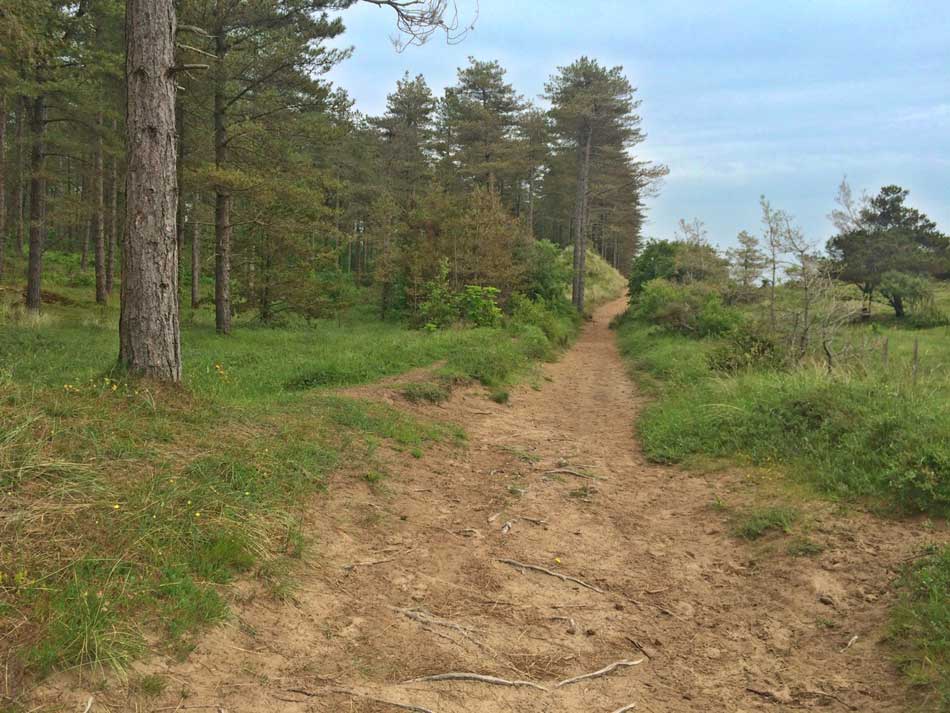
The soft sandy paths of the dunes were quite hard work though and seemed to go on forever, lined to one side with the columns of conifer trunks as I ran along the edge of Newborough Forest. There were running trails marked along these paths as well as a number of walking trails. I seemed to be following a red marked running trail as I ran along the sands and danced between the tree roots.
-
- Newborough Forest
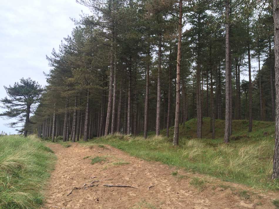
-
- Running Trail
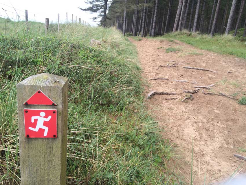
-
- Sandy Paths
I did stop briefly on a log for a snack but not for long as the flies were out in force and they seemed to like me. I suppose a sweaty, smelly, grey, middle-aged runner has to be attractive to something!
Llanddwyn
After a few more soft sandy dunes, the Coast Path emerged out onto the wide expanse of Llanddwyn Bay. Unfortunately the views across to Dinas Dinlle weren’t up to much today but it was nice to be out in the open and surrounded by sand.
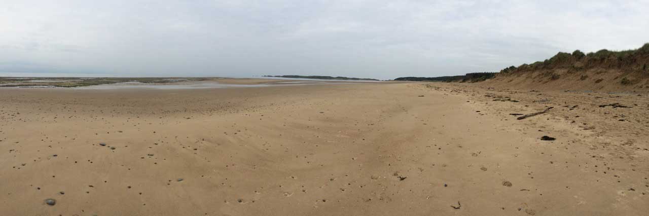
Llanddwyn Bay
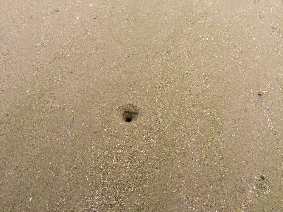
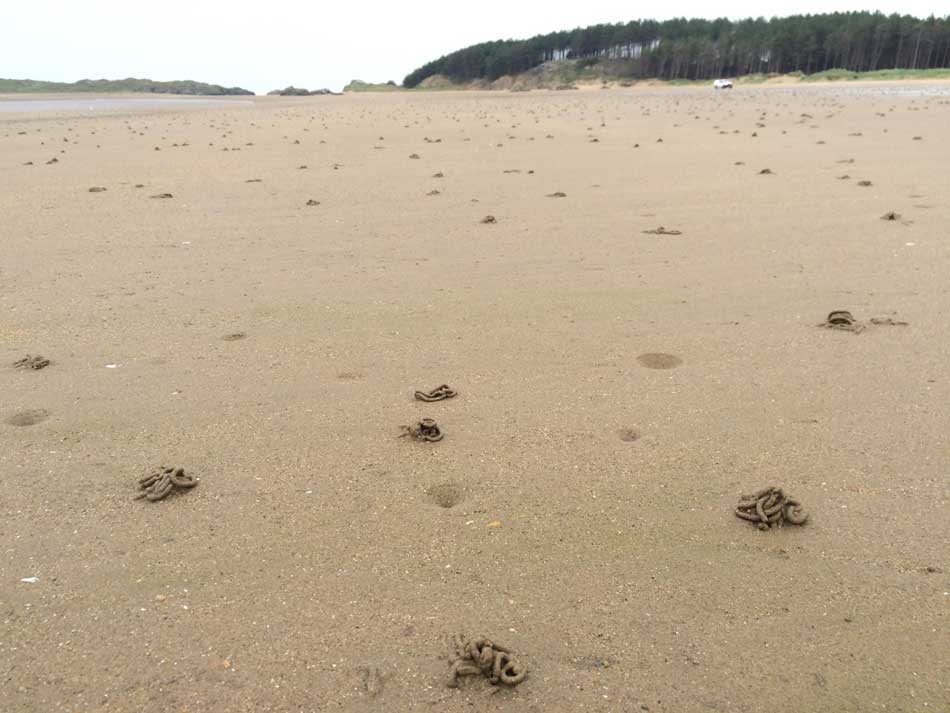
I made my way around the sweep of the bay towards Llanddwyn Island, looking out for the firmer patches of sand. In places the beach was covered in worm casts and the telltale signs of razor clam burrows.
-
- Razor Clam Burrow
-
- Worm Casts
I made my way out to the rocks between the forest and the Island. I’d been here many years ago on a geology field trip to look at these rocks so thought I’d better take another look today seeing as they are such a famous outcrop. They are pillow lavas formed of basalt, a basic igneous rock. This basalt erupted on the ocean floor as lava which oozed out as small ‘blobs’ which cooled rapidly in the cold sea water and piled up as separate ‘pillow’ shapes, each with a concave bottom as it sagged over the rounded top of an earlier one. I didn’t spend long here looking for a good view of the pillow shapes but I did spot some even if they aren’t obvious in the photo.
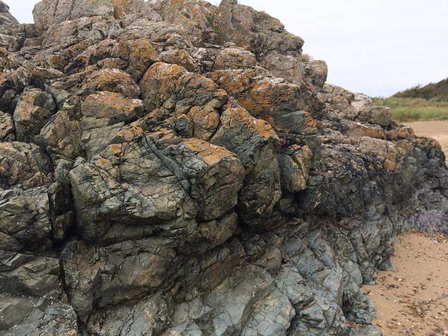
Pillow Lavas
Llanddwyn Island
Geology trip complete, I made my way across yet more soft sand and onto the paths of crushed shell on Llanddwyn Island.
Llanddwyn Island
Llanddwyn Island is a lovely place, even today without any sunshine. Llanddwyn is not quite an island as it remains attached to the mainland at all but the highest tides. Today the tide was still quite low so it was easily accessible. I made my way up onto it’s grassy top covered in clumps of bright pink thrift, lichen covered rocks and a network of little paths.
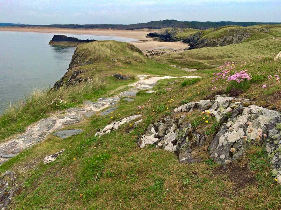
Llanddwyn Island Path
Despite being only a small, low-lying island it still gave some lovely views out across Llanddwyn Bay to the SE and Maltraeth Bay to the NW.
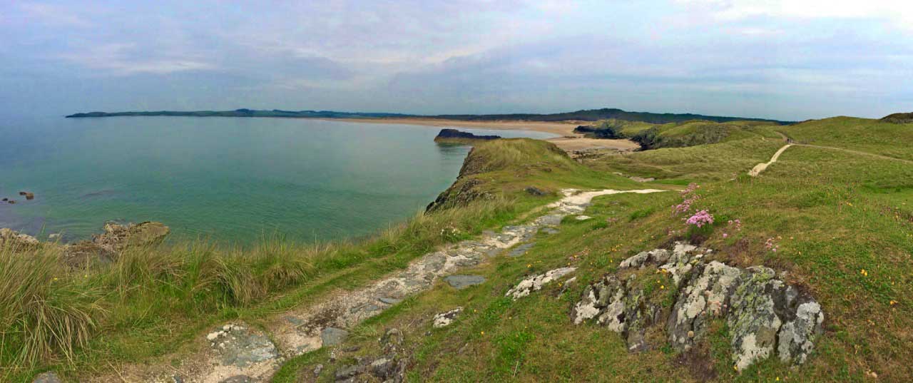
Maltraeth Bay
As well as interesting geology and natural history the island has a rich maritime history too and there are plenty of buildings and monuments to explore. These include a beacon, called Tŵr Bach at the tip of the island which was built to provide guidance to ships heading for the Menai Straits. Another more effective lighthouse, Tŵr Mawr, which was modelled on the windmills of Anglesey, was built nearby in 1845. The older lighthouse has however now returned to service after a modern light was placed on top.
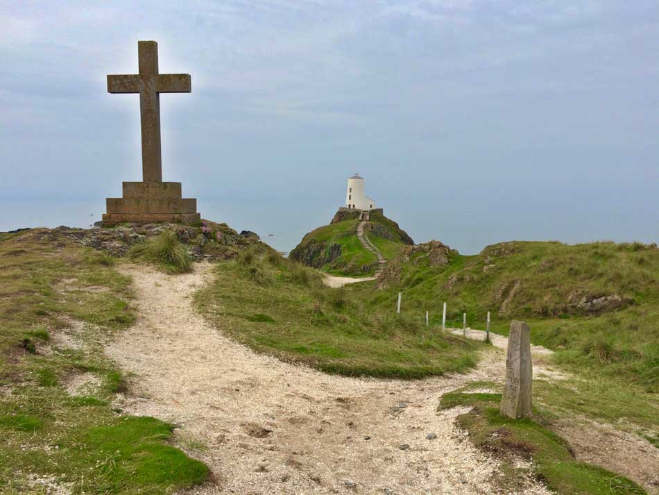
Llanddwyn Monuments
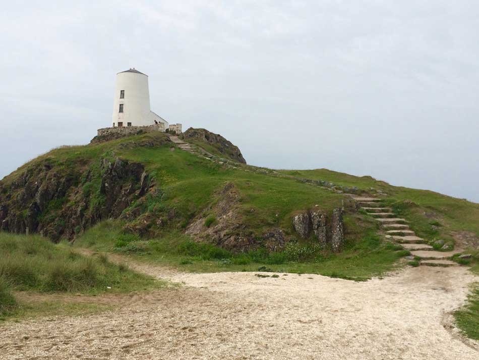
Twr Mawr
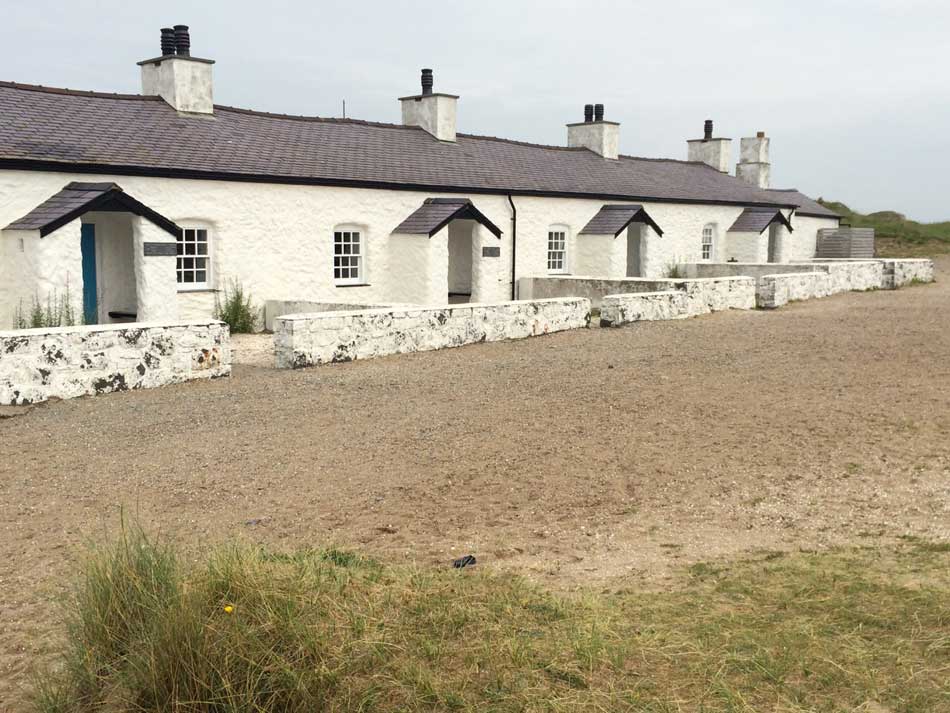
I also ran past a pretty little row of cottages with a cannon in front of them. These were built near the towers to house pilots who guided ships into the Strait. I’m not sure what they are used for now, it looks as though they may have some sort of a museum in them. As well as housing the pilots, there was also a lifeboat stationed here and the cannon was used to summon the lifeboat crew from Newborough.
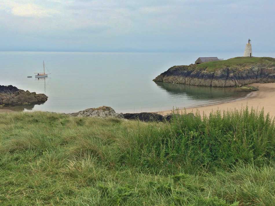
Twr Bach and Sandy Bay
Cottages
There are of course lovely little sandy bays and gorgeous views too.
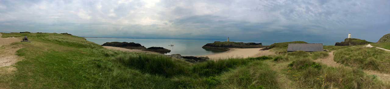
Llanddwyn Island Views
Newborough Forest
After my little foray onto Llanddwyn Island it was back across the beach to the ‘mainland’ and then onto the trails through Newborough Forest. These trails went on and on for a lot longer than I expected with a few little ups and downs here and there but were for the most part flat. Although mainly gravelly there were a few softer, sandy patches but despite these I was once again picking up the pace. Miles, 20, 21, 22 and 23 were all fairly well paced and getting faster. Not bad given the amount of time I had already been running today.
- Mile 20: 9:16 mins/mile
- Mile 21: 9:09 mins/mile
- Mile 22: 8:25 mins/mile
- Mile 23: 8:22 mins/mile
The last of these was along the tarmac path across The Cob at the inland end of Maltraeth Sands as I reached the little village of Malltraeth and my destination for the day.
End of the Day
Home Time
I’d covered just over 23 miles of coast path in 3:38:32 and was now well into my way around Anglesey.
The bus wasn’t due for 45 minutes though so I bought a drink from the nearby shop and then paced up and down waiting for the bus to arrive. The bus took me back to my car and then I headed into Bangor to get a coffee. I parked in Morrisons Car Park and ended up having quite a long walk through town for a panini and a coffee before heading back up the steep hill to my car. I did also pop into the supermarket though for a big bag of M&M’s to keep me going on the 2 hour drive home.
I didn’t stop once at home of course as I had to check the surf, do some gardening and went for a little bike ride with Morgan after what had been another successful day running around the Wales Coast Path. My achilles was sore the following day though so I may have to rest it for a bit.
Discover more from A Simple Life of Luxury
Subscribe to get the latest posts sent to your email.


I remember going to Anglesey sea zoo many years ago, I think you had just started working in Bristol Zoo.
You are certainly seeing a lot of nice sights x