Kitzbuhel Day 5 – Covering some Ground
Day 5 of my trip to Kitzbuhel and with my bike in transit back to Wales I’d have to rely on my feet for entertainment and transport today. I was up early, 3am to be exact so went for a nice early morning run at around 5am.
Running Kitzbuhel
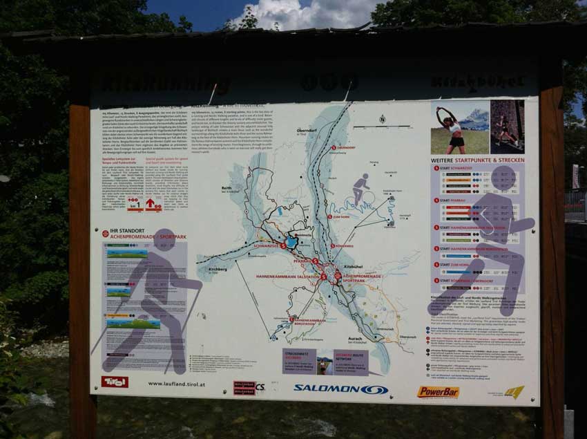
There are loads of really well-marked running trails in Kitzbuhel and a good amount of information on the various routes too. Thankfully, unlike most of the signs here in Austria these were in English as well as German so I could actually read it! There are several starting points for the trails and they range from short easy trails at under 3km to longer more challenging trails. Some are flat and some head off into the hills.
Kitz Running
I hadn’t been running for a few weeks other than in my race so wanted to take it easy and just go for an easy jog this morning so headed out following the signs for a 5km run. This had a little bit of elevation in it but not much. The trail was marked at every junction with good sign-posts so there was no chance of getting lost and additionally there were markers every kilometre too so show you your progress. I felt fairly good as I came towards the end of it though so decided to head off on another trail that was fairly flat but another 8km long. At a slow pace taking in the local scenery, it took me an hour to do these two runs so I was back at the hotel for around 6am.
Not a bad way to start the day, especially with a nice bath and a huge buffet breakfast waiting for me at the hotel.
Walking in the Tirol
My main plan for the day was to head off for a walk in the hills though. I’d already cycled up the Horn and had been up the Hahnenkaam on the cable car, so I decided to head for a hill to the North West of Kitzbuhel called Rauher Kopf. The map I had was a little odd though and I didn’t notice this until later in the day. The map itself was marked with lots routes and the one I wanted to follow for most of the day was number ’62’. I looked this up on the back of the map and it said it was 11km with 668m of climbing and should take around 4 hours.
I had a bit of a walk from Kitzbuhel to Schwarzsee first and then thought I’d follow a bit of another trail to a place called Munichau, before heading down to the golf course and follow trail number 62. Once I finished that trail I planned to head onto another trail that took me up over another hill to a lake called Gieringer Weiher where I would have a swim before heading back to Kitzbuhel from the North. This part of my walk essentially followed Trail 12 which according to the map was 9.8km and took about 3 hours. Usually the timings are off with such things and I tend to cover the ground quite a bit quicker than they say, especially on my own, so I was expecting it to take me about an hour to get to the start of the first trail, around 3 hours to do that trail and then another two for the second trail which makes 6 hours in total. I headed off at around 8:30am in glorious sunshine, but the forecast was for thunderstorms and heavy rain to move in during the afternoon. I was hoping to be back before these arrived.
I stopped of at Lake Schwarzee for yet some more photos as I just can’t get enough of the panoramic view here and then followed what was part of the run course around the lake and into the Bruggerhof camp site where I stopped for a quick ‘nature break’. I had to remember whether or not I was a ‘Damen’ or a ‘Herren’ though as the signs here are only in German and I know no German at all… Judging by the fact that the ‘Herren’ option had urinals I think I got it right!
I then continued on through the forest and into the little village of Munichau. The sun was shining, the birds were signing in the trees and Austria was looking lovely. After crossing the road I headed down some small streets admiring the local houses and found my way to the golf course. It was certainly a very well kept and very upmarket golf course, even as golf courses go so I felt a little out of place tramping through it wearing shorts and trainers with my rucksack on my back. I didn’t get too many funny looks though and soon crossed the river and then started on the trail marked ’62’ on the map.
I’d been walking for just over an hour now, which with the stops was bang on target for what I expected. In the real world all of the trails are marked by yellow signs. The signs show the next point on the trail with a distance and time to that point and sure enough, Trail ’62’ was marked on the next sign so I was in the right place. The next place was Hennleiten and it would take 20 minutes to get there. As expected about 15 minutes later I was at Hennleiten, so not only was I on the right trail but it was going to taking less time than suggested by the map.
Which Trail?
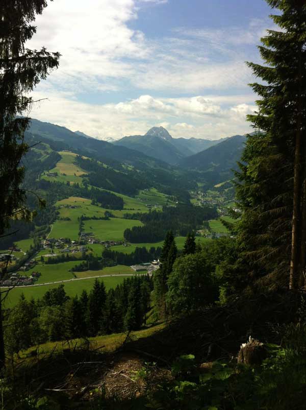
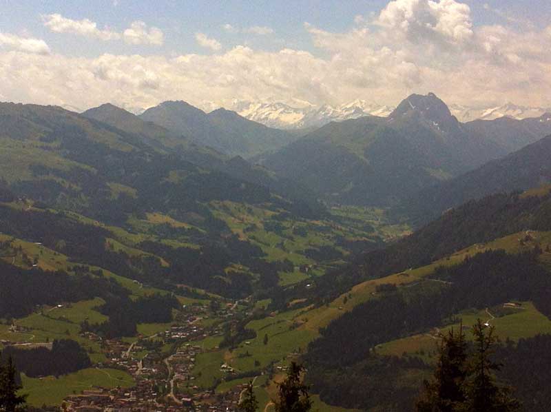
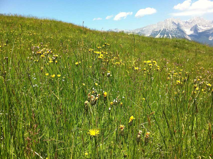
I continued on my way up the ever steepening path, passing places marked on the map and signs and following the trail marked number 62. The views were amazing, there were butterflies all around me and the higher I went, the more of the snow-capped mountains I could see off in the distance. The towns and villages in the valley below were getting smaller as I rose ever higher into the hills.
-

- Alpine Valley
-
- Snow-capped Mountains
-
- Walking in the Tirol
The next destination on the map and signs was Rauher Kopf which was the summit of the hill. However, Trail ’62’ had been replaced by Trail ’63’ and the signs were saying that the summit was 2 ½ hours away. That confused me a little as the whole trail was only supposed to take 4 hours, and I’d been walking up hill for an hour already. By my calculations that would mean that the trail from the Golf Course to the Summit was a 4 hour walk, so with the trail back down the other side being of similar length, what was originally a 4 hour walk had suddenly become a 6 hour walk.
At first I thought that maybe the map and signs only gave time and distances for one way, but as this was a circular walk that would be silly. I checked the back of the map and noticed that although marked as Trail 62 on the map. The description of the Trail 62 on the back of the map didn’t go all the way to the summit of Rauher Kpof and actually cut off most of this trail. The map itself had two trails marked ’62’, but the trail I was wanting to follow was Trail 63. This wasn’t listed with the other walks on the back of map and was in a little area of its own called the ‘Wilder Kaiser Panoramic Trail‘. The stats for this trail were actually 17km and 5 hours. Oh well, that’s the walk I wanted to do so I’d continue on my way following the signs for Trail 63!
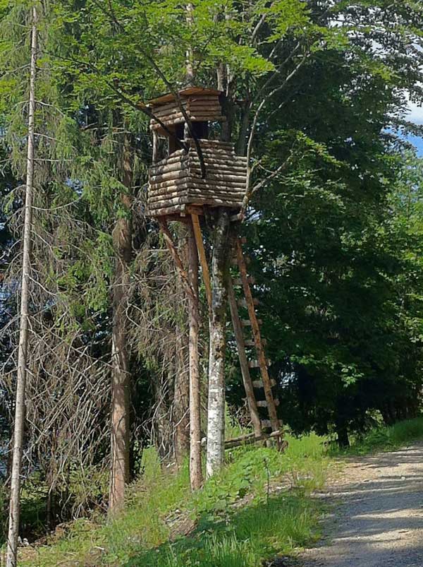
The trail steepened and became more rugged the further up I went but it was a perfect day for walking and it was just me, the birds, bees and butterflies and some amazing scenery. I came across a little wooden treehouse thing at one point so climbed to the top of it to take a look. It felt quite high up there looking over the drop to the valley far below so coming back down was a little scary.
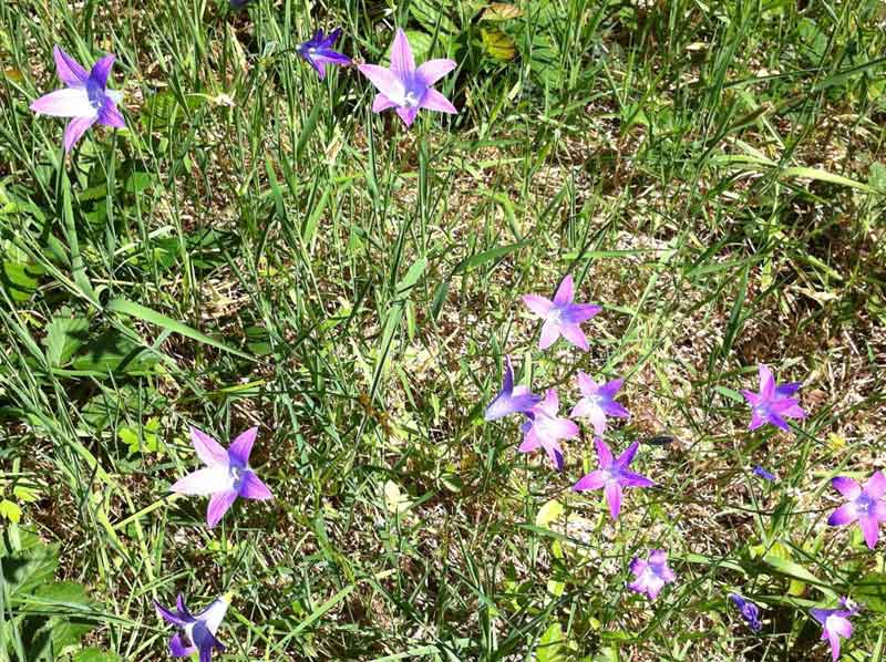
-
- Alpine Flowers
-
- Treehouse
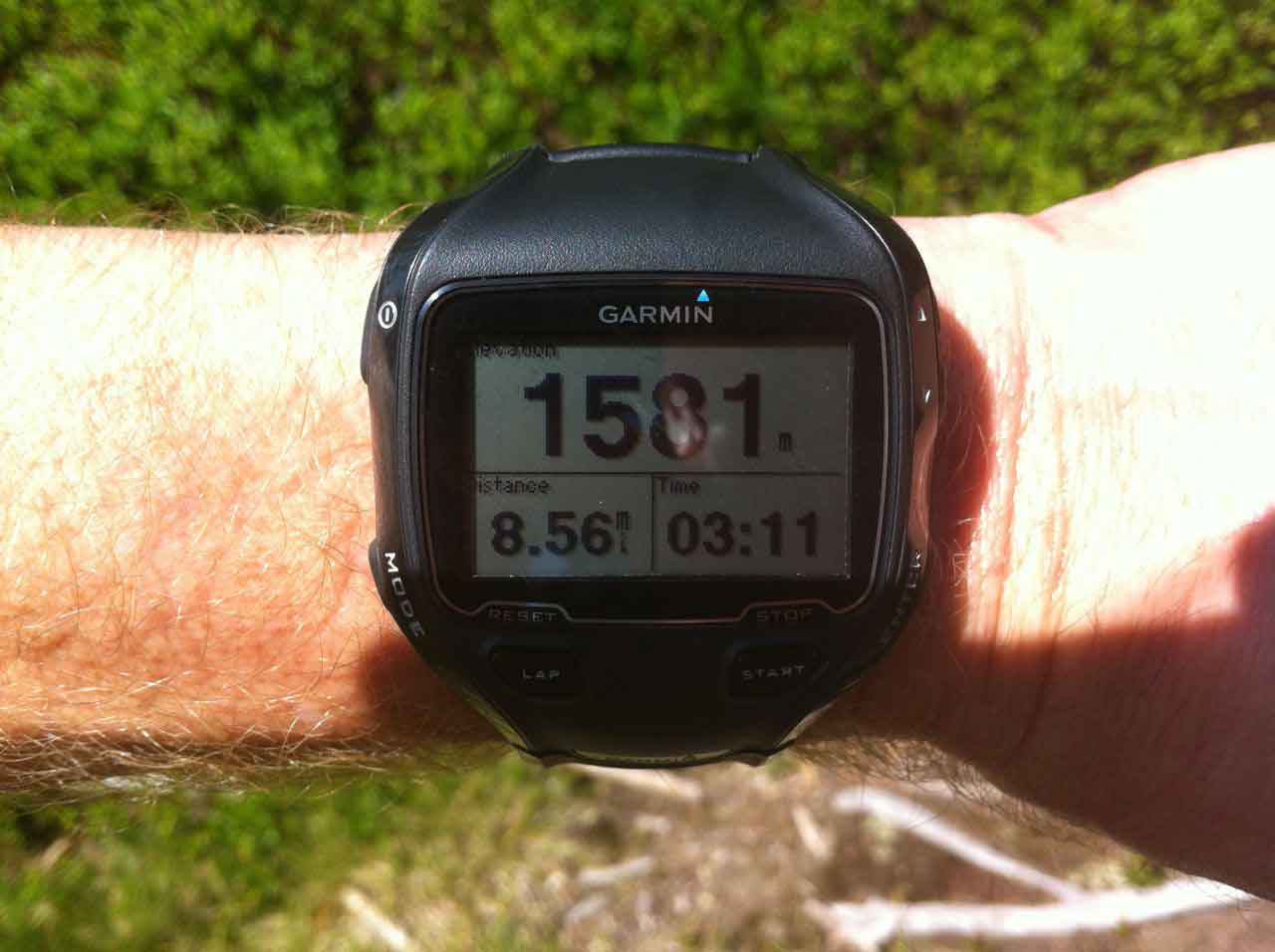
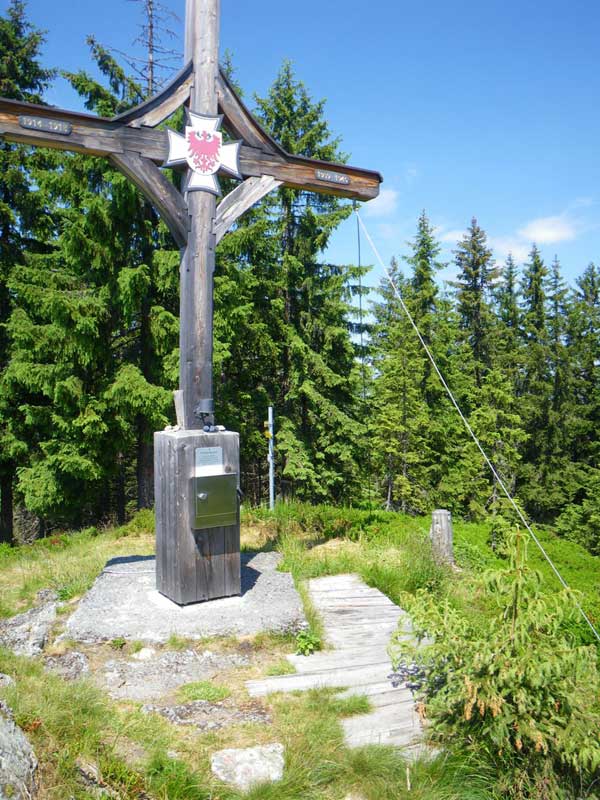
Eventually after about 3 hours of walking I approached the summit. I was hoping for a nice 360º view but there were quite a few trees up here still which obscured the views in some directions but it was still a nice place. There was a geocache here so I looked for that and got attacked by thousands of beetles as I did so. I was on the summit after 3:11 of walking and having covered just over 8.5 miles.
-
- Which Way?

-
- GPS
-
- Rauher Kopf
I then headed off in the opposite direction from the summit, hoping to head back down the other side of the hill. However, somehow this just took me back to a point that I had been at before. My options were to head back up to the summit where I had just come from, head down the hill the way I had come earlier or follow a path that was sign-posted as heading to Kirchberg. Kirchberg is a town far down in the valley below on the wrong side of the hill so I didn’t follow that, I didn’t want to go back up to the summit so I decided to head back down the steep track I’d come up earlier and hope for a junction with an additional option a little further down.
Sure enough I came to another junction, but once again all signs pointed either to the summit of Rauher Kopf or to Kirchberg, none of them pointed to anywhere that I wanted to go. There was however a trail with no signpost that headed in roughly the direction I wanted to go – I was now using the sun as a navigation aid – so I followed it. This trail snaked it’s way around the hill side following the contours for the most part. Strangely though there were no signposts and no markers as there had been on all the other trails. Not to worry though it was heading in vaguely the right direction and seemed like a good, wide trail so must go somewhere.
At least, that is what you would have thought, but after 30 minutes of following this wide, well-surfaced trail through the forests, the forest abruptly came to an end, as did the trail. There was a thick, barbed wire fence right across the trail, and then nothing, just open grassland on the other side. There wasn’t even a faint marking of a trail beyond it. I didn’t want to walk back up the hill the way I’d just come, so I climbed the fence and started making my way across the hillside in the general direction I needed to go, once again using the sun as a navigational aid.
Alpine Meadows
There I was merrily tramping through the grass across a hillside in Austria. I had a vague idea of where I was and where I was going but that was about it, I was wearing shorts and trainers, had a small bottle of water and an apple to keep me going and there were big thunderstorms on the way. I still had the option of going back the way I had come, but that way was getting longer and longer with every step I took and I was now descending the hill quite quickly, so retracing my steps was becoming less of an option all the time.
Then all of a sudden I had a huge electric shock across my arms – I’d walked into an electric fence. Even after hitting it I could barely see the thin wire against the grassy hillside. What few fence posts there were supporting the electric fence were tiny and obviously only temporary so it was difficult to see them. It hadn’t done any harm though so I scrambled under it, heading for what looked like a tractor trail a little further down the slope. There were a few more temporary electric fences between me and the trail, but I spotted these this time and scrambled under them. I then crested a little rise and came across a herd of cows, presumably these were being kept in place by the electric fences. They were fairly friendly as I walked through them, with the ground beneath my feet becoming more difficult to walk on thanks to having been churned up by the cows. I was however getting closer to what was definitely a track of some sort so kept heading in that direction.
Eventually I came to a deep gully that I had to jump across before finally getting to the trail which zig-zagged its way steeply down the hillside. There were still no signs and this trail didn’t feel quite right, but it was heading down the hill towards more distinct paths below and I could see a couple of house and path junctions on the hill below. The trail I was following was heading a little too far North away from Kitzbuhel, but hopefully one of the junctions below would have a sign post. I then came a cross a little farmhouse with someone sat outside whittling away on some wood. He didn’t even look up to say hello as I went through the gates near the house, so I left him to himself and continued on down towards the roads. Finally, after about an hour of wandering aimlessly through the Austrian Alps wondering where I was going there was a yellow signpost and a place called Wirtsalm was about an hour away.
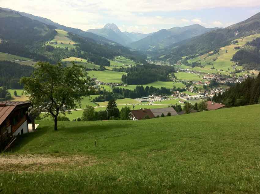
That was where I wanted to go so I had been heading the right way despite the sudden lack of signposts and trails. The numbers on these signposts didn’t seem to correlate with those on the map, but I was exactly where I thought I had been and all was good. The trail continued down the hill through Wirtsalm. I had to negotiate a few more electric fences and electric gates but these at least had signs on them. I couldn’t read the signs as they were of course in German but I got the gist of them and managed to avoid any more nasty shocks. I passed a couple coming up the other way who were English and had done the triathlon. I had a little chat, put them right as to where they were on the map as they were lost already despite still being on a well marked trail – I did warn them that the signposts become a little haphazard towards the top. I then continued on down past a chapel and out onto open grassland and into the town of Reith. I ate my apple and decided to stop at a shop for an ice-cream. Unfortunately the shops here seem to close between midday and 3pm so there was no ice-cream for me in Reith.
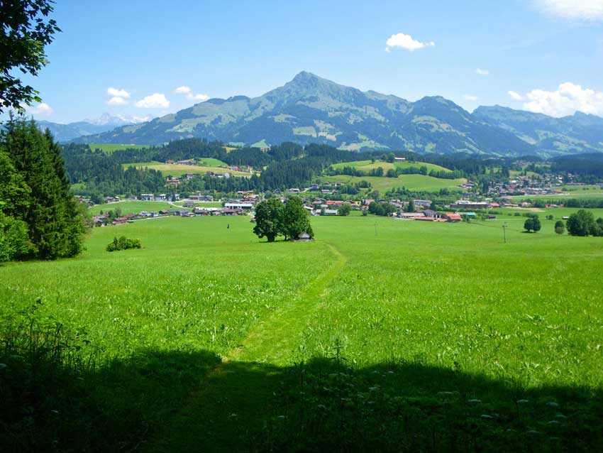
View into Reith
Here’s the first part of the walk up to my little lake swim.
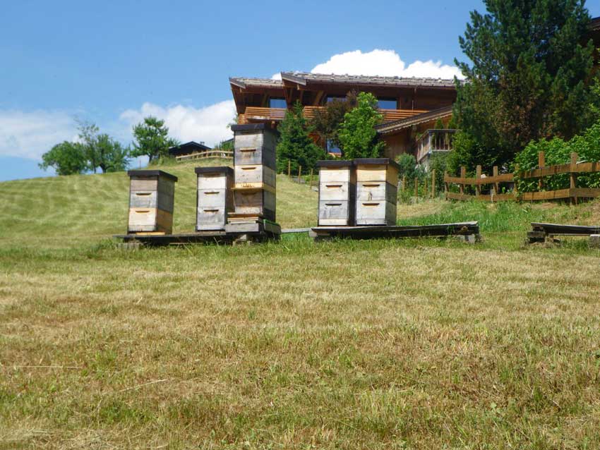
Bees, Lakes and Farmhouses
I picked up trail 52 in Reith which was now very well marked and headed up over the hill we had cycled up in the triathlon, heading for the little lake of Gieringer Weiher. The scenery here was beautiful with green hillsides dotted with lovely wooden farmhouses and covered with wild-flower meadows. I passed a number of bee-hives and could hear bees buzzing and crickets chirping in grasses and woodlands all around me. There were farmers cutting and raking the hay meadows by hand and the farmhouses looked idyllic nestling on the rolling green hills. The architecture of the houses fits in so well with the natural environment that they actually add to it and make it nicer.
-
- Beehives
-
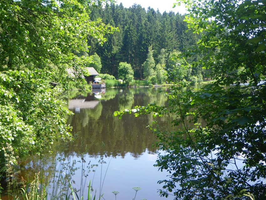
- Geiringer Weiher
-
- Swimming Lake
-
- Tirol Scenery
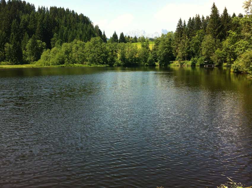
After a bit of a climb and then a stroll through the woodlands I came across the lake I was heading for and was surprised to find a little cafe and shop there as well. I walked around the edge of the lake watching lots of bright green frogs plopping and splashing into the water as I approached. I stripped off, put my trunks on and went for a lovely swim in the lake, before drying off and heading to the cafe for that ice-cream I had been hankering after. If only we were allowed to swim in lakes like this in the UK. This one was actually a very quiet lake, but elsewhere larger lakes have dedicated swimming areas, often with slides and pontoons and all sorts of fun things.
After my swim I headed off onto trail 12 out around a couple more little lakes, and past a big wooden outhouse that turned out to be a bee-house full of about 50 hives and then down a steep hill to the Kitzbuhel River. Here the trail would would have taken me along the river close to the main road so I followed a different trail back up onto the hill and across yet more beautiful farmland before heading down into Kitzbuhel past some huge and obviously very expensive houses.
Once back in Kitzbuhel I stopped at a coffee shop for a coffee and a cake. As I sat there the sky clouded over a little after what had been a day of glorious sunshine. The forecast had been for heavy thunderstorms, but thankfully there had been no sign of them yet. I popped to the shops to buy some presents for Anna and Morgan and headed back to the hotel as it was now around 4:30pm. 5 minutes after getting into my hotel room, the heavens opened and the rain lashed down for the rest of the night. Phew, I’d made it back just in time!
The whole walk had been just over 18 miles in distance with a considerable amount of climbing. What with that, the little adventure on the top of the hill, the electric fences, the swim in the lake, the views and the weather it had been quite an adventure.
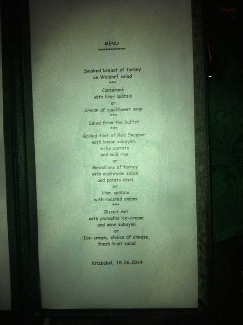
I was glad of the hotel pool and sauna once I’d got back, and the Weiner Schnitzel for dinner was just the ticket. Along with the other 4 courses of course! I forgot to take a photo of the menu tonight though so can’t share it with you today!
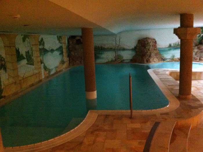
Hotel Pool
After Dinner I met Helen for a drink and finally got to try Kaiserschmarren. Kaiserschmarren is a light, caramelized pancake made from a sweet batter using flour, eggs, sugar, salt, and milk, baked in butter. It’s a little more fluffy than a pancake and taste like a cross between pancakes and doughnuts. Served with plum or cranberry jam and dusted with icing sugar it was quite a treat and they give you a huge portion too. I may have just eaten a huge 5 course dinner but I managed to squeeze a large plate of Kaiserschmarren in too.
Discover more from A Simple Life of Luxury
Subscribe to get the latest posts sent to your email.


Sounds lovely, but I don’t think I would have managed it! The walk that is, I would have managed the hotel pool and food