A Walk in the Hills – Tarren Hendre
With a few bits of new kit and the OMM looming on the horizon, I decided to make the most of my Bank Holiday afternoon and head out into the hills. It wasn’t a particularly exciting day weather wise with grey skies, light winds and the possibility of drizzle on the hilltops.
It was 1pm when I decided to head out, and having already spent an hour on the turbo trainer that morning I didn’t want to go too far.

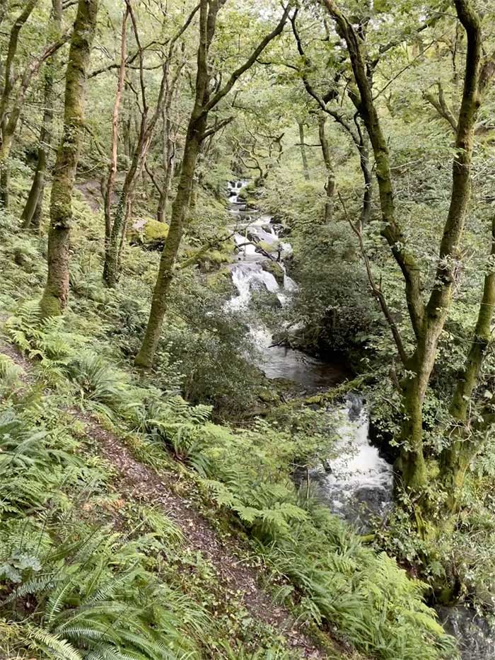
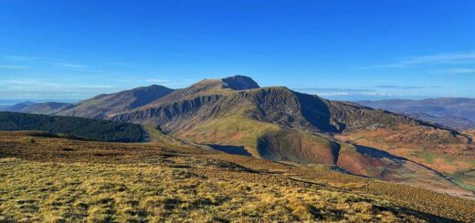
I decided a little drive to Abergynolwyn and a jaunt up Tarren Hendre was in order. I quickly packed my bag and headed off so that I could start the walk just after 2pm. Once parked in Abergynolwyn I headed off up the road and then onto way-marked trails that followed Nant Gwernol as it tumbled down the hillside over numerous waterfalls. It was very wet and muddy underfoot, even along these well kept paths.
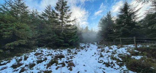
I carried on up the hill towards the huge piles of slate at Bryn Eglwys quarry where fences protected people from the prceipitous drops into the sheer-sided quarries. I rounded the mountains of slate, splashing through muddy puddles as I went. From here I headed off into the coniferous forest, following a poorly defined path.
I was using a Harvey 1:40,000 map as that’s what we’ll be using in the OMM. I thought it made sense to see how I got on with it. After 50 years of using standard OS Maps it was taking a bit of getting used to. I wasn’t entirely sure which of the almost parallel trails I was on, or even if these were in fact trails. I could have stopped to check the key on the map I guess but I knew I was heading in the right direction so just kept going.
Now and then fallen trees block my path and I had to clamber over or under them. One of them was too high to go over so under I went, forced to crawl. Typically there was an extremely boggy bit of ground under it so I found myself up to my waist crawling through thick mud. Yep, my rucksack chose this time to get caught on the fallen tree trunk to. I had to reverse out from under the tree, crawling backwards though the thick mud and try again, this time getting even lower so that I was pretty much swimming through the mud! Fortunately, it wasn’t a cold day as I hadn’t really expected to be bog-snorkelling!
After a while the trail crossed a track as I expected. I still wasn’t sure which one I was on though. If I was on the more easterly path then I need to turn right onto the track and then left a few hundred metres along it to get onto the more westerly path. If I was already on the more westerly trail then I needed to head straight across the track on continue upwards.
The track headed downhill somewhat and I still had a long climb ahead of me so I decided heading straight across and uphill was the best option. Up I went through more confierous plantation and more mud.
After a while the trail started to bear to the left and head further east. Damn it, I was on the wrong one! It didn’t really matter as it would just add a little bit of distance to my walk and I’d soon be able to turn right and meet up with the top of the other one anyway. Although, as I walked through the rows of trees, the avenues between them to my right looked quite inviting. They headed in exactly the right direction to cut off the corner and intersect with path along the ridge that I was heading for. Yes, it looked quite steep but it couldn’t be too far (only about 200m by my reckoning) and the avenues between the trees looked quite clear. I also had a new compass that I wanted to play with so I checked my bearings made sure it was indeed taking me where I wanted to go and headed off away from the track across country through the trees.
It was quite steep but the ground underfoot was drier here and I was able to easily make my way up through the trees. There were a few fallen trees and brambles to negotiate at the edge of the plantation but I soon emerged out of the forest and onto a hillside. I could see the ridge I was aiming for above me with the fenceline I was expecting to see. Perfect, I’d cut off the corner saved myself 10 minutes of walking and was where I wanted to be. The only problem was that the ridge line was still about 50m away (horizontally) but between me and it was a really steep slope of thigh-deep bilberry bushes and heather. Oh well, it wasn’t far.
Off I set, battling my way through the vegetation. At some points it was just impossible to make any headway. I was trying to go up but the slope and the resistance of the plants just forced me sideways. Partway up I stopped for a rest and ate some of the blueberries that were in front of me. My legs were purple having squashed countless blueberries as I battled through them, but they had at least brushed off much of the dried mud from my earlier bog-snokelling exploits. I wasn’t making much progress up the hill and had now probably wasted more time than I had saved. There was nothing for it but to forge on, this time using my hands to haul myself up through the vegetation too.
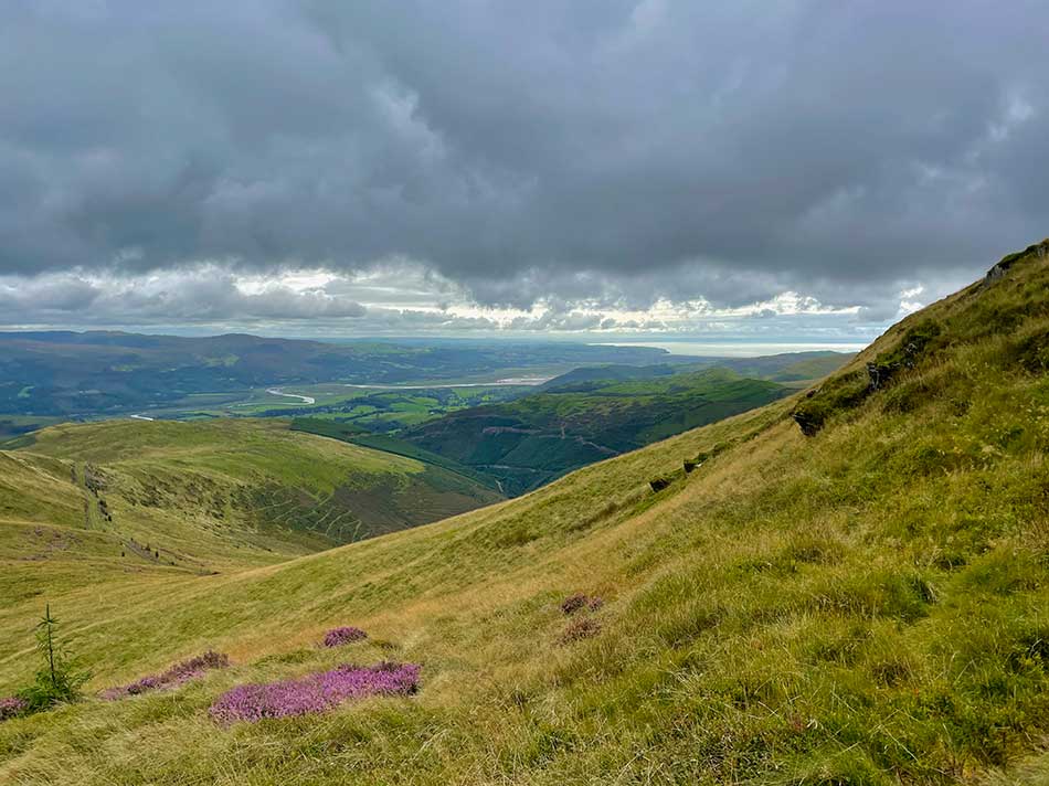
Finally I made it to the fence line, clambered over and walked up the final few metres to the ridge. I was greeted by views down to the Dyfi Valley and back home to Borth.
There was also a prefect little sheep track that followed the ridge line heading ever upwards towards Tarren Hendre. Lesson learned I followed the track this time as it gently curved around the ridge. It was still a very boggy trail in places but the going was much easier despite being uphill.
Towards the top I came to a fence intersection where I checked on my geocache that I hid up here in March 2007. It was still there, exactly where I’d put it and in good condition! I continued on across the boggy hilltop to the summit of Tarren Hendre. Here I decided to head across country once again using my map and compass as a guide rather than any tracks on the ground. I was heading for a sheep fold in the Dolgoch valley where I should be able to join a good track back down to the road. As it happens I ended up following a fence line almost all the way so the compass wasn’t really needed but I was checking it now and then anyway and pretending the fence wasn’t there.
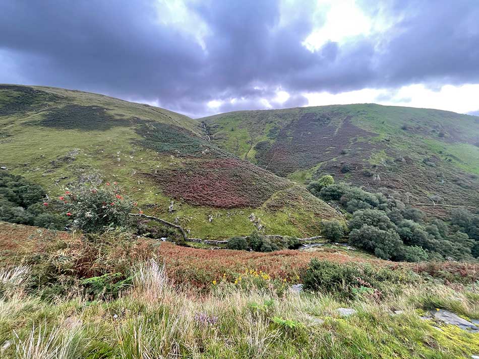
The final drop down to the sheep-fold was a little steep and boggy but I was soon there and now out of the wind. The shep-fold was actually full of sheep which made me and them jump a little as I approached. I joined the track and made my way down the quiet hillside towards Dolgoch with views of the waterfalls below me.
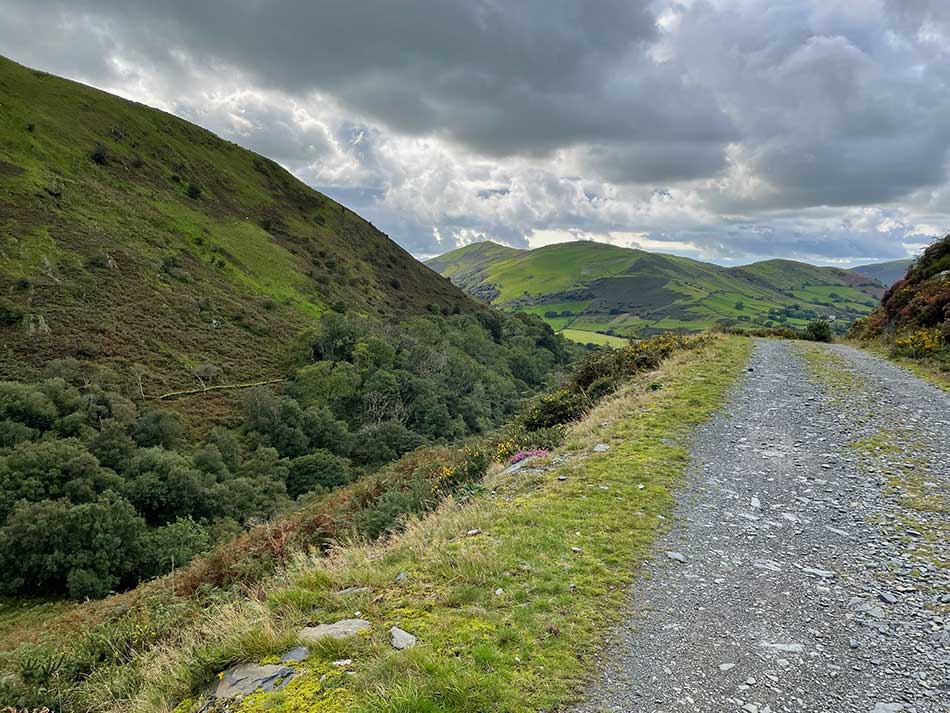
I crossed the steam railway line and then followed the road back to Abergynolwyn as the train puffed and hooted it’s way between the two. Once back at the car it was just a short drive home for dinner.
It may have been a bit of a last mimute decision to head into the hills and it might not be the most exciting of hills to climb but it was a nice afternoon out and well worth doing. I think I’ve started to get familiar with the Harvey map as well which has to help.
Discover more from A Simple Life of Luxury
Subscribe to get the latest posts sent to your email.


Sounds scary to me !