Isle of Man Coast Path – The Sound to Fleshwick
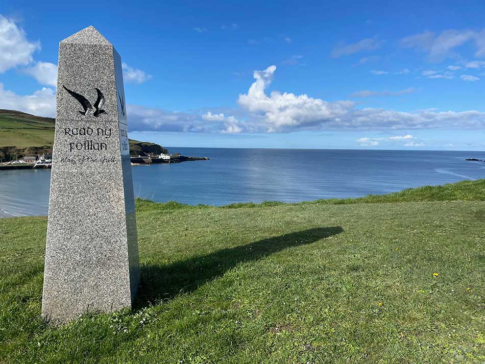
The last time I was on the Isle of Man I started running around the Coast Path. The Raad Ny Foillan (Way of the Gull) is the island’s premier long-distance path at around 100 miles. Officially opened in 2018 it quickly became one of the most popular walking routes in the British Isles. The path takes walkers through a diverse range of landscapes, including dramatic cliffs, sandy beaches, and tranquil bays, as well as through charming coastal towns and villages.
Back in 2019 – before the days of Covid-19 and before my heart attack, I did two stretches of the path; Douglas to Derby Haven (13.5 miles) and Derby Haven to The Sound (15.2 miles). I probably wasn’t up to those sorts of distances these days. Not on a hilly, clifftop run through difficult terrain anyway. I’d also be relying on Anna to meet me at the end and she wouldn’t want to sit around waiting too long either – not even with the dramatic views of the Isle of Man to admire.
Obviously, I’d have to start at The Sound so as to overlap a little and would continue on my way clockwise around the island. The first stop after The Sound would be Port Erin.
The Sound to Port Erin
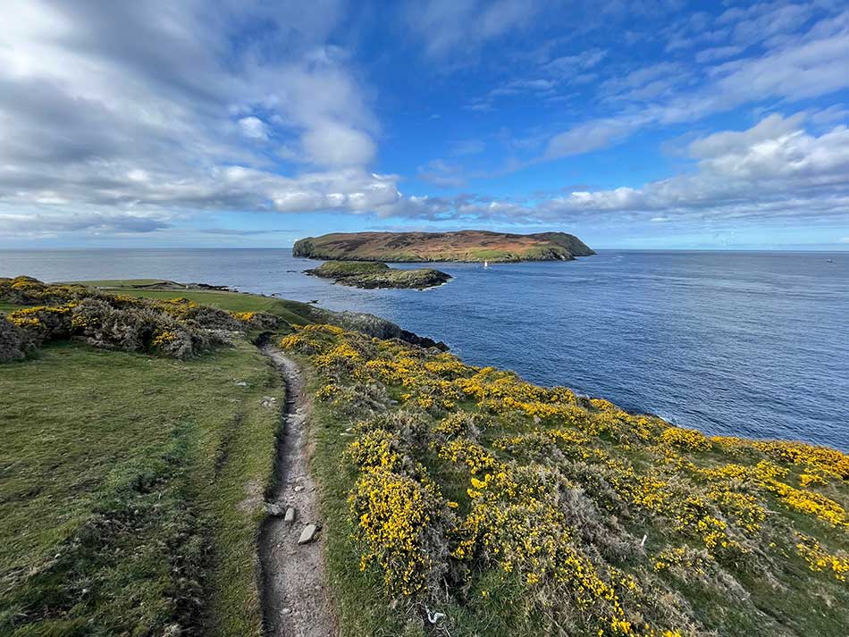
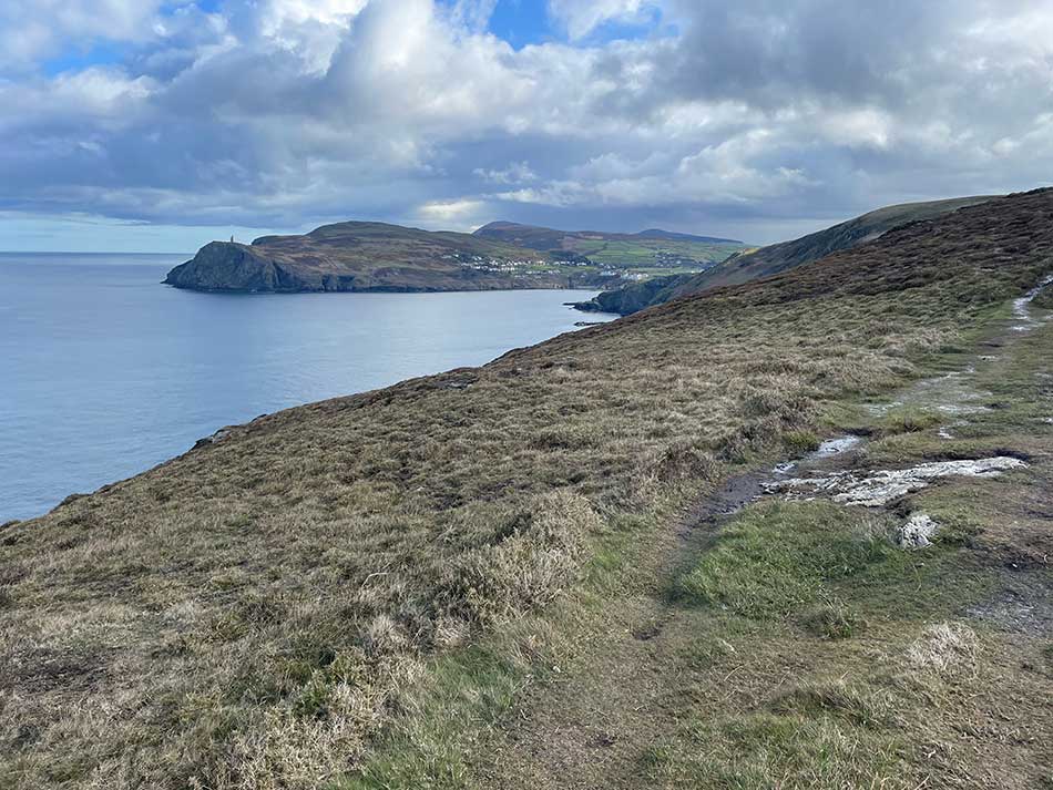
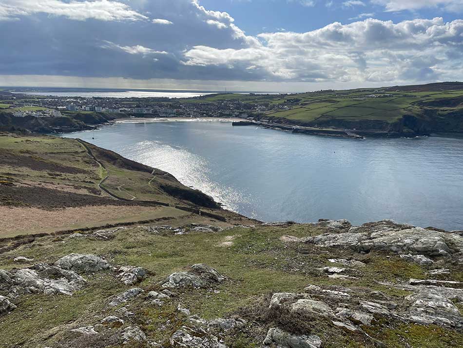
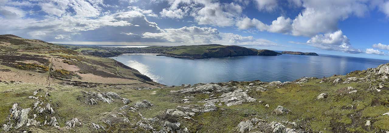
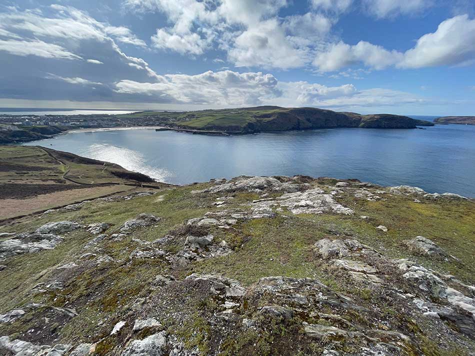
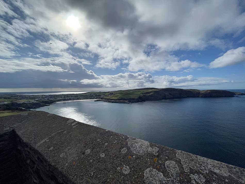
Anna dropped me off at The Sound car park on Friday morning. It was a cool, calm morning with bright blue skies. The sea was untroubled by winds and the gorse was in full bloom. I set off at a steady pace. I’d had a sore back for a while so took it easy. After clambering over the stile at the end of the car park I was out onto open clifftops with just the birds and the views for company. The views out to the Calf of Man were stunning.
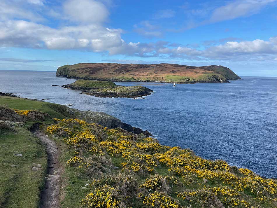
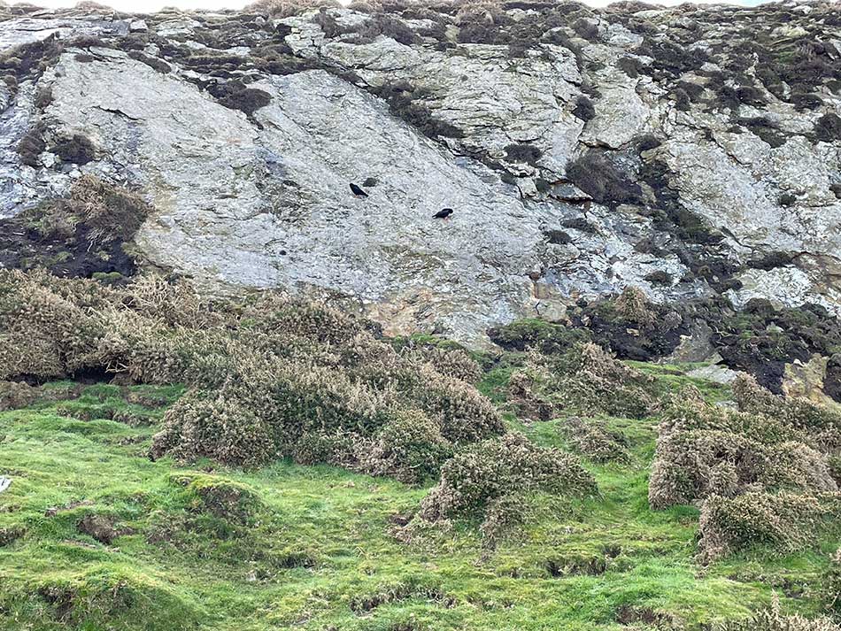
I sound rounded the corner and headed into more rocky conditions where Choughs followed me from rocky outcrop to rocky outcrop. There was quite a bit of climbing and descending along here and plenty of rocky sections where I needed to keep my wits about me.
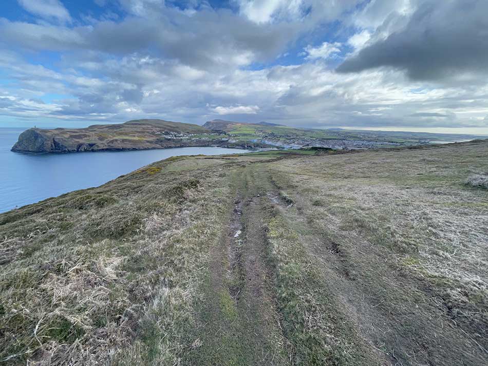
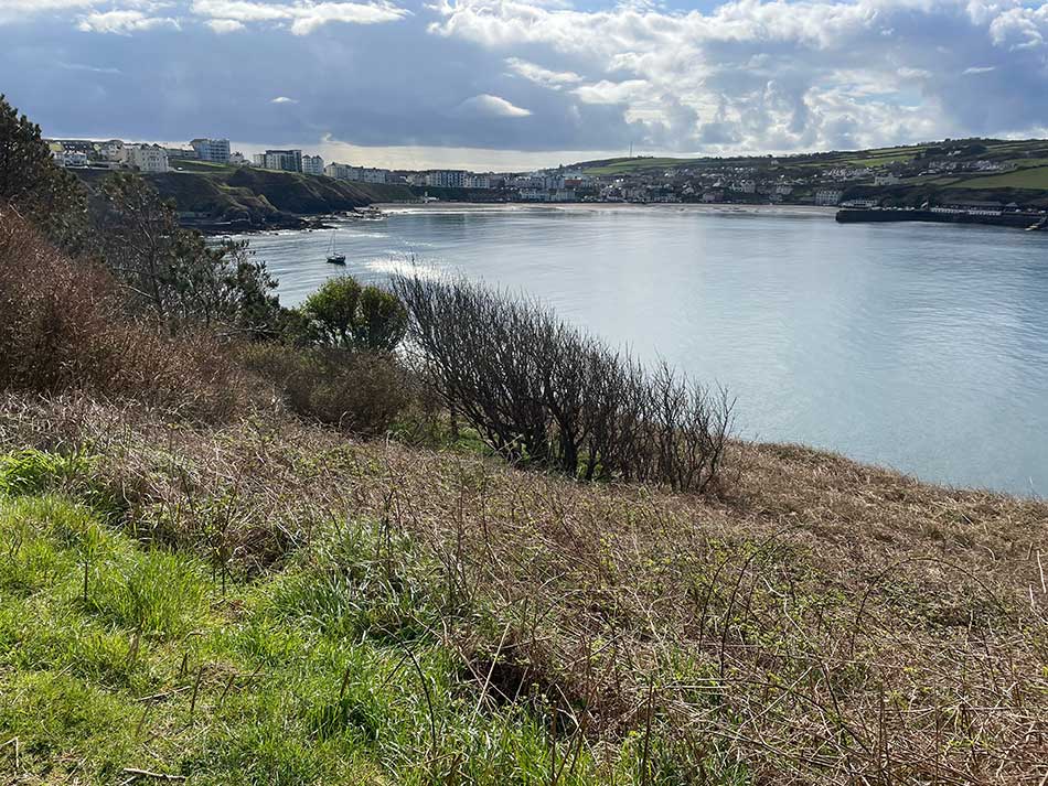
Soon Port Erin came into view. First I could see Milner’s Tower on Bradda Head and then as I rounded the cliffs, the entire sweep of Port Erin lay before me. We’d spent the previous evening parked at the old Marine Research Station watching a huge pod of dolphins in the bay. Today it was quiet with no activity in the water.
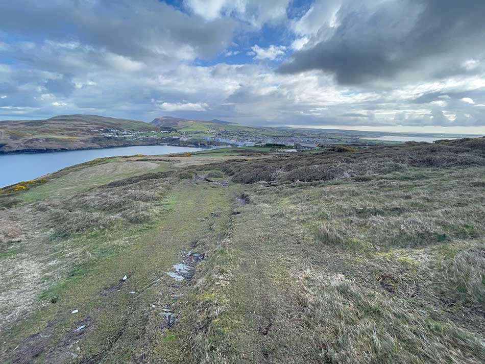
The path was quite muddy in places here and then quite wet. Eventually, it took me down to a wall that sat precariously on the cliff tops where I splashed through a little stream. This turned into something of a torrent as the path turned left and headed down some steps in the cliff. Each step was a mini waterfall. This water then turned into a proper waterfall off the side of the cliff as I made my way down the steps to the bottom. There was a slight diversion here down steps built from scaffolding to avoid the construction works going on at this end of Port Erin.
At the bottom of the cliff, I turned right and followed the path around the sweep of Port Erin’s Promenade. Anna was sat waiting for me in the car. I had a little drink of water, said hello and then made plans to continue on my way and meet her in Fleshwick.
Port Erin to Fleshwick
From Port Erin, the next obstacle was to climb Bradda Head. I followed the signs and little obelisk which took me up onto the cliff road and then down onto a twisty, winding path that clung to the cliffs.
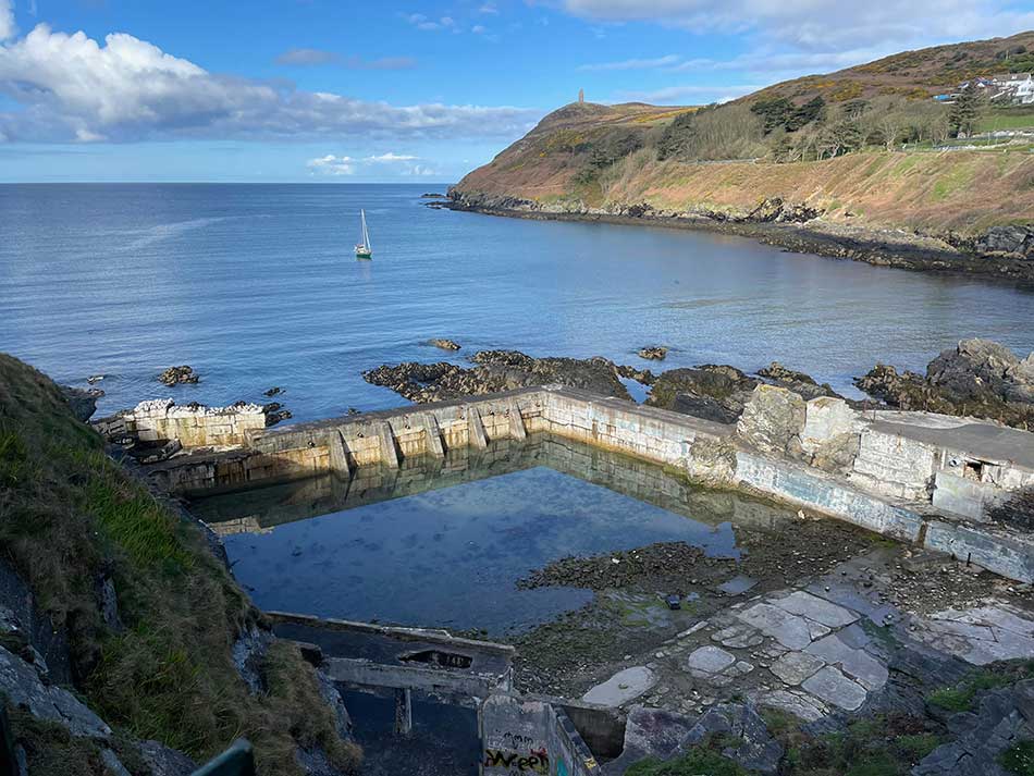
It was fairly easy going once on the path. It took me past the former Menagh Baths. I’m surprised that no-one has re-developed these considering the recent upsurge in Open Water swimming and Lido Swimming. I’m sure they’d become quite an attraction here.
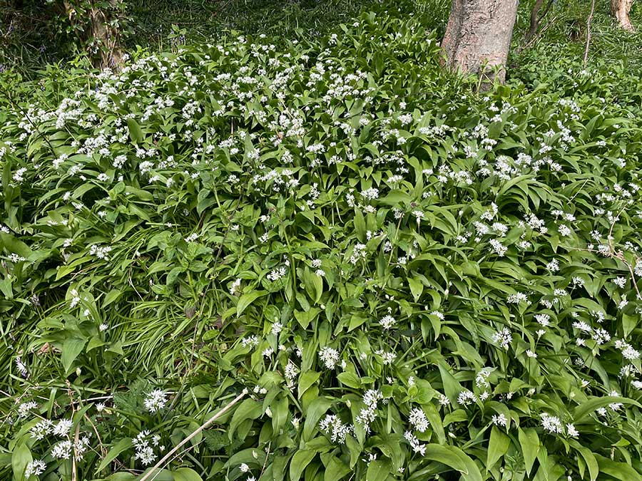
The path then descended all the way back down to sea level at Spaldrick Beach before starting to climb again as it made its way up through the wooded slopes of Bradd Glen. In places, the paths were lined with the unmistakable smell of wild garlic. Some of the paths seemed to be dead ends and I think I found them all so had to double back on myself a couple of times. At least I had nice views looking back on Port Erin as I did so.
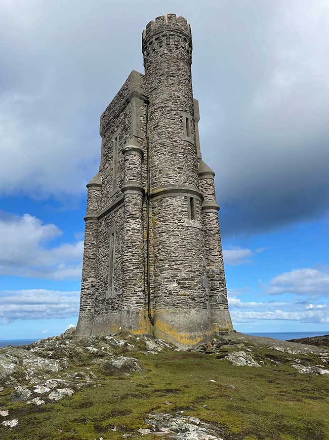
I passed through the hotel grounds and headed out onto more open hillside with the target of Milners Tower clearly visible silhouetted against the blue skies ahead. I discovered a few more dead ends here but eventually climbed steeply to the top of Bradda Head. I of course made a slight detour to the tower itself and climbed the 43 steps to the top.
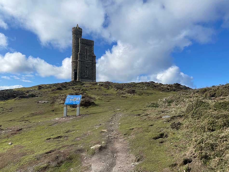
Milner’s Tower was originally erected to honour a local philanthropist and benefactor, William Milner. He was a wealthy safe maker who moved to Port Erin in the mid-1800s. He invested, personally and financially, in the livelihood of the village, with particular care for the local fishermen and impoverished families. By 1871, Milner was so beloved among the community that a tower was secretly commissioned and funded by private donations to honour his contributions to the people of Port Erin. Milner soon found out about the plans and ended up funding much of the remaining building costs himself as a further gesture of goodwill.
The tower’s unique design is an homage to the locks that generated Milner’s wealth.
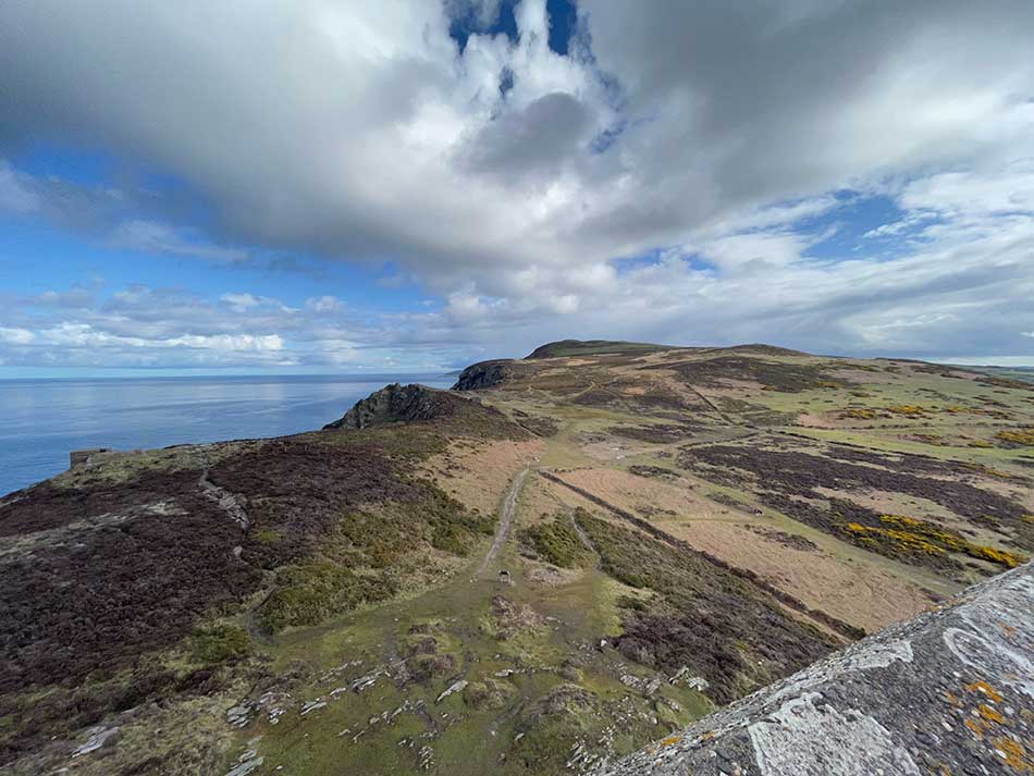
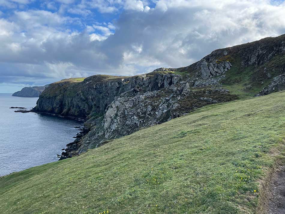
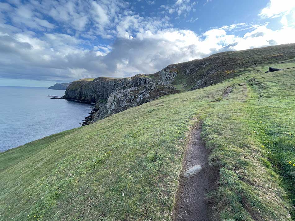
Once back down on terra firma, I continued along the path, heading for Fleshwick. You’d be forgiven for thinking that Bradda Head was the high point but it’s not. The path actually climbs much higher from here. It takes you through open, boggy moorland to the summit at twice the height of Milner’s Tower, high above the North Bradda Mines.
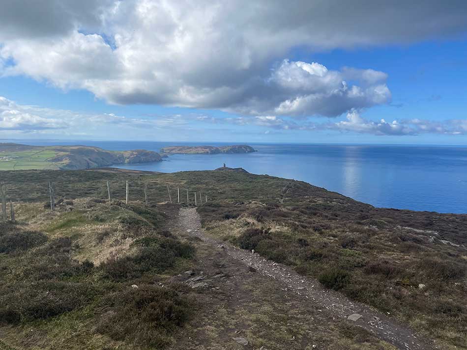
The path then weaves its way through a gorse and heather-lined clifftop path where the going was difficult thanks to the slippery, peaty mud beneath my feet. Eventually, it starts to descend but doesn’t become any easier. It then descends down a very steep track to Fleshwick Bay where Anna was waiting for me in the car.
There were a couple of people here who had been walking. One of whom had been struggling with a group of walkers so had decided to call it a day. We weren’t quite sure of his plans as he had to get to Peel so we offered to give him a lift into Port Erin. At least there he would be able to find a bus or taxi as he had little chance of doing so at Fleshwick!
For me, that was the end of the Coast path running for the holiday. I’d only covered an additional 6 miles or so. I had planned to run from here to Niarbyl another day, but the fog set in and I would have been able to see nothing. So, that will have to wait for another trip.
Discover more from A Simple Life of Luxury
Subscribe to get the latest posts sent to your email.