Wales Coast Path Run – Tenby to Manorbier
Coast Path Vital Stats
Tenby to Manorbier
- Distance: 8.80 miles
- Elevation Gain Today: 437m
- Highest Elevation: 86m
- Time: 1:48:45
- Av. Pace: 12:21 mins/mile
- Calories: 1150
Totals to Date
- Total Distance: 893.13 miles
- Total Time: 167:12:35
- Total Elevation Gain: 26003
- Total Calories: 83524
- Distance to go: 199 miles
This was my first time back out on the Coast Path since my heart attack just over 7 months ago. The heart attack was totally unexpected and at the time no one was sure if I’d ever be able to run again. Thankfully I’ve been recovering slowly but surely and now finally have the confidence to get back out and continue with my project to run around the whole of Wales.
Quite a lot has of course changed. The pace was never fast on these runs but it was now likely to be even slower. I also had Anna close at hand as support driver and back-up. There was of course some anxiety for both of us as I’d be miles from help, exerting myself on fairly inaccessible bits of coastline. I was going to take it easy though, we had done what we could to keep things safe and I had to start somewhere. Hopefully after a few sections we’ll get used to the idea again.
Today’s run was to start in Tenby so Anna and I left home around 8am for the 2½ hour drive. It was a grey, windy day but dry. The drive down was uneventful and I pulled onto the seafront of Tenby North Beach. Starting here would mean that I’d overlap a little with where I finished last time but it was a good place to start.
Running Circles around Tenby
I jumped out of the car and double checked that I had everything. This now included my GTN spray, my Frontier X ECG recorder and of course my phone was essential. I made sure Anna knew where where she was meeting me along the way. The end point was Manorbier but we had a mid-point meeting place at Lydstep too. Anna could track my progress using Strava Beacon and she even had the defib in the car!
I set off along the prom of Tenby and then dropped down towards the harbour. The tide was out, it was a cool, windy day but just about right for running.
I stopped at the toilets just below Tenby Castle and then somehow managed to run around in a circle through the streets of Tenby and ended up back at the top where I had started! I ran back down to the harbour again and this time took a different road through Tenby. Somehow this one wasn’t much better and I ended up back in the centre of Tenby again desperately looking for Coast Path signs. There were none to be seen. I weaved my way through the streets, out along the golf course and then emerged through the dunes onto Tenby South Beach
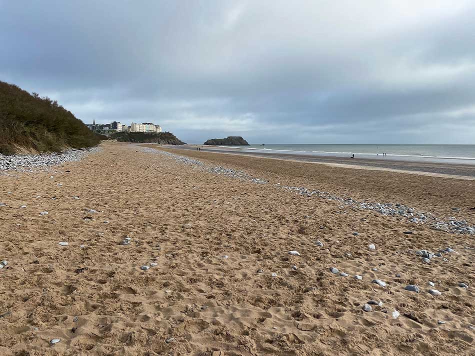
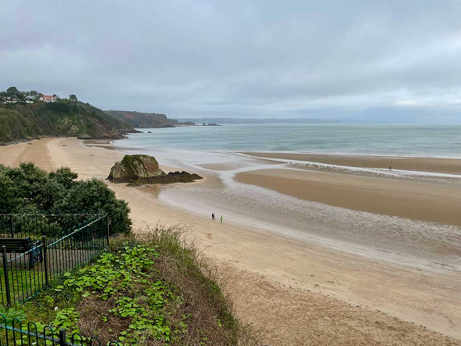
I had a quick look back towards Tenby and then turned right onto the soft sands for a run along the beach. At the end of the beach I climbed up onto a path towards Giltar Point where I had views out across the long sweep of sands to Tenby in the Distance. I was feeling fine.
From Giltar point I had a good view of Caldey Island. It was quite a bit larger than I had thought! Ahead of me was a nice undulating path along the tops of the low cliffs.


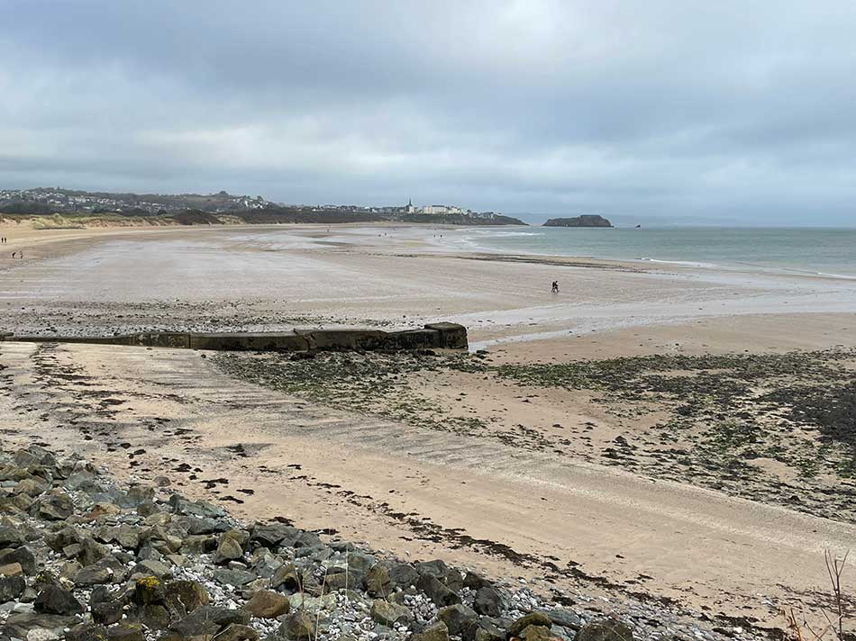
I made my way along the path watching the choppy seas crash against the rocks below. The cliffs became more impressive in places and I could see the beach of Lydstep in the distance. It didn’t take that long for Lydstep to come into view proper. Although by now it had taken a little longer than planned to get to this point thanks to my detours in Tenby.


I dropped down from the cliffs at Lydstep, through a caravan site and then down again onto the beach itself where I once again ran along the sands towards a slipway. I ran up the slipway, paused at the top for a photo and realised here why I may have missed the signs in Tenby. It seems as though the usual blue and yellow ‘dragon shell’ signs of the coast path aren’t used so much along the Pembrokeshire Coast Path. This was the first one I had seen. Instead the little acorn sign seemed to be the ones to follow. I headed off along the road and then uphill towards a National Trust Car park where I met Anna.


I found Anna easily enough. She was a little chilly in the car but I didn’t stop long. I said hello, told her I was feeling fine. Had a swig of coke and then checked we both had the same meeting point for the end of the run. I’d done close to 6 miles now but only had a couple more to go. The route had originally been 7.75 miles, but with the detours in Tenby it was likely to be close to 9 now. I felt up to it so soon continued on my way allowing Anna to start the car, put the heaters on and head to Manorbier.
Lydstep to Manorbier
I then had a flight of what looked like newly constructed steps to descend. This of course meant a steep climb back up the other side. Taking things easy on my first Coast Path run with stents in my coronary artery I power walked this rather than ran it, and even paused at the top to take a photo.


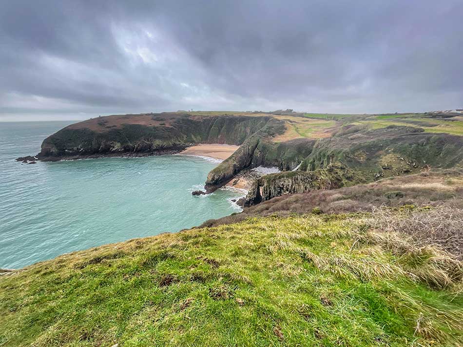
It was then a short run along the cliff tops to Church Door Cove and Skrinkle Haven. The wind had been a strong headwind all the way so far which made the going tough. It was also a little chilly on the clifftops now as well. The sun did try to break though now and then but never properly and only very briefly.
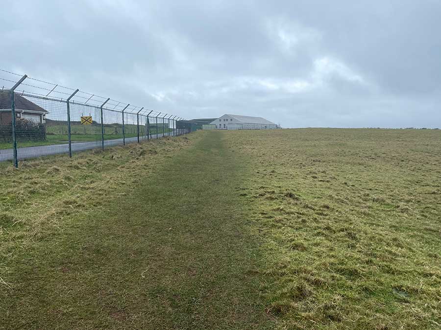
I left the beach of Skrinkle Haven behind me and circumnavigated the air base alongside high fences and military buildings.
From here there were a few more ups and downs past some impressive cliffs.


I then descended towards the sands of Manorbier past the King’s Quoit Cromlech, a neolithic burial chamber.


It was then a short jog across the sands and up into the car park where Anna was waiting for me with the towering castle walls looming above.


It had been a total of 8.8 miles. Not much in the grand scheme of things but considering what had happened since my last Coast Path run, quite an achievement.
After a quick change in the car park we headed into Tenby for a celebratory coffee and cake. We then had a stroll around Tenby. The sun was beginning to come out now so I took a few nicer photos of Tenby.


We then headed off to Trefloyne Manor where we would stay the night.
Discover more from A Simple Life of Luxury
Subscribe to get the latest posts sent to your email.


Lovely to read all about the coastal walk again ..you must be pleased to be back ? Looking forward to reading more.
Very lucky you have a wife like Anna, not sure I’d be quite so obliging !
I wouldn’t want to be walking along photo 18 in the dark .
Ps
No selfie this time !