Wales Coast Path Run – Port Talbot to Swansea
Coast Path Vital Stats
Port Talbot to Swansea
- Distance: 13.64 miles
- Elevation Gain Today: 95m
- Highest Elevation: 35m
- Time: 2:27:14
- Av. Pace: 11:01 mins/mile
- Calories: 1230
Totals to Date
- Total Distance: 749.65 miles
- Total Time: 138:18:37
- Total Elevation Gain: 21670
- Total Calories: 68054
- Distance to go: 342 miles
It’s been ages since I’ve done any of my Wales Coast Path Run project. At last on Monday I had time to continue with it. So, after driving to North Wales the day before it was time to head to South Wales for the next stage of my adventure. If you are new to this blog then I’m attempting to run around the whole of Wales, bit by bit when time and fitness allows.
The drive to Port Talbot was around 2½ hours but I wasn’t in anything of a hurry as the public transport that I would need later in the day was pretty regular in these parts of the world. I found some free parking, slipped on my running shoes and headed out into the sunshine. It was a nice fresh autumn morning. Blue skies above but there was a chill in the air and temperatures were in single figures.
My parking spot was a hundred yards or so further along the coast path than where I stopped last time so I ran across the roundabout to the railway station to make sure I overlapped and turned back and re-traced my steps past the car and onto the Coast Path.
Through Port Talbot
I have to admit that I might find it a little difficult to write too much about this stage of the path as it wasn’t the most exciting. The first mile or so was though the streets of Port Talbot and worse still, mainly along a busy dual carriageway. It took me around a couple of roundabouts, over the River Afan and then the first noticeable obstacle was a large pedestrian bridge over the A4241.
From here I continued through the streets of Port Talbot and then out onto the banks of the River from where I could see a large ship in the docks.


It was nice to see small sand dunes and sand for a while even if the concrete jungle was still immediately to my right. The path followed the river to its mouth and then turned right to run along the top of Aberavon Beach.
Aberavon
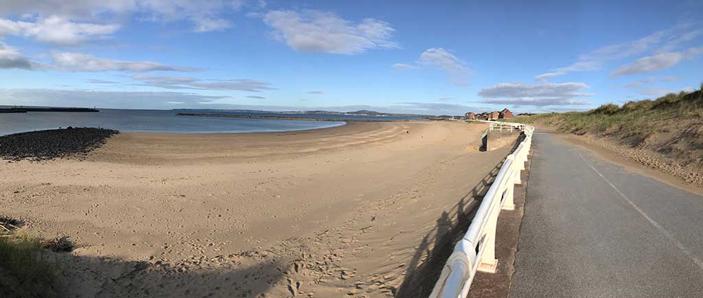
The Path followed the prom for a mile or so with nothing but beach to my left, various features of the prom to my right and then the houses of Aberavon beyond that. Below my feet was nothing but tarmac and the occasional painted sign to keep pedestrians and cyclists segregated.
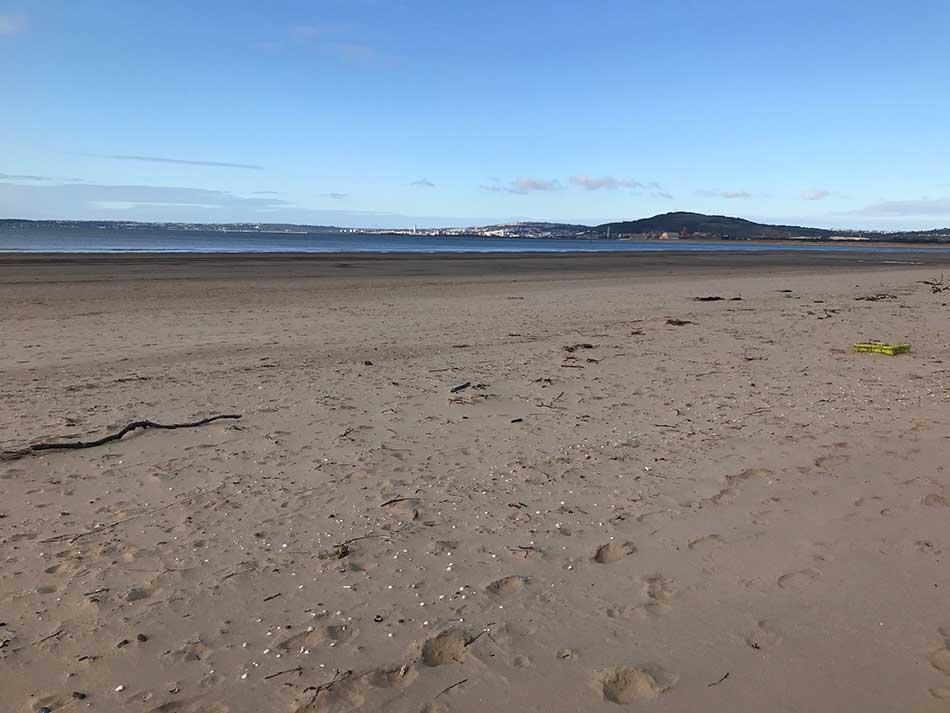
Eventually the path took me into a little housing estate and then up through the dunes which were much more extensive here and out onto the sands of the beach itself.
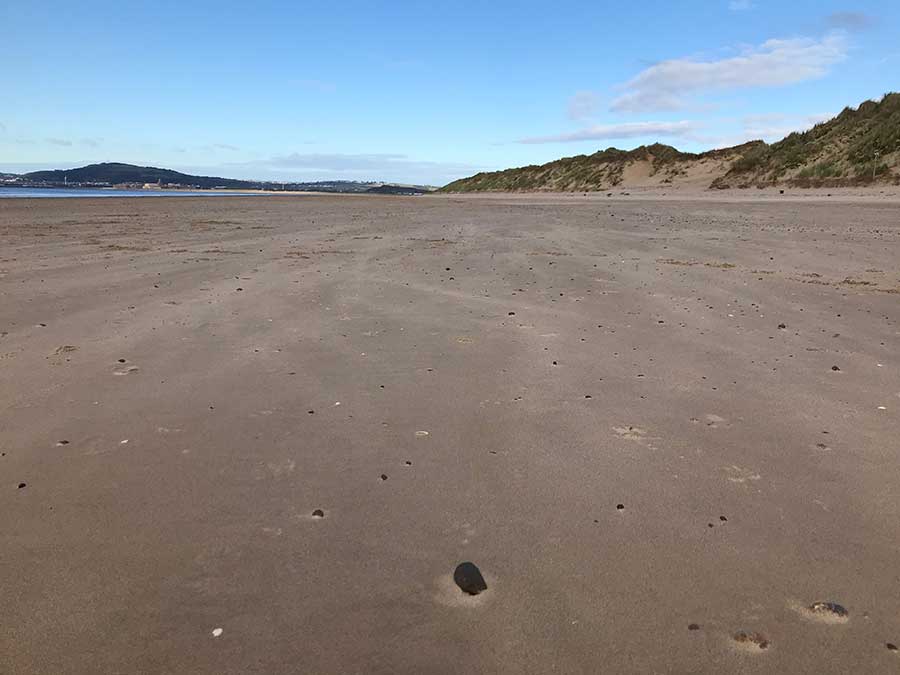
It was nice to have a break from the tarmac for a while as I followed the coast with the huge sweep of Swansea Bay opened out before me.
After a little while on the sands, I spotted a lone sign at the foot of the dunes. Upon investigation it was the familiar ‘dragon shell’ of the Wales Coast Path directing me up and over the soft sand of the dunes.
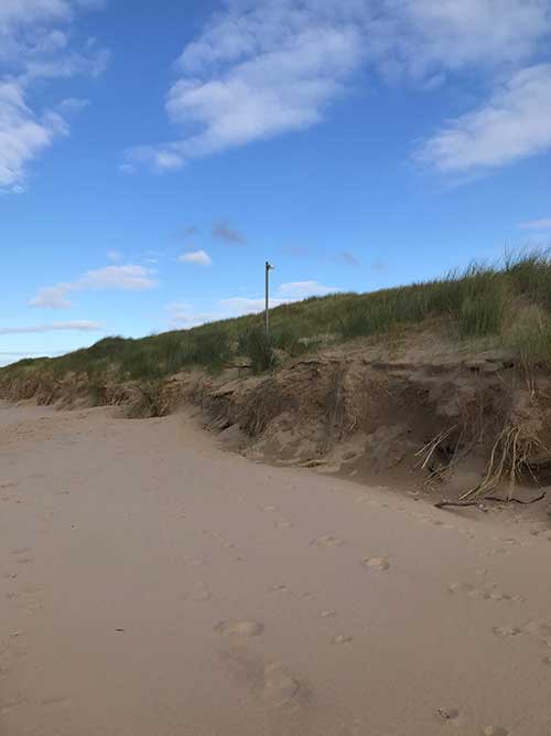
Up and over the dunes I went and then back down through the dunes and out onto some scrubby wasteland alongside the heavy industrial buildings of oil refineries and steel works.
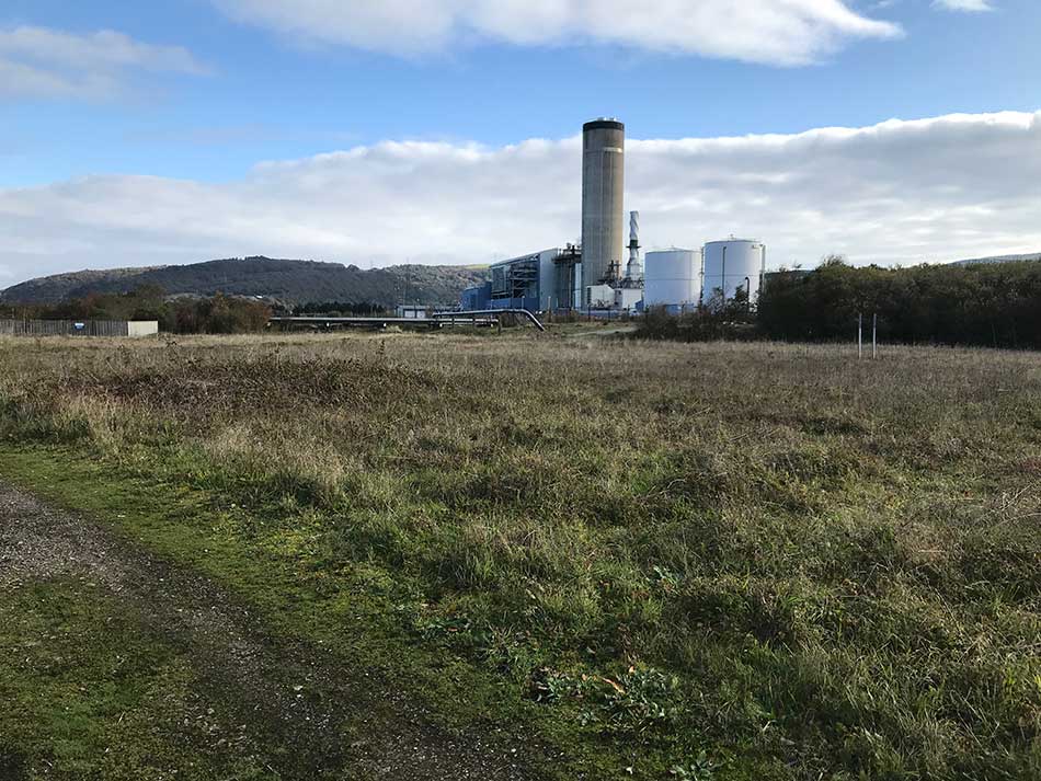
I’m never quite sure exactly what all of the buildings are in such areas. Google Maps just shows them as cooling towers, but I soon came across a long oil pipeline leading from the sea to the buildings so I’m assuming they are refining oil here for use elsewhere in South Wales.
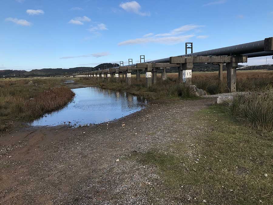
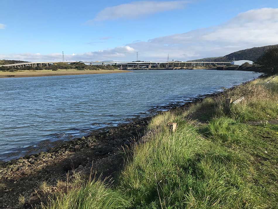
I headed under the pipeline and then up onto a gravely path past yet more heavy industry. According to the map the next series of huge buildings which didn’t have the usual strange pipes, chimneys, towers and conveyer belts was a papermill. As I ran past this I headed out onto the banks for the River Neath. I turned right onto it’s banks and it was clear that there was going to be a bit of a detour here to cross the waters. Two huge road bridges dominated the skyline in front of me. The first carrying the M4 high above the river, the second carrying the equally busy A48. Not only were they a little way upstream from where I was but there would be something of a climb up onto them.
Over the River
For now though I had a pleasant little run along the banks of the river. After a while, and a few little gates, I emerged out onto the streets of Briton Ferry. This took me up a little hill, under the M4 and then out onto the A48 where I climbed up onto the bridge. It wasn’t quite as bad as I was expecting as the pedestrian footpath was segregated from the road by quite a way and there was a bike path between us as well. As I climbed onto the Bridge I went over the top of a huge recycling centre and could see the even larger bridge of the M4 beyond it. I passed huge pylons and climbed to the same height as the M4 bridge. I crossed the River Neath. On the far side of the river I could see firemen lined up in a neat row, all stood to attention in their uniforms outside a fire station.


Once finally across the bridge I descended to a large roundabout and then turned left to continue back towards the coast. This wasn’t the nicest of sections as it followed the busy A482, ducked under the road via a graffiti clad subway and then continued along the other side as huge lorries thundered past in a never-ending stream. Eventually I came to another roundabout and headed off into the village of Jersey Marine.
Along the Canal
Here I took a poorly sign-posted left turn onto the banks of the Tennant Canal. At last I was away from the roads and noise for a while. I was no longer on tarmac but a muddy little track with the clear waters of the canal to my right. The muddy path did soon become a quagmire and then it seemed to be part of the canal itself as I found myself running through ankle deep water for a while. It might have been wet along here but it was certainly nicer than the tarmac as the swampy woodland closed in around me and wildlife took over.


This path continued for quite a while through the trees. The canal become more and more choked with vegetation and eventually was taken over by reeds until it was no more. I ran past a sports field and then across a bridge over what remained of the canal. Here there was nothing to be seen of it, just reeds and lots of fly-tipping (what is wrong with people!)
I was now entering the outskirts of Swansea and was soon plunged back into civilisation. I negotiated impressive looking bridges and ran alongside the A483 once again. I was then directed off towards the harbour where new trendy wine-bars and coffee shops seem to have sprung-up alongside modern gyms and waterside housing complexes.
I ran around the dockside and then out towards the River Tawe with it’s marina full of shiny boats. From here I headed and across the Tawe Barrage as I once again headed towards the coast.


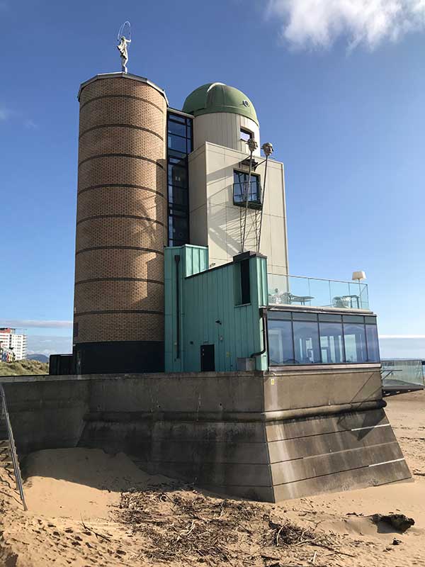
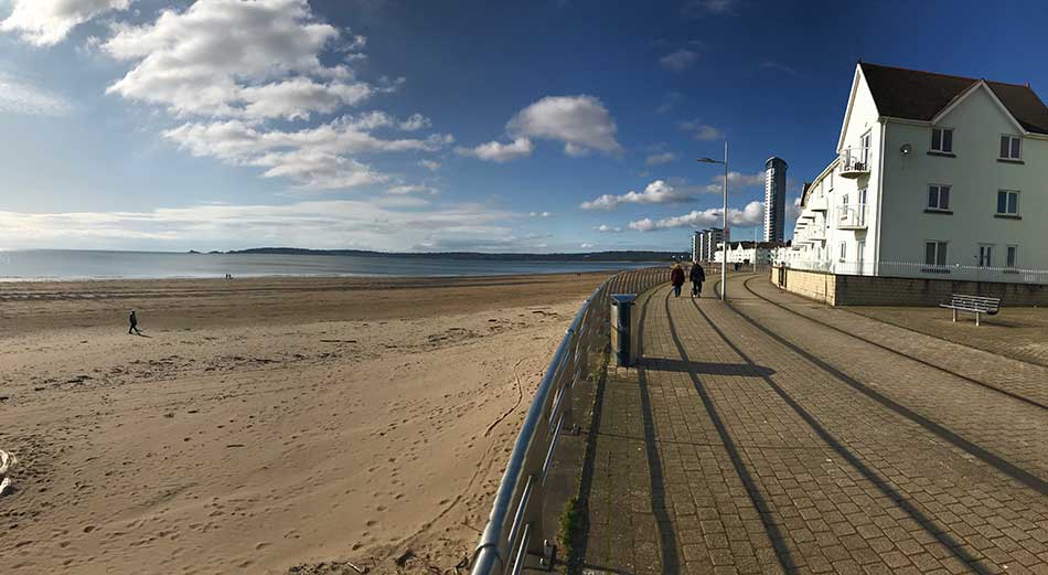
I was now on the coast and running along the prom towards Swansea seafront. Modern apartments lined the prom to my right as the sands opened out to my left. I passed the impressive Tower of the Eccliptic.
The Tower of the Ecliptic (also known as the Swansea Observatory or the Marina Towers Observatory) was designed by architect Robin Campbell in 1989 for the local astronomical society. The building’s design and coastal setting make it a distinctive landmark. Inside, the observing room is a hanging scale model of the solar system, the walls are bathed in vibrant blues and purples from the stained glass oculus overhead. Inside the dome, at the top of the adjacent tower, is a 500mm telescope, the largest of its kind and the largest telescope in Wales. The dome’s 5-meter shell floats on a trough of water and oil allowing the dome to be turned using only one finger.
Such architectural elements made the Tower of the Ecliptic an exciting educational setting as well as a rare union between art and science. In early 2010, however, due to a disagreement with the Swansea City Council regarding the building’s rental terms, the astronomical society decided it could no longer afford to occupy the observatory. This resulted in the observatory closing so the valuable educational resource has been lost. Such a shame. It looked impressive from the outside so I can only imagine how cool it must be inside.
My route took me further along the Swansea Seafront. Here I had the option of continuing on towards Mumbles Point or heading into town to find the bus station and ending the run here. I opted for the latter as I was feeling quite tired by now and 13 miles would be enough for my first long run in a while. I soon found the bus station and waited for my ride back to Port Talbot.
That’s another 13 miles or so ticked off and means that the next section should take me away from the urban areas of South Wales and out onto the Gower Peninsula. There’s still a long way to go and plenty of adventure on the path ahead.
Discover more from A Simple Life of Luxury
Subscribe to get the latest posts sent to your email.


