Offa’s Dyke Path Run – Llandegla to Castle Mill
Offa’s Dyke Vital Stats
Llandegla to Castle Mill
- Distance: 16.61 miles
- Elevation Gain Today: 647m
- Highest Elevation: 496m
- Time: 2:54:38
- Av. Pace: 10:31mins/mile
- Av. Heart Rate: 131bpm
- Max Heart Rate: 153bpm
- Calories: 1417
Totals to Date
- Total Distance: 492.96 miles
- Total Time: 92:05:03
- Total Elevation Gain: 13755
- Total Calories: 46373
- Distance to go: 132 miles
I managed to continue my run around Wales on Monday with a section of Offa’s Dyke from Llandegla to Castle Mill. The forecast was for it to be wet, cold and windy, and that’s exactly what it was as I set of from home in the pitch black at 6am. After a dark and dreary drive through Wales I arrived in Llandegla at first light to find that my phone hadn’t been charging. I need it as an emergency tool should something happen to me whilst out in the hills and also as a camera. I therefore sat in the van for 15 minutes putting some charge into it before I could get going. It was raining outside and not quite light yet. I guess that I should really have made a cup of tea in the camper and made myself comfortable for a while.
My plan today was around 16 miles to a little place called Castle Mill. There were three buses a day from here to Chirk so if I could get there before 11:49am I should be OK. If not, I’d have either a 3 hour wait for the next bus or would have to add a couple of miles onto my run with a detour into Chirk. I had hoped to set off by 8am but I was now sat here waiting for a phone battery to charge so time was ticking.
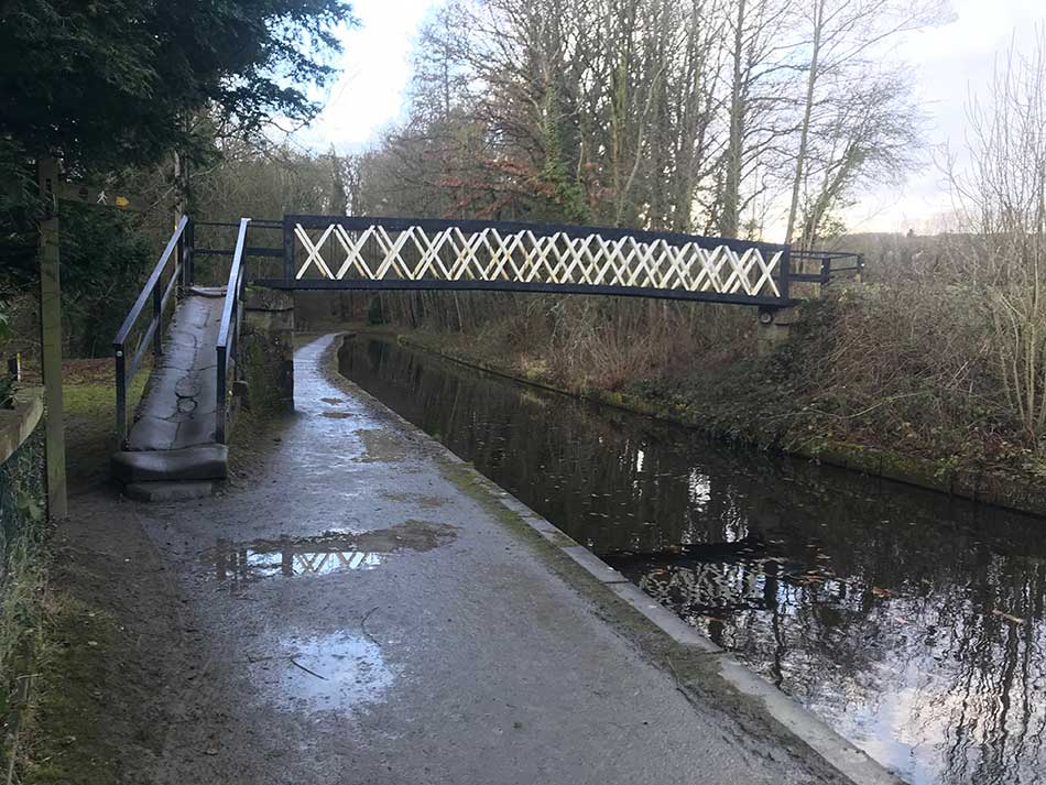
Once there was enough juice in my battery I set off into the gloom through Llandegla as school children headed off to school. The route took me across the A5104, down a little lane and then across the busy A525, over a stile and into a muddy field. I crossed a bridge over a little stream and then had a big climb up through various fields that were crossed with large electricity pylons towards Llandegla Forest.
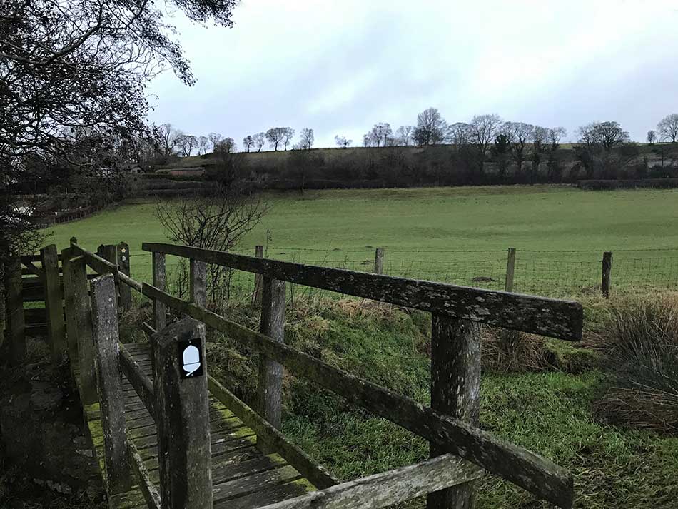
Bridge
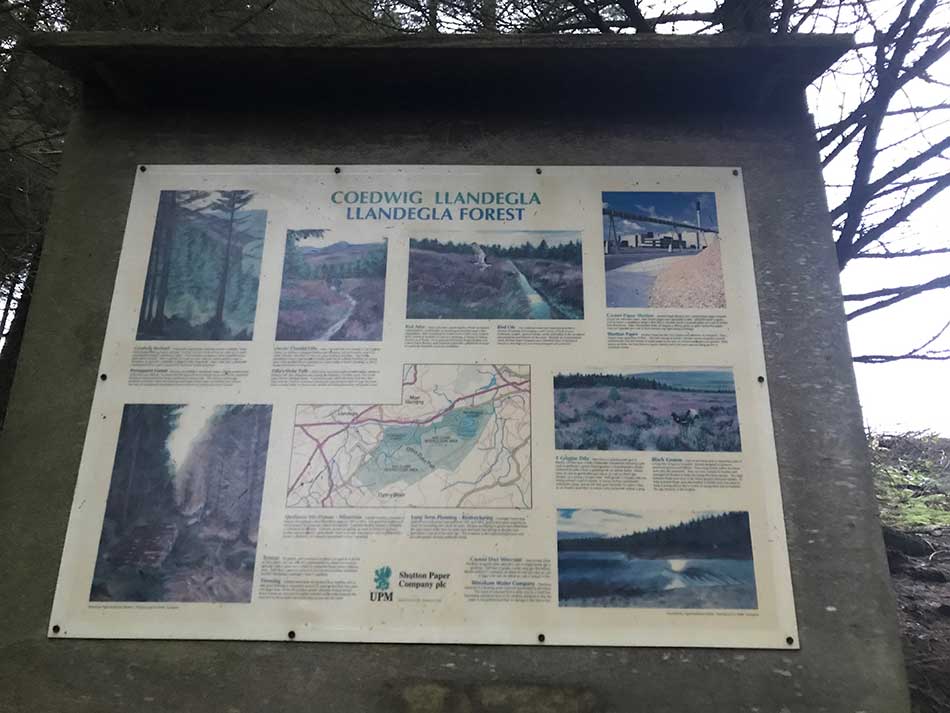
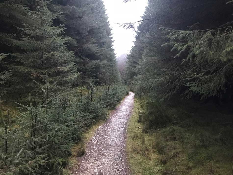
Llandegla Forest
I was heading away from civilisation and all was quiet in the morning gloom. It was only just raining, but not enough to warrant a hood and it wasn’t too cold either. As I approached the edge of Llandegla Forest I looked back to see the pylons marching across the patchwork of fields under foreboding dark skies. It was dark ahead of me too in the confines of the conifers and the trail headed steeply upwards.
-

- Llandegla Forest
-
- Into the forest
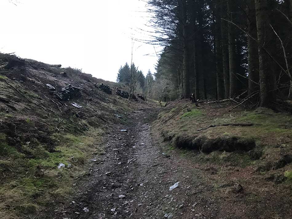
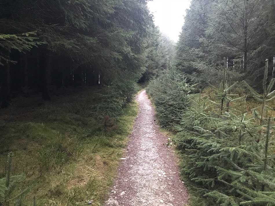
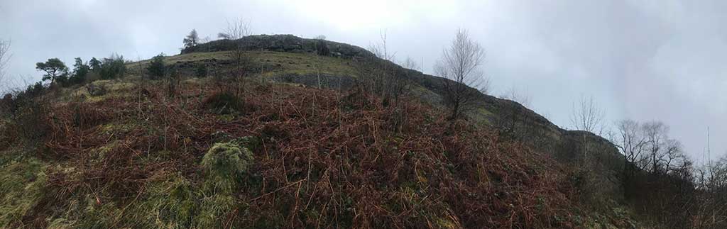
Some areas were clear felled and there had been a fair bit of forestry work going on so many of the paths were thick with claggy mud. As I delved deeper into the forest I made my way through the network of meandering, criss-crossing paths. I crossed mountain bike paths that I have ridden in the past, walking paths that went in every direction and various running paths too. All the while I was following the familiar acorn emblem of the Offa’s Dyke National Trail which took me virtually straight up the steep hillside through the forest. There were conifers everywhere and nice trails to follow.
-
- Conifers
-
- Conifers
Eventually, I emerged out of the top of the forest crossed a couple of larger tracks passed through a gate out onto the heathland. It was now raining a little heavier and the heather was soaking my legs as I made my way along the muddy track. I was jumping over rocks and picking my way through the terrain. Ahead of me the rounded peaks of Cefn y Gader and Cefn y Gist were shrouded in mist and murk. All around was heather.
Heathland
This area is heavily managed and the heather cut back in places for the rearing and shooting of grouse. It’s difficult to see the extent of this from the ground. To really appreciate the mark on the landscape you need to see it from the air so here’s some aerial imagery from Google Earth.
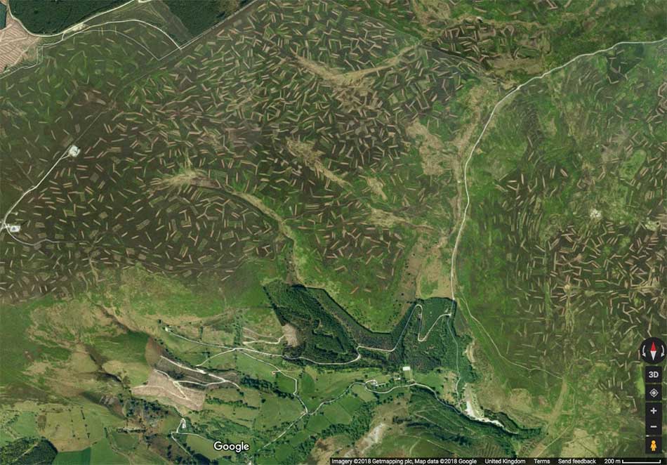
Managed Heather Moorland
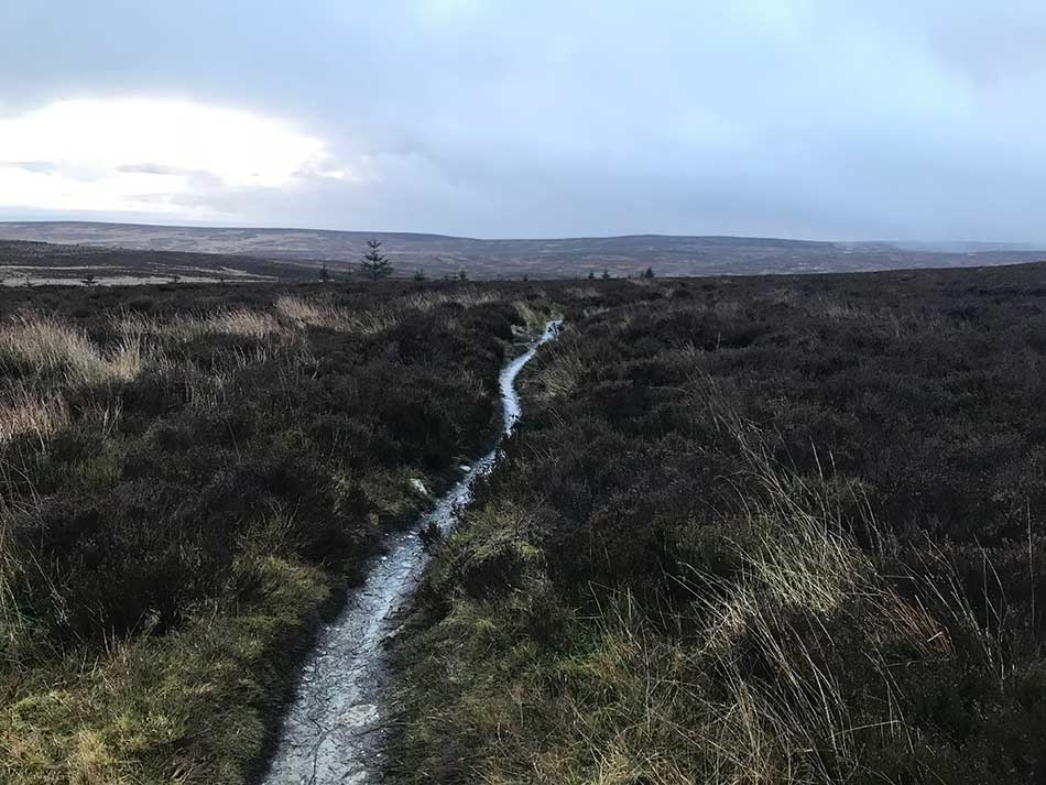
You can clearly see the areas of heather cut back for the grouse and areas where it has been cut in the past and is now regenerating. It was obviously a much nicer day when this photo was taken that it was today though. Halfway across the moorland it started pouring with rain. My hood went up, the wind picked up and things were getting decidedly miserable. You can just see the path I was following at the top of the above image, cutting from the centre of the image in a NW-SE direction towards the road. Much of it was boardwalk consisting of a couple of planks of wood. Thankfully, despite appearance they weren’t at all slippery. As I approached the road, the path had been recently paved with slabs of yellowy limestone. Nice easy running if it weren’t for the wind and rain.
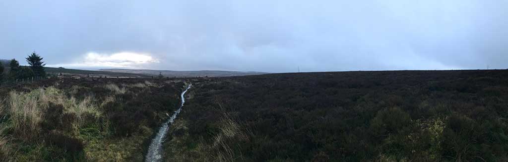
Moorland Pano
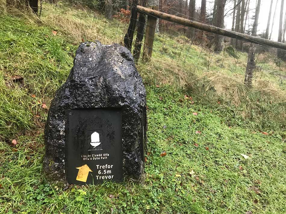
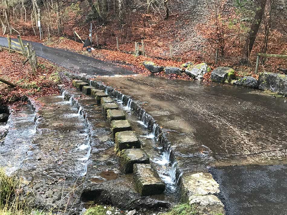
I turned right onto the winding tarmac road and the rain and wind increased in intensity. I was now soaked through and progress was impeded somewhat by the strong headwind. It was exposed up here and there was no one around as I made my way along the road. Eventually this descended into a little valley, appropriately names ‘World’s End’. This was once the site of a lead and silver mine. I crossed a ford and then headed off onto a small muddy, rocky track through a little woodland signposted towards Trevor 6.5 miles away.
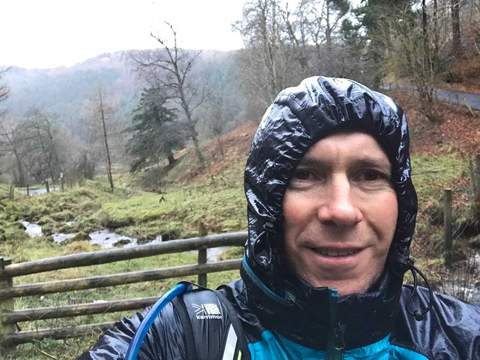
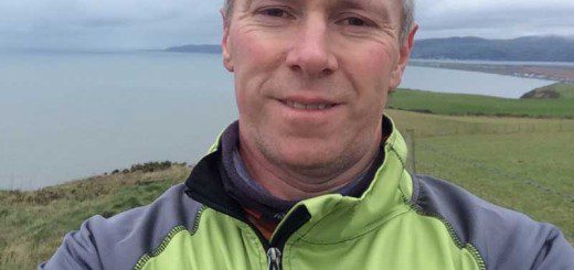
-
- SoggySelfie
-
- Towards Trevor
-
- Ford
Weather
The rain was still wet, the wind was still blowy, the trails were still slippery and tricky and there was no one else daft enough to be out in this weather. The temperature was dropping now too as I made my way through the scrubby woodland.
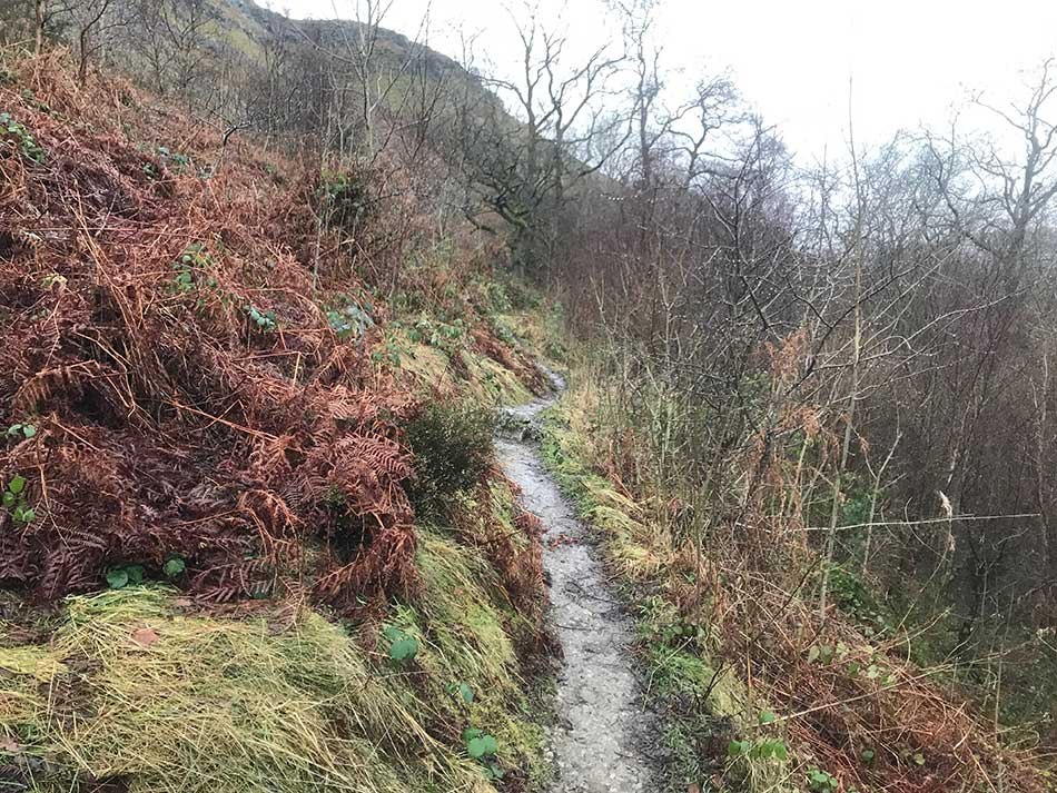
Scrubby Woodland
Mind you, whilst on the subject of the weather, it has to be said that considering this is a journey around the periphery of Wales there haven’t been too many days like this one. Wales isn’t known for it’s sunny climes. It is known for its weather but usually the wet, grey wild variety of weather. Today it was living up to that reputation. I don’t remember too many other days where it has rained on my journey though. There have been some, but I don’t think there have been any with proper, wet welsh rain. The type of driving rain that soaks you to the bone regardless of what expensive layered mountain clothing you have on. The type of cold, wet rain that Wales is known for and that you have to experience to believe. Today I believed I was in Wales again as I was drenched. I was only wearing running socks and shoes, thin running tights, a merino wool base layer and an old running jacket. The jacket was waterproof and was doing quite a good job but rain was getting in around my face and one sleeve of the jacket is quite badly torn so it wasn’t quite up to the job.
Cliffs
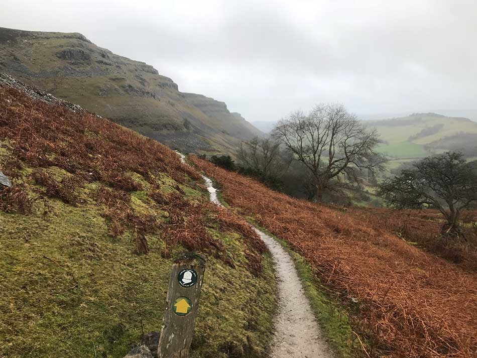
As the scrubby woodland gave way I could see glances of the impressive cliffs of Craig yr Adar above me. The path emerged out onto the steep hillside with drops down to the Eglwyseg valley below. Even the farms in the valley below looked deserted and shut up against the weather.
Crag yr Adar
The path clung to the hillside and passed a number of steep, rocky cliffs to my left with views into the valley below to my right.
Cliffs
The well sign-posted path crosses a number of scree slopes below Craig Arthur. Every now and then there is a grassy interlude between the scree slopes and a couple of little stream crossings. The views out the the south west would be spectacular could I see them, and the cliffs above an imposing sight. Unfortunately today’s weather doesn’t really do them justice and doesn’t lead to great photography either. You can see the path I took through the scree slopes below Craig Arthur in the photo below which was taken from one of the grassy interludes.
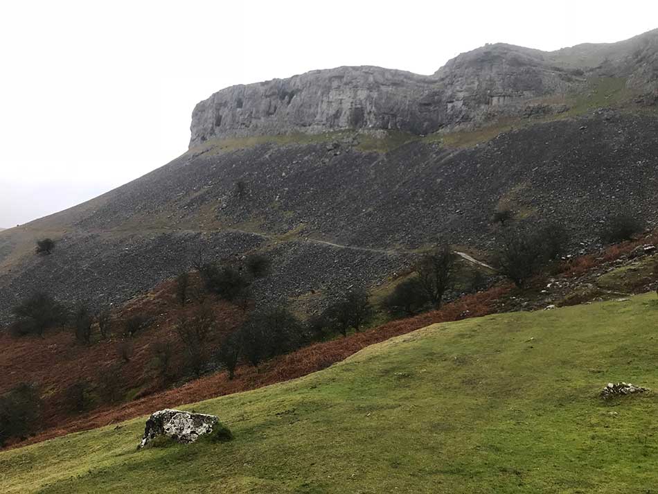
Scree Slopes
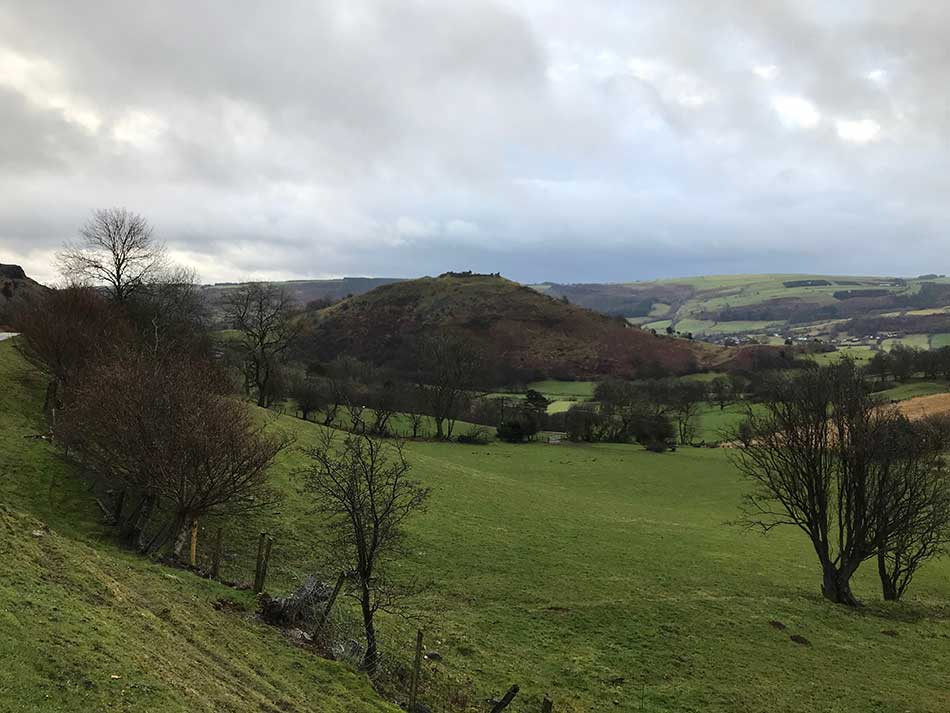
Eventually the path emerges out onto a tarmac road above a farm. A prominent hill topped by Castell Dinas Brân dominates the view ahead. Castell Dinas Brân is a medieval castle probably built in the 1260’s by Gruffydd Maelor II, a Prince of Powys Fadog, on the site of several earlier structures, including an Iron Age hillfort. The Iron Age hillfort was built around 600 BC. An earthen rampart was constructed probably topped by a wooden palisade and this was further protected by a deep ditch on the shallower southern slope. The walls of the hillfort encircled a village of roundhouses.
Castell Dinas Bran
As the road curves around onto the Panorama Walk the view into the upper reaches of the Dee valley opens up. The town of Llangollen could be seen in the valley below, along with other little settlements and the busy A5. Up here though all was quiet. The rain has eased a little and finally there was some wildlife around too. The first sign of animal life that I’d seen for a while. This included a Green Woodpecker that flew off through the trees as I approached. The road took me past more cliffs, and Trevor Quarry and then down a steep path into the woods around Trevor Hall where it emerged onto the A539. I followed the road for a little while and then down under a little bridge, across a muddy field containing a couple of uninterested horses and then out onto the Llangollen Branch of the Shropshire Union Canal.
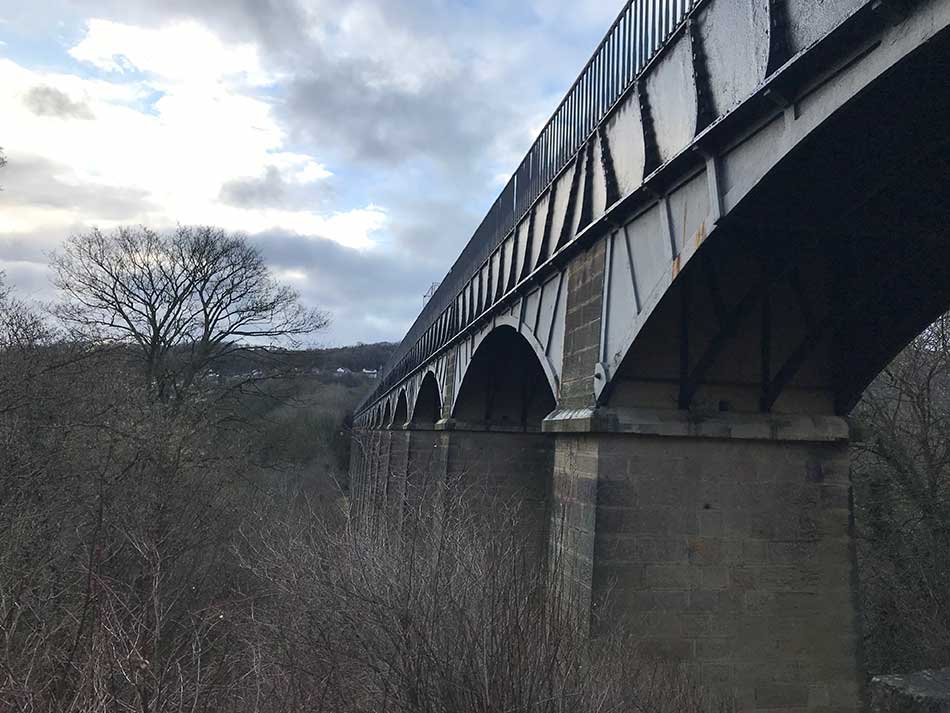
Aqueduct
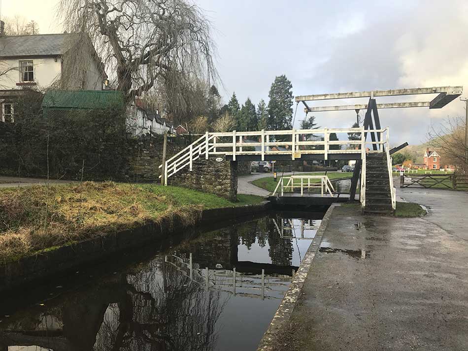
Next on my agenda and hopefully one of the highlights was a crossing of the Pontcysyllte Aqueduct. I’d been looking forward to this with some trepidation. It is an alternative route on the Offa’s Dyke path and one only for those with a head for heights. At 40m it carries the Llangollen Canal on 18 stone and cast iron arches over the River Dee. The aqueduct was one of the first major feats of civil engineering undertaken by Thomas Telford, who was becoming one of Britain’s leading industrial civil engineers; although his work was supervised by William Jessop, a more experienced canal engineer. It took ten years to design and build, and was completed in 1805. It is now the oldest and longest navigable aqueduct in Great Britain and the highest in the world.
As I approached, I followed the somewhat convoluted signs for the alternative route. This took me along a canal, over an attractive little canal bridge and then out to the lock gates at Pontcysyllte.
Canal
I followed the signs down under the aqueduct and back up the other side and out onto the aqueduct itself.
Pontcysyllte Aqueduct
I read the plaque containing information on the aqueduct and then looked out across it.
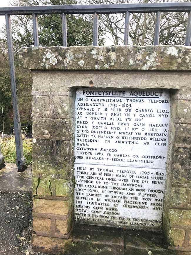
Aqueduct Plaque
There was also a sign saying that children needed to be supervised at all times due to the wide gaps in the historic railings! At least there were railings in the pedestrian side. The canal side simply has a huge drop from the waters edge with no protective railings at all!
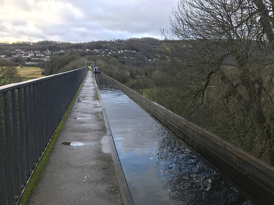
Aqueduct Crossing
Unfortunately I also spotted another sign saying that the towpath and canal was closed. Grrrr. I’d come all this way had psyched myself up for the heights and now couldn’t cross it anyway.
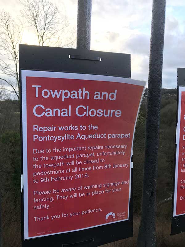
Closed
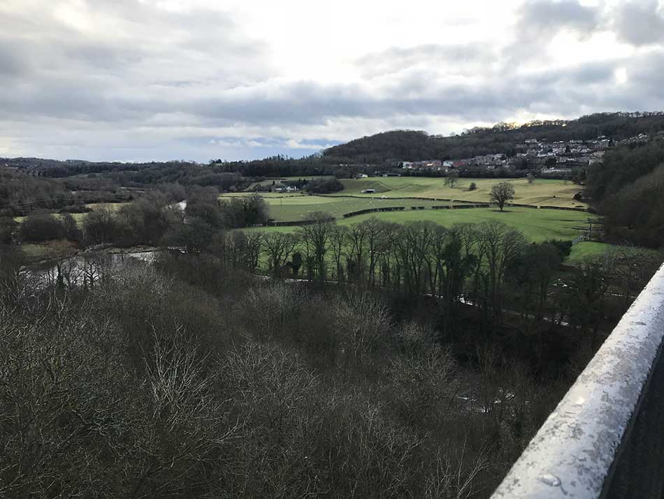
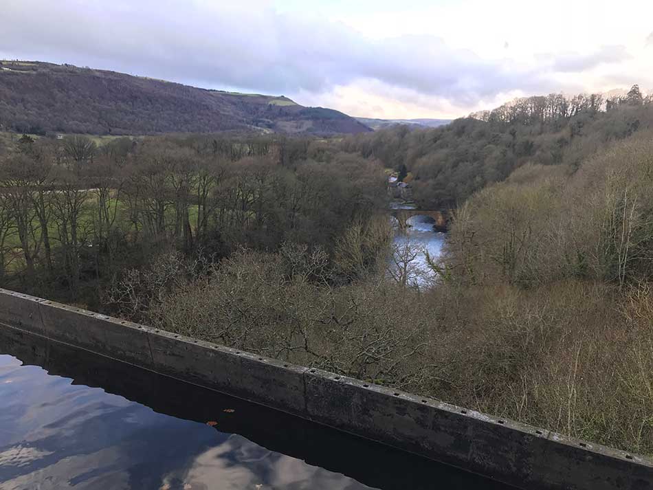
I made my way out as far onto the aqueduct as I could, took a few pictures of the view from the top and then headed back. I couldn’t go very far onto it so the photos aren’t great and I didn’t get any exhilarations from the height or exposure.
-
- View from the aqueduct
-
- Canal Edge
Not only was my excitement of the crossing dulled, but I now had to retrace my steps back down under the aqueduct, along the other canal and back to where the detour started. I joined the non-alternative route once again and then emerged out onto a little road just a few metres from where I had been 5 minutes ago. No aqueduct crossing, and extra detour and a pointless 5 minute run to bring me back to almost the same spot. That was a waste of time!
Oh well, on I went, down to the River Dee and across the Gate Road Bridge from where I could see the aqueduct spanning the valley. There on the top were the workmen who had barred my way as well.
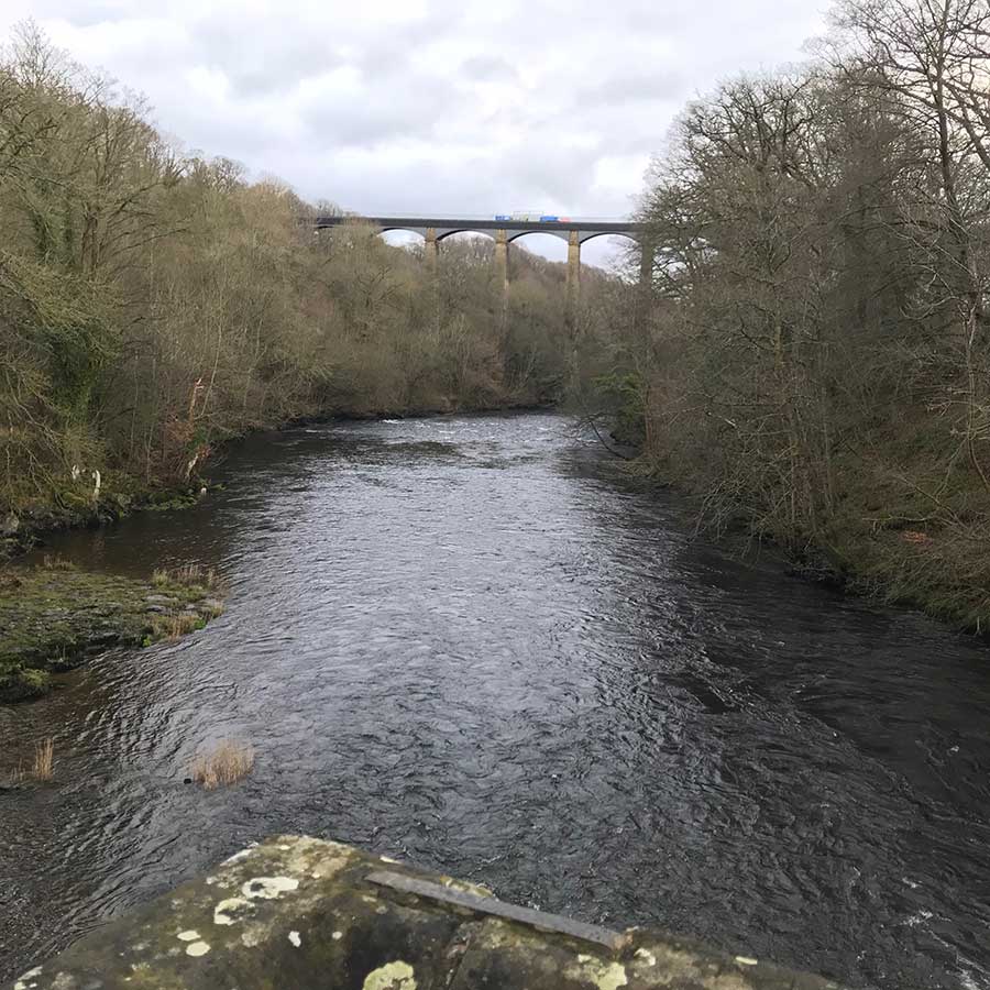
Aqueduct
At least I had got to see it from this viewpoint as well as from on top I suppose. We can always come back another day to cross it properly.
Canals and Farmland
The route now took me up through the village of Froncysyllte and back out onto the Llangollen Canal on the other side of the aqueduct. Here I crossed a swing bridge and followed the flat, easy going towpath alongside the canal.
Swing Bridge
As the canal went under a road bridge I was surprised to find myself following signs up onto the bridge and back through some muddy fields on the far side of the canal. The path turned left away from the canal, through another field and then crossed the main A5 road. I was then following signs through more muddy fields and farmland. The rain had eased for a little whilst along the canalside but it had returned again by now as I made my way through soggy fields and puddly minor roads.
I passed numerous farms and weaved my way through an agricultural landscape then climbed up a hill towards Chirk Castle. There is an alternative route here too which takes you through the grounds and woodland of Chirk Castle. Unfortunately this too was closed ‘due to adverse weather’!
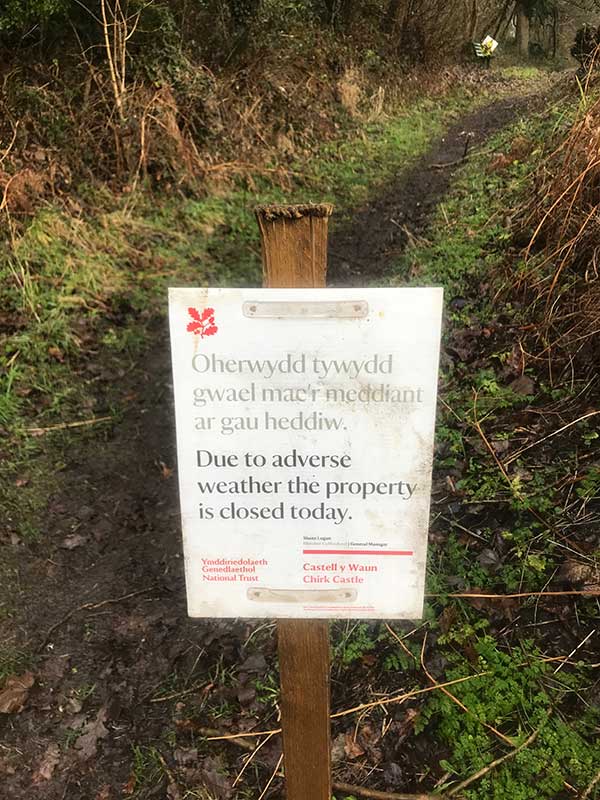
Closed Again
Adverse weather? You’re telling me. It was now absolutely pouring with rain again. The bits of me that had dried out a little were once again soaked through. Fingers and toes were wrinkled and everything was dripping wet. I made my way up over the top of the hill and then down the other side, onto a muddy track that descended steeply and became a stream due to the heavy rain. This soon emerged onto a road right next to the bus stop that I was aiming for.
Right on the border with England and Wales, this bus stop didn’t seem like one that was particularly well frequented. There was no shelter whatsoever and it was now raining harder than ever. Spray covered me as lorries sped past on the road just inches from my muddy vantage point. I donned my hat and gloves, pulled up my buff over my nose and settled in for what was about to be a 30 minutes wait for the bus.
-
- Pouring Rain at Gate of the Dead
-
- Gate of the Dead Bus Stop
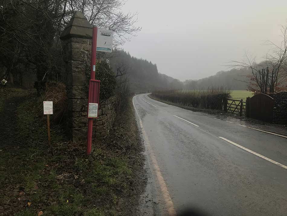
The gateway that I was stood at is known as the Gate of the Dead. In 1165 an invading English army was ambushed by Welsh forces in the wooded Ceiriog Valley. A brutal battle ensued and the dead were buried nearby hence the name of the gate. Apparently there is an ancient oak here too but I can’t say that I noticed it.
I was soon joined by a guy from the house opposite. Clearly, someone standing at this bus stop was something of a novelty and he couldn’t resist coming over to see what I was doing. He told me various things about the buses and how I could probably go to Llangollen rather than Chirk on this bus and then buy a Wrexham Day Ticket to save myself some money on the subsequent buses to Wrexham and on to Llandegla. he also pointed out several times that certain things we could see were in Wales whilst others were in England. He was nice enough though and it helped pass some time as I shuffled from leg to leg trying to keep warm.
The Journey Back
Just as the bus was about to arrive a car pulled up at the bus stop and it’s occupant asked if we were waiting for the bus – surely someone on the bus stop here isn’t that much of a novelty!? I said that I was and he told me that the bus was still facing in the opposite direction and had broken down. It was being pulled onto a tow truck and wasn’t going to be coming. I was now faced with a dilemma. A 3 hour wait for the next bus or a 2.5 mile walk/run into Chirk. It was nice of the guy in the car to have stopped to tell me, but I willed him to offer me a lift into Chirk as well. It worked, he asked where I was going and said he could give me a lift into Chirk.
I apologised for getting his car seat wet as I got in, but I wasn’t going to be too polite about it. I wanted in the car and I wanted a lift to Chirk. He dropped me off at the bus stop where I now only had a 15 minute wait for the bus to Wrexham. Not only had he saved me a long wait or a long walk but he’d saved me some time and some money. The rain had stopped now too.
The bus soon arrived and I got into it’s warmth. It certainly wasn’t cosy in there but it was dry and more comfortable than standing outside in wet clothes. The bus dropped me off at Wrexham Bus Station where I had about an hour to wait for the bus to Llandegla. Little did I know that Wrexham Bus Station was the coldest place on Earth! OK, I may be exaggerating a little there but it certainly isn’t the warmest place in Wrexham. I know that much for sure. I bought a coffee and a brownie and shivered as I ate and drank it. It did little to warm me.
I paced up and down but that didn’t help either. In the end I found a seat with a slither of sunlight on it and sat there doing my best to keep warm. Sitting in the bus station of a fairly large town wearing running tights and running kit in January is a little odd in itself. When those tights are caked in mud and you’re wearing a little running hat and lycra gloves too is probably a little odd. Add to that the fact that I was shivering uncontrollably and my teeth were chattering meant that people were keeping their distance! Strange folk generally inhabit bus stations and today I must have looked like one of the strange ones!
Buses came and went as did the people who were waiting for them. It was a cold winters day and I looked on with envy at everyone with their big thick jackets, hats and scarves as I sat there shivering away to myself in soaking wet lycra. A couple of well-dressed 20-something women even had lovely cosy looking, brightly coloured fleece blankets wrapped around them as they made their way through the bus station. I point out that they were well-dressed simply to distinguish them from the usual blanket bearing clientele of a bus station. These were well-to-do women and their blankets were designer accoutrements. They didn’t have ‘hungry and homeless’ signs, nor were they swigging on White Lightning cider. Nope these blankets were made to look good as well as keep them warm. No such luxury for me – although I did have a foil survival blanket in my rucksack – I wonder if I could pull that off and make it look good?
The bus arrived just a couple of minutes late and I was at last on my way back to Llandegla. The run had taken me 3 hours and it took the same amount of time to get back to where I started from on public transport. I was finally back at the van though where dry clothes and a bag of Haribo waited for me. I soon felt dry but not yet warm as I started the 1hr 45 minute drive home.
That was another leg of my quest to circumnavigate Wales complete. One that called for a nice warm bath once I got home!
Discover more from A Simple Life of Luxury
Subscribe to get the latest posts sent to your email.


Well that just proves how mad you are.
What a lovely man to let you get in his car… I’m not sure I would have and you are my son lol