Wales Coast Path Run – Burry Port to Ferryside
Coast Path Vital Stats
Burry Port to Ferryside
- Distance: 16.34 miles
- Elevation Gain Today: 308m
- Highest Elevation: 130m
- Time: 3:19:13
- Av. Pace: 12:11 mins/mile
- Calories: 1683
Totals to Date
- Total Distance: 832.96 miles
- Total Time: 154:28:25
- Total Elevation Gain: 23424
- Total Calories: 76544
- Distance to go: 250 miles
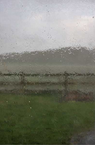
Tuesday morning was with us and once again I was off onto the Wales Coast Path. This time my aim was to run the section between Burry Port and Ferryside. The weather forecast wasn’t great but I was up early anyway so decided to just go for it come what may. I was soon in the car and heading south. The drive to Ferryside was fairly short at under 1hr 45 mins at this time of day. Skies were grey and ominous. The windscreen wipers had been called into action here and there.
I arrived just in time to see the 7:04am train leaving the station! Not to worry, I was actually planning on getting the 7:36am train anyway, I was just here earlier than expected. I sat in the car park for a while and then waited on the platform in a brief sunny spell. It was quite chilly though so I had my jacket on.
The train was on time and very quiet so I had a whole carriage to myself. Being a train it takes quite a direct route to Burry Port. It stopped at Kidwelly en route and 12 minutes after getting on I was at my destination. It was going to take me a little longer than 12 minutes to get back to the car.
Pembrey
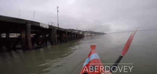
The sun was still out when I got off the train so I took off my jacket, stuffed it in my rucksack and prepared to run. First task of the day was to run through the streets of Burry port and down to the RNLI car park where I had finished last weeks run. I made sure to overlap with last weeks efforts just a little bit and then doubled back on myself. All was quiet as I ran around the little harbour of Burry Port.
There were a few people out walking dogs who all stood off to the side to get out of my way. I had views out over the Loughor Estuary to north coast of the Gower which was shrouded in rain. On the far side of the harbour the path took me down onto the sands of a nice sandy beach and then up into the dunes. Behind the dunes was a nice flat path alongside a caravan park. This path continued beyond another breakwater with views overlooking salt marsh and sandy beach.
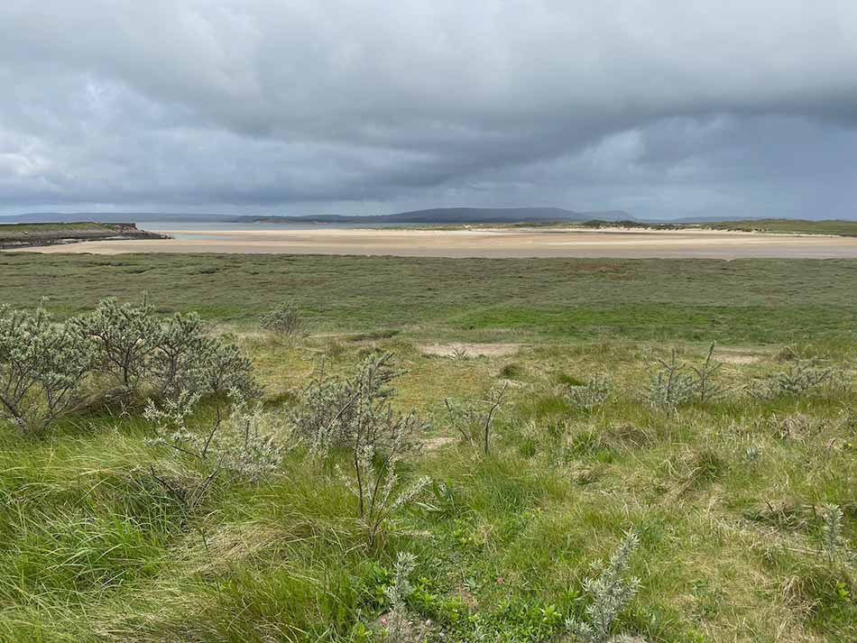
The sun had gone and it was now starting to rain. I stopped to put on my jacket just in time. The rain started hammering down and a nasty little headwind came along for the ride. I was alone with the rain, the wind and the path that continued along the tops of the salt marsh lined by sea buckthorn.
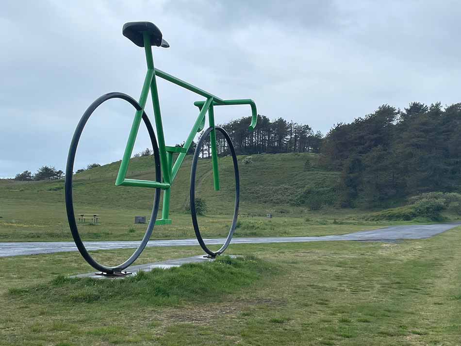
After about 2 ½ miles of running I turned right into the Pembrey Country park. I know parts of this park fairly well having raced cyclocross here many times and having done the ‘Race the Tide’ mountain bike race here too. I was on paths that I knew. What I didn’t know was that in my rucksack my phone had made a phantom phone call to Anna and had recorded a voicemail message that was close to 8 minutes long. When she played it back to me later in the day all you could hear was the steady metronomic slap of my feet and slosh of water in my hydration pack! I only discovered that I was on a call to Anna when I stopped to take a photo of the giant bike sculpture alongside the cycle racing circuit.
I sent Anna a quick text message to let her know that I was fine and hadn’t tried to contact her in an emergency. I then continued on my way through the Pembrey Country Park. As I came to the dry ski slope, the route map on my watch had me following the road through the Park. The signs on the ground however pointed me up the hill to the top of the ski slope. I followed the signs which took me on a bit of a pointless loop up the hill and then back down it again. I weaved my way through the park and then out across the dunes and down onto the massive expanse of sand that is Cefn Sidan Sands.


It was still raining and the headwind was a little stronger here as I turned right and started making my way along the endless beach. Shells crunched beneath my feet, my hood flapped in the wind and there was a gentle roar of the surf rolling into the shore. Otherwise the place was deserted. The beach goes on forever with just the occasional skeleton of boats here and there and giant barrel jellyfish washed up on the sand.
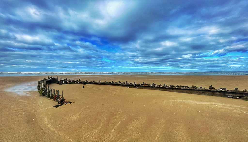
There was also a pile of rocks as a random sea defence. I say random as it’s the only one and it doesn’t seem to be protecting anything. There’s nothing inland of the rocks, just dunes and woodland as there is for miles either side of it. I wondered why it was there. Perhaps it was an experiment to see how well such things would work.
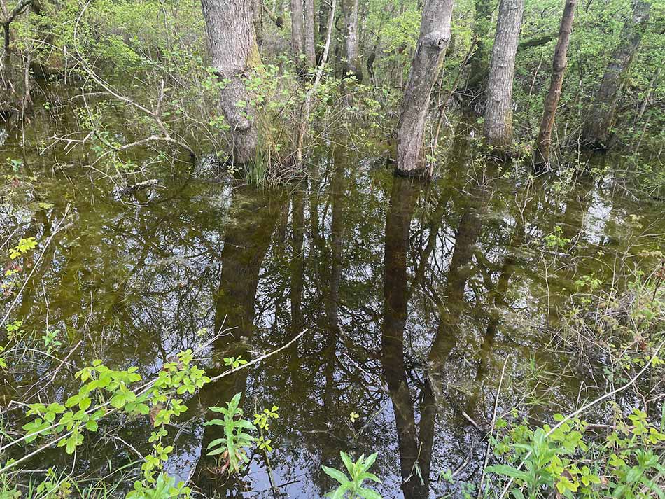
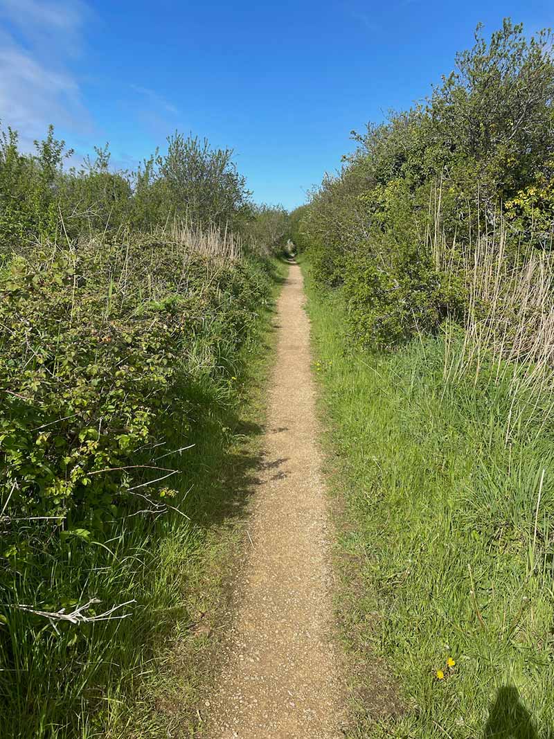
The northern end of the beach is part of a military training range. So, once halfway along this stretch of sand the route took me up through the dunes and out along a concrete path through Pembrey Forest. Trees grew all around with their feet in the wet slacks. Birdsong began to fill the air and the rain eased.
To Kidwelly
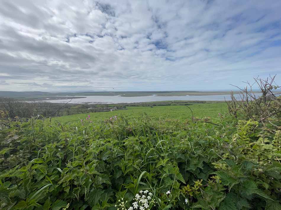
After a long run through the trees the landscape opened out into grazed dairy farmland where cows watched bemused as I jogged past. I stopped to take my jacket off as the sun came out. The concrete path contined through the fields, raised somewhat to keep it dry. It then climbed up onto an embankment along the southern edge of marshland that lined the Gwendraeth Fach estuary.
Across the estuary I could see the bright white caravans and buildings of Carmarthen Bay Holiday Park. To my right through the trees I could see the tarmac and towers of Pembrey Airport. The military were out in force here with hundreds of large vehicles, land-rovers and tents galore. There must have been a training exercise going on. Depite the fact that it was now gone 9am, many of the soldiers seemed to be stood at the side of their tents cleaning their teeth – I would have expected them to have done half a days training by now, not just be getting up!


I left the airport and soldiers behind and ran past a little pond which was glistening in the sunshine as two swans glided across it. As I approached the railway line that I had been on earlier I had to duck under a low bridge. Luckily there was a convenient reminder to ‘duck’.


The path then turned left and followed the main road into the outskirts of Kidwelly. Rather than go straight through the town it soon took me through a farmyard over the railway line again and out onto a lovely little path alongside a creek.
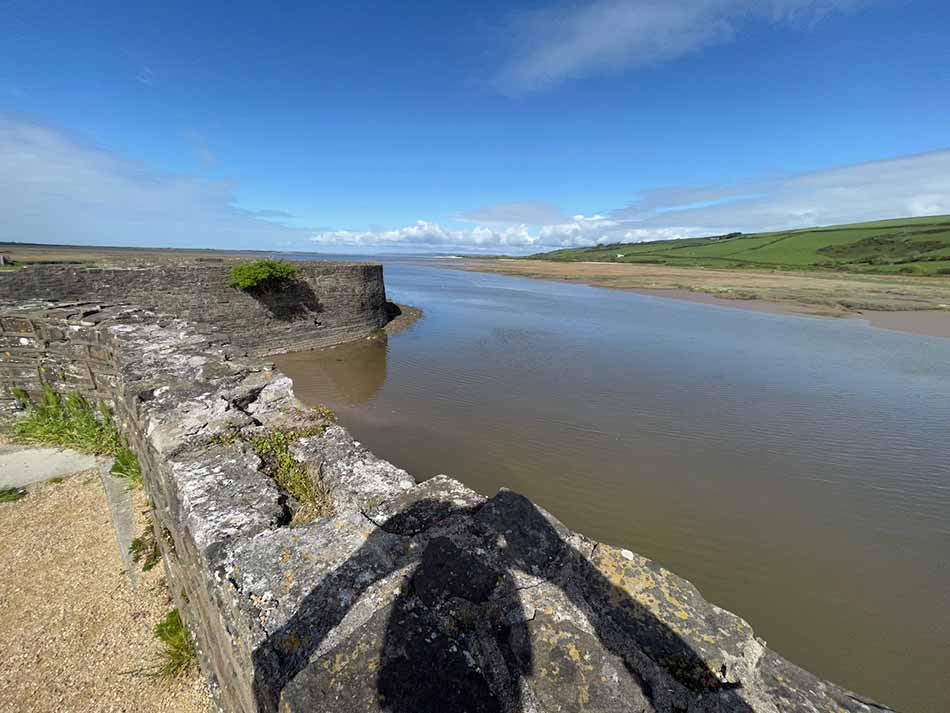
Butterflies flitted from flower to flower and things felt quite warm now that the sun was out fully and the wind had eased. I crossed a little bridge over the creek and followed the path towards Kidwelly Quay. My right calf was seizing up a little though so I stoped to try to stretch it out. It didn’t really help so on I plodded, stopping at the quay to once again stretch and take some photos.
The path then doubled back on itself, past a water treatment plant and then headed back into Kidwelly along a residential street. My calf was hurting quite a bit now so I started walking for a while. I’d covered 11 miles so far so should have been able to keep running but if I tired to it was pretty sore. I thought that maybe it was better to walk for a while so made my way through the streets of Kidwelly at a much slower pace. My pace until now had actually been pretty good averaging around 9:00 mins/mile. That came to an abrupt cliff-edge as my run became a walk. You can see it drop off at mile 11 in the chart below.

The path took me through Kidwelly over the river and then back along the far side of the river through a nature reserve. There were a number of people about now, out walking dogs or for a morning stroll. I was still walking rather than running but was at least going faster than those around me.
Kidwelly to Ferryside
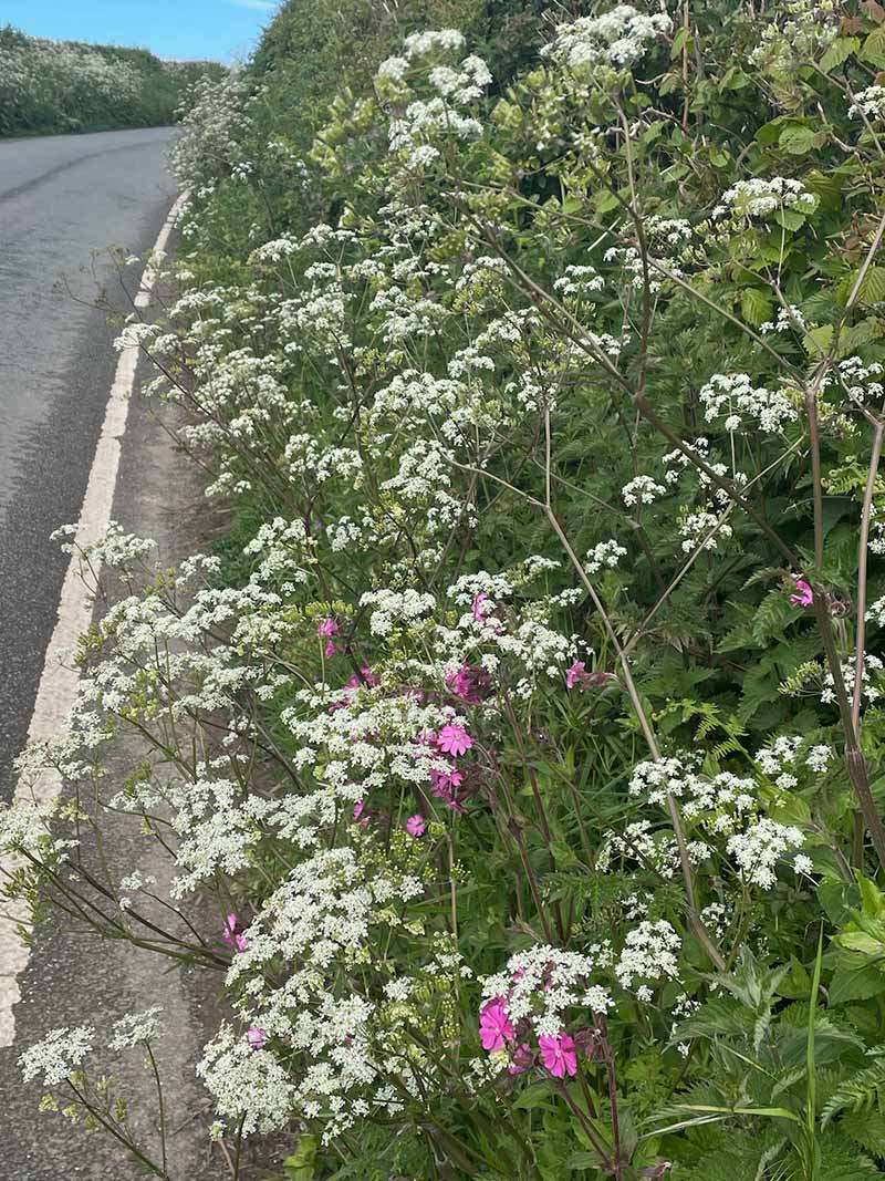
Once out of the Nature Reserve in Kidwelly the path followed a road lined with wildflowers and started to climb a hill.
I tried to run a few more times but my calf wasn’t having it so I resigned myself to walking the rest of the way. Not a bad call really as the path turned right and headed steeply up a rocky track. Up it went for quite a while until it weaved it’s way into the little village of Llansaint. The housse perched on top of the hill here had some amazing views out over the estuary and even onto the Gower and Worms head in the distance.
I started to descend past a caravan site and then into some grassy fields that were still wet from the earlier rain. The fields then became a wooded valley covered in Bluebells as I dropped down to a little stream at the bottom of it.


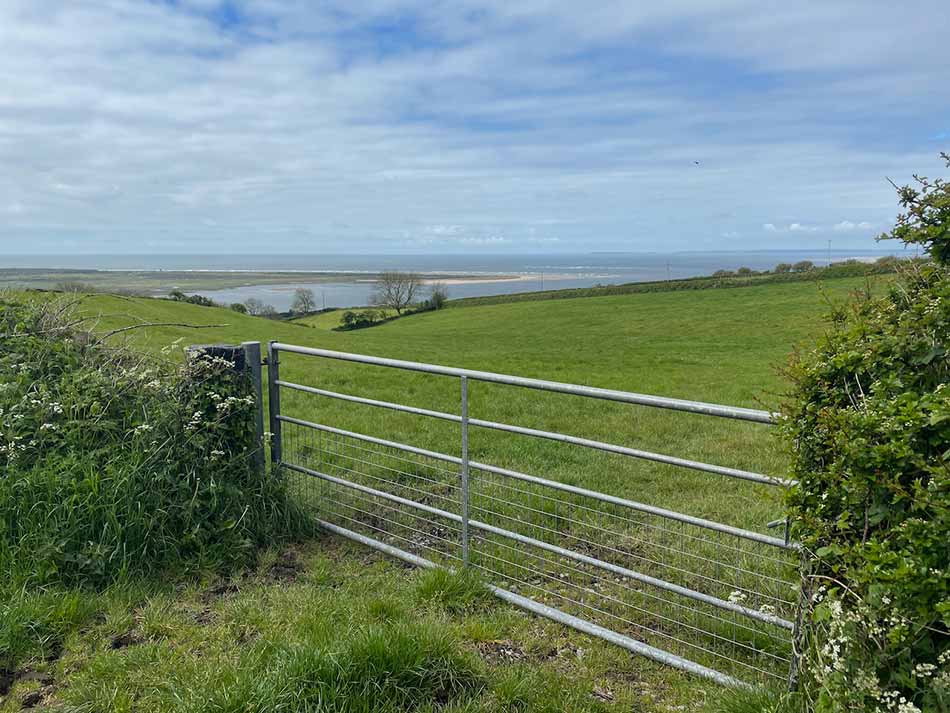
Of course, I now had another steep climb up the other side. Wooden steps led my way through the woodland and emerged once more into farmland at the top. I walked through a couple more fields of long wet grass. I went past a huge barn that was being converted into something grand. Then up onto another hill from where I could now get little glimpses of the Rover Towy and the village of Llansteffan on it’s far banks.
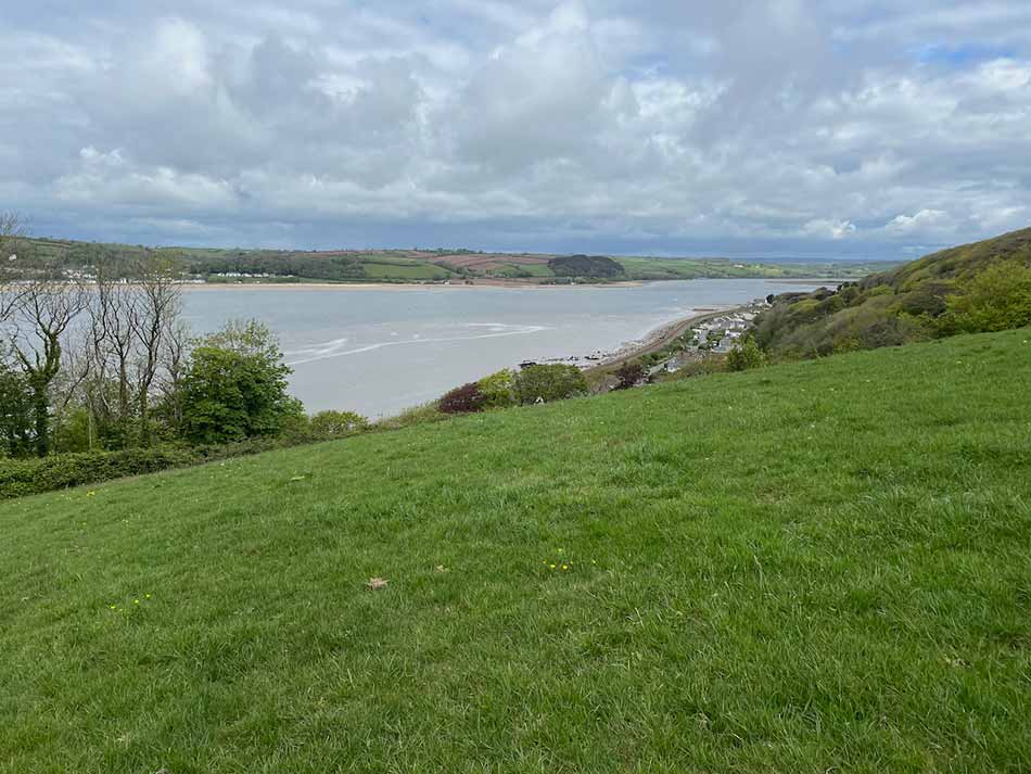
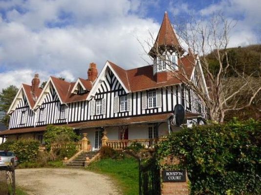
More fields of waist high wet grass took me down towards Ferryside. There was a scrubby little woodland with a choked stream to negotiate for a while and then I came out into Ferryside itself. I followed the path down to the village alongside some interesting houses and the impressive looking Royston Court.
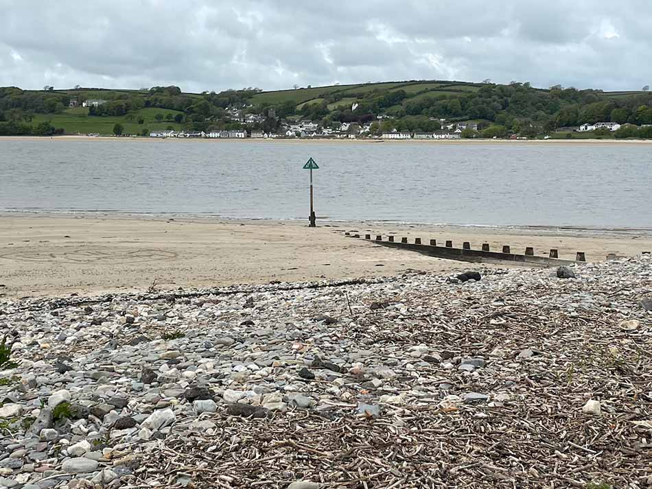
Finally I emerged out onto the riverside at Ferrsyside where I could see Llansteffan across the water. This will be my destination next time.
The second part of my run may have been a walk but the terrain would have made it much slower anyway. I had covered just over 16 miles in total today as I continue to whittle down the distance remaining. It’s now around 250 miles to go!
A quick change beside the car and I was soon on my way home. Considering the rain earlier it had tuned into a nice day.
Discover more from A Simple Life of Luxury
Subscribe to get the latest posts sent to your email.


Once again a lovely sounding run/ walk. You’ve certainly seen some lovely places ,sights and sounds along the way with photos to prove it . In your old age you’ll be able to read all about your adventure and maybe even share them with your Grandchildren x
Ps hope your leg is ok now