Wales Coast Path Run – Mostyn to the Border
Coast Path Vital Stats
Mostyn to The Border
- Distance: 21.78 miles
- Elevation Gain Today: 117m
- Highest Elevation: 62m
- Time: 3:31:27
- Av. Pace: 9:43 mins/mile
- Av. Heart Rate: 127bpm
- Max Heart Rate: 145bpm
- Calories: 1820
Totals to Date
- Total Distance: 445.81miles
- Total Time: 83:31:20
- Total Elevation Gain: 11009
- Total Calories: 41626
- Distance to go: 453 miles
Another day on my Coast Path Run project, and what could be a fairly significant one. Not only was it another 20 miles or so ticked off, but it was the final 20 miles of the path, taking me to the northern end of the Wales-England Border. I wasn’t sure if I would finish it on Monday as I haven’t been doing much running lately and 20 miles is quite a long run.
On one hand I was hoping I would be able to make it to the border. On the other I had promised myself to take note of how my legs and feet were feeling and be prepared to stop short of the border if they were hurting too much. I’m susceptible to shin splints, especially if I ramp up the running distance or frequency too much. I’m also quite prone to achilles and foot injuries. I certainly didn’t want to stop a few miles short of the border, but that would be preferable to an injury that would prevent me from continuing with the rest of the Wales circumnavigation.
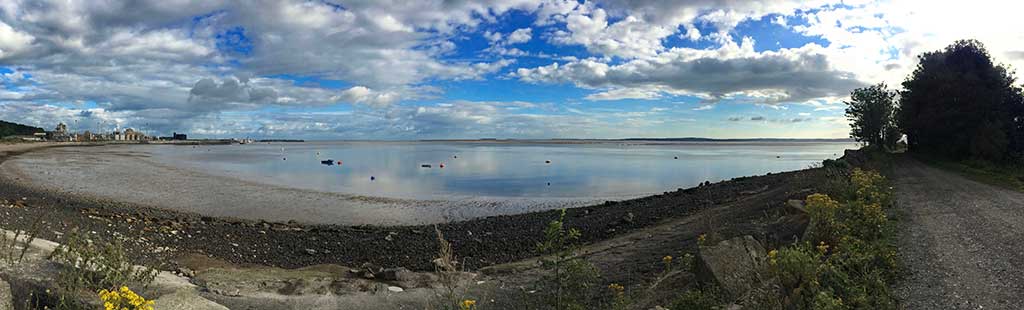
My starting point this week was Mostyn, a dreary looking town overlooking the Dee estuary. I had identified a place to park right where I had stopped last week. It was in the car park of a dilapidated hotel right on the main road through Mostyn. Free, easy parking and right next to the bus stop to which I would return later. My target was of course the Wales – England border but there was a good bus service running virtually alongside the coast path all the way so I could stop at any point and return to the car.
I couldn’t start as early as I would have liked as there wasn’t enough petrol in the car so I had to wait until 6am when the petrol station would be open. I then drove along the quiet roads of North Wales through pouring rain to arrive in Mostyn at around 8:30am. I wasn’t liking the look of the weather but there was little I could do about that. The day before had been wet, windy and chilly as well so I had packed more layers than I usually would. I was wearing my usual running shorts and top. In my backpack I had plenty of energy bars and gels, water, two maps to cover the area, a thin jacket, a long-sleeved merino wool top and a buff. I was ready for the rain but not looking forward to it. I also carry my phone which doubles as my camera, some money, my keys and have a survival blanket at the bottom of the bag just in case.
Thankfully, as I pulled up in Mostyn the rained actually stopped so my extra layers stayed in the bag as I re-joined the Coast Path.
Mostyn to Flint
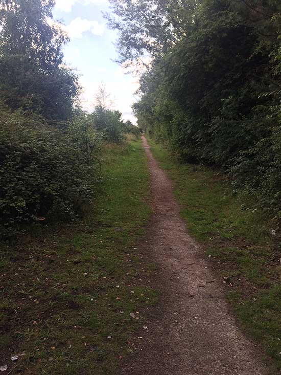
I wasn’t really sure what to expect of this bit of coastline as it hugs the southern edge of the River Dee. Last weeks section from Rhyl to Mostyn (and the section before that) had been fairly hard going with miles and miles of endless flat grey concrete followed by miles of soft sand. I had my more cushioned and heavier road running shoes on again today rather than my trail running shoes as I was expecting more of the same. However, after a few hundred yards the Coast Path signs took me off the main road and across a railway bridge.
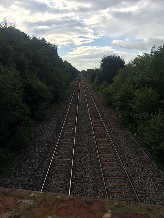
Over the Railway Bridge
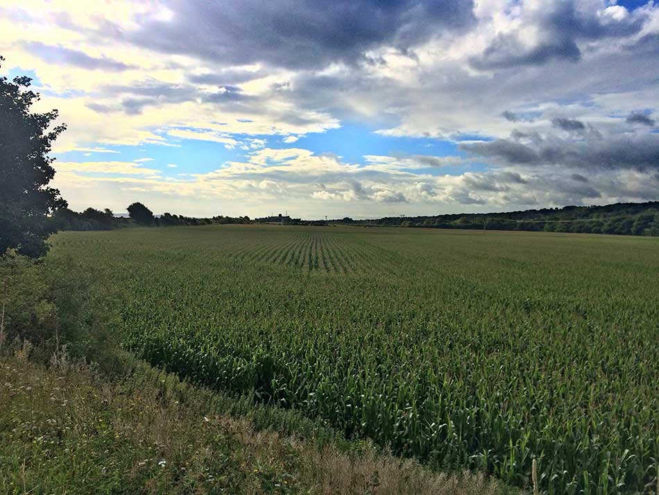
The Railway line would be a constant companion for most of this run. The path led down into a small woodland with muddy tracks and out onto the coastline. There were some lovely views out over the bay and to my right over fields of sweetcorn. Although the wind was quite strong it was blowing offshore here and the little bay with its boats and buoys looked quite tranquil. The noise, hustle and bustle of the main road was soon forgotten and the sun had come out too. This was at last a little nicer and more peaceful.
-

- Boats and Buoys
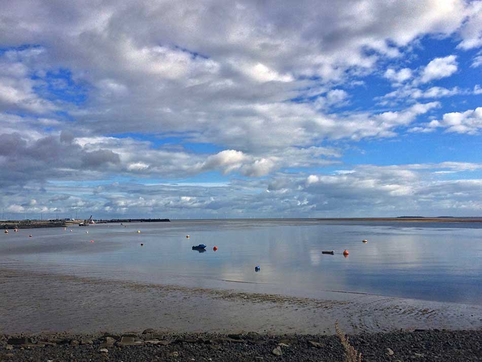
-
- Sweetcorn
-
- Tranquil Bay
The path was a pot-holed, gravelly affair. Not exactly a soft surface but a change from tarmac and concrete even if it did mean I had to watch my footing on the uneven surface. The path hugged the coast with the sandbanks of the River Dee estuary to my left. The path was defended by a sea wall and a pile of boulders along it’s length and to my right were fields and the railway line then road beyond that. I won’t mention the small sewage works that I passed.
The Duke of Lancaster
Soon the huge hulk of a ship came into view. “The TSS Duke of Lancaster”, a former Sealink passenger ferry, started to dominate the view with its rusting funnel and row of 5 lifeboats atop a huge black body. The Duke of Lancaster operated in Europe from 1956 to 1979. Along with her sister ships the TSS Duke of Rothesay and the TSS Duke of Argyll she was amongst the last passenger-only steamers built for British Railways (at that time, also a ferry operator).
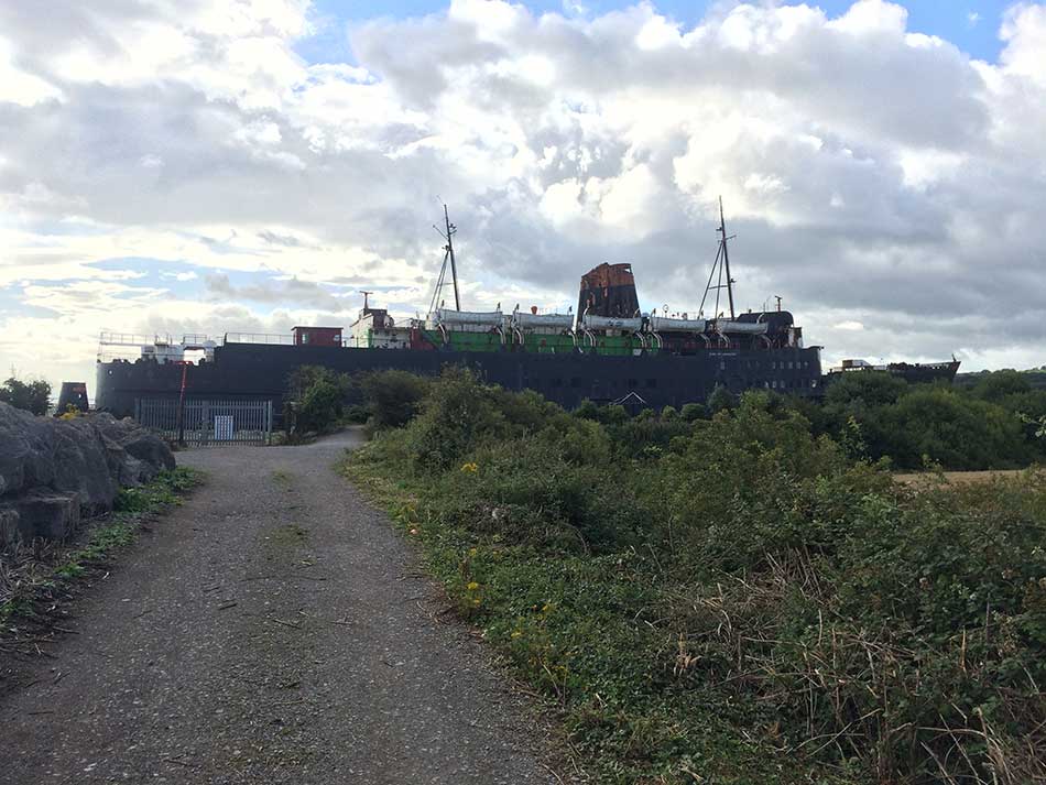
The Duke of Lancaster
On August 10th, 1979, “The Duke of Lancaster” was beached at Llanerch-y-Mor in North Wales with the intention of turning it into a floating leisure and retail complex called ‘The Fun Ship’. The project never saw the light of day due to many long running legal disputes with the local council. The continuing disputes were probably the death knell for the Fun Ship with her owners sick of the attacks they closed the business in 2004. They have continued to fight the case over the years and are still doing so but unfortunately the ship has stood closed ever since.
I had seen photos of it covered in graffiti. Graffiti artists had been commissioned to cover it with “bright and surreal” artworks. The first phase of the project saw ‘Kiwie’ and other European graffiti artists paint murals on the ship between August and November 2012 and the second phase in 2013 included the work of British-based artists such as Snub23, Spacehop, Dan Kitchener and Dale Grimshaw. I couldn’t see any of this as I approached the ship, maybe it was on the other side.
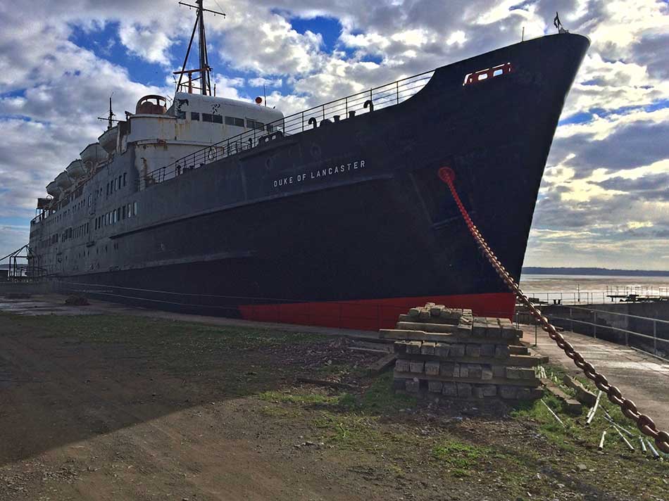
Duke of Lancaster
There is no public access to the ship and it was surrounded by high fences and barbed wire overgrown with brambles and buddleia. There were a few gaps for some photos but no sign of the graffiti anywhere. It still looked fairly majestic sat here all on it’s own on the River Dee. I wonder what will become of it now?
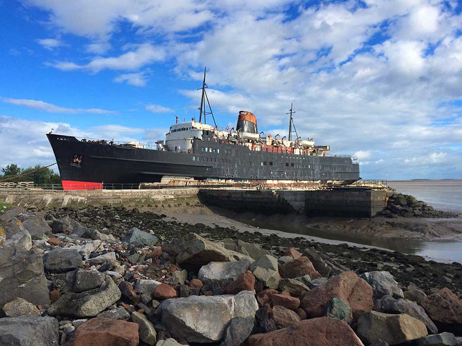
Duke of Lancaster
As I left the ship behind me the path became a raised grassy embankment alongside fields. At last, proper soft ground beneath my feet, a few bits of mud and time to concentrate on where I was putting my feet.
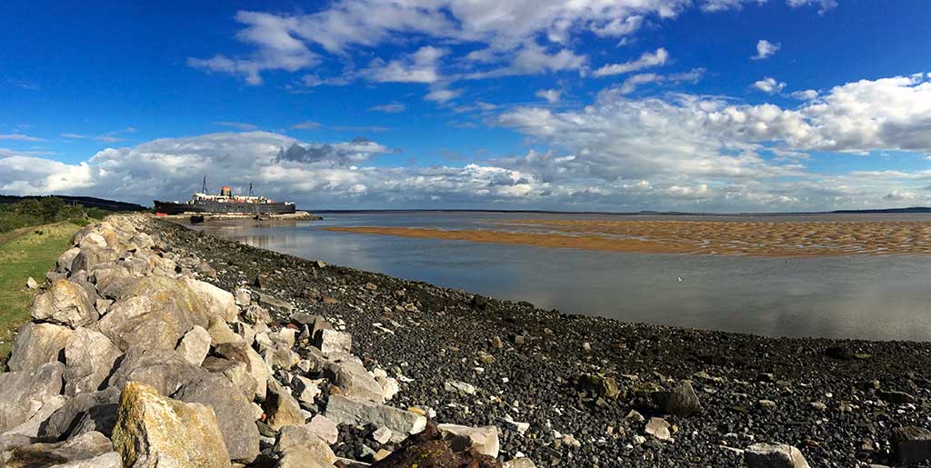
Ships and Sandbanks
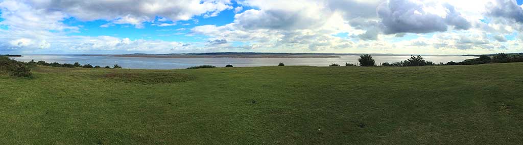
There were a number of stiles and gates to negotiate and every so often a train would whizz by on the railway line beyond the fields. It was now a lovely day with a stiff breeze keeping me cool and plenty of sunshine lighting up the ripples on the extensive River Dee sandbanks.
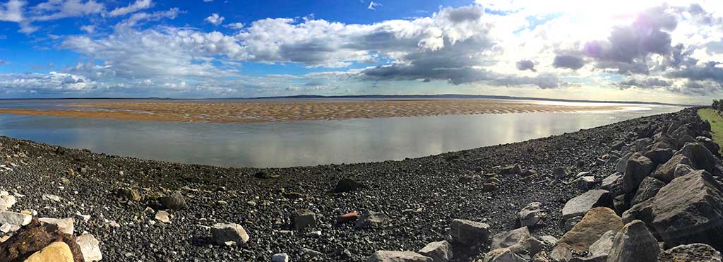
Dee Estuary Sandbanks
There was surprisingly little in the way of wildlife about though. The occasional gull here and there and one or two Grey Herons but that was about it. No sign of fish in the river, no butterflies on the buddleia and no rabbits on the grass. I wonder where it all was?
I was feeling OK, although my shins were a little sore. They had been before I started so I was being hyper-aware of them but I hoped they would ease up as I continued my run. I was taking things easy and going at a steady pace. What with stops for photos and all of the stiles to negotiate it was never going to be fast but I was making good progress and good time.
Eventually I ran past a few cows grazing in a thistle strewn field and emerged out onto tarmac again as I negotiated the small dock at Greenfield. There were a number of people coming and going here and the path once again became a little more defined. There were now business parks and industry to my right. There was also plenty of dog walkers and their dogs to keep me on my toes. The associated hazards of dogs made me pay particular attention to where I was putting my feet on certain stretches too. There were occasional noticeboards about the River Dee and industrial looking sculptures here and there such as this fish inspired beacon.
Beacon
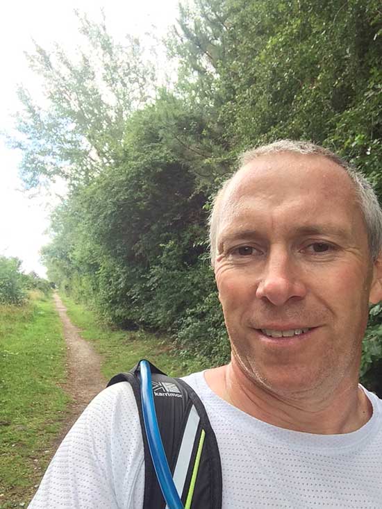
I decided to force myself to stop briefly for a bite of an energy bar and a drink every 4 miles so I did so along this stretch of Coast Path. The path was now a narrow muddy strip with hawthorn and birch either side of it. I was at least out of the wind. The stop was the perfect opportunity for a coast path selfie too.
-
- Dog Walking Paths
-
- Coast Path Selfie
On I went with the ever narrowing estuary to my left. Out across areas of marsh with little raised boardwalks, up through small areas of scrubby woodland. Now and then the path headed inland a little to the railway line where I was able to cross little streams and outlets. At one point I had to duck under a low railway bridge as I avoided the muddy puddles below my feet and the concrete bridge structure above my head.
Bagillt Beacon
In Bagillt the path took a detour up a small hill to the Bagillt Beacon. This was inspired as part of a series of beacons along the Flintshire Coast, an idea that was conceived as part of the Wales Coast Path Vision. The noticeboard next to the beacon reveals the full story.
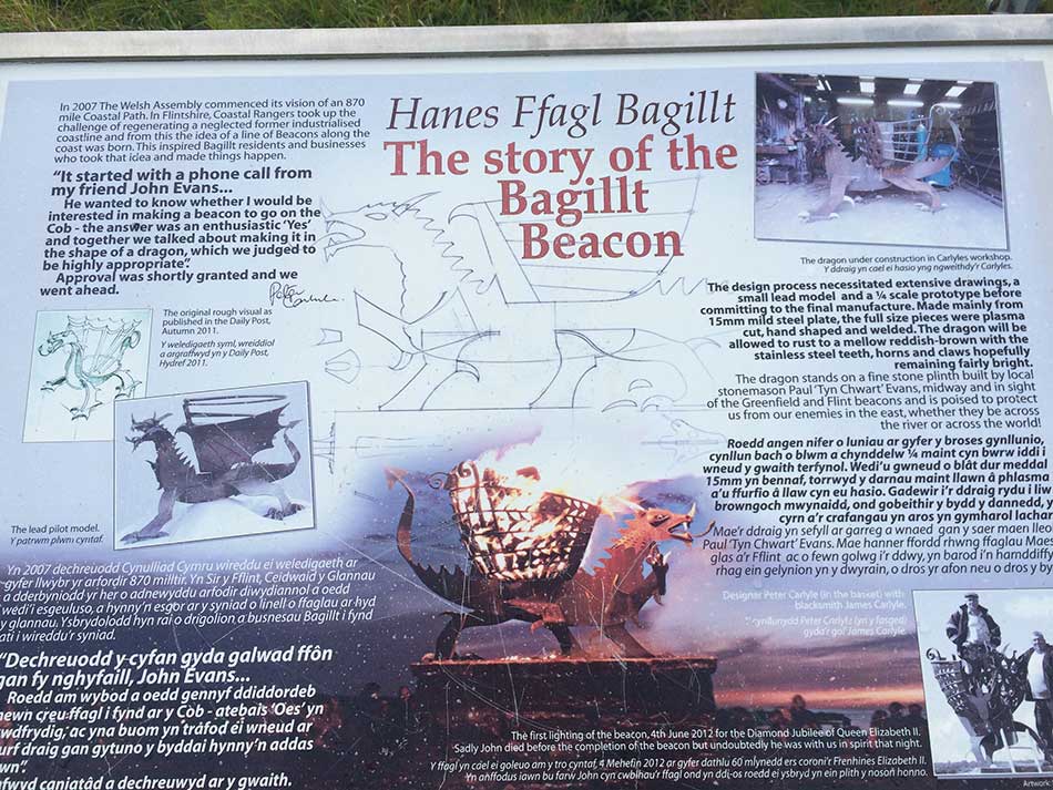
Notice-Board
Made from steel, the dragon has rusted to a reddish brown colour and stands atop of stone plinth.
Bagillt Beacon
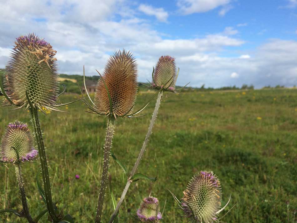
The path descended through a thistle-strewn field and continued ever onwards along the banks of the River Dee.
-
- View from the Beacon
-
- Thistles
Eventually I approached Flint. The path once again became better maintained as it looped around Flint Marsh and out to the headland. It then headed inland along a wide, muddy river outlet and back down the other side.
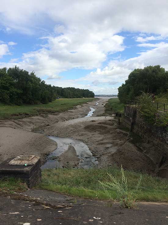
Outlet
I was now running alongside a wire fence separating me from an industrial estate. A group of women were sat outside a factory building having a coffee break as I headed into the scrubby woods around the estate. Smells of epoxy emanated from the buildings but in amongst the trees it was fairly quiet and pleasant.
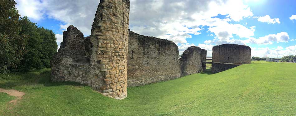
Flint Castle
I emerged from the trees to the sight of Flint Castle.
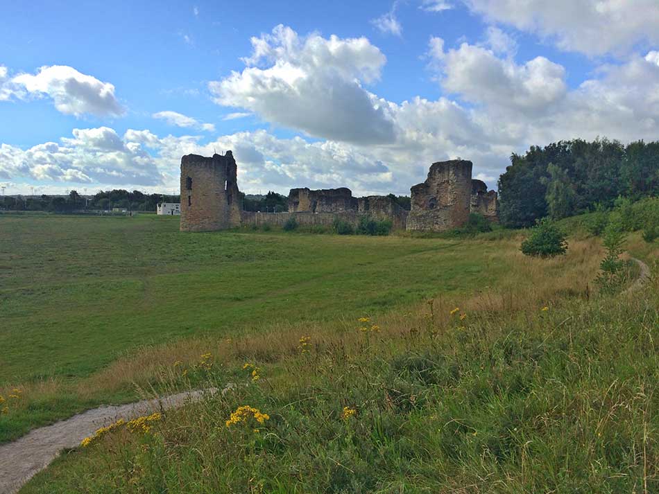
Flint Castle
Begun in 1277, it was one of the first castles to be built in Wales by King Edward I. It’s ruins are now managed by CADW. The coast path looped around the castle, through the edge of Flint and then back out onto the coast. In the distance were the towers and buildings of modern industry that would rival the size of those of Flint Castle.
Industry on the Horizon
The Castle itself was bathed in sunlight.
Flint Castle
Flint to The Border
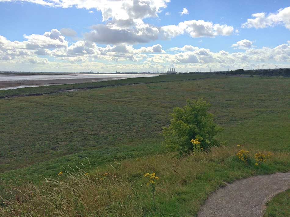
After a short stretch back on the edge of the muddy coast the path headed out onto the main road. The peace of the coast was shattered by thundering lorries, speeding cars and the hustle and bustle of modern life. There was little to note along here as I followed the main road which became a dual carriageway in places, getting ever closer to the huge towers of the power station. Soon I headed under a large road bridge and around a roundabout with the Power Station looming over me. There were pylons heading off in all directions and the towering structure of a massive bridge spanning the River Dee.
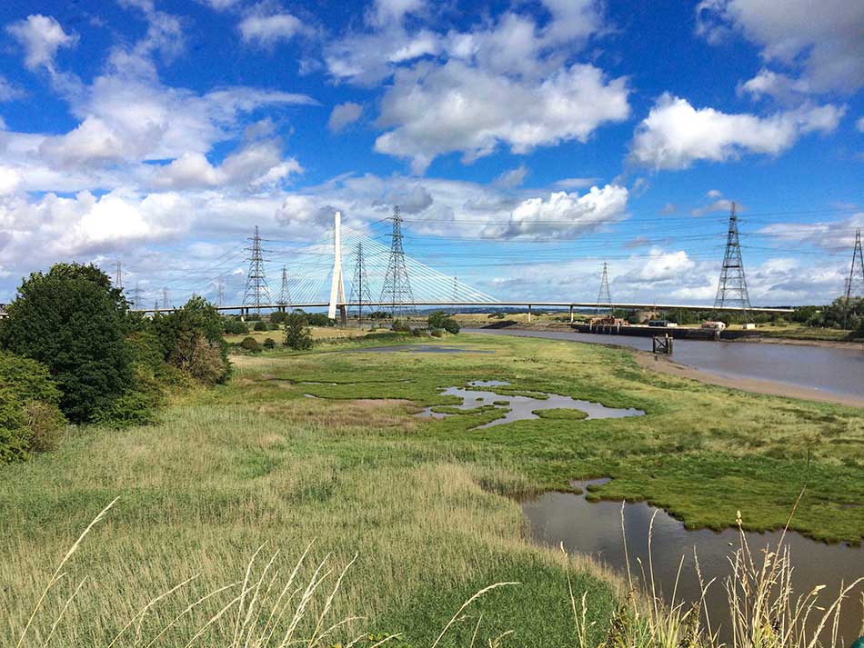
Bridges and Pylons
I headed off into Connah’s Quay for a long straight run through the town, passing various colleges and schools and then more commercial areas of town. After a couple of miles the path turned left and crossed the railway line once again. I went through some residential areas, through a small industrial site, along a narrow path overgrown with brambles between high fences and then out onto the quay itself. The river was now much narrower and solitary boats were hauled up onto the muddy grassy banks.
I passed landing stages and other neglected river-side structures. Ahead of me was a railway bridge with its steel spans painted greenish-grey.
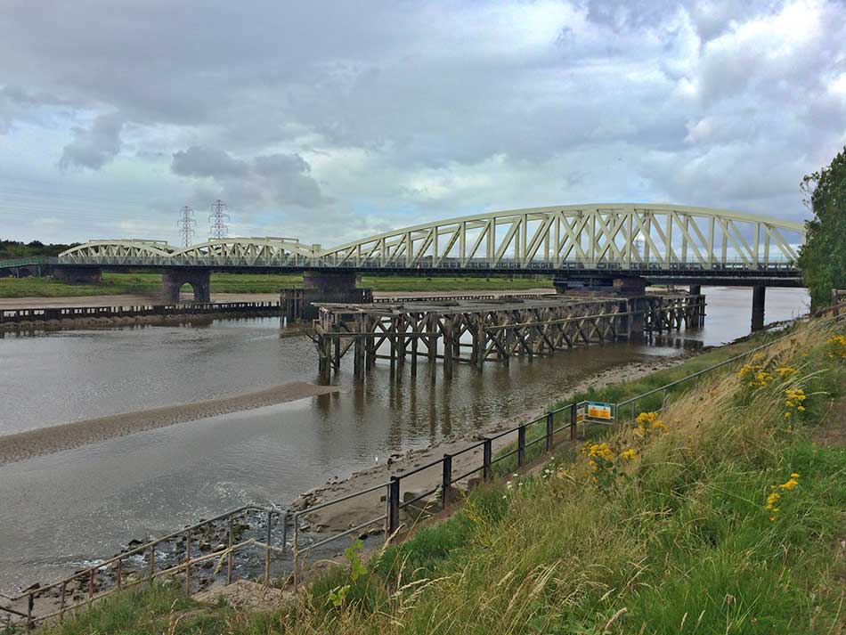
Crossing the River Dee
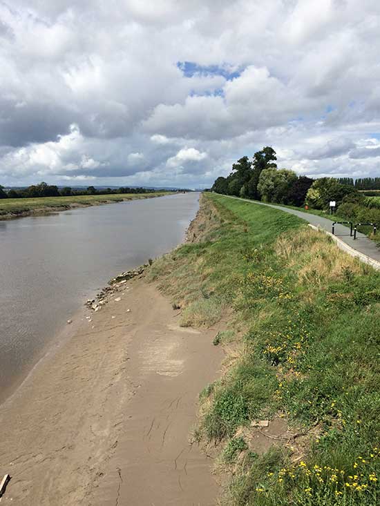
The map showed the Coast path continuing along the southern banks of the River Dee here and then crossing it at the next set of bridges. The signs directed me across the footbridge alongside the railway bridge so I followed the signs. It didn’t really make much difference as the river was now much narrower and the path followed it’s banks on either side. Ahead of me was a dead straight, dead flat ribbon of tarmac. Nothing but the river to my right, tarmac beneath my feet and huge open fields edged by trees to my left. I could just make out what looked like a bridge miles off in the distance.
On I went, with the bridge in the distance seeming to stay just out of proper sight. I had now ran around 15 miles and still had 5 to go. Five miles of this unrelenting dead straight path alongside an unchanging river. There were at least a few lapwing here and there to add some excitement. I did also soon notice tiny little coast path signs embedded in the tarmac every now and then. At first I thought they were distance markers so started taking note of how often I saw them. They weren’t consistently spaced though. I think they were actually located where other small paths may have once joined the coast path.
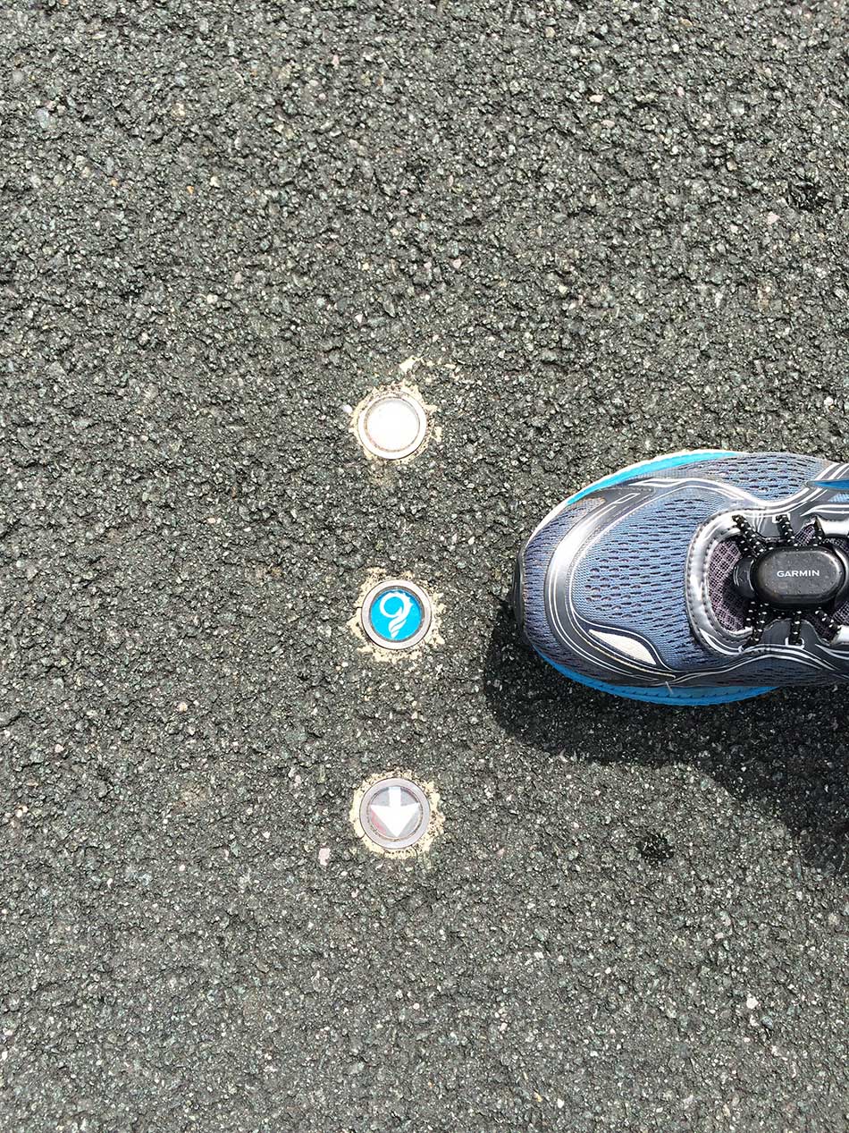
Tiny Signs in the Road
Eventually I came to the foot-bridge that had seemingly stayed forever on the horizon. A brief break from the dead straight monotony that hadn’t helped my tiring legs. I looked back as I negotiated the bridge and could just see the power station miles behind me.
Path Along the Dee
There was also a sign showing the distances of the Coast Path, not far to go.
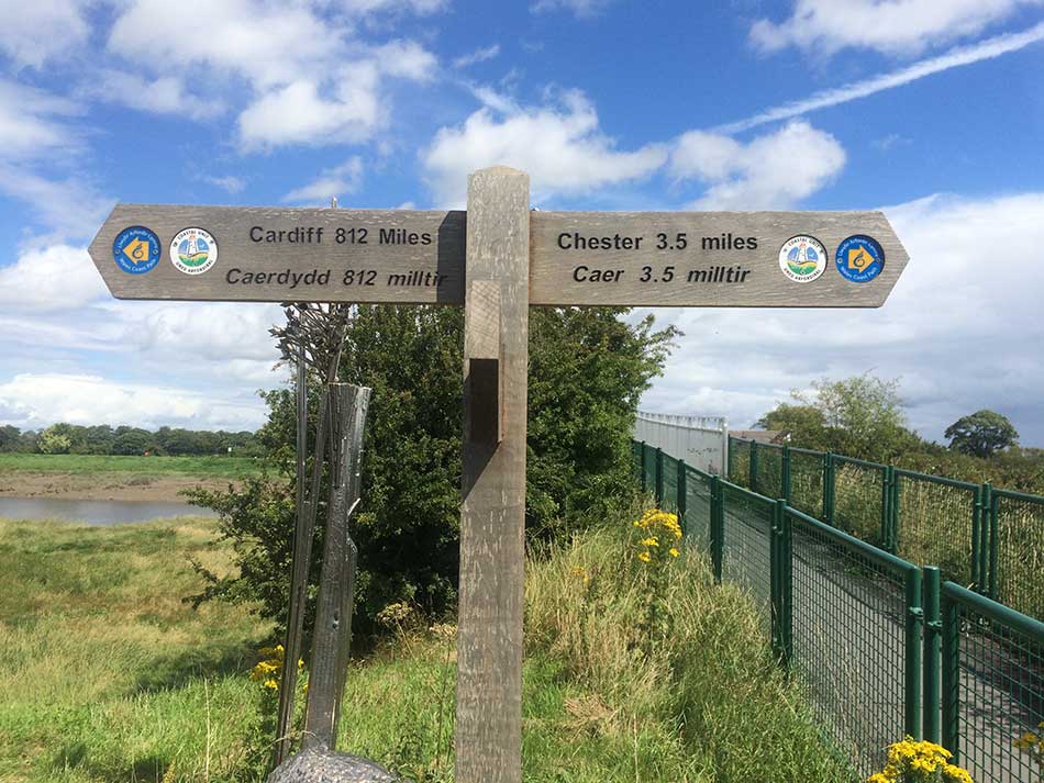
Nearly There
Ahead I still had a couple of miles of riverside tarmac. There were at least a few people here, riding bikes and walking dogs along the path. There were also signs of the outskirts of Chester on the opposite side of the river as I passed industrial buildings and an out of town shopping centre that backed onto the river.
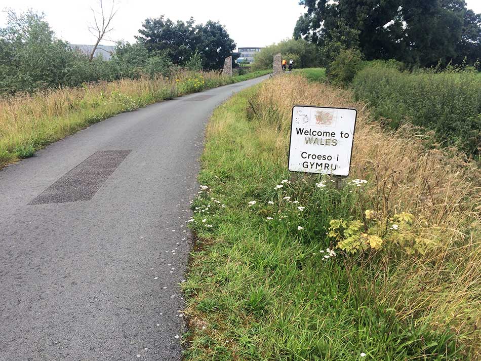
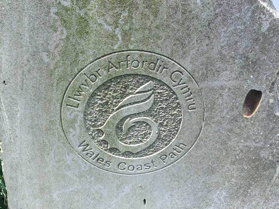
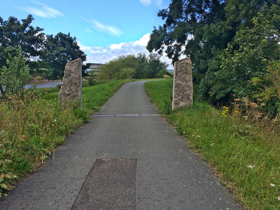
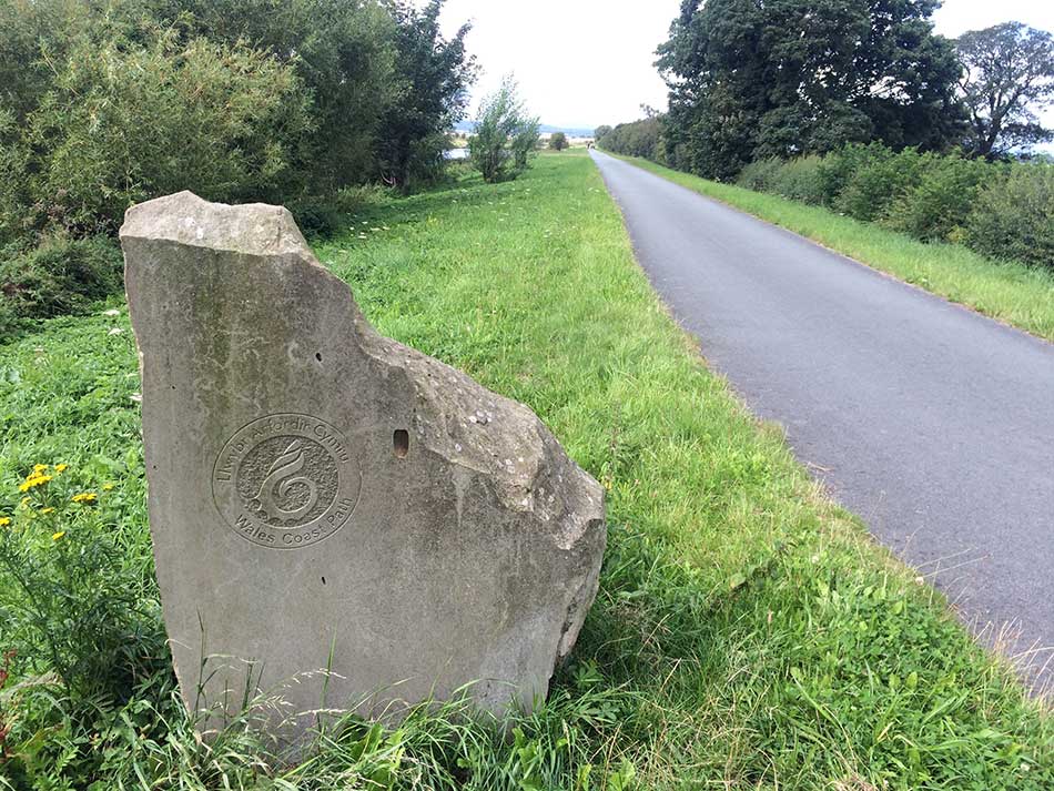
Finally, after 20 miles of running I reached the Wales England Border and the start / finish of the Wales Coast Path. There wasn’t really much here to mark the momentous occasion. Two limestones marker stones on the border itself, a Stone with the Coast Path sign carved into it on the Welsh side of the border and a tatty looking ‘Welcome to Wales’ sign on the English side of the border. That was it.
-
- Welcome to Wales
-
- Wales Coast Path
-
- The Wales England Border
-
- Marker Stone
I went a little further ‘just in case’ and then turned around to head back to the footbridge a mile or so back down the river. Here I crossed the river and headed into Saltney where I could catch the bus back.
Offa’s Dyke
Thoughts were already on the next stage of my adventure and there was a sign at the edge of the footbridge to remind me of this.
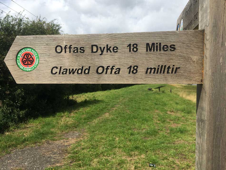
Offa’s Dyke Here I come
I’d now completed all of the Northern section of the Wales Coast Path. Having started in Llanrhystud in the middle of Cardigan Bay I had now ran 445.81 miles of the Wales Coast Path. Along the coast of Cardigan Bay, inland around the Dovey Estuary, across the Mawddach estuary and north onto the Lleyn Peninsula. All the way around the rocky coasts of the Lleyn and then along the southern edge of the Menai Straits. Across the Straits onto Anglesey and all the way around the coast of Anglesey. Back onto the mainland and then along the North Wales Coast to the border. Next the plan is to run along the Offa’s Dyke Path, following the Wales-England border all the way to South Wales. Once in South Wales I will once again join the Coast Path and run all along South Wales, around the Gower, around Pembrokeshire and finally complete the circuit in Llanrhystud in the middle of Cardigan Bay. There’s still a long way to go!
Today’s run including the run to the bus stop had been 21.78 miles and my legs felt fine. A little tired of course but no pain.
Here’s a Relive video of the journey.
The bus journey back to the car was fairly uneventful and I was soon on my way home with a stop at Morrisons in Denbigh for some food and drink to keep me going.
Discover more from A Simple Life of Luxury
Subscribe to get the latest posts sent to your email.