Wales Coast Path Run – Cardiff to Rhoose
Coast Path Vital Stats
Cardiff to Rhoose
- Distance: 20.46 miles
- Elevation Gain Today: 405m
- Highest Elevation: 75m
- Time: 3:21:26
- Av. Pace: 9:51 mins/mile
- Calories: 1641
Totals to Date
- Total Distance: 699 miles
- Total Time: 129:40:42
- Total Elevation Gain: 20991
- Total Calories: 63717
- Distance to go: 391 miles
What a day for a Coast Path run. I’ like to say that it was unseasonably Spring-like, but it was actually more like summer. Clear blue skies, a light breeze and temperatures over 18ºC. It certainly didn’t feel or look like a winters day in February.
Today’s plan was to run from Cardiff to Rhoose. So, I was up early (3:30am) so that I could leave the house before 5am and get to Rhoose ready for the 8am train to Cardiff Central. That all went without a hitch and I was soon in the centre of Cardiff and ready to run.
It was already warming up from the 3ºC when I left the house so it was time to take my jacket off and head out into the chill of the morning.
Running Through Cardiff
The first mile or so had me weaving through the wide streets of Cardiff where commuters were busy heading off to work. It was busy in places, but not overly so as I made my way from the railway station towards the Coast Path. I crossed the fountains in Callaghan Square and then picked up the Coast Path where I left it last time, just past Bute Street. Here it took me towards Cardiff Bay.
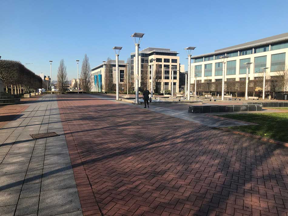
I headed along a long straight road through the city and then out into Roald Dahl Plaza where the impressive Wales Millenium Centre building gleamed in the morning sunlight.


I ran at a nice steady pace through the streets and plaza’s of Cardiff. Cardiff Bay was ahead of me as I dropped down onto the wharf with the iconic Pierhead building behind me.
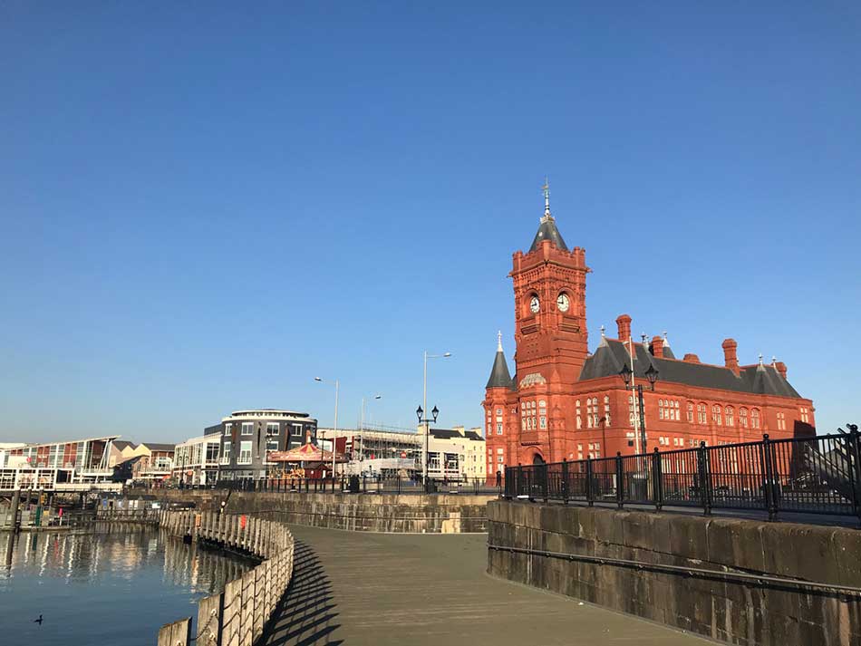
The waters of Cardiff Bay were calm and there wasn’t a cloud in the sky as I ran around it’s Eastern Edge. Along Harbour Drive where there where Coast Path signs in the pavement and then out onto the main causeway. From here I could look back across the waters to the Cardiff Skyline.


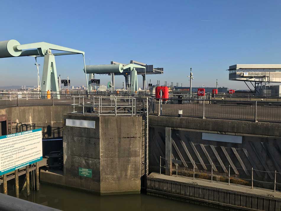
I crossed the causeway along with lots of other joggers and cyclists and then crossed the main barrage too. Ahead of me lay a steep hill up towards Penarth Head.
Penarth
I climbed through the streets of Penarth as the temperature was rising too. I passed Saint Augustines Church and then headed back down the other side towards Penarth Seafront. I soon emerged to views of Penarth Pier and then was back down at sea-level for a run along Penarth Prom.


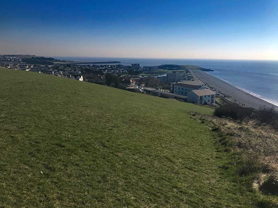
It was fairly easy going along here as the sun sparkled on the waters of Penarth Bay as it lapped gently against the shore. All was quiet in Penarth as I made my way to the far end and then up onto the low cliffs at Cosmeston. I was able to run on the grass alongside the path here which was a welcome break from pounding the pavements as I had done so far.
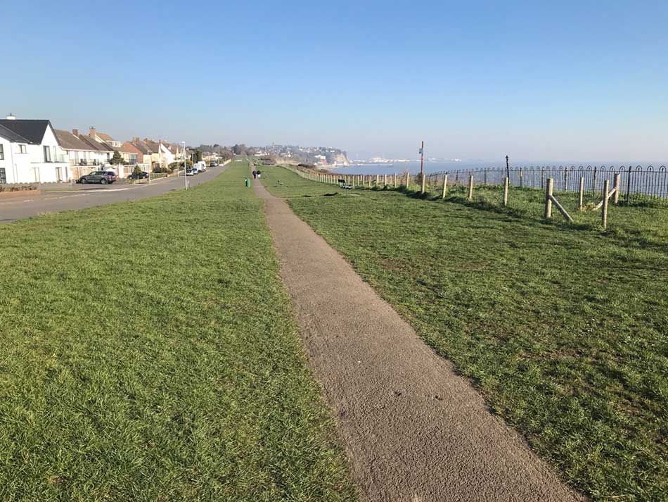
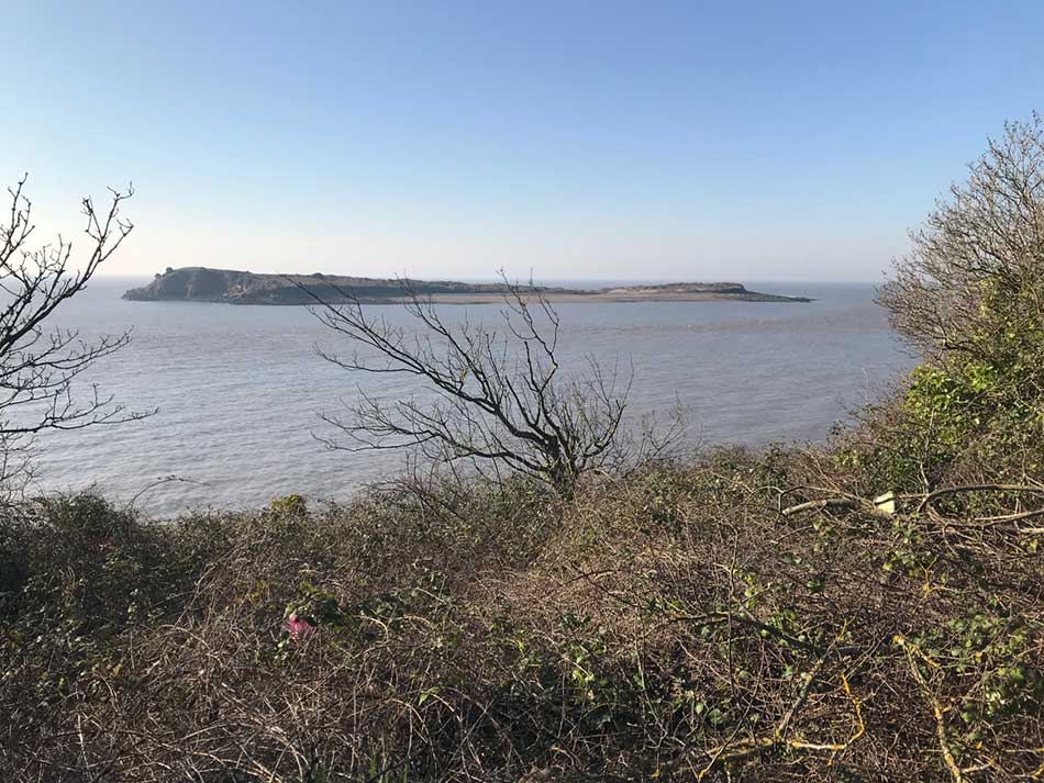
Eventually I left the urban areas of Cosmeston, Penarth and Cardiff behind me and headed out onto paths along the clifftops. Here and there I could see views back along the coast and out onto the shimmering waters of the Severn Estuary. Despite the glorious weather it was still a little hazy so I couldn’t see out across to England, nor could I see the islands of Flat Holm and Steep Holm. Although in amongst the trees there wasn’t many vantage points anyway.
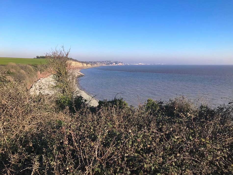
I soon rounded Lavernock Point and continued on my way.

Lavernock Point Lavernock Point Selfie
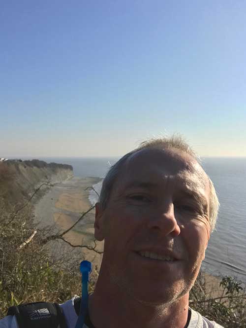
From Lavernock Point I had views over Ball Bay and to Sully Island beyond. I’d never been here before and was surprised at how nice the coastline was. Trees lined the edges of the beaches and rocky points jutted out into the sea.
Swanbridge and Sully Bay
After Lavernock Point I headed inland a little to circumnavigate a Holiday Village and then dropped down towards Swanbridge from where I had views out to Sully Island. The tidal currents ripped between the island and the mainland.
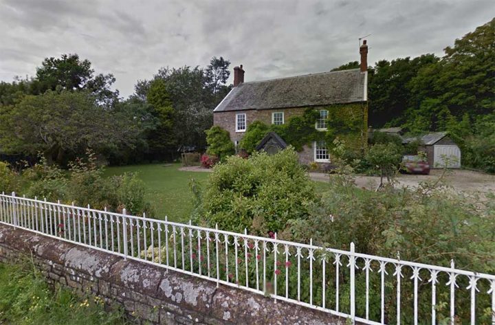
Swanbridge itself was a picture perfect village in this weather. The first house I came to looked idyllic. It was right on the waters edge with views out to Sully Island. I think it may have been a little out of my price range though, as were the cars on the drive!
As I ran through Swanbridge, there was a motorcyclist who had stopped on the shore to fly his drone. I ran past the Fisherman’s Wife pub and then onto a pebbly path besides bungalows that backed right onto the beach. Each had perfectly manicured lawns and Spring flowers in the gardens. The Cordylines alongside the path here gave the place a tropical air.


The path took me all along the bay, past a sailing club, alongside playing fields and then out onto more wooded paths and finally to Ty Hafan Children’s Hospice. Here the path turned right and headed inland.
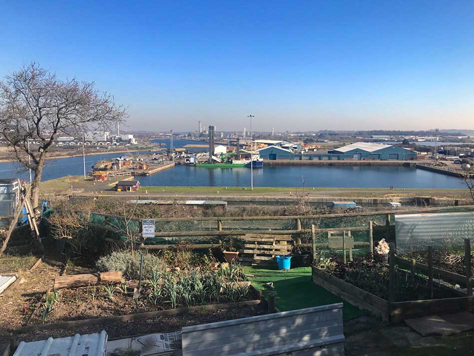
Towards Barry
I soon found myself on a busy ‘A’ road that doubled back on myself for a while. I was then running alongside the road for a few miles. Crossing busy junctions and roundabouts and then around large industrial areas where huge chimneys dominated the skyline. Eventually I started climbing slightly along a long straight road lined with ornate street lighting. The main railway line that I had travelled along earlier was to my right, the busy road into Barry on my left.
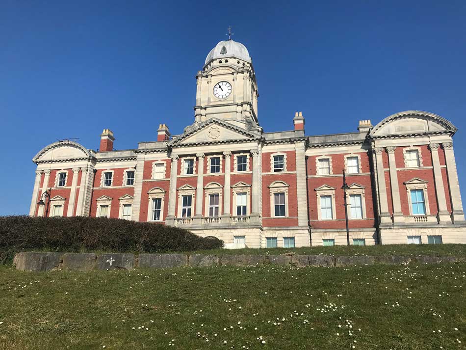
As I entered Barry I passed the impressive Barry Council Building and then dropped down towards the docks.
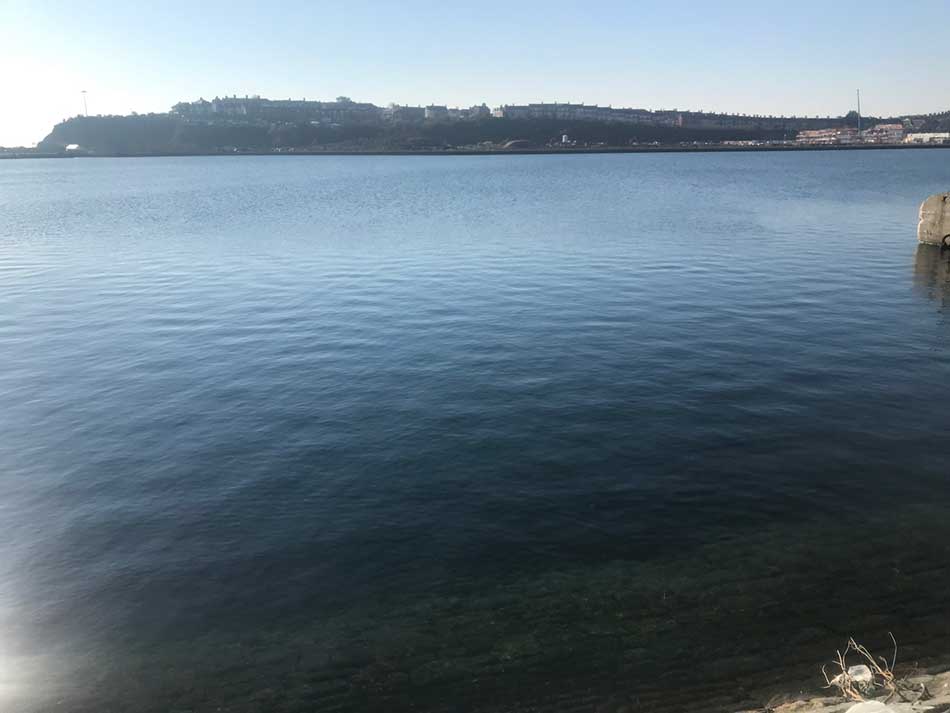
From the dockside I could look out across the waters to Barry Island. I’d be running along here soon.
There were lots of people on the dockside, walking dogs and feeding the birds. I was soon into the streets of Barry where house building seemed to be running amok with new developments everywhere. These were accompanied by large supermarkets too. After a while the route turned left and started heading up onto Barry Island itself.
Barry Island
The Coast Path takes you on a circuitous route here all the way around Barry Island for a few miles, only to end up back a few hundred yards from where you started. It’s worth it though as missing Barry Island would be a shame.
First I had views out over Barry Docks from a road alongside some well kept allotments as I climbed to the top of the island. Barry Island isn’t actually an island these days, but it was up until the 1880s when it was linked to the mainland as the town of Barry expanded.
The path then skirts around the edge of Barry Island, past the breakwater and the Lifeboat Station and along the top of Jackson’s Bay before heading out to the point where the National Coastwatch Institution looks out over the sea.


The Coast Path then rounded the headland and Whitmore Bay opened out in front of me. The big wheel of the Barry Island Pleasure Beach could be seen, multi-coloured beach huts lined the shore and the sweep of golden sand was packed with holiday-makers. Barry Island is jokingly known as Barry-bados but today it certainly looked like a scene from a summer beach rather than a winters day in February.
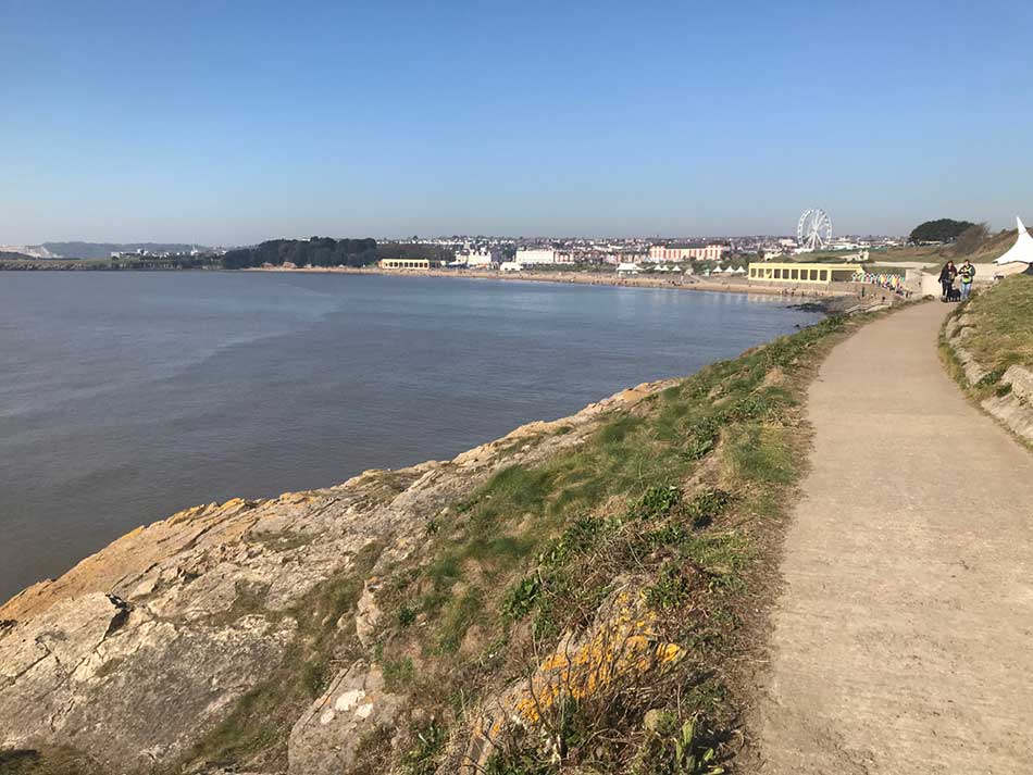
I usually prefer quiet, secluded bays or wide open expanses of wind-lashed coast, but I must admit that the fun, sun and resort-like excitement of Barry Island was pleasant enough today. There were people everywhere. Playing ball on the beach, building sand-castles, paddling in the waters, playing crazy golf, walking dogs, riding bikes and skateboards and of course eating ice creams, fish and chips and drinking coffee. The place was alive and everyone was loving it.


I decided that I would just have to stop for five minutes and treat myself to a Coast Path Cornetto!
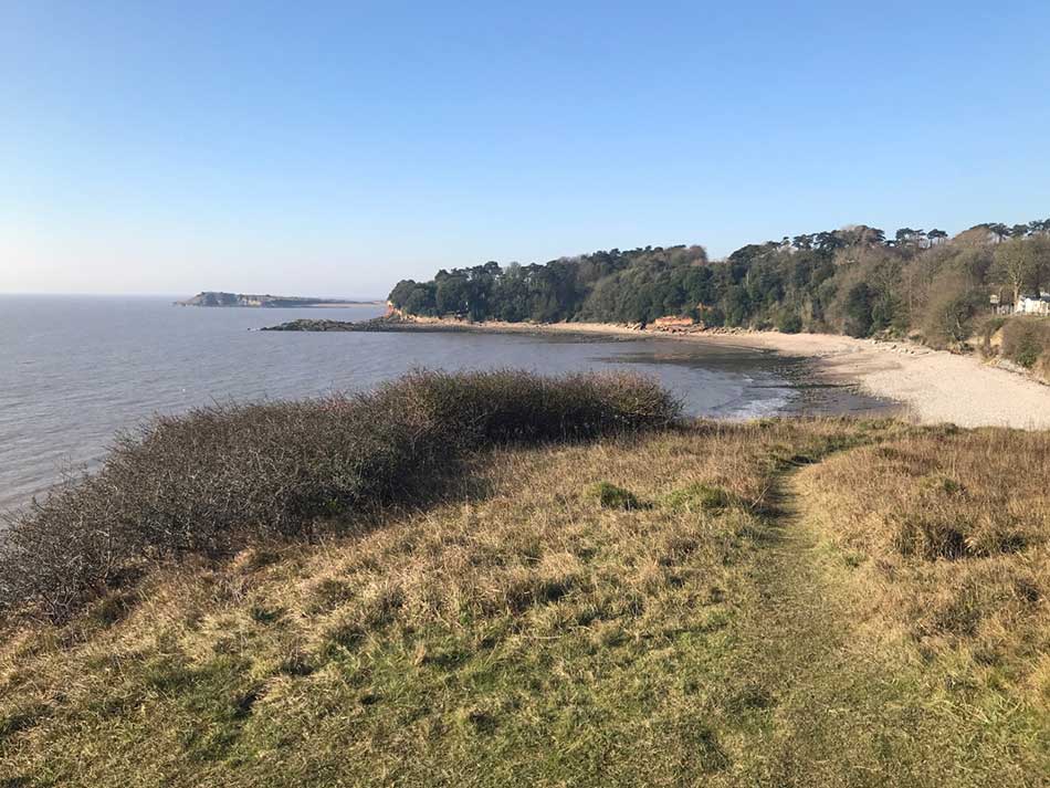
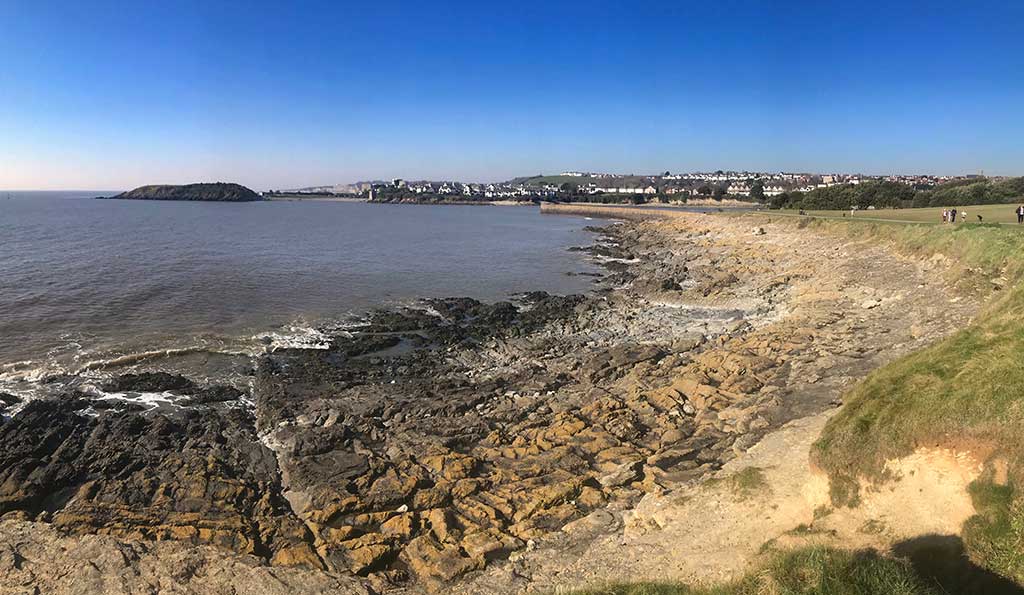
After running along the prom I dropped down onto the sands and then up through a wooded slope towards Friars Point where a series of paths led out into the grassy promontory.


From Friars Point I was able to look out across the bay towards the Knap
I now dropped down past a breakwater onto the banks of Barry Harbour where boat hulks rotted in the mud.


The path took me all the way around the harbour, past the huge Barry Island Car Park and then up onto a parkland where ground-keepers were out in force preparing it for the summer.
The Knap
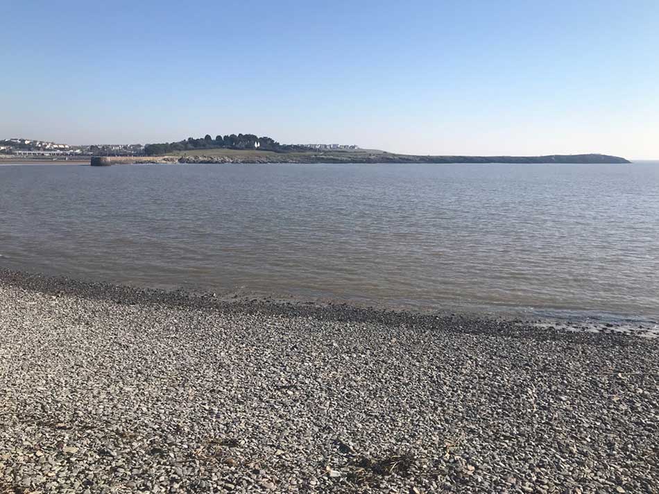
Next I headed through the streets of Cold Knap and then down some steps onto Watch House Bay. From here I could look back to Friars Point where I had been a little while earlier.
I headed out to the point and then past the paths of Old Knap Swimming Pool, up onto the prom and past the Marine Lake.


Once again it was busy here with people enjoying the day.
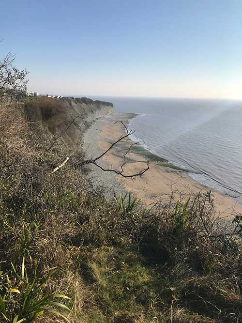
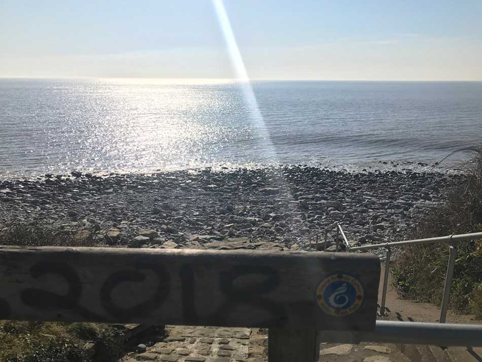
I headed on my way along the top of the pebbly beach and then up a steep grassy climb towards Marine Drive. I stopped at the top to catch my breath and take a photo of the beach below.
The Coast Path then took me along the tops of the cliffs on grassy fields and then into the shade of Cliff Wood.
Porthkerry
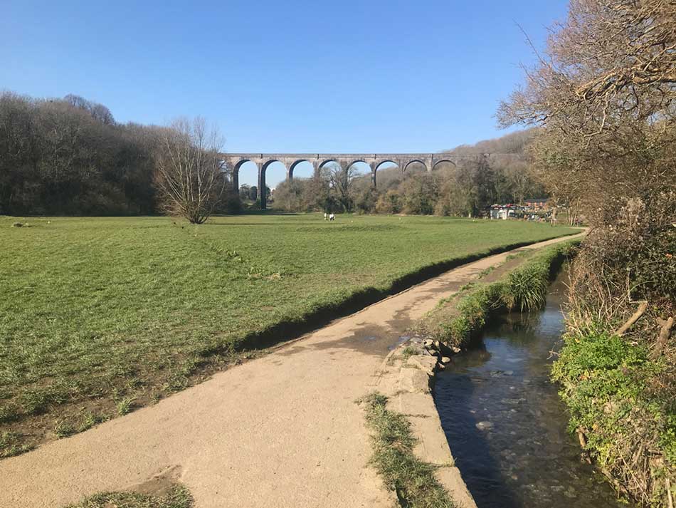
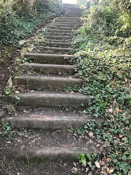
After a while I descended a series of steep steps in the woodland and emerged out onto the beach at Porthkerry. Once again there were people out walking and enjoying the weather. Porthkerry Viaduct dominated the view inland.
I made my way along the grassy paths and then out onto a rocky path amongst the trees at the far side of the bay. From here it was another steep climb up a muddy path towards the caravans of Porthkerry leisure Park. At one point there was another steep set of steps leading up – just what my legs needed now!
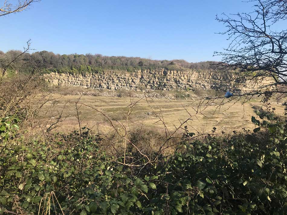
The Coast path took me through the caravan park and then out onto a series of paths that led around a large quarry.
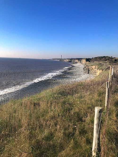
Dams Bay and Rhoose Point
I was nearing the end for the day now. The path took me along the cliff tops with Dams Bay below. I soon entered into a maze of paths through old limestone quarry workings which reminded me somewhat of the quarries that I spent so much time in on the Isle of Portland on the South Coast. Butterflies were out flitting from place to place amongst the quarry rubble and the dry paths led me past towering stacks of limestone.


Finally I came to the end of the day with just over 20 miles covered. Before turning right off the coast path to head to the car I could see the next stretch of coastline up ahead. That would have to wait for another day.
Part of me wanted to continue on as the day couldn’t have been better, my legs didn’t necessarily seem quite so keen. I turned right to head inland and leave the sparkling seas behind.
The car was just a short climb away and I was soon back and getting changed in the sunshine. It had been a perfect day on the Coast Path and that was another 20 miles ticked off. This had been the best stretch along the South Coast of Wales so far.
Heading Home
All that lay ahead was a 3 hour drive through Wales. Once at home, the surf was still as good as it gets. Morgan had been at home alone all day so I asked if he wanted to go for a surf. As usual he was non-committal which I must admit I was slightly relieved to hear as I wasn’t sure I had the energy to go surfing as well. I would of course been accommodating had he wanted to go as it doesn’t take too much tom persuade me to go surfing.
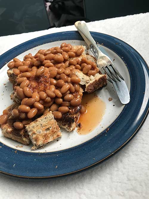
As usual, Morgan had been a typical 14 year old boy and had barely moved from his xBox. He did send me a photo of his lunch though. Partly to prove he had actually had some and partly because he was secretly pleased with his culinary skills – yep, beans on toast!
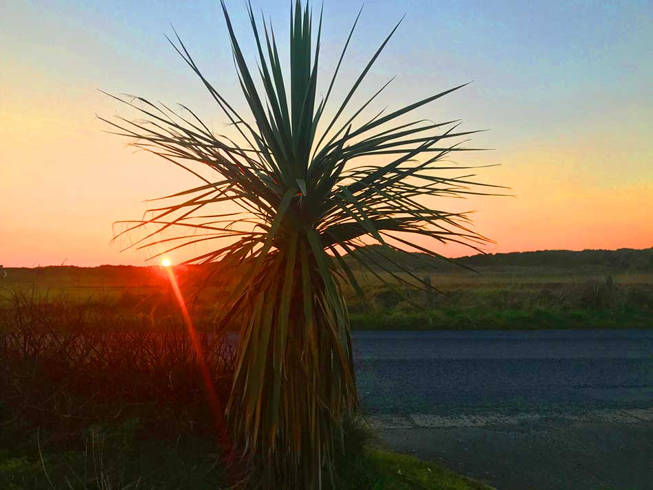
After a shower and a bit of a refresh there was just time to walk over to the beach again. Ynyslas was looking quite tropical as the sun set. Wales had hit an all time high February temperature of 20.8ºC!
Re-fuelling was taken care of thanks to burger, home-made chips and beer,


As we ate this, Morgan and I sat watching the news. The main story on the Welsh news was the unseasonable weather and they had a long report from Barry Island. We kept an eye out during the whole report but didn’t see me anywhere. It would have been funny if we’d seen me go running past in the background!
Discover more from A Simple Life of Luxury
Subscribe to get the latest posts sent to your email.


It has been amazing weather, the photos prove that. Would it have been your favourite stretch if it had been cold, wet and windy I wonder.
Only my favourite stretch along the South Wales Coast, not favourite overall and it wasn’t up against very stiff competition!
Al.
Oh ok, so far the rest has been mostly industrial .