Wales Coast Path Run – Rhoose to Ogmore-by-Sea
Coast Path Vital Stats
Rhoose to Ogmore-by-Sea
- Distance: 17.33 miles
- Elevation Gain Today: 424m
- Highest Elevation: 47m
- Time: 3:06:57
- Av. Pace: 10:47 mins/mile
- Calories: 1524
Totals to Date
- Total Distance: 716.79 miles
- Total Time: 132:47:39
- Total Elevation Gain: 21415
- Total Calories: 65241
- Distance to go: 374 miles
Another good day on the Wales Coast Path for me. This time along the Cliffs of South Wales from Rhoose to Ogmore-by-Sea. Just over 17 miles in total on a nice Spring day.
I set off from home before 7am so as to arrive in Ogmore-by-Sea within plenty of time for the 9:50am bus to Rhoose. It was a pretty damp drive there. Misty and murky most of the way and quite a bit of rain too. The roads were wet and full of puddles and it was looking like it was going to be a damp day. Things did dry up a little as I headed south though and by the time I left the busy motorway and headed towards the beach at Ogmore-by-Sea it was dry but overcast.
I had a bit of a wait for the bus, so rather than just standing there I started walking in the direction it would go. About 1½ miles later and a few bus stops it was nearly time for the bus so I waited at the bus stop and soon jumped on and paid the £4.40 single fare to Rhoose.
The bus journey was fairly quiet as it wove it’s way through lots of little country lanes with elderly people getting on and off here and there. It would take an hour to get to Rhoose so I made myself comfortable and watched the world go by.
A few more people got on the bus at Llantwit Major and after a while there was quite a bit of shouting between people from one end of the bus to the other. It all started to turn into quite a commotion and got a little out of hand so rather than hang around to see what happened I got off the bus a few stops early and started my run earlier than intended. It was a good job I did as about a mile along the road just beyond where I would have got off I could see the bus pulled up at the side of the road with a couple of police cars next to it and people being man-handled off it! I left them to it and made my way past Rhoose Railway Station and out onto the Coast Path.
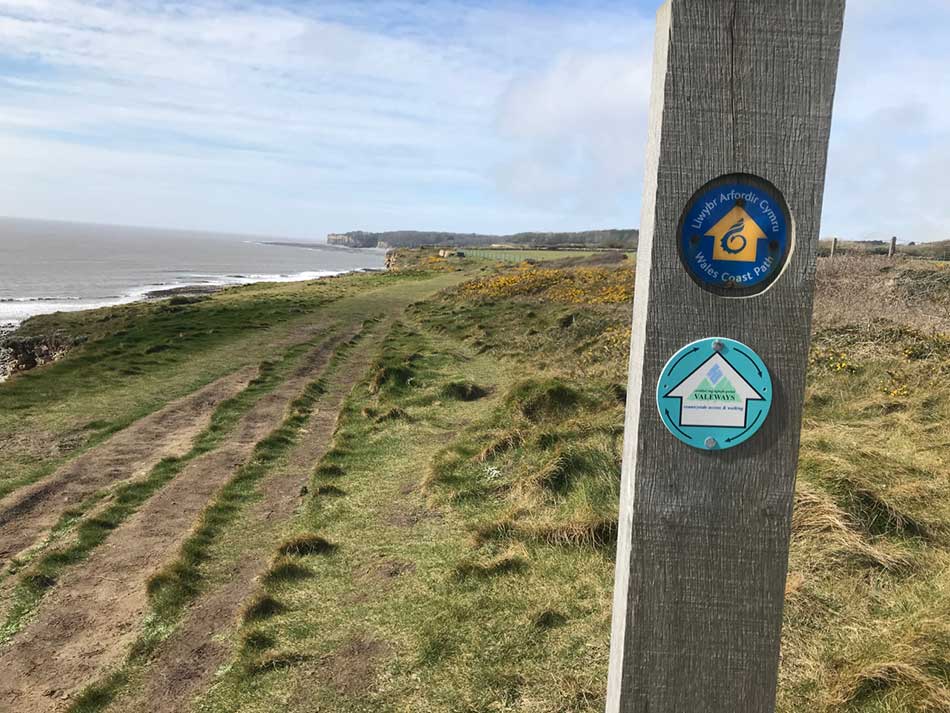
Rhoose to Limpert Bay
It was now quite warm and there was even some hazy sunshine as I turned right onto the Coast path and started making my way West into a stiff breeze. I was up on low cliffs above an extensive wave-cut platform which was covered in the characteristic joints of limestone.
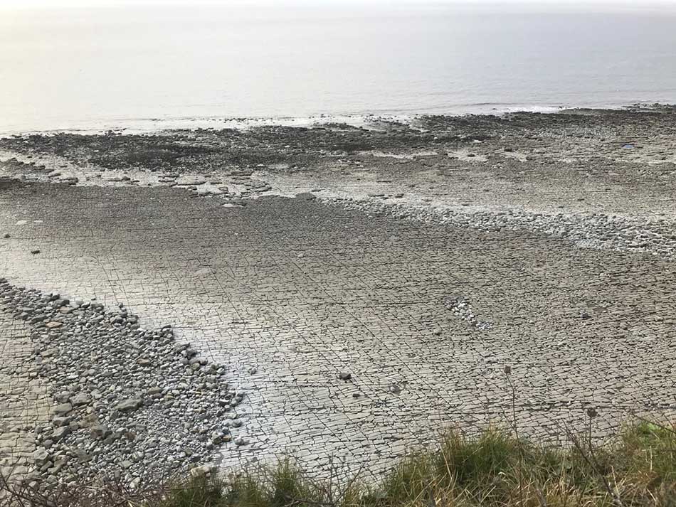
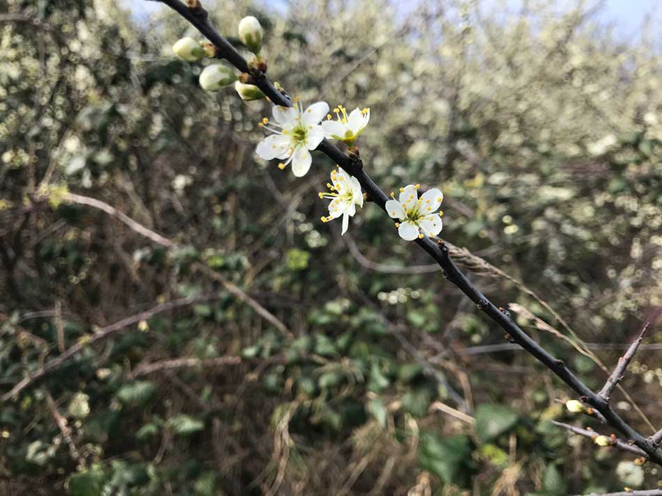
The path was alongside a rocky field and there were skylarks singing overhead. Things were still a little overcast but there were signs of blue sky here and there. There was a definite feeling of Spring in the air and blackthorn was bursting into flower in the hedgerows.
After a while on the cliffs I negotiated a few steps down and up through a little valley and emerged in a large caravan park. From here I could look back the way I had come along the cliffs and down onto Ffontygari Bay

After making my way along the recently mowed grass of the caravan park it was out onto some steps overlooking Aberthaw Nature Reserve. I was soon down amongst the creeks and muddy banks and running past the remains of the Aberthaw Lime Works.


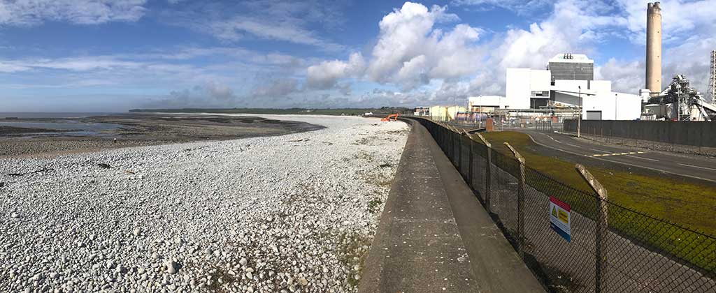
The sun was now making an appearance and down out of the wind it was quite warm. Soon I found myself approaching Aberthaw Power Station. The first sign other than the huge chimney and pylons that had been seen ahead of me all day was huge concrete groynes on the beach. All part of the sea defences to keep the power station safe. I crossed a little bridge and was now making my way around the power station itself. All the while I was hemmed in between an enormous concrete sea wall and a tall wire perimeter fence. As usual the power station itself was a mish-mash of silos, chimneys, huge oversized buildings, pipes, chimneys and warning signs.


I was at least able to climb up ladders onto the sea wall in places from where I could get a better view of the power station itself and the bleached pebbles of Limpert Bay.
I soon left the power station behind me and headed out onto muddy, rocky paths behind Limpert Bay. I was hopping between the rocks and dodging the deepest of puddles as I made my way towards Summerhouse Bay. Dandelions were in flower along the more surfaced paths, but from time to time I was reduced to walking thanks to having to cross beaches full of large, unstable pebbles.


The Cliffs of Llantwit Major
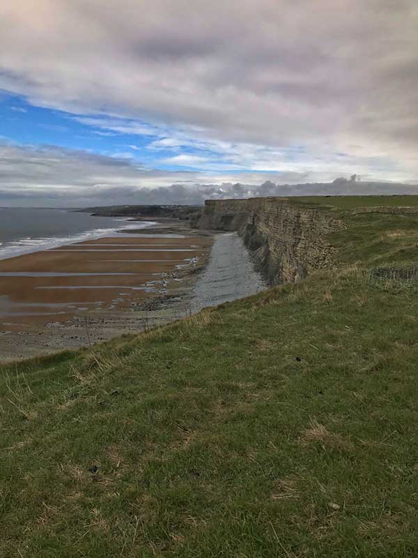
After a while I started to climb up onto the fields that run across the tops of the impressive Cliffs of Llantwit Major. The going was relatively easy, mainly along field edges where rocky soils kept me aware of my footing. I passed the Coast Watch Tower and from time to time good views of the cliffs stretching along the coastline. Looking out to sea I could see ships in the distance and beyond that could just make out the hills of Exmoor.


Ahead of the me the cliffs were now bathed in sunlight and the shadows cast by the overhanging bedding planes highlighted the layers in the cliffs. On the beaches below, the gentle folds in the bedding planes created patterns on the beach.


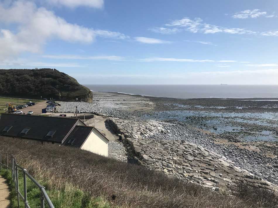
The cliffs continued for quite a while with Nash Point visible in the far distance. Eventually I descended a steep slope and emerged out onto the somewhat busy Llantwit Major Beach. People and cars were a bit of a shock to the system after miles of solitude along the clifftops.
I soon crossed the car park and once again headed up onto yet more cliffs. I was alone again. It was me, the occasional crow, some coast path signs and the ever present song of skylarks.
Tresillian Bay, St Donats and Nash Point
The path started to undulate a little more here, dropping down into little bays and breaks in the cliffs, crossing little streams and always getting close to the lighthouse at Nash Point. The white-walls of the houses at Tresillian Bay glowed in the sunshine and all was peaceful.
Down on the beaches in the shelter of the cliffs it was a lovely Spring day, but it was still quite blustery on the top of the cliffs and going was a little slow into the wind. I was in no hurry though so continued on my way. Climbing out of the bays and back onto the clifftops.
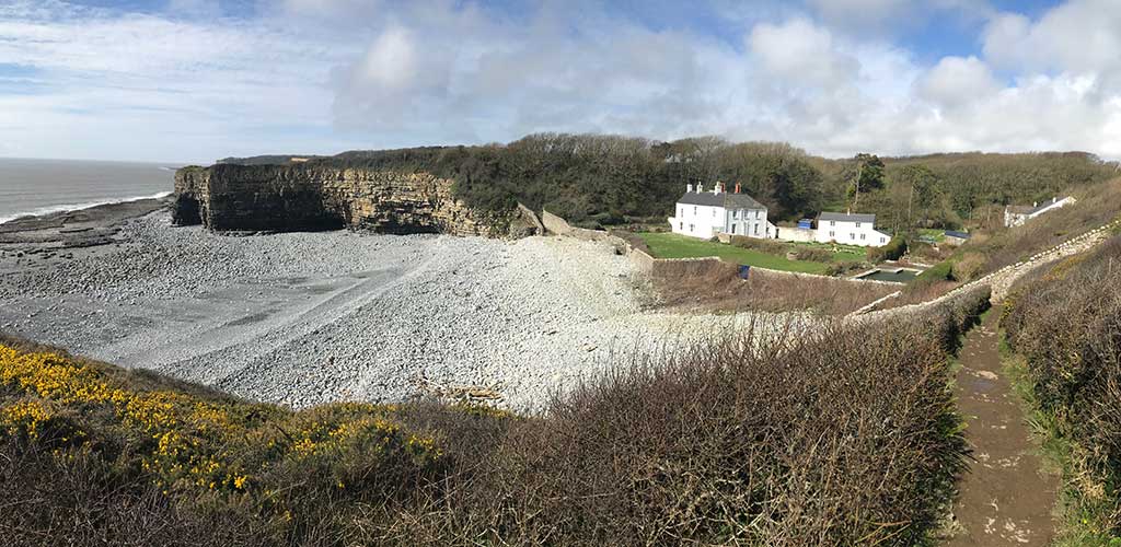
The next place of note was St Donat’s Castle which brought with it people again. Not many though, just a few milling about on the seafront. The grounds of this medieval castle descend in a series of terraces to the sea. Here fortified walls keep the sea and prying eyes out. I did spot what looked like a lovely open air swimming pool within the walls though. It was difficult to get a good view of it but it looked very well kept. I could just glimpse it again through the trees as I climbed once more up onto the cliffs.


The muddy trails through the coastal woodlands were quite slippery at times so I had to keep my wits about me.
The next target were the lighthouses at Nash Point. I’d been able to see these for miles and was now finally approaching them as I made my way into the wind along the clifftops. A bell on a buoy out to see was ringing hauntingly in the swell.
I was soon jogging past the clean walls of the lighthouses themselves, and the huge steel tubes of the foghorns. I’m just glad it was a clear day as running past these in the mist and murk with them sounding would have been completely different experience.


Nash Point to Ogmore By Sea
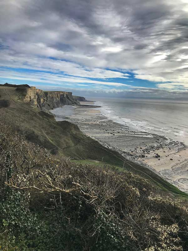
Leaving the lighthouse behind I descended first towards Nash Point Car Park and then once again climbed up high onto the fields above Nash Point Cliffs. Once again the path undulated along the cliff tops, dropping down to cross streams here and there and opening out with some views of the impressive cliffs and the wide expanse of beach far below.


I gingerly made my way down the steep sided slopes to Monknash Beach and then one again up onto the top of the cliffs. The cliffs along here were probably the most impressive so far today. Occasionally walkers could be seen on the sands looking like little specks in the vastness below.
After the windy clifftops it was actually quite nice to descend into some coastal woodland at Nant Cwm Mawr where I crossed the stream then once again headed up some new steps to the clifftops.


The cliffs just went on forever. With Monknash and Nash Point behind me these were now the Cliffs of St Brides Major.
Eventually I headed towards civilisation again. First was the parkland of Dunraven Castle were there were quite a few people. Unfortunately when I went to take some photos of the castle my phone had a notification on it saying ‘iPhone is currently unavailable, try again in 5 minutes’. I have no idea what was going on with it but it wouldn’t respond to anything I did so I couldn’t get any photos. It did come back to life again later on.
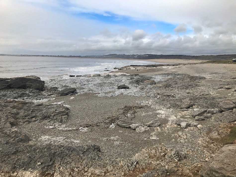
After the long climb out of Dunraven Bay there were now signs of houses to my right as I passed Southerndown and then made my way alongside high stone walls to Ogmore-by-Sea. Eventually I dropped down closer to the sea where the rocks gave way to little coves. The rocks here were Triassic Conglomerates. These conglomerates were formed when short violent storms caused flash-floods which carried debris down the Triassic hillsides and deposited it as alluvial fans of coarse, red conglomerate. These lie uncomformably atop the grey Carboniferous Limestone below.


Eventually the low cliffs petered out and the sands of Ogmore By Sea opened out in front of me.
My car was just off the main path and not too far away so I was soon back where I had started many hours earlier.
With another 17 miles or so of Coast Path completed all that was left now was the drive home. It was 5:30pm when I got home so just enough time for a shower, to cook dinner for Morgan and myself and then time to look at the photos and write this blog post.
Discover more from A Simple Life of Luxury
Subscribe to get the latest posts sent to your email.


