Offa’s Dyke Path Run – Hay-on-Wye to Pandy
Offa’s Dyke Vital Stats
Hay-on-Wye to Pandy
- Distance: 16.20 miles
- Elevation Gain Today: 763m
- Highest Elevation: 704m
- Time: 2:52:56
- Av. Pace: 10:40mins/mile
- Av. Heart Rate: 132bpm
- Max Heart Rate: 160bpm
- Calories: 1424
Totals to Date
- Total Distance: 595.31 miles
- Total Time: 111:06:48
- Total Elevation Gain: 18721m
- Total Calories: 54607 Kcal
- Distance to go: 35 miles
After a break of a few weeks it was back to Offa’s Dyke for me on Monday. The first bus from Pandy was at just after 7am. As that was a 2½ hour drive I had to leave the house by 4:30am at the latest. I’d need to give myself 15 minutes to find a suitable parking space, get changed and find the bus stop. I also add an extra 15 minutes onto my travel time as a contingency to cover for any issues that might arise. That meant leaving at 4:00am and therefore getting up at 3:00am so that I could get ready, have breakfast and such like.
I don’t usually set an alarm as I always wake up ½ an hour up before it goes off, but 3am seemed quite early even to me so I set an alarm before going to bed. Sure enough, I woke up at 2:30am ½ an hour before the alarm went off. Rather than just lie in bed awake I got up. That gave me chance to do some work that had come in overnight while eating breakfast. With that job done I would have satisfied, happy clients when they started up their computers on Monday morning.
I set off as planned just after 4am for a horrible drive through a dark, wet and dirty Wales. There were lots of dirty lorries on the road to keep things slow. Lots of roadworks and traffic lights and a constant need to clean the windscreen to clear it of the muck and grime from the road. A good job I’d added the 15 minute contingency to my travel time.
By the time I got to Pandy, parked up in the exact spot I had hoped and got changed I only had 20 minutes to wait for the bus. My parking spot was right next to the bus stop though and right on the Offa’s Dyke path where I intended to finish the run today so no lengthy detours were required.
The bus was on time and I checked with bus driver that the Explorer Ticket was the best way to go and soon set off on the bus towards Hereford. Rather than go into Hereford I got off at the Tesco store a few miles outside the town centre as I could then use their toilet. I could also waste some time waiting the hour and 10 minutes for my next bus. It would have remiss of me not to have a pecan and maple bun along with a cappuccino while I waited.
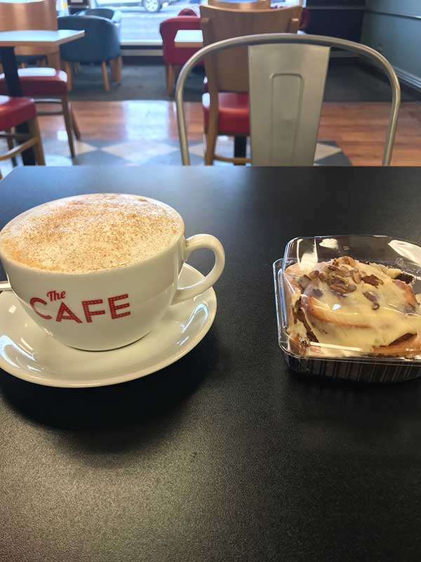
Coffee and Cake
Coffee and cake dispatched I was soon back outside waiting the remaining half an hour for the bus to Hay-on-Wye. It was still a little chilly at around 8ºC so I paced up and down in my shorts trying to keep warm. The sun was trying to come out but had yet to warm things up.The bus was a little late but I was soon in its warmth for the 50 minute trip to Hay-on-Wye. I arrived there at 10:45, over 8 hours after getting up and nearly 7 hours after starting my journey. At last I could start the run that I had come here for!
Out of Hay on Wye
The first section of the path today took me down out of Hay-on-Wye and through some muddy fields before following the treeline alongside Dulas Brook. It was a breezy morning and the earlier sunshine had disappeared to leave grey cloudy skies. It was still chilly but as it was dry I’d taken my jacket off and hoped to warm up as soon as the trail started going up.
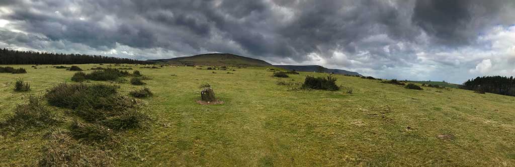
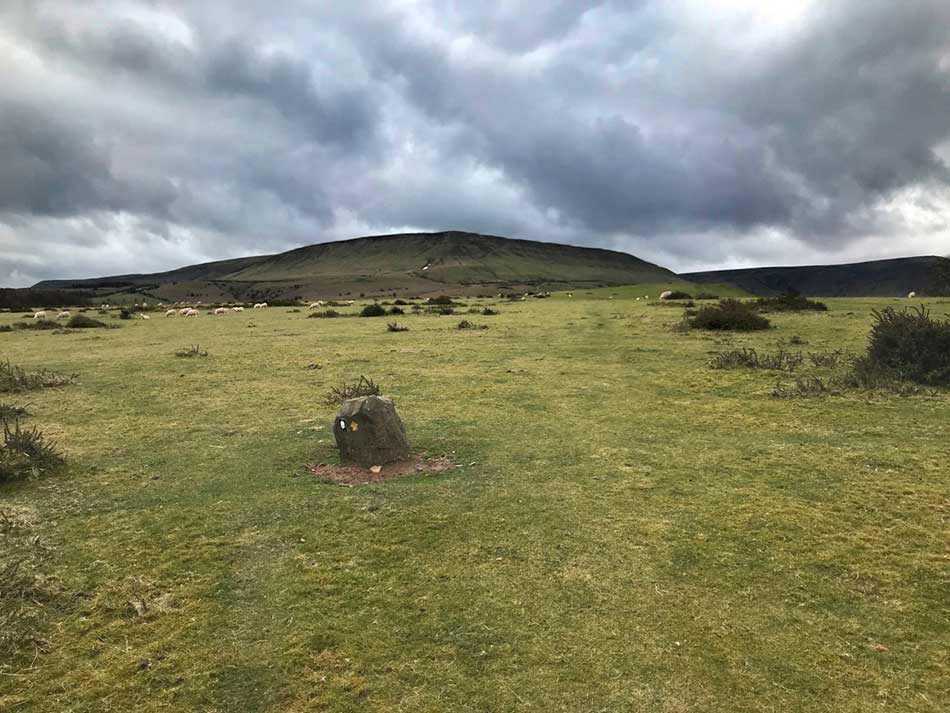
Sure enough, a couple of fields later and the gradient started to increase a little. I overtook another guy out running who asked if I was going ‘up to The Bluff’ I said I thought I was as I was following Offa’s Dyke to Pandy – he seemed suitably impressed! I crossed a minor road, made my way through a few more fields and across another road then the path angled steeply upwards. The going was tough here. Muddy, slippery and very steep so I was walking at times already. It didn’t last too long though as I emerged out onto another small lane for a while. It was still uphill but at a lesser gradient so I was back up and running. I passed through a farmyard and then out onto the short grass covered slopes of open hillside. I was now on the extensive Craswall Common with the imposing slopes of Hay Bluff ahead of me. The ground underfoot was good but the strong headwind was now keeping my pace in check.
-

- Crasswell Common
-
- Hay Bluff Ahead
On Hay Bluff
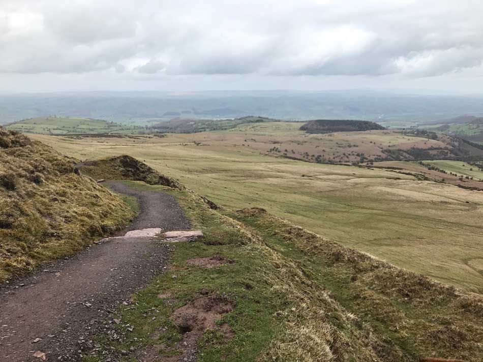
After a small section along the mountain road I was soon off onto the rocky, muddy, tussocky slopes of Hay Bluff. The ground underfoot was quite wet in places as I jumped over little gulleys and gradually started making my way upwards. After a while the grassy slopes increased in steepness and I started following a well marked path that traversed up the eastern flank of Hay Bluff. This is a popular walking route and the path became better defined and well maintained the higher I climbed until it became a purpose built wide, gravel path. It started raining as I climbed but I didn’t put my jacket on as the gradient was enough to keep me warm.
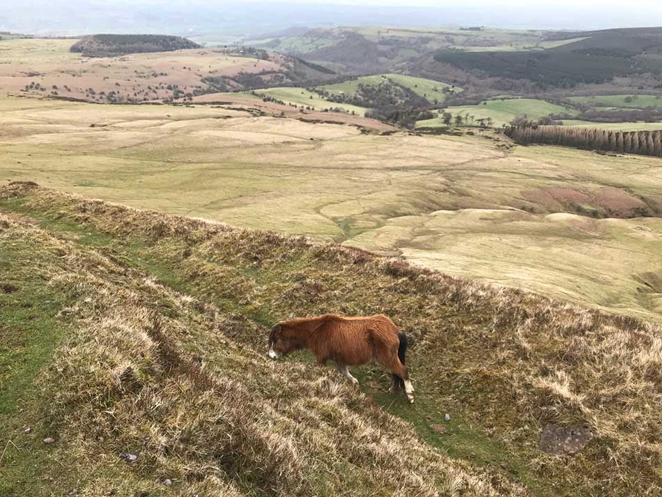
Wild ponies grazed the short grass to the sides of the path and valley views opened out below.
-
- Well kept path
-
- Valley Views
-
- Pony
-
- Looking back down into the valley
-
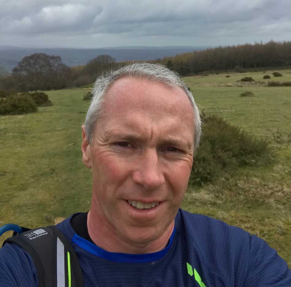
- Black Mountain Selfie
-
- Climbing to the ridge
As I ran along a stretch of path that has been resurfaced with flagstones so as to withstand the constant erosion of walkers boots I passed a group of walkers. They were all well wrapped up with several layers. Fleece and high-tech fabrics, hats, gloves, waterproofs, walking boots gaiters, the lot. I ran past in a pair of skimpy shorts and a thin thermal top feeling like a hardy fell runner. I’m sure I even had some respectful glances from the walkers! The vegetation around me was now short scrubby heather and red grouse broke free from their cover in it as I ran past.
Along the Ridge of the Black Mountains
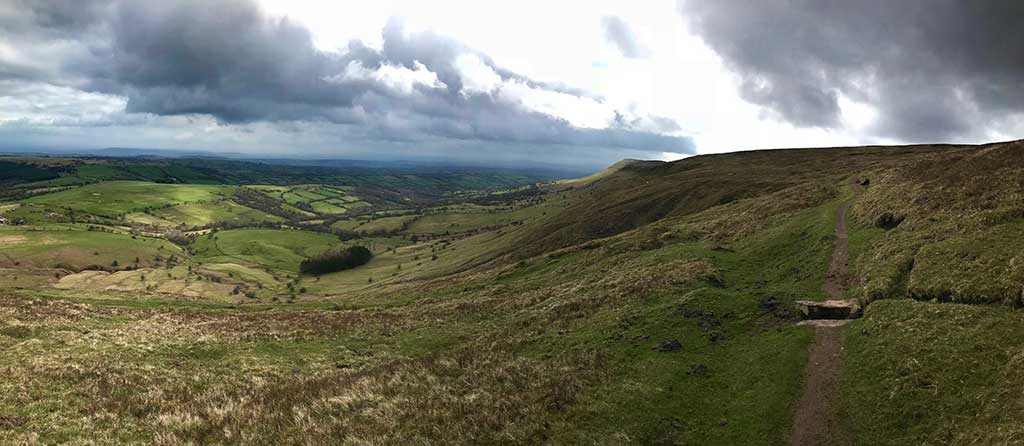
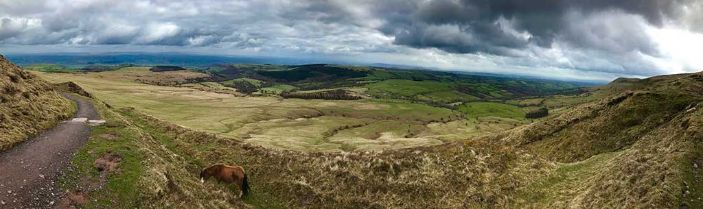
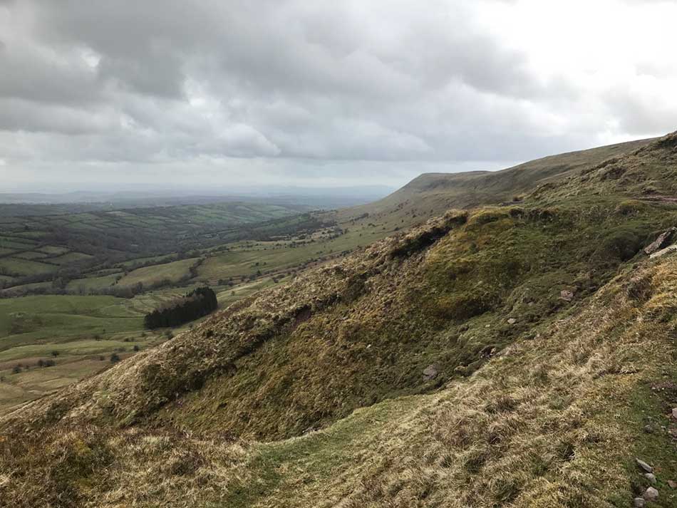
Soon I was out onto the top of Hay Bluff with the ridge top ahead of me. There was little to see here really, just miles and miles of featureless moorland extending in all directions. This was Hatterall Ridge, the eastern ridge of the Black Mountains with the Llanthony valley in Wales to the west and the Olchon valley in Herefordshire to the east. My route along Offa’s Dyke Path would take me along the entire length of Hatterall Ridge in a sustained, high level run for the day.
There was little to break it up. The path would change from sections of hard flagstone, sections of muddy track, sections of raised rough gravelled path and some wider grassy areas. Heather dominated the landscape to either side and birds of prey soared overhead. There was the odd carin of piled stones here and there and an occasional trig point to mark the high points. The high points were barely discernible otherwise, just parts of the ridge higher than those around them but everything was at a fairly similar level up here.The highest point of the day was actually when I first came out onto Hatterall Ridge at it’s northern end. Here the path reached 703m, the highest point of the day and the highest point on the entire Offa’s Dyke ridge. No doubt it is also the highest point on my journey around Wales too. I did nothing to mark this momentous occasion.
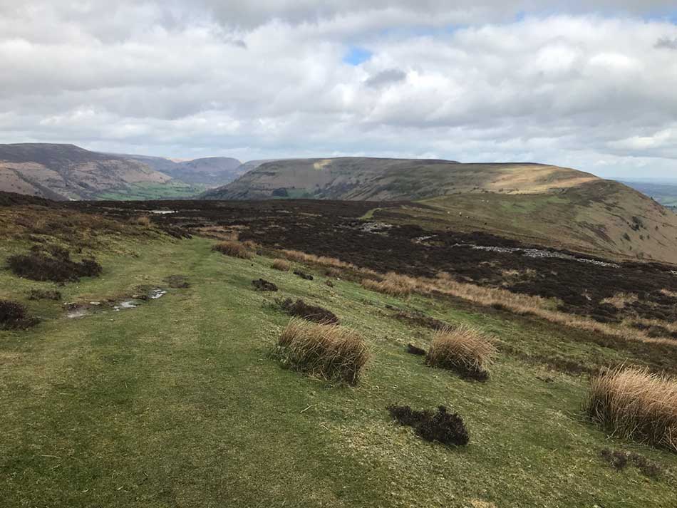
Hatterall Ridge
At one point there was a strange barren landscape with cairns dotted around it and sandy, muddy, boulder strewn ground to negotiate. For the most part it was well kept, obvious paths across a never ending moorland. The Black Mountains comprise the northeast part of the Brecon Beacons National Park. They are a group of old red sandstone hills, the highest of which is Waun Fach. Their ridges such as the one I was following are formed as part of a dissected plateau so ridges similar in stature to the one I was on could be seen running parallel to the west. To the east there was a patchwork of fields and villages in the valley far below. Otherwise there was little to look at.
Black Mountains
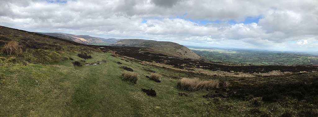
I passed a couple of groups of walkers all wrapped up against the elements so that only their eyes were showing. I guess it was quite chilly up here in the wind but if I kept the pace up I was warm enough. It was still raining lightly, the skies were grey and there was a constant headwind to battle against. On I went along the ridge top as it snaked it’s way across the landscape. Finally after about 7 miles of ridge top running I started to descend. First only gently but then as the ridge seemingly ran out and stopped I started heading down more steeply.
Downhill to Pandy
The heather moorland was once again replaced by short grass and then fields before I headed onto a bouldery, muddy, slippery green lane. This emerged out onto a small road where I turned right and headed uphill once again for a short distance towards Pandy.
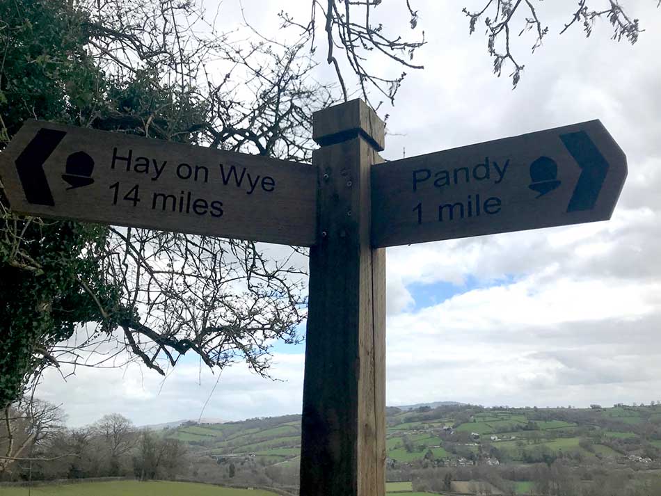
Signpost
I then turned left and descended along the road for a while before climbing over a stile and running through a muddy field alongside an electric fence. The soggy grass was cut up by hoof marks and towards the bottom of the field there was no option but to wade through ankle deep mud. I came back out onto the road for a short distance, crossed another road and then ran through another muddy field before crossing the busy railway line. This is the main Cardiff to Manchester line so I didn’t hang around here for too long, just crossed the lines and continued on my way before a train came hurtling past.
-
- Bridge
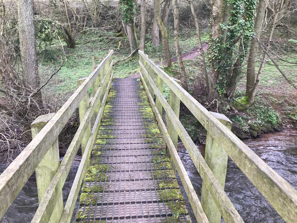
-
- River Honddu
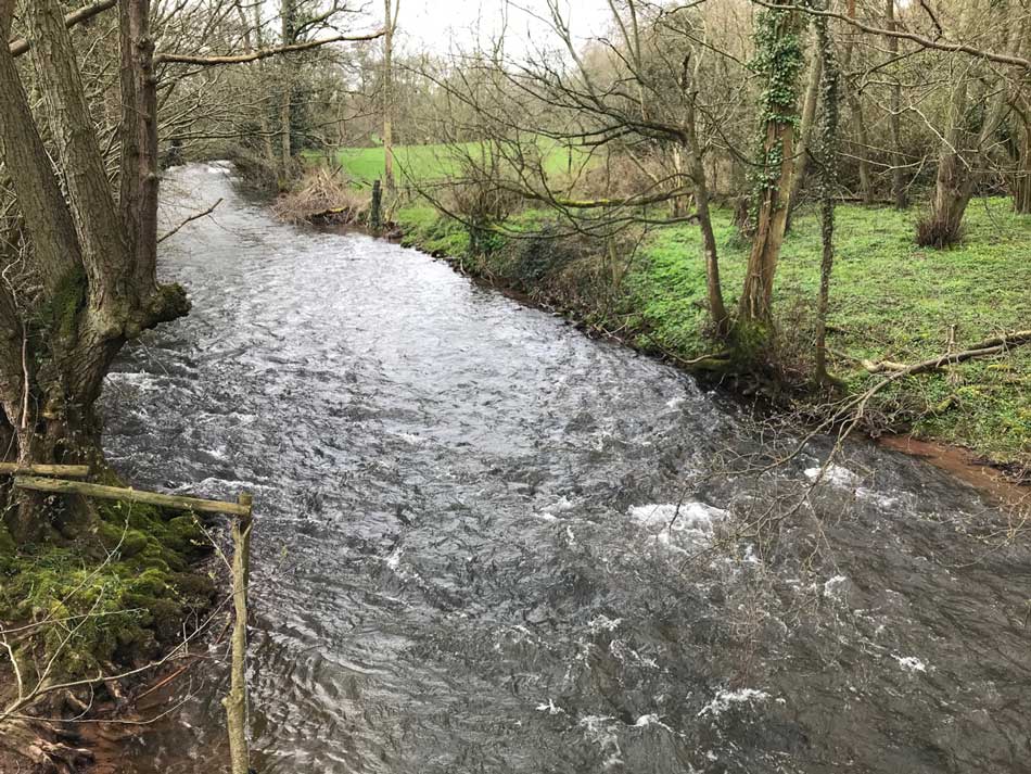
A couple more fields and a bridge overt eh River Honddu and I was back at the van ready for the journey home.
Home and Injury
The journey home was fairly uneventful so I was back at home ready for a shower by about 4:30pm. My Achilles was a little sore by the time I got home though and then flared up over the evening to the stage where I could barely walk. The next morning it was even worse so I ended up hobbling to work grumpily as it looks as though I’ll be out of action for a while. There’s only about 35 miles left of the Offa’s Dyke Path as well but it doesn’t look as though I’ll be finishing it any time soon. I think it’ll be a while before my Achilles is able to take the strain. Typical, just as I was feeling a little fitter and was ready to start upping the intensity ready for some races I’m once again out of action.


Nice read Alan, I’m very jealous of your maple and pecan bun.
Oh no that’s a shame, didn’t you have any warning ?
You already know that it will need resting so I won’t tell you that .
Take care x
No, it was a little tight on the run, but that’s nothing unusual. Easing off a little ow though so hopefully I’ll be able to do some training again soon. I just have to lay off the Pecan buns whilst not able to train as so far I’ve been gaining 1.5kg per day due to not burning off the calories in the normal fashion.
Oh well at least it’s beginning to get better.As for giving up the buns I don’t doubt you ‘ve putting on weight without exercising but at least you know it will fall off when you start again. Whereas I’m just slowly putting weight on and on …. And thats without the buns, maybe some chocolate though.
Where exactly did you park? Was planning to do some of this as a walk and I recall largecpullouts but can’t remember quite where.
Hi Kristina,
Take a look at this map: https://drive.google.com/open?id=1EBJRH3Xabk2yBb51oSDe_QQzqvsrlDnY&usp=sharing
I parked right by the Lancaster Arms, just on the road beside it, but I’ve marked a couple of other spots that would have been fine as well.
Hope that helps.
Al.
Should also have said that the bus stops are marked on the map as well and were very handy, as was the Offa’s Dyke Path itself. No extra steps needed on that day!
I haven’t done any more of the path since this day though as I managed to injure my achilles during this run and it still hasn’t fully recovered. I’m also racing most weekends at the moment but fully intend to continue on with my run around Wales sometime soon. Probably not until October now though.
Al.